Fraud Blocker Skip to main content

Tote Bag > Europe > United Kingdom > Wales > Maps

Maps Tote Bag Collection (#19)

Discover the beauty of Wales with our Maps of Wales Tote Bags from Media Storehouse. These high-quality bags feature intricately detailed maps of various regions in Wales, making them the perfect accessory for travelers and armchair explorers alike. The sturdy material ensures durability and practicality, while the vibrant colors and clear map designs add a touch of style to your everyday carry. Whether you're planning a trip to the land of castles and coastlines or simply want to show off your love for Wales, our Maps of Wales Tote Bags are the ideal choice. Carry your essentials in style and explore the wonders of Wales with our beautifully crafted bags.
Wales is a country located in the United Kingdom, and it has been mapped for centuries

1,221 Tote Bags

Background imageMaps Tote Bag Collection: North of Wales, Pass of Llanberis (colour litho)

North of Wales, Pass of Llanberis (colour litho)
7165885 North of Wales, Pass of Llanberis (colour litho) by English School, (19th century); Private Collection; (add.info.: North of Wales, Pass of Llanberis)

Background imageMaps Tote Bag Collection: Newcastle coal field (engraving)

Newcastle coal field (engraving)
7165958 Newcastle coal field (engraving) by English School, (19th century); Private Collection; (add.info.: Newcastle coal field)

Background imageMaps Tote Bag Collection: Panel (Map), England, 1784. Creator: Unknown

Panel (Map), England, 1784. Creator: Unknown
Panel (Map), England, 1784. Kitchins most Accurate Map of the Roads of England and Wales: with the distances by the Mile Stones, and other most exact Admensurations between Town & Town

Background imageMaps Tote Bag Collection: Map Sampler, England, c. 1800. Creator: Unknown

Map Sampler, England, c. 1800. Creator: Unknown
Map Sampler, England, c. 1800. The counties of England and Wales, the German Ocean

Background imageMaps Tote Bag Collection: Sampler (Map), England, c. 1800. Creator: Unknown

Sampler (Map), England, c. 1800. Creator: Unknown
Sampler (Map), England, c. 1800. The counties of England and Wales, the German Ocean, and Britannia

Background imageMaps Tote Bag Collection: 6867108

6867108

Background imageMaps Tote Bag Collection: 6867088

6867088

Background imageMaps Tote Bag Collection: 6867106

6867106

Background imageMaps Tote Bag Collection: 7177128

7177128

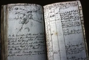
Background imageMaps Tote Bag Collection: Ships Logbook belonging to Lieutenant William Bligh, 1789 (ink on paper)

Ships Logbook belonging to Lieutenant William Bligh, 1789 (ink on paper)
ELD1152376 Ships Logbook belonging to Lieutenant William Bligh, 1789 (ink on paper) by English School, (18th century); National Library of Australia, Canberra

Background imageMaps Tote Bag Collection: Llanthoney Abbey, Monmouthshire (engraving)

Llanthoney Abbey, Monmouthshire (engraving)
3649221 Llanthoney Abbey, Monmouthshire (engraving) by English School, (19th century); Private Collection; (add.info.: Llanthoney Abbey, Monmouthshire)

Background imageMaps Tote Bag Collection: St Patricks Island, Peel, Isle of Man (b / w photo)

St Patricks Island, Peel, Isle of Man (b / w photo)
3631846 St Patricks Island, Peel, Isle of Man (b/w photo) by English Photographer, (19th century); Private Collection; (add.info.: St Patricks Island, Peel, Isle of Man)

Background imageMaps Tote Bag Collection: Ordnance survey map of Roman Britain (colour litho)

Ordnance survey map of Roman Britain (colour litho)
3643686 Ordnance survey map of Roman Britain (colour litho) by English School, (20th century); Private Collection; (add.info.: Ordnance survey map of Roman Britain, second edition (c 1931)

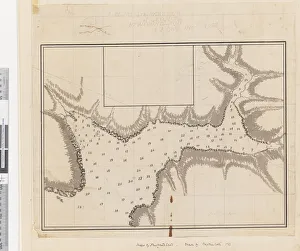
Background imageMaps Tote Bag Collection: Page 37c Plan of the harbour of St. Lucia

Page 37c Plan of the harbour of St. Lucia
5670304 Page 37c Plan of the harbour of St. Lucia by Unknown artist, (18th century); Mitchell Library, State Library of New South Wales; (add.info.: Original Sketches, Drawings)

Background imageMaps Tote Bag Collection: Page 29 Ice Islands, 1768-75 (w / c)

Page 29 Ice Islands, 1768-75 (w / c)
5670293 Page 29 Ice Islands, 1768-75 (w/c) by Hodges, William (1744-97); Mitchell Library, State Library of New South Wales; (add.info.: Original Sketches, Drawings)

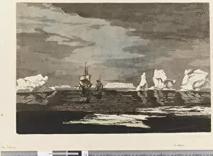
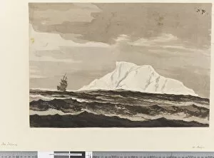
Background imageMaps Tote Bag Collection: Page 28 Ice islands with the Resolution and Adventure, 1768-75 (w / c)

Page 28 Ice islands with the Resolution and Adventure, 1768-75 (w / c)
5670292 Page 28 Ice islands with the Resolution and Adventure, 1768-75 (w/c) by Hodges, William (1744-97); Mitchell Library, State Library of New South Wales; (add.info.: Original Sketches, Drawings)

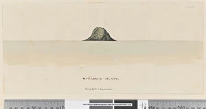
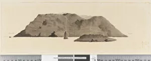
Background imageMaps Tote Bag Collection: Page 25a / b Osnabrug Island bearings by W 5 leagues distant

Page 25a / b Osnabrug Island bearings by W 5 leagues distant
5670288 Page 25a/b Osnabrug Island bearings by W 5 leagues distant, 1768-75 (drawings & engravings) by Hodges, William (1744-97); Mitchell Library

Background imageMaps Tote Bag Collection: Page 25b / b Profile of unidentified Pacific Island showing a lagoon, 1768-75 (w / c)

Page 25b / b Profile of unidentified Pacific Island showing a lagoon, 1768-75 (w / c)
5670284 Page 25b/b Profile of unidentified Pacific Island showing a lagoon, 1768-75 (w/c) by Hodges, William (1744-97); Mitchell Library

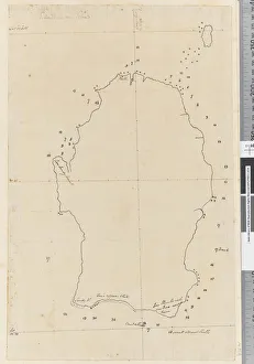
Background imageMaps Tote Bag Collection: Page 38a Map of S. Andehman Island (pen & ink)

Page 38a Map of S. Andehman Island (pen & ink)
5670305 Page 38a Map of S. Andehman Island (pen & ink) by Unknown artist, (18th century); Mitchell Library, State Library of New South Wales; (add.info.: Original Sketches, Drawings)

Background imageMaps Tote Bag Collection: Page 21a Diagram of a native canoe, 1768-75 (pen & ink)

Page 21a Diagram of a native canoe, 1768-75 (pen & ink)
5670275 Page 21a Diagram of a native canoe, 1768-75 (pen & ink) by Hodges, William (1744-97); Mitchell Library, State Library of New South Wales; (add.info.: Original Sketches, Drawings)

Background imageMaps Tote Bag Collection: Page 3b View of unidentified island. In ink on left hand side N by E

Page 3b View of unidentified island. In ink on left hand side N by E
5670254 Page 3b View of unidentified island. In ink on left hand side N by E and on right hand side E by N, 1768-75 (pen & ink and wash) by Hodges, William (1744-97) (attr)

Background imageMaps Tote Bag Collection: Page 3 Profile of the Island of St. Jago, Cape Verde Island

Page 3 Profile of the Island of St. Jago, Cape Verde Island
5670252 Page 3 Profile of the Island of St. Jago, Cape Verde Island. Titled The Island of St Jago where the point D bears WSW distant 3 leagues

Background imageMaps Tote Bag Collection: iv. A View of the Watering Place Tegadoo Bay, New Zealand, 23 Oct 1769

iv. A View of the Watering Place Tegadoo Bay, New Zealand, 23 Oct 1769
5670249 iv. A View of the Watering Place Tegadoo Bay, New Zealand, 23 Oct 1769 by Cook, James (1728-79); Mitchell Library, State Library of New South Wales; (add.info.: Possibly draw by Isaac Smith)

Background imageMaps Tote Bag Collection: ib. A Plan of the Harbour of Croque in Newfoundland, 1763 (pen & ink and wash)

ib. A Plan of the Harbour of Croque in Newfoundland, 1763 (pen & ink and wash)
5670246 ib. A Plan of the Harbour of Croque in Newfoundland, 1763 (pen & ink and wash) by Cook, James (1728-79); Mitchell Library, State Library of New South Wales; (add.info.: Original Sketches)

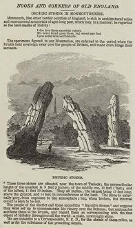
Background imageMaps Tote Bag Collection: Druidic Stones in Monmouthshire (engraving)

Druidic Stones in Monmouthshire (engraving)
1101781 Druidic Stones in Monmouthshire (engraving) by English School, (19th century); Private Collection; (add.info.: Druidic Stones in Monmouthshire)

Background imageMaps Tote Bag Collection: Frontispiece of Atlas of the Countries of England and Wales

Frontispiece of Atlas of the Countries of England and Wales
833802 Frontispiece of Atlas of the Countries of England and Wales by Christopher Saxon, London 1579 (hand-coloured engraving) by English School

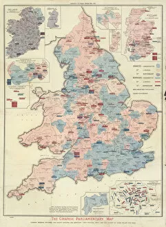
Background imageMaps Tote Bag Collection: The Graphic Parliamentary Map (colour litho)

The Graphic Parliamentary Map (colour litho)
726785 The Graphic Parliamentary Map (colour litho) by English School, (19th century); Private Collection; (add.info.: The Graphic Parliamentary Map)

Background imageMaps Tote Bag Collection: Praehagraphy of England, being a map of that Kingdom illustrative of the principle

Praehagraphy of England, being a map of that Kingdom illustrative of the principle
3062960 Praehagraphy of England, being a map of that Kingdom illustrative of the principle battles fought in it, 1807 (engraving) by English School, (19th century); National Army Museum

Background imageMaps Tote Bag Collection: Members of the New House of Commons (engraving)

Members of the New House of Commons (engraving)
1614018 Members of the New House of Commons (engraving) by English School, (19th century); Private Collection; (add.info.: Members of the New House of Commons)

Background imageMaps Tote Bag Collection: Visit of the Prince of Wales to North America (engraving)

Visit of the Prince of Wales to North America (engraving)
1612650 Visit of the Prince of Wales to North America (engraving) by English School, (19th century); Private Collection; (add.info.: Visit of the Prince of Wales to North America)

Background imageMaps Tote Bag Collection: Ceremony of Opening Newport Dock, Monmouthshire (engraving)

Ceremony of Opening Newport Dock, Monmouthshire (engraving)
1587090 Ceremony of Opening Newport Dock, Monmouthshire (engraving) by English School, (19th century); Private Collection; (add.info.: Ceremony of Opening Newport Dock, Monmouthshire)

Background imageMaps Tote Bag Collection: Front cover of A Compleat Sett of Mapps of England and Wales in General

Front cover of A Compleat Sett of Mapps of England and Wales in General
XYC261682 Front cover of A Compleat Sett of Mapps of England and Wales in General... 1724 (leather) by Badeslade, Thomas (1718-50); Yale Center for British Art, Paul Mellon Collection

Background imageMaps Tote Bag Collection: BT1. 47. 9 The dedication to Queen Elizabeth I from a book of maps of England

BT1. 47. 9 The dedication to Queen Elizabeth I from a book of maps of England
NCO90881 BT1.47.9 The dedication to Queen Elizabeth I from a book of maps of England and Wales by Christopher Saxton, published 1579 by English School

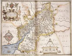
Background imageMaps Tote Bag Collection: Gloucester(shire), 1579 (hand-coloured engraving)

Gloucester(shire), 1579 (hand-coloured engraving)
985997 Gloucester(shire), 1579 (hand-coloured engraving) by Saxton, Christopher (c.1542-c.1610); 41.5x55 cm; Private Collection; (add.info.: Gloucester(shire); Glocestriae

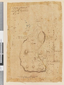
Background imageMaps Tote Bag Collection: Page 37a A Sketch of Block Island, latitude of the South Head 41: 9 N

Page 37a A Sketch of Block Island, latitude of the South Head 41: 9 N
5670302 Page 37a A Sketch of Block Island, latitude of the South Head 41: 9 N, 1768-75 (pen & ink) by Hodges, William (1744-97); Mitchell Library

Background imageMaps Tote Bag Collection: Page 32b New Zealand Portrait of a Maori, 1768-75 (red chalk)

Page 32b New Zealand Portrait of a Maori, 1768-75 (red chalk)
5670297 Page 32b New Zealand Portrait of a Maori, 1768-75 (red chalk) by Hodges, William (1744-97); Mitchell Library, State Library of New South Wales; (add.info.: Original Sketches, Drawings)

Background imageMaps Tote Bag Collection: Page 32a View, possibly of Dusky Bay, New Zealand, 1768-75 (w / c)

Page 32a View, possibly of Dusky Bay, New Zealand, 1768-75 (w / c)
5670296 Page 32a View, possibly of Dusky Bay, New Zealand, 1768-75 (w/c) by Hodges, William (1744-97); Mitchell Library, State Library of New South Wales; (add.info.: Original Sketches, Drawings)

Background imageMaps Tote Bag Collection: Page 25 Resolution Bay in the Marquesas. 1774, 1768-75 (w / c)

Page 25 Resolution Bay in the Marquesas. 1774, 1768-75 (w / c)
5670282 Page 25 Resolution Bay in the Marquesas. 1774, 1768-75 (w/c) by Hodges, William (1744-97); Mitchell Library, State Library of New South Wales; (add.info.: Original Sketches, Drawings)

Background imageMaps Tote Bag Collection: Page 20 A large sailing canoe of the Friendly Islands, 1768-75 (pen & ink and wash)

Page 20 A large sailing canoe of the Friendly Islands, 1768-75 (pen & ink and wash)
5670273 Page 20 A large sailing canoe of the Friendly Islands, 1768-75 (pen & ink and wash) by Hodges, William (1744-97); Mitchell Library

Background imageMaps Tote Bag Collection: Page 19 (a) Middleburg Island bearing W bys distant 3 leagues (b

Page 19 (a) Middleburg Island bearing W bys distant 3 leagues (b
5670271 Page 19 (a) Middleburg Island bearing W bys distant 3 leagues (b) West point of Middleburg N by W four miles (c) Middleburg E bys distant five miles (d)

Background imageMaps Tote Bag Collection: Page 13 Matavai Bay, Otaheite, 1768-75 (w / c)

Page 13 Matavai Bay, Otaheite, 1768-75 (w / c)
5670263 Page 13 Matavai Bay, Otaheite, 1768-75 (w/c) by Roberts, Henry (1756-96); Mitchell Library, State Library of New South Wales; (add.info.: Original Sketches, Drawings)

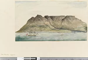
Background imageMaps Tote Bag Collection: Page 12 Table Mountain, Capetown, 1768-75 (w / c)

Page 12 Table Mountain, Capetown, 1768-75 (w / c)
5670262 Page 12 Table Mountain, Capetown, 1768-75 (w/c) by Hodges, William (1744-97); Mitchell Library, State Library of New South Wales; (add.info.: Original Sketches, Drawings)

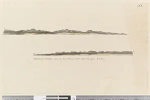
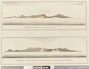
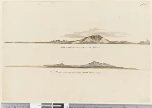
Background imageMaps Tote Bag Collection: Page 6 Island of Bonavista: 2 Profiles. Titled: Island of Bonavista S. W

Page 6 Island of Bonavista: 2 Profiles. Titled: Island of Bonavista S. W
5670257 Page 6 Island of Bonavista: 2 Profiles. Titled: Island of Bonavista S.W. distant 5 leagues and The Island of Bonavista when the hill A, off which lies a ledge of rocks bears west 2 leagues

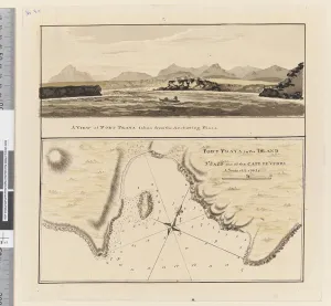
Background imageMaps Tote Bag Collection: Page 3a Chart of Port Praya in the Island of St Jago, Cape Verde Islands

Page 3a Chart of Port Praya in the Island of St Jago, Cape Verde Islands
5670253 Page 3a Chart of Port Praya in the Island of St Jago, Cape Verde Islands. Titled Port Praya in the Island St Jago one of the Cape de Verds sic A scale of 2 to 1/2 a mile / A View of Port

Background imageMaps Tote Bag Collection: Page 1 (a) Profile of the coast of the Isle of Mayo, Cape Verde Islands

Page 1 (a) Profile of the coast of the Isle of Mayo, Cape Verde Islands
5670251 Page 1 (a) Profile of the coast of the Isle of Mayo, Cape Verde Islands. (b) Profile of the coast of Isle of Mayo Cape Verde Islands, looking north west, 1768-75 (pencil)

Background imageMaps Tote Bag Collection: v Great Natural Arch, 75 long, 27 broad, 45 high, Tegadoo Bay, New Zealand

v Great Natural Arch, 75 long, 27 broad, 45 high, Tegadoo Bay, New Zealand
5670250 v Great Natural Arch, 75 long, 27 broad, 45 high, Tegadoo Bay, New Zealand, 1769 by Cook, James (1728-79); Mitchell Library

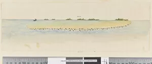
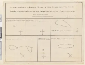
Background imageMaps Tote Bag Collection: iii. Sketches of the islands Lagoon, Thrum-Cap, Bow-Island, the Two Groups

iii. Sketches of the islands Lagoon, Thrum-Cap, Bow-Island, the Two Groups
5670248 iii. Sketches of the islands Lagoon, Thrum-Cap, Bow-Island, the Two Groups, Bird Island and Chain Island, lying in the South, Sea

Background imageMaps Tote Bag Collection: Page 27a Ice Island, 1768-75 (w / c)

Page 27a Ice Island, 1768-75 (w / c)
5670291 Page 27a Ice Island, 1768-75 (w/c) by Hodges, William (1744-97); Mitchell Library, State Library of New South Wales; (add.info.: Original Sketches, Drawings)


All Professionally Made to Order for Quick Shipping


-

Maps Tote Bag Collection

Wales is a country located in the United Kingdom, and it has been mapped for centuries. Maps of Wales have been used to document its geography, topography, and infrastructure. These they are be found in various formats such as paper maps, online maps, and digital GIS systems. They provide detailed information about the physical features of Wales such as mountains, rivers, lakes, roads and railways. Additionally they also show political boundaries between countries within Europe that border Wales such as England and Ireland. Maps of Wales are an invaluable resource for anyone wanting to explore this beautiful country or understand its history better.
+

Our beautiful Wall Art and Photo Gifts include Framed Prints, Photo Prints, Poster Prints, Canvas Prints, Jigsaw Puzzles, Metal Prints and so much more

Media Storehouse offers a collection of Maps of Wales United Kingdom Europe, which includes various wall art options such as framed prints, photo prints, canvas prints, jigsaw puzzles and greeting cards. The maps showcase the geography and topography of Wales in detail with different scales and styles. Our collection features historical maps from the 16th century to modern-day versions that highlight the country's political boundaries, cities, towns and natural landmarks. These maps are perfect for those interested in Welsh history or geography enthusiasts who want to explore the region's diverse landscapes. The Media Storehouse Maps of Wales United Kingdom Europe collection is an excellent way to add character to any room while also providing educational value. Whether it be for personal use or as a gift idea for someone special, these maps offer something unique that can't be found elsewhere. With so many options available at affordable prices, anyone can find their ideal map print or puzzle within this extensive collection.
+

What are Maps of Wales United Kingdom Europe art prints?

Maps of Wales United Kingdom Europe art prints are high-quality reproductions of historical and contemporary maps that depict the geography, topography, and landmarks of Wales, the United Kingdom, and Europe. These prints showcase the intricate details of each map in stunning clarity and vivid colors. They are perfect for anyone who loves history, geography or wants to add a touch of sophistication to their home decor. These art prints come in various sizes and styles to suit different tastes and preferences. Some feature antique maps from centuries ago while others show modern-day roadmaps with detailed information on cities, towns, highways, rivers, mountains among others. The Maps of Wales United Kingdom Europe art prints make great gifts for students studying geography or history as well as those who have an interest in cartography. Overall these beautiful pieces offer a unique way to explore the rich cultural heritage of Wales UK & Europe through its landscapes depicted on paper.
+

What Maps of Wales United Kingdom Europe art prints can I buy from Media Storehouse?

We offer a wide range of Maps of Wales United Kingdom Europe art prints that showcase the beauty and diversity of this region. You can choose from vintage maps, contemporary designs, and everything in between. These prints are available in various sizes to suit your needs and preferences. Some popular options include antique maps that depict the historical boundaries of Wales or detailed topographical maps that highlight its natural features. You can also find artistic renditions that capture the unique character and charm of Welsh towns and cities. Whether you're looking for a decorative piece for your home or office, or you want to gift someone with a meaningful keepsake, we have something for everyone. Their high-quality prints are produced using state-of-the-art printing technology on premium materials to ensure long-lasting durability and vibrant colors. With so many options to choose from, you're sure to find the perfect map print that captures your love for Wales United Kingdom Europe.
+

How do I buy Maps of Wales United Kingdom Europe art prints?

To purchase Maps of Wales United Kingdom Europe art prints, you can visit our online gallery. We offer a wide range of high-quality maps that are perfect for decorating your home or office space. You can browse through our collection and select the map that best suits your preferences. Once you have selected the map, you can choose from various sizes and framing options to customize it according to your needs. We offer a variety of frames such as black wood, white wood, silver metal, and gold metal. To complete your order, simply add the item to your cart and proceed to checkout. You will be prompted to enter your shipping information and payment details before submitting the order. Media Storehouse ensures that all their products are printed on high-quality paper using state-of-the-art printing technology. This guarantees that you receive a beautiful piece of artwork that is both durable and visually stunning.
+

How much do Maps of Wales United Kingdom Europe art prints cost?

We offer a wide range of Maps of Wales United Kingdom Europe art prints at varying prices. Our collection includes vintage and contemporary maps that showcase the beauty and history of Wales, the United Kingdom, and Europe as a whole. The cost of these prints depends on several factors such as size, framing options, and paper quality. Our you can choose from different sizes ranging from small to large formats to suit their needs. We also provide various framing options such as black or white frames that complement the artwork's style. Additionally, our high-quality paper ensures that each print is durable and long-lasting. Whether you're looking for a unique piece to decorate your home or office space or searching for an ideal gift for someone special who loves maps, we have something for everyone in our collection. So explore our website today to discover beautiful Maps of Wales United Kingdom Europe art prints at affordable prices.
+

How will my Maps of Wales United Kingdom Europe art prints be delivered to me?

We take great care in ensuring that your Maps of Wales United Kingdom Europe art prints are delivered to you safely and securely. We use high-quality packaging materials to protect your artwork during transit, so it arrives at your doorstep in pristine condition. We work with trusted delivery partners who have a proven track record for delivering packages on time and without any damage. Depending on where you live, we may use different carriers to ensure the fastest possible delivery times. Once your order is dispatched from our warehouse, you will receive an email notification with tracking information so that you can keep tabs on its progress. If there are any issues with the delivery or if you have any questions about your order, our customer service team is always available to assist you. We strive to make sure that receiving your Maps of Wales United Kingdom Europe art prints is a hassle-free experience that leaves you completely satisfied with both the product and service provided by Media Storehouse.