Home > North America > United States of America > New York > New York > Maps
Map of the city of New York, showing its political divisions and subdivisions

![]()
Wall Art and Photo Gifts from Fine Art Finder
Map of the city of New York, showing its political divisions and subdivisions
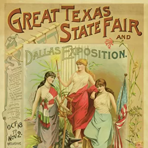
1079253 Map of the city of New York, showing its political divisions and subdivisions, 1870 (black ink with colour wash additions on paper, backed with cloth) by American School, (19th century); 45x100 cm; Collection of the New-York Historical Society, USA; (add.info.: one of four separate photographs showing sections, recto and verso/ four insets showing Manhattan voting wards and senate districts, congressional districts, school districts, and justices districts.
unidentified); eNew York Historical Society; American, out of copyright
Media ID 22633138
© New York Historical Society / Bridgeman Images
Congress Districts Manhattan Plans Sections Senate Surveys
FEATURES IN THESE COLLECTIONS
> Arts
> Artists
> G
> David Grim
> Fine Art Finder
> Artists
> American School
> Fine Art Finder
> Artists
> David Grim
> Maps and Charts
> Early Maps
> North America
> United States of America
> Maps
> North America
> United States of America
> New York
> New York
> Manhattan
> Related Images
> North America
> United States of America
> New York
> New York
> Maps
EDITORS COMMENTS
This print showcases a historic "Map of the city of New York, showing its political divisions and subdivisions" from 1870. Measuring 45x100 cm, this black ink with color wash additions on paper, backed with cloth masterpiece is part of the esteemed collection at the New-York Historical Society in the USA. The map offers an intricate depiction of New York City's political landscape during the 19th century. With meticulous detail, it highlights various sections and districts within Manhattan, including voting wards, senate districts, congressional districts, school districts, and justices districts. These insets provide valuable insights into the city's governance structure at that time. Created by an anonymous American School artist from the 19th century, this map serves as both a historical artifact and a work of art. Its significance lies not only in its cartographic accuracy but also in its representation of America's evolving political landscape during that era. As you explore this image captured by Bridgeman Images for Fine Art Finder, immerse yourself in the rich history embedded within each stroke. Let your imagination wander through time as you envision bustling streets filled with politicians and citizens navigating their way through these intricately divided neighborhoods. This remarkable piece invites us to reflect on how far we have come while honoring our shared heritage rooted in politics and community development.
MADE IN AUSTRALIA
Safe Shipping with 30 Day Money Back Guarantee
FREE PERSONALISATION*
We are proud to offer a range of customisation features including Personalised Captions, Color Filters and Picture Zoom Tools
SECURE PAYMENTS
We happily accept a wide range of payment options so you can pay for the things you need in the way that is most convenient for you
* Options may vary by product and licensing agreement. Zoomed Pictures can be adjusted in the Cart.