Home > Arts > Artists > H > George Hayward
Map of the original grants of village lots from the Dutch West India Company to

![]()
Wall Art and Photo Gifts from Fine Art Finder
Map of the original grants of village lots from the Dutch West India Company to
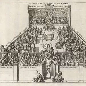
1079277 Map of the original grants of village lots from the Dutch West India Company to the inhabitants of New-Amsterdam (now New-York) lying below the present line of Wall Street, 1857 (black ink, with colour wash, on paper) by Hayward, George (c.1800-72); 42x50 cm; Collection of the New-York Historical Society, USA; (add.info.: New Amsterdam; Maps from D.T. Valentines Manual of the Corporation of the City of New York and his History of New York); eNew York Historical Society; American, out of copyright
Media ID 22633150
© New York Historical Society / Bridgeman Images
Downtown Lower Manhattan Manhattan New Amsterdam Survey Surveys Villages
FEATURES IN THESE COLLECTIONS
> Arts
> Artists
> H
> George Hayward
> Arts
> Artists
> P
> those present
> Arts
> Portraits
> Pop art gallery
> Street art portraits
> Fine Art Finder
> Artists
> George Hayward
> Maps and Charts
> Early Maps
> Maps and Charts
> India
> North America
> United States of America
> Maps
> North America
> United States of America
> New York
> New York
> Manhattan
> Related Images
> North America
> United States of America
> New York
> New York
> Maps
EDITORS COMMENTS
This print showcases a historical treasure, the "Map of the original grants of village lots from the Dutch West India Company to the inhabitants of New-Amsterdam (now New-York) lying below the present line of Wall Street". Created in 1857 by George Hayward, this black ink masterpiece with color wash on paper measures 42x50 cm and is proudly held in the esteemed collection of the New-York Historical Society, USA. Transporting us back in time, this map offers a glimpse into the origins and development of one of America's most iconic cities. With meticulous detail, it reveals how land was allocated to early settlers in lower Manhattan during colonial times. As we explore its intricate lines and markings, we can almost feel ourselves walking through those ancient streets that have since transformed into bustling avenues. The significance of this map extends beyond its artistic beauty; it serves as a testament to New York City's rich history and diverse cultural heritage. From its days as New Amsterdam under Dutch rule to becoming an integral part of American identity, this map encapsulates centuries' worth of stories within its boundaries. As we peer into each village lot meticulously plotted on this map, we are reminded that beneath our modern cityscape lies a tapestry woven by countless generations before us. It is a reminder that progress does not erase history but builds upon it – creating layers upon layers that make up our vibrant metropolis today.
MADE IN AUSTRALIA
Safe Shipping with 30 Day Money Back Guarantee
FREE PERSONALISATION*
We are proud to offer a range of customisation features including Personalised Captions, Color Filters and Picture Zoom Tools
SECURE PAYMENTS
We happily accept a wide range of payment options so you can pay for the things you need in the way that is most convenient for you
* Options may vary by product and licensing agreement. Zoomed Pictures can be adjusted in the Cart.