Home > Animals > Mammals > Spalacidae > Antiquus
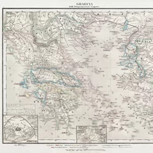
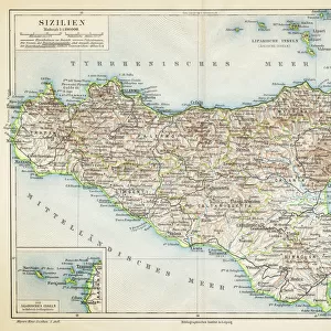
Map of Italy in the time before the Romans (coloured engraving)
")
![]()
Wall Art and Photo Gifts from Fine Art Finder
Map of Italy in the time before the Romans (coloured engraving)
7148253 Map of Italy in the time before the Romans (coloured engraving) by Kiepert, Heinrich (1818-99); Private Collection; (add.info.: Map of Italy in the time before the Romans. Illustration from Atlas Antiquus, Twelve Maps of the Ancient World for Schools and Colleges, by Dr Henry Kiepert (Dietrich Reimer, Berlin, c1889).); © Look and Learn
Media ID 25155160
© Look and Learn / Bridgeman Images
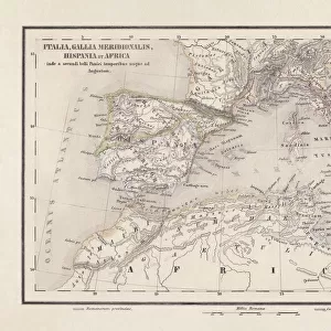
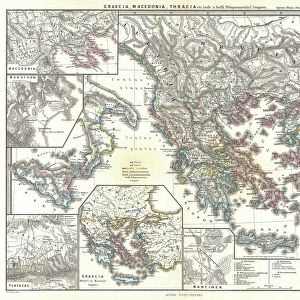
Atlas Cartography City Map City Plan Etruria Etruscan Etruscan Civilization Etruscans General Map Latium Mediterranean Meditteranean Sicily Sicily Sicilian Street Plan Syracuse Antiquit Greece Greek Greeks Mythological Character Mythological Figure Myths Pagan Paganism Pagans Polytheism Polytheist
FEATURES IN THESE COLLECTIONS
> Animals
> Mammals
> Spalacidae
> Antiquus
> Arts
> Artists
> E
> Etruscan Etruscan
> Arts
> Artists
> I
> Italian School Italian School
> Europe
> Greece
> Related Images
> Europe
> Italy
> Heritage Sites
> Syracuse and the Rocky Necropolis of
> Europe
> Italy
> Lazio
> Rome
> Fine Art Finder
> Artists
> Heinrich Kiepert
EDITORS COMMENTS
This coloured engraving, titled "Map of Italy in the time before the Romans" takes us on a journey back to ancient times. Created by Heinrich Kiepert in the late 19th century, this illustration is part of his renowned Atlas Antiquus collection. The map showcases the intricate geography and rich history of Italy before Roman influence dominated the region. It depicts various mythological figures and symbols, highlighting the strong connection between religion and cartography during that era. Paganism and polytheistic beliefs are evident as we explore this vibrant tapestry of colours. From Etruria to Latium, from Greece to Sicily, every corner of Italy comes alive through Kiepert's skilled engravings. The Mediterranean Sea acts as a backdrop, reminding us of its vital role in shaping trade routes and cultural exchange throughout history. As we delve into this visual masterpiece, it becomes clear that each stroke carries immense historical significance. This map serves as a gateway to understanding ancient civilizations such as the Etruscans and Greeks who once thrived on Italian soil. Bridgeman Images has preserved this exquisite piece for our appreciation today. Through its vivid details and meticulous craftsmanship, "Map of Italy in the time before the Romans" invites us to immerse ourselves in an era long gone but forever etched into our collective memory.
MADE IN AUSTRALIA
Safe Shipping with 30 Day Money Back Guarantee
FREE PERSONALISATION*
We are proud to offer a range of customisation features including Personalised Captions, Color Filters and Picture Zoom Tools
SECURE PAYMENTS
We happily accept a wide range of payment options so you can pay for the things you need in the way that is most convenient for you
* Options may vary by product and licensing agreement. Zoomed Pictures can be adjusted in the Cart.