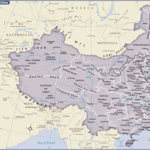
Home > Africa > Guinea > Maps
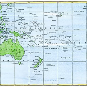
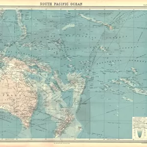
Geographic map of the islands of the Pacific Ocean in Oceania, 19th century. Polynesia, Micronesia, New Zealand, Australia, New Guinee, Philippines, Java, Borneo, Malaysia, Indonesia, China Sea. Colourful engraving of the 19th century

![]()
Wall Art and Photo Gifts from Fine Art Finder
Geographic map of the islands of the Pacific Ocean in Oceania, 19th century. Polynesia, Micronesia, New Zealand, Australia, New Guinee, Philippines, Java, Borneo, Malaysia, Indonesia, China Sea. Colourful engraving of the 19th century
NWI4879032 Geographic map of the islands of the Pacific Ocean in Oceania, 19th century. Polynesia, Micronesia, New Zealand, Australia, New Guinee, Philippines, Java, Borneo, Malaysia, Indonesia, China Sea. Colourful engraving of the 19th century.; (add.info.: Geographic map of the islands of the Pacific Ocean in Oceania, 19th century. Polynesia, Micronesia, New Zealand, Australia, New Guinee, Philippines, Java, Borneo, Malaysia, Indonesia, China Sea. Colourful engraving of the 19th century.); Photo © North Wind Pictures
Media ID 38266792
© Photo © North Wind Pictures / Bridgeman Images
Borneo Filipino Geographical Map Guinee Indonesia Indonesia Indonesian Indonesian Malaysia Malaysian Micronesia New Caledonia New Zealand Pacific Ocean Papua New Guinea Philippines Polynesia South East Asia
FEATURES IN THESE COLLECTIONS
> Asia
> Indonesia
> Related Images
> Asia
> Malaysia
> Related Images
> Asia
> Philippines
> Maps
> Asia
> Philippines
> Related Images
> Fine Art Finder
> Artists
> Unknown Artist
EDITORS COMMENTS
This stunning 19th-century engraving captures the intricate details of the islands of the Pacific Ocean in Oceania. From Polynesia to Micronesia, New Zealand to Australia, and beyond, this colorful map showcases the diverse geography of the region.
The vibrant hues used in this engraving bring each island to life, highlighting their unique characteristics and locations within the vast expanse of the Pacific Ocean. The intricate lines and labels provide a wealth of information about each island, making it not only a beautiful piece of art but also an educational tool for understanding the geography of Oceania.
As you explore this map, you can see familiar names like Indonesia, Malaysia, and Borneo alongside lesser-known islands like New Guinea and Java. The inclusion of major bodies of water such as the China Sea adds another layer of complexity to this detailed depiction.
Whether you have a personal connection to these islands or simply appreciate historical cartography, this print is sure to captivate your imagination. Transport yourself back in time with this enchanting glimpse into 19th-century exploration and discovery in one of Earth's most fascinating regions.
MADE IN AUSTRALIA
Safe Shipping with 30 Day Money Back Guarantee
FREE PERSONALISATION*
We are proud to offer a range of customisation features including Personalised Captions, Color Filters and Picture Zoom Tools
SECURE PAYMENTS
We happily accept a wide range of payment options so you can pay for the things you need in the way that is most convenient for you
* Options may vary by product and licensing agreement. Zoomed Pictures can be adjusted in the Cart.