Home > Europe > United Kingdom > Scotland > Maps
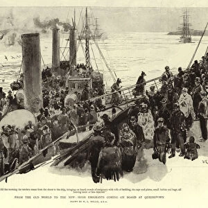
Ecclesiastical Map of the British Isles in the Middle Ages (colour litho)
")
![]()
Wall Art and Photo Gifts from Fine Art Finder
Ecclesiastical Map of the British Isles in the Middle Ages (colour litho)
6016369 Ecclesiastical Map of the British Isles in the Middle Ages (colour litho) by Shepherd, William R. (1871-1934); Private Collection; (add.info.: Ecclesiastical Map of the British Isles in the Middle Ages. Illustration for Historical Atlas by William R Shepherd (3rd and revised edition, University of London Press, 1924).); © Look and Learn
Media ID 25158036
© Look and Learn / Bridgeman Images
Atlas Wales Mythological Character Mythological Figure Myths Pagan Paganism Pagans Polytheism Polytheist
FEATURES IN THESE COLLECTIONS
> Arts
> Artists
> I
> William Ireland
> Europe
> Republic of Ireland
> Maps
> Europe
> United Kingdom
> England
> Maps
> Europe
> United Kingdom
> Scotland
> Maps
> Europe
> United Kingdom
> Wales
> Maps
> Europe
> United Kingdom
> Wales
> Posters
> Fine Art Finder
> Artists
> William R. Shepherd
> Maps and Charts
> Early Maps
> Maps and Charts
> Related Images
EDITORS COMMENTS
This print showcases an exquisite "Ecclesiastical Map of the British Isles in the Middle Ages". Created by William R. Shepherd, a renowned cartographer from the early 20th century, this color lithograph offers a fascinating glimpse into the religious landscape of medieval Britain. The map is richly detailed, depicting not only the geographical features but also highlighting the ecclesiastical divisions that shaped religious life during that era. It presents a visual tapestry of churches, monasteries, and cathedrals spread across England, Scotland, Wales, and Ireland. As we explore this intricate artwork further, it becomes evident that religion played a central role in shaping society during this period. The map's inclusion of mythological figures and characters hints at the influence of paganism on early Christianity. This juxtaposition serves as a reminder of how ancient beliefs intertwined with emerging religious practices. With its historical significance and meticulous craftsmanship, this print transports us back to an era where faith held immense power over people's lives. It invites us to reflect on how religion has evolved over time while reminding us of our shared heritage. Whether you are captivated by history or fascinated by maps' artistic beauty, this Ecclesiastical Map provides both educational value and aesthetic pleasure. Its presence in any collection would undoubtedly spark conversations about spirituality's enduring impact on human civilization throughout centuries past.
MADE IN AUSTRALIA
Safe Shipping with 30 Day Money Back Guarantee
FREE PERSONALISATION*
We are proud to offer a range of customisation features including Personalised Captions, Color Filters and Picture Zoom Tools
SECURE PAYMENTS
We happily accept a wide range of payment options so you can pay for the things you need in the way that is most convenient for you
* Options may vary by product and licensing agreement. Zoomed Pictures can be adjusted in the Cart.