Fraud Blocker Skip to main content

Home > Fine Art Finder > Maps (celestial & Terrestrial)

Maps (celestial & Terrestrial) Collection (page 33)

1,542 items

Background imageMaps (celestial & Terrestrial) Collection: The Kingdome of Scotland, engraved by Jodocus Hondius (1563-1612) from Theatre

The Kingdome of Scotland, engraved by Jodocus Hondius (1563-1612) from Theatre
XCF113485 The Kingdome of Scotland, engraved by Jodocus Hondius (1563-1612) from Theatre of the Empire of Great Britain, pub

Background imageMaps (celestial & Terrestrial) Collection: Hull, detail from the map of the North and East Ridings of Yorkshire, engraved by Jodocus Hondius

Hull, detail from the map of the North and East Ridings of Yorkshire, engraved by Jodocus Hondius
XCF113479 Hull, detail from the map of the North and East Ridings of Yorkshire, engraved by Jodocus Hondius (1563-1612) from John Speeds Theatre of the Empire of Great Britain, pub

Background imageMaps (celestial & Terrestrial) Collection: The Kingdome of England, engraved by Jodocus Hondius (1563-1612) from John Speed s

The Kingdome of England, engraved by Jodocus Hondius (1563-1612) from John Speed s
XCF113483 The Kingdome of England, engraved by Jodocus Hondius (1563-1612) from John Speeds Theatre of the Empire of Great Britain, pub

Background imageMaps (celestial & Terrestrial) Collection: The Bishoprick and City of Durham, engraved by Jodocus Hondius (1563-1612) from John

The Bishoprick and City of Durham, engraved by Jodocus Hondius (1563-1612) from John
XCF113482 The Bishoprick and City of Durham, engraved by Jodocus Hondius (1563-1612) from John Speeds Theatre of the Empire of Great Britain, pub

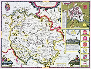
Background imageMaps (celestial & Terrestrial) Collection: Herefordshire, engraved by Jodocus Hondius (1563-1612) from John Speeds Theatre

Herefordshire, engraved by Jodocus Hondius (1563-1612) from John Speeds Theatre
XCF113475 Herefordshire, engraved by Jodocus Hondius (1563-1612) from John Speeds Theatre of the Empire of Great Britain, pub

Background imageMaps (celestial & Terrestrial) Collection: Cambridgeshire, engraved by Jodocus Hondius (1563-1612) from John Speeds Theatre

Cambridgeshire, engraved by Jodocus Hondius (1563-1612) from John Speeds Theatre
XCF113474 Cambridgeshire, engraved by Jodocus Hondius (1563-1612) from John Speeds Theatre of the Empire of Great Britain, pub

Background imageMaps (celestial & Terrestrial) Collection: Gloucestershire, engraved by Jodocus Hondius (1563-1612) from John Speeds Theatre

Gloucestershire, engraved by Jodocus Hondius (1563-1612) from John Speeds Theatre
XCF113477 Gloucestershire, engraved by Jodocus Hondius (1563-1612) from John Speeds Theatre of the Empire of Great Britain, pub

Background imageMaps (celestial & Terrestrial) Collection: Buckinghamshire, engraved by Jodocus Hondius (1563-1612) from John Speeds Theatre

Buckinghamshire, engraved by Jodocus Hondius (1563-1612) from John Speeds Theatre
XCF113478 Buckinghamshire, engraved by Jodocus Hondius (1563-1612) from John Speeds Theatre of the Empire of Great Britain, pub

Background imageMaps (celestial & Terrestrial) Collection: Worchestershire, engraved by Jodocus Hondius (1563-1612) from John Speeds Theatre

Worchestershire, engraved by Jodocus Hondius (1563-1612) from John Speeds Theatre
XCF113472 Worchestershire, engraved by Jodocus Hondius (1563-1612) from John Speeds Theatre of the Empire of Great Britain, pub

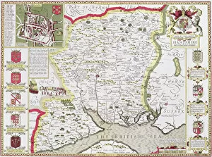
Background imageMaps (celestial & Terrestrial) Collection: Hantshire, engraved by Jodocus Hondius (1563-1612) from John Speeds Theatre

Hantshire, engraved by Jodocus Hondius (1563-1612) from John Speeds Theatre
XCF113466 Hantshire, engraved by Jodocus Hondius (1563-1612) from John Speeds Theatre of the Empire of Great Britain, pub

Background imageMaps (celestial & Terrestrial) Collection: Norfolk, engraved by Jodocus Hondius (1563-1612) from John Speeds Theatre

Norfolk, engraved by Jodocus Hondius (1563-1612) from John Speeds Theatre
XJF113468 Norfolk, engraved by Jodocus Hondius (1563-1612) from John Speeds Theatre of the Empire of Great Britain, pub. by John Sudbury and George Humble

Background imageMaps (celestial & Terrestrial) Collection: Shropshyre, engraved by Jodocus Hondius (1563-1612) from John Speeds Theatre

Shropshyre, engraved by Jodocus Hondius (1563-1612) from John Speeds Theatre
XCF113464 Shropshyre, engraved by Jodocus Hondius (1563-1612) from John Speeds Theatre of the Empire of Great Britain, pub

Background imageMaps (celestial & Terrestrial) Collection: Northamtonshire, engraved by Jodocus Hondius (1563-1612) from John Speeds Theatre

Northamtonshire, engraved by Jodocus Hondius (1563-1612) from John Speeds Theatre
XCF113463 Northamtonshire, engraved by Jodocus Hondius (1563-1612) from John Speeds Theatre of the Empire of Great Britain, pub

Background imageMaps (celestial & Terrestrial) Collection: Suffolk and the situation of Ipswich, engraved by Jodocus Hondius (1563-1612)

Suffolk and the situation of Ipswich, engraved by Jodocus Hondius (1563-1612)
XCF113457 Suffolk and the situation of Ipswich, engraved by Jodocus Hondius (1563-1612) from John Speeds Theatre of the Empire of Great Britain, pub

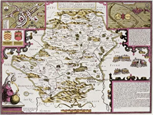
Background imageMaps (celestial & Terrestrial) Collection: Hartfordshire and the situation of Hartford, engraved by Jodocus Hondius (1563-1612)

Hartfordshire and the situation of Hartford, engraved by Jodocus Hondius (1563-1612)
XCF113460 Hartfordshire and the situation of Hartford, engraved by Jodocus Hondius (1563-1612) from John Speeds Theatre of the Empire of Great Britain, pub

Background imageMaps (celestial & Terrestrial) Collection: Rutlandshire with Oukham and Stanford, engraved by Jodocus Hondius (1563-1612)

Rutlandshire with Oukham and Stanford, engraved by Jodocus Hondius (1563-1612)
XCF113456 Rutlandshire with Oukham and Stanford, engraved by Jodocus Hondius (1563-1612) from John Speeds Theatre of the Empire of Great Britain, pub

Background imageMaps (celestial & Terrestrial) Collection: Beatus of Turin mappamundi (engraving)

Beatus of Turin mappamundi (engraving)
XIR215564 Beatus of Turin mappamundi (engraving) by Italian School, (12th century); Bibliotheque Nationale, Paris, France; (add.info.: after Beatus of Liebana (8th), Asturian monk; ); Italian

Background imageMaps (celestial & Terrestrial) Collection: Map of the St. Lawrence Estuary (pen & ink and w / c on paper)

Map of the St. Lawrence Estuary (pen & ink and w / c on paper)
XIR214130 Map of the St. Lawrence Estuary (pen & ink and w/c on paper) by French School, (18th century); Service Historique de la Marine, Vincennes

Background imageMaps (celestial & Terrestrial) Collection: Map of the Great Lakes (pen & ink and w / c on paper)

Map of the Great Lakes (pen & ink and w / c on paper)
XIR214129 Map of the Great Lakes (pen & ink and w/c on paper) by Jolliet, (18th century); Service Historique de la Marine, Vincennes

Background imageMaps (celestial & Terrestrial) Collection: Geo-Hydrographic Mappamonde (coloured engraving)

Geo-Hydrographic Mappamonde (coloured engraving)
XIR214121 Geo-Hydrographic Mappamonde (coloured engraving) by French School, (18th century); Bibliotheque Nationale, Paris, France; French, out of copyright

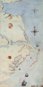
Background imageMaps (celestial & Terrestrial) Collection: Map of Raleighs Virginia (lithograph)

Map of Raleighs Virginia (lithograph)
BAL109987 Map of Raleighs Virginia (lithograph) by White, John (fl.1570-93) (after); 48x23.5 cm; Private Collection; English, out of copyright

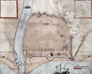
Background imageMaps (celestial & Terrestrial) Collection: Entrenchments, Puerto Rico (litho)

Entrenchments, Puerto Rico (litho)
BAL109980 Entrenchments, Puerto Rico (litho) by White, John (fl.1570-93) (after); 31.5x22 cm; Private Collection; (add.info.: made by Mr Ralph Lane in 1585; ); English, out of copyright

Background imageMaps (celestial & Terrestrial) Collection: Fortified Encampment, Puerto Rico (litho)

Fortified Encampment, Puerto Rico (litho)
BAL109981 Fortified Encampment, Puerto Rico (litho) by White, John (fl.1570-93) (after); 36.3x44.5 cm; Private Collection; (add.info.: 11 May and 23 May 1585); ); English, out of copyright

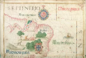
Background imageMaps (celestial & Terrestrial) Collection: Mouth of the Amazon, Brazil, detail from a world atlas, 1565 (vellum)

Mouth of the Amazon, Brazil, detail from a world atlas, 1565 (vellum)
XJL208770 Mouth of the Amazon, Brazil, detail from a world atlas, 1565 (vellum) by Homem, Diego (16th century); The National Library of Russia, St. Petersburg, Russia; Portuguese, out of copyright

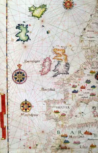
Background imageMaps (celestial & Terrestrial) Collection: The British Isles, Iberia and Northwest Africa, detail from a world atlas, 1565 (vellum)

The British Isles, Iberia and Northwest Africa, detail from a world atlas, 1565 (vellum)
XJL208769 The British Isles, Iberia and Northwest Africa, detail from a world atlas, 1565 (vellum) by Homem, Diego (16th century); The National Library of Russia, St

Background imageMaps (celestial & Terrestrial) Collection: Central America and the Pacific, detail from a world atlas, 1565 (vellum)

Central America and the Pacific, detail from a world atlas, 1565 (vellum)
XJL208765 Central America and the Pacific, detail from a world atlas, 1565 (vellum) by Homem, Diego (16th century); The National Library of Russia, St. Petersburg, Russia; Portuguese, out of copyright

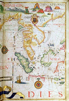
Background imageMaps (celestial & Terrestrial) Collection: Mainland Southeast Asia, detail from a world atlas, 1565 (vellum)

Mainland Southeast Asia, detail from a world atlas, 1565 (vellum)
XJL208764 Mainland Southeast Asia, detail from a world atlas, 1565 (vellum) by Homem, Diego (16th century); The National Library of Russia, St. Petersburg, Russia; Portuguese, out of copyright

Background imageMaps (celestial & Terrestrial) Collection: Corsica, Sardinia and Sicily, detail from a world atlas, 1565 (vellum)

Corsica, Sardinia and Sicily, detail from a world atlas, 1565 (vellum)
XJL208763 Corsica, Sardinia and Sicily, detail from a world atlas, 1565 (vellum) by Homen, Diego (fl.1558); The National Library of Russia, St. Petersburg, Russia; Portuguese, out of copyright

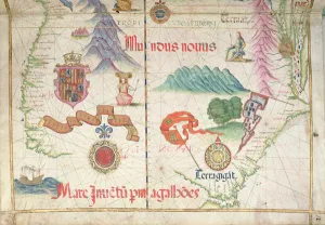
Background imageMaps (celestial & Terrestrial) Collection: South America (South), detail from world atlas, 1565 (vellum)

South America (South), detail from world atlas, 1565 (vellum)
XJL208761 South America (South), detail from world atlas, 1565 (vellum) by Homem, Diego (16th century); The National Library of Russia, St. Petersburg, Russia; Portuguese, out of copyright

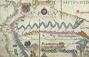
Background imageMaps (celestial & Terrestrial) Collection: Northern South America, detail from a world atlas, 1565 (vellum)

Northern South America, detail from a world atlas, 1565 (vellum)
XJL208760 Northern South America, detail from a world atlas, 1565 (vellum) by Homem, Diego (16th century); The National Library of Russia, St. Petersburg, Russia; Portuguese, out of copyright

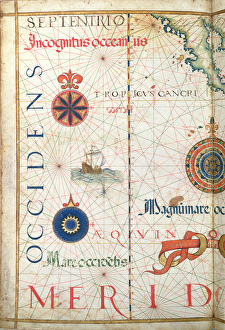
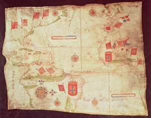
Background imageMaps (celestial & Terrestrial) Collection: Map of the Atlantic Ocean, c. 1550 (vellum)

Map of the Atlantic Ocean, c. 1550 (vellum)
XIR182124 Map of the Atlantic Ocean, c.1550 (vellum) by Portuguese School, (16th century); Bibliotheque Nationale, Paris, France; Portuguese, out of copyright

Background imageMaps (celestial & Terrestrial) Collection: Map of the state of Texas, 1835 (coloured engraving)

Map of the state of Texas, 1835 (coloured engraving)
XJL181922 Map of the state of Texas, 1835 (coloured engraving) by Burr, David (fl.1835); Private Collection; American, out of copyright

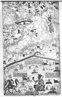
Background imageMaps (celestial & Terrestrial) Collection: Detail from the Catalan Atlas, 1375 (vellum)

Detail from the Catalan Atlas, 1375 (vellum)
XIR174899 Detail from the Catalan Atlas, 1375 (vellum) by Cresques, Abraham (1325-87); Bibliotheque Nationale, Paris, France; Spanish, out of copyright

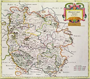
Background imageMaps (celestial & Terrestrial) Collection: Map of Herefordshire, 1695 (coloured engraving)

Map of Herefordshire, 1695 (coloured engraving)
BAL16027 Map of Herefordshire, 1695 (coloured engraving) by Morden, Robert (fl.1682-1703); Map House, London, UK; English, out of copyright

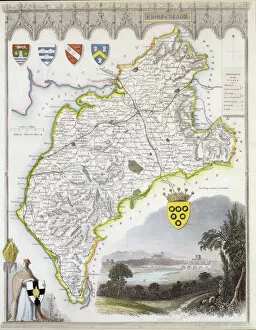
Background imageMaps (celestial & Terrestrial) Collection: Map of Cumberland, from Moules English Counties, c

Map of Cumberland, from Moules English Counties, c
BAL16025 Map of Cumberland, from Moules English Counties, c.1836 (hand coloured steel plate engraving) by Moule, Thomas (1784-1851); Map House, London

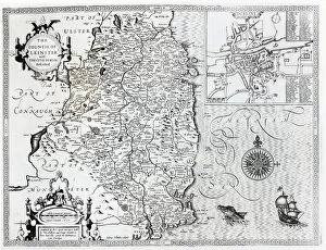
Background imageMaps (celestial & Terrestrial) Collection: The County of Leinster with the City of Dublin Described, engraved by Jodocus Hondius (1563-1612)

The County of Leinster with the City of Dublin Described, engraved by Jodocus Hondius (1563-1612)
XJF105449 The County of Leinster with the City of Dublin Described, engraved by Jodocus Hondius (1563-1612), from Theatre of the Empire of Great Britain, pub

Background imageMaps (celestial & Terrestrial) Collection: Victory of the English Royal Navy in the Bay of Cadiz, engraved by Robert Vaughan (fl

Victory of the English Royal Navy in the Bay of Cadiz, engraved by Robert Vaughan (fl
XJF105706 Victory of the English Royal Navy in the Bay of Cadiz, engraved by Robert Vaughan (fl.1622-78) (engraving) by English School

Background imageMaps (celestial & Terrestrial) Collection: Plan of the Battle of Flodden Field in 1513 (engraving)

Plan of the Battle of Flodden Field in 1513 (engraving)
XJF105374 Plan of the Battle of Flodden Field in 1513 (engraving) by English School; Private Collection; English, out of copyright

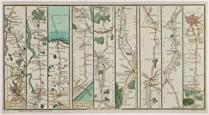
Background imageMaps (celestial & Terrestrial) Collection: A New Plan of the Road from London to Dover and from Calais to Paris, engraved by Smith and Jones

A New Plan of the Road from London to Dover and from Calais to Paris, engraved by Smith and Jones
XYC143676 A New Plan of the Road from London to Dover and from Calais to Paris, engraved by Smith and Jones, 1801 (colour engraving) by Smith, C. A

Background imageMaps (celestial & Terrestrial) Collection: World Map detailing the Expeditions and Global Circumnavigation of Sir Francis Drake (c

World Map detailing the Expeditions and Global Circumnavigation of Sir Francis Drake (c
XJF100261 World Map detailing the Expeditions and Global Circumnavigation of Sir Francis Drake (c.1540-96) 1577-2580 (engraving) (b&w photo) by English School

Background imageMaps (celestial & Terrestrial) Collection: World map; Vera Totius Expeditionis Nauticae, charting the circumnavigation of the globe by

World map; Vera Totius Expeditionis Nauticae, charting the circumnavigation of the globe by
XJF100253 World map; Vera Totius Expeditionis Nauticae, charting the circumnavigation of the globe by (left) Sir Francis Drake (1540-96) and (right) Thomas Cavendish (1560-92) c.1595 (engraving)

Background imageMaps (celestial & Terrestrial) Collection: Map of North America, showing the boundaries of the United States, Canada and the

Map of North America, showing the boundaries of the United States, Canada and the
BAL111039 Map of North America, showing the boundaries of the United States, Canada and the Spanish Possessions, according to the proposals of the Court of France in 1782


All Professionally Made to Order for Quick Shipping


-

Why Choose Us?

We are a leading provider of Art Prints and Photo Gifts since 2003, working in partnership with a range of Sporting Clubs, Charities, Museums and Picture Libraries. A large share of profits from any of their images will go directly towards supporting that charity or club. Our archive of images is carefully curated to bring you a wide range of subjects, including landscapes, wildlife, architecture, and more. We ship from our partner labs in the UK, USA, EU (Netherlands) and Australia.
+

How do I place an order?

Ordering is quick & easy - Just follow 5 Simple Steps:
  1. Find your image: Use our search box or browse our online photo Collections to find the image you want.

  2. Choose your print format: Select your desired product and add it to your cart.

  3. Enter your details: If you're a returning customer, simply enter your email address and password, and we'll fill in your billing and shipping address details. All personal details are held securely and are fully GDPR compliant. As standard, we remove all Personally Identifiable Information after 12 months.

  4. Pay for your purchase: We use state-of-the-art security for online shopping and do not have access to your card details.

  5. Sit back and relax: We'll email you confirmation of your order and when it's dispatched. Registered customers can also track orders in the 'My Account' area.

+

How do I pay for an order?

You can pay for your order with most of the major credit and debit cards, or PayPal. For added security, major financial institutions process payment details separately and securely on our behalf. We do not have access to your online payment card details. Online payments are preferred however we do take phone orders. For UK customers only we accept cheques issued against a UK bank.
+

Is my data safe?

We take data security very seriously. We do not have access to your full card details and all payments are requested over a fully secure connection. Additionally, we fully comply with current European and GDPR legislation, and automatically remove all personal data after at most 12 months (unless you have an account with us and have signed in recently). We also have a strict opt-in policy and would never sell your personal details. Your data is only used to fulfill your order promptly and efficiently.
+

Is wall art ready to hang?

For quick and easy installation all wall art, including framed prints, canvas prints and metal prints are supplied with a ready to hang solution on the back. Generally, saw tooth hangers are applied as they allow wall art to hang flush against the wall. The serrated edge of the hanger prevents the frame from shifting or tilting when hung.
+

Are the photo prints fade resistant?

Yes, we use archival quality photo paper photographic paper for vivid reproduction Prints are an accurate representations of the original artwork, which is preserved for artistic character and authenticity. We guarantee they match previews shown on our web site