Fine Art Print > North America > United States of America > New York > New York > Maps
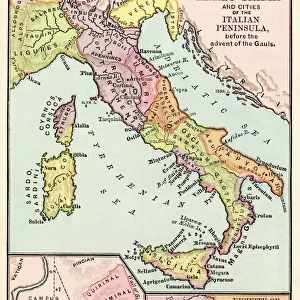
Fine Art Print : Germany map 1875


![]()
Fine Art Prints from Fine Art Storehouse
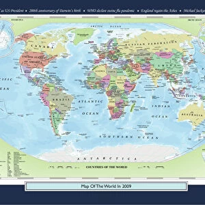
Germany map 1875
The Independent Course Comprehensive Geography by James Monteith, A.S. Barnes & Co, New York & Chicago 1875
Unleash your creativity and transform your space into a visual masterpiece!
THEPALMER
Media ID 13612203
© This content is subject to copyright
Globe Navigational Equipment Paper Drawing Art Product
20"x16" (+3" Border) Fine Art Print
Step back in time with our exquisite Germany map print from The Palmer's Atlas, published in 1875. This stunning fine art print, taken from The Independent Course in Comprehensive Geography by James Monteith, showcases the historical political boundaries and territories of Germany during this era. The intricate details and vibrant colors bring the past to life, making it a captivating addition to any home or office. Perfect for history enthusiasts, geography buffs, or anyone who appreciates the beauty of historical cartography. Hang it on your wall and let the story of Germany's rich history unfold before your eyes.
20x16 image printed on 26x22 Fine Art Rag Paper with 3" (76mm) white border. Our Fine Art Prints are printed on 300gsm 100% acid free, PH neutral paper with archival properties. This printing method is used by museums and art collections to exhibit photographs and art reproductions.
Our fine art prints are high-quality prints made using a paper called Photo Rag. This 100% cotton rag fibre paper is known for its exceptional image sharpness, rich colors, and high level of detail, making it a popular choice for professional photographers and artists. Photo rag paper is our clear recommendation for a fine art paper print. If you can afford to spend more on a higher quality paper, then Photo Rag is our clear recommendation for a fine art paper print.
Estimated Image Size (if not cropped) is 45.9cm x 40.6cm (18.1" x 16")
Estimated Product Size is 66cm x 55.9cm (26" x 22")
These are individually made so all sizes are approximate
Artwork printed orientated as per the preview above, with landscape (horizontal) orientation to match the source image.
FEATURES IN THESE COLLECTIONS
> Europe
> Germany
> Related Images
> Europe
> Related Images
> Maps and Charts
> Related Images
> North America
> United States of America
> Maps
> North America
> United States of America
> New York
> New York
> Maps
> North America
> United States of America
> New York
> Related Images
> Fine Art Storehouse
> The Magical World of Illustration
> Palmer Illustrated Collection
> Fine Art Storehouse
> Map
> Historical Maps
EDITORS COMMENTS
This print showcases a historical gem, the Germany map from 1875. A true testament to the artistry of cartography, this piece is an exquisite representation of James Monteith's comprehensive geography work titled "The Independent Course Comprehensive Geography". Published by A. S. Barnes & Co in New York and Chicago in 1875, this map holds immense cultural and historical significance. With its horizontal orientation, the Germany map takes us on a journey through time, offering a glimpse into Europe's past. The intricate details etched onto paper through engraving techniques transport us to an era long gone but not forgotten. This antique masterpiece captures the essence of physical geography with precision and elegance. As we admire this engraved image, we are reminded of the importance of maps as navigational tools before modern technology took over. It serves as a reminder that once upon a time, globes were essential equipment for explorers and adventurers alike. "The Independent Course Comprehensive Geography" by James Monteith has left an indelible mark on our understanding of the world during that period. Through THEPALMER's lens at Fine Art Storehouse, this remarkable artifact is preserved for future generations to appreciate and study. Let this mesmerizing print transport you back in time while celebrating both artistry and history intertwined within one captivating frame.
MADE IN AUSTRALIA
Safe Shipping with 30 Day Money Back Guarantee
FREE PERSONALISATION*
We are proud to offer a range of customisation features including Personalised Captions, Color Filters and Picture Zoom Tools
SECURE PAYMENTS
We happily accept a wide range of payment options so you can pay for the things you need in the way that is most convenient for you
* Options may vary by product and licensing agreement. Zoomed Pictures can be adjusted in the Cart.