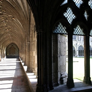
Fine Art Print > Europe > United Kingdom > England > Kent > Canterbury
Fine Art Print : Plan of Canterbury in the Sixteenth Century, (1943). Creator: Frans Hogenberg
. Creator: Frans Hogenberg")


![]()
Fine Art Prints from Heritage Images
Plan of Canterbury in the Sixteenth Century, (1943). Creator: Frans Hogenberg
Plan of Canterbury in the Sixteenth Century, (1943). Map of the walled city of Cantuarbury in Kent, originally published c1580 by Georg Braun and Frans Hogenburg. The Latin text translates as: Canterbury, famous city in the very fertile county of England; notable as an archiepiscopal see. From " English Cities and Small Towns", by John Betjeman. [Collins, London, 1943]
Heritage Images features heritage image collections
Media ID 19780975
© The Print Collector/Heritage Images
Betjeman Braun Britain In Pictures Canterbury City Walls Collins Frans Frans Hogenberg Georg Hogenberg John Betjeman Kent Plan Sir John Betjeman Social History Town Wall Walled City Walled Town Walls William Collins William Collins And Sons William Collins Sons Georg Braun
21"x14" (+3" Border) Fine Art Print
Discover the rich history of Canterbury with our exquisite Fine Art Print of the Sixteenth Century Plan of Canterbury, created by renowned mapmakers Georg Braun and Frans Hogenberg. This captivating print, published in 1580, showcases a detailed and intricate depiction of the walled city of Canterbury in Kent, England. The meticulous attention to detail in this antique map transports you back in time, providing a unique perspective of the city's layout and architectural features during the Renaissance period. Add an air of sophistication and historical charm to your home or office with this stunning Fine Art Print from Media Storehouse's extensive collection.
21x14 image printed on 27x20 Fine Art Rag Paper with 3" (76mm) white border. Our Fine Art Prints are printed on 300gsm 100% acid free, PH neutral paper with archival properties. This printing method is used by museums and art collections to exhibit photographs and art reproductions.
Our fine art prints are high-quality prints made using a paper called Photo Rag. This 100% cotton rag fibre paper is known for its exceptional image sharpness, rich colors, and high level of detail, making it a popular choice for professional photographers and artists. Photo rag paper is our clear recommendation for a fine art paper print. If you can afford to spend more on a higher quality paper, then Photo Rag is our clear recommendation for a fine art paper print.
Estimated Image Size (if not cropped) is 53.3cm x 35.5cm (21" x 14")
Estimated Product Size is 68.6cm x 50.8cm (27" x 20")
These are individually made so all sizes are approximate
Artwork printed orientated as per the preview above, with landscape (horizontal) orientation to match the source image.
FEATURES IN THESE COLLECTIONS
> Animals
> Mammals
> Muridae
> Fortior
> Arts
> Artists
> C
> William Collins
> Arts
> Artists
> S
> William Small
> Europe
> United Kingdom
> England
> Canterbury
> Europe
> United Kingdom
> England
> Kent
> Canterbury
> Europe
> United Kingdom
> England
> Kent
> Related Images
> Europe
> United Kingdom
> England
> Maps
> Maps and Charts
> Related Images
EDITORS COMMENTS
This vibrant print showcases the "Plan of Canterbury in the Sixteenth Century" by Frans Hogenberg, originally published in 1580. The map depicts the walled city of Cantuarbury in Kent, England, renowned for its fertility and as an archiepiscopal see. This image is featured in John Betjeman's book "English Cities and Small Towns" published by Collins in 1943. The photograph captures the intricate details of this historic city, with its colorful buildings nestled within sturdy walls that once protected its inhabitants. It offers a glimpse into Canterbury's rich history, transporting viewers back to the sixteenth century when these streets bustled with life. As we admire this snapshot from the past, we are reminded of how time has shaped our surroundings. The print not only serves as a visual delight but also provides valuable insights into social history and urban development during that era. With William Collins and Sons' publication bringing this remarkable piece to light once again, it becomes clear why Sir John Betjeman chose to include it in his collection. Its inclusion allows us to appreciate both the beauty of Canterbury and its significance within British history. Whether you have a personal connection to Canterbury or simply appreciate historical maps, this print is sure to captivate your imagination and transport you back through time.
MADE IN AUSTRALIA
Safe Shipping with 30 Day Money Back Guarantee
FREE PERSONALISATION*
We are proud to offer a range of customisation features including Personalised Captions, Color Filters and Picture Zoom Tools
SECURE PAYMENTS
We happily accept a wide range of payment options so you can pay for the things you need in the way that is most convenient for you
* Options may vary by product and licensing agreement. Zoomed Pictures can be adjusted in the Cart.