Home > Arts > Modern art pieces
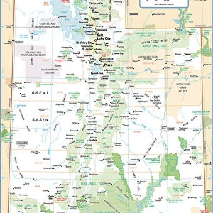
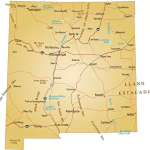
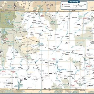
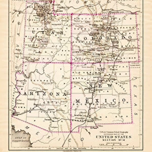
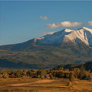
United States South West map 1897

![]()
Wall Art and Photo Gifts from Fine Art Storehouse
United States South West map 1897
The World-Wide Atlas of Modern Geography, Political and Physical W. & A.K. Johnston - London 1897
Unleash your creativity and transform your space into a visual masterpiece!
THEPALMER
Media ID 14457465
© Roberto A Sanchez
Arkansas Atlas California Colorado Country Geographic Area Earth Kansas Louisiana Missouri Nevada New Mexico North America Paper Texas Utah World Map Retro Styled
FEATURES IN THESE COLLECTIONS
> Europe
> United Kingdom
> England
> London
> Related Images
> Fine Art Storehouse
> Map
> Historical Maps
> Fine Art Storehouse
> Map
> USA Maps
> Maps and Charts
> Early Maps
> Maps and Charts
> World
> North America
> Mexico
> Related Images
> North America
> United States of America
> Arkansas
> Related Images
> North America
> United States of America
> California
> Related Images
> North America
> United States of America
> Colorado
> Related Images
> North America
> United States of America
> Kansas
> Related Images
EDITORS COMMENTS
This print showcases a vintage map of the United States Southwest from 1897, taken from "The World-Wide Atlas of Modern Geography" by W. & A. K. Johnston in London. The retro-styled image exudes an antique charm with its engraved details and delicate lines, transporting viewers back to a time when cartography was meticulously crafted by hand. The map encompasses the vast region of the American Southwest, featuring states such as California, Nevada, Utah, Colorado, Texas, Missouri, Kansas, New Mexico, Louisiana, and Arkansas. Its intricate design highlights both the political and physical geography of these areas. Printed on high-quality paper that adds to its nostalgic appeal, this old-world relic serves as a testament to human curiosity about our planet's diverse landscapes. It offers a glimpse into how people perceived their country's geographic area over a century ago. As we gaze upon this enchanting piece of history captured by THEPALMER for Fine Art Storehouse collection enthusiasts can appreciate not only the beauty but also gain insight into how our understanding of Earth has evolved throughout time. Whether displayed in homes or offices alike, this remarkable artwork invites us to reflect on our place within North America while celebrating the artistry involved in creating such detailed maps long before modern technology took hold.
MADE IN AUSTRALIA
Safe Shipping with 30 Day Money Back Guarantee
FREE PERSONALISATION*
We are proud to offer a range of customisation features including Personalised Captions, Color Filters and Picture Zoom Tools
SECURE PAYMENTS
We happily accept a wide range of payment options so you can pay for the things you need in the way that is most convenient for you
* Options may vary by product and licensing agreement. Zoomed Pictures can be adjusted in the Cart.