Framed Print > Europe > United Kingdom > England > London > Boroughs > City of London
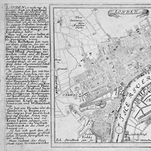
Framed Print : Map of London, c1560


![]()
Framed Photos From Heritage Images
Map of London, c1560
Map of London c1560 during the reign of Queen Elizabeth I, 1558-1603
Heritage Images features heritage image collections
Media ID 15167942
© London Metropolitan Archives (City of London) / Heritage-Images
A1 Premium Frame with A2 Poster
Step back in time with our exquisite Media Storehouse Framed Prints featuring the captivating Map of London, c1560. This rare and intriguing map transports you back to the Elizabethan era, showcasing the bustling streets and key landmarks of London during the reign of Queen Elizabeth I. Each print is meticulously framed with care, preserving the historical charm and intricate details of the map. Add a touch of history to your home or office with this stunning and unique addition to your decor.
Premium Paradise Wooden Range A1 Premium Poster Frame (86x62cm) with A2 Poster (59x42cm) and mounted behind a white matt board to make your photo really stand out. FSC Certified and Rainforest Alliance Certified for environmental, social, and economic sustainably. High transparency tempered glass window with a smooth finished frame. Great for filling empty walls, decorating blank spaces, or creating eye-catching gallery walls. Frames arrive ready to hang. Sent with secure, protective packaging. Smooth wooden veneer mimics the real wood look and feel with ultra-durable scratch resistance tempered glass.
Contemporary Framed and Mounted Prints - Professionally Made and Ready to Hang
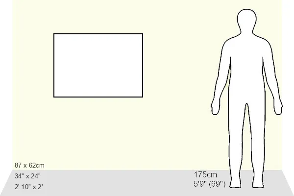
Estimated Image Size (if not cropped) is 57.8cm x 57.8cm (22.8" x 22.8")
Estimated Product Size is 86.6cm x 62cm (34.1" x 24.4")
These are individually made so all sizes are approximate
Artwork printed orientated as per the preview above, with landscape (horizontal) or portrait (vertical) orientation to match the source image.
FEATURES IN THESE COLLECTIONS
> Arts
> Minimalist artwork
> Monochrome artwork
> Fine art
> Arts
> Minimalist artwork
> Monochrome artwork
> Monochrome paintings
> Europe
> United Kingdom
> England
> London
> Boroughs
> City of London
> Europe
> United Kingdom
> England
> London
> River Thames
> Europe
> United Kingdom
> England
> Maps
> Europe
> United Kingdom
> England
> Rivers
> Maps and Charts
> Related Images
EDITORS COMMENTS
This print showcases a remarkable piece of history - the Map of London, c1560. Created during the reign of Queen Elizabeth I, this intricate engraving offers a glimpse into the city's landscape between 1558 and 1603. The anonymous artist behind this masterpiece has beautifully captured the geographical features of London, including its majestic River Thames. As we delve into this nineteenth-century reproduction, it is impossible not to be mesmerized by the level of detail presented. Every street, building, and landmark is meticulously etched onto the paper, allowing us to explore London as it once was. This map serves as a time capsule that transports us back to an era when bustling markets thrived in narrow alleyways and grand palaces adorned the riverbanks. Preserved within Guildhall Library and Art Gallery's collection, this monochrome treasure holds immense historical significance. It provides invaluable insights into how London evolved during one of England's most iconic periods. Whether you are an avid historian or simply fascinated by cartography, this print invites you on a journey through time.
MADE IN AUSTRALIA
Safe Shipping with 30 Day Money Back Guarantee
FREE PERSONALISATION*
We are proud to offer a range of customisation features including Personalised Captions, Color Filters and Picture Zoom Tools
SECURE PAYMENTS
We happily accept a wide range of payment options so you can pay for the things you need in the way that is most convenient for you
* Options may vary by product and licensing agreement. Zoomed Pictures can be adjusted in the Basket.