Fraud Blocker Skip to main content

Boundaries Collection (page 4)

"Exploring Boundaries: Tracing the Historical Imprints of Scotland's Borders" This captivating satellite image showcases the intricate boundaries that define Scotland

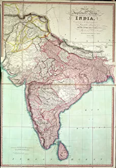
Background imageBoundaries Collection: Improved Map of India published in London 1820 (colour lithograph)

Improved Map of India published in London 1820 (colour lithograph)
XCF267430 Improved Map of India published in London 1820 (colour lithograph) by English School, (19th century); Private Collection; English, out of copyright

Background imageBoundaries Collection: Map of Southern India, 1898 (colour lithograph)

Map of Southern India, 1898 (colour lithograph)
XCF267429 Map of Southern India, 1898 (colour lithograph) by English School, (20th century); Private Collection; English, out of copyright

Background imageBoundaries Collection: Map of India, 1857 (colour lithograph)

Map of India, 1857 (colour lithograph)
XCF267428 Map of India, 1857 (colour lithograph) by English School, (19th century); Private Collection; (add.info.: showing British territories published for the East India Company; ); English

Background imageBoundaries Collection: Map of Paris, June 1800 (coloured engraving)

Map of Paris, June 1800 (coloured engraving)
XIR167356 Map of Paris, June 1800 (coloured engraving) by French School, (19th century); Bibliotheque Nationale, Paris, France; (add.info.: Plan de Paris, juin 1800)

Background imageBoundaries Collection: Picture No. 10763741

Picture No. 10763741
KENYA - Maasai herdsman with sheep, goats & cattle just outside reserve boundaries Date:

Background imageBoundaries Collection: Picture No. 10762018

Picture No. 10762018
Zambia. South Luangwa National Park - The Mfuwe Lodge situated at the shore of a pond is one of the few lodges within the national park boundaries Date:

Background imageBoundaries Collection: Picture No. 10899412

Picture No. 10899412
Native Black Poplar / Black-poplar (Populus nigra ssp.betulifolia) Date:

Background imageBoundaries Collection: Map of the United States of Mexico, 1847 published by J Disturnall. This was appended

Map of the United States of Mexico, 1847 published by J Disturnall. This was appended to the Treaty of Guadalupe-Hidalgo which ended the Mexican American War (1846-1848)

Background imageBoundaries Collection: Tonkinese kitten with its hair standing up watching second kitten approaching

Tonkinese kitten with its hair standing up watching second kitten approaching

Background imageBoundaries Collection: Two kittens (Felis sylvestris catus) clinging to opposite sides of a tree

Two kittens (Felis sylvestris catus) clinging to opposite sides of a tree

Background imageBoundaries Collection: Wales, United Kingdom, satellite image C014 / 0084

Wales, United Kingdom, satellite image C014 / 0084
Wales, satellite image. North is at top. Natural colour satellite image showing Wales in the United Kingdom, with the surrounding territories shaded out

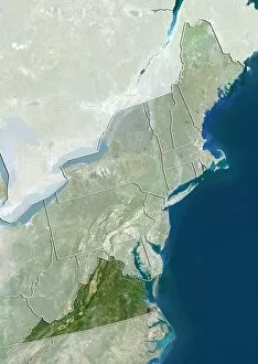
Background imageBoundaries Collection: Northeastern USA, satellite image C014 / 0091

Northeastern USA, satellite image C014 / 0091
Northeastern USA, satellite image. North is at top. Natural colour satellite image showing the Northeastern USA divided into its states, and the Atlantic Ocean (blue) at right

Background imageBoundaries Collection: Virginia, USA, satellite image C014 / 0090

Virginia, USA, satellite image C014 / 0090
Virginia, satellite image. North is at top. Natural colour satellite image showing the state of Virginia, USA, with the surrounding states of the Northeastern USA shaded out

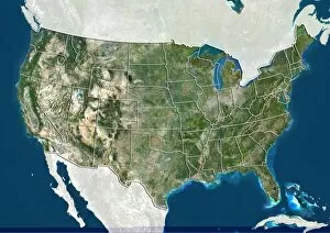
Background imageBoundaries Collection: United States, satellite image C014 / 0087

United States, satellite image C014 / 0087
United States, satellite image. North is at top. Natural colour satellite image showing the United States of America (except Hawaii and Alaska), divided into its states

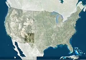
Background imageBoundaries Collection: New Mexico, USA, satellite image C014 / 0086

New Mexico, USA, satellite image C014 / 0086
New Mexico, satellite image. North is at top. Natural colour satellite image showing the state of New Mexico, USA, with the other US states shaded out. The USA consists of 50 states

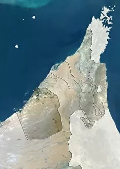
Background imageBoundaries Collection: Dubai, UAE, satellite image C014 / 0082

Dubai, UAE, satellite image C014 / 0082
Dubai, satellite image. North is at top. Natural colour satellite image showing the emirate of Dubai, United Arab Emirates (UAE), with the surrounding emirates shaded out

Background imageBoundaries Collection: Switzerland, satellite image C014 / 0079

Switzerland, satellite image C014 / 0079
Switzerland, satellite image. North is at top. Natural colour satellite image showing Switzerland divided into its cantons (member states)

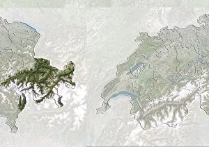
Background imageBoundaries Collection: Graubunden, Switzerland, satellite image C014 / 0078

Graubunden, Switzerland, satellite image C014 / 0078
Graubunden, satellite image. North is at top. Natural colour satellite image showing the canton of Graubunden, Switzerland, with the surrounding Swiss cantons (member states) shaded out

Background imageBoundaries Collection: Coimbra, Portugal, satellite image

Coimbra, Portugal, satellite image
Coimbra, satellite image. North is at top. Natural colour satellite image showing the district of Coimbra, Portugal, with the surrounding Portguese districts shaded out

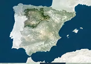
Background imageBoundaries Collection: Castile and Leon, Spain, satellite image C014 / 0076

Castile and Leon, Spain, satellite image C014 / 0076
Castile and Leon, satellite image. North is at top. Natural colour satellite image showing the Castile and Leon autonomous community, Spain

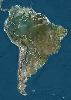
Background imageBoundaries Collection: South America, satellite image

South America, satellite image
South America. Satellite image of South America, showing the borders (white lines) of the countries, and the Caribbean Sea (top right)

Background imageBoundaries Collection: Etched columnar grain structure C016 / 2059

Etched columnar grain structure C016 / 2059
Etched columnar grain structure. Spun-cast tube section, etched to reveal a columnar grain structure. Grains are microscopic crystals (crystallites) that together, separated by visible boundaries

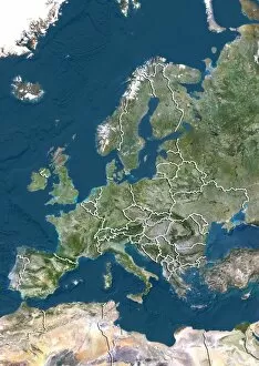
Background imageBoundaries Collection: Europe, satellite image

Europe, satellite image
Europe. North is at top. Satellite image of Europe, showing the borders (white lines) of the countries. Image compiled from data acquired by LANDSAT satellites, in 2012

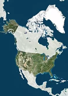
Background imageBoundaries Collection: United States, satellite image

United States, satellite image
United States. North is at top. Satellite image showing the United States of America with the surrounding territories shaded out. The USA consists of 50 states

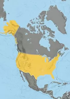
Background imageBoundaries Collection: United States, relief map

United States, relief map
United States. North is at top. Relief map showing the United States of America with the surrounding territories shaded out. The USA consists of 50 states

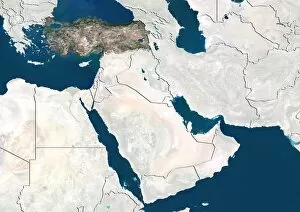
Background imageBoundaries Collection: Turkey, satellite image

Turkey, satellite image. North is at top. Satellite image showing Turkey, with the surrounding countries shaded out. Turkey is a Eurasian country

Background imageBoundaries Collection: Kazakhstan, satellite image

Kazakhstan, satellite image
Kazakhstan. North is at top. Satellite image of the Republic of Kazakhstan, with the surrounding countries shaded out. Kazakhstan is located in Central Asia

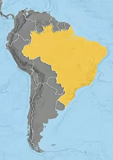
Background imageBoundaries Collection: Brazil, relief map

Brazil, relief map
Brazil. North is at top. Relief map of Brazil (yellow) in South America, showing the borders (white lines) of the surrounding countries

Background imageBoundaries Collection: Centre region, France, satellite image

Centre region, France, satellite image
Centre region, France. North is at top. Satellite image of a close-up on the departments that make up the Centre administrative region of France, with the surrounding areas shaded out

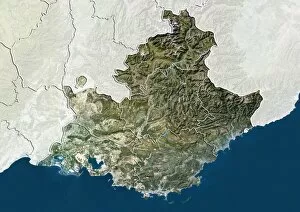
Background imageBoundaries Collection: Provence-Alpes-Cote d Azur, France

Provence-Alpes-Cote d Azur, France. North is at top. Satellite image of a close-up on the departments that make up the Provence-Alpes-Cote d Azur administrative region of France

Background imageBoundaries Collection: Tibet, China, relief map

Tibet, China, relief map
Tibet, China. North is at top. Relief map compiled from satellite data, showing the Tibet Autonomous Region (Tibet, yellow) and the surrounding Chinese provinces and regions (grey)

Background imageBoundaries Collection: Bavaria, Germany, relief map

Bavaria, Germany, relief map
Bavaria, Germany. North is at top. Relief map compiled from satellite data, showing the state of Bavaria (yellow), Germany, with the surrounding German states shaded out (grey)

Background imageBoundaries Collection: Texas, USA, relief map

Texas, USA, relief map
Texas, USA. North is at top. Relief map compiled from satellite data of the USA, showing the state of Texas (yellow), with the surrounding states shaded out (grey). The USA consists of 50 states

Background imageBoundaries Collection: Ile-de-France, France, satellite image

Ile-de-France, France, satellite image
Ile-de-France, France. North is at top. Natural colour satellite image of a close-up on the Ile-de-France administrative region of France

Background imageBoundaries Collection: Val-de-Marne, France, satellite image

Val-de-Marne, France, satellite image
Val-de-Marne, France. North is at top. Natural colour satellite image showing the French department of Val-de-Marne, with the surrounding regions shaded out. Paris can be seen at upper left

Background imageBoundaries Collection: Seine-Saint-Denis, France

Seine-Saint-Denis, France. North is at top. Natural colour satellite image showing the French department of Seine-Saint-Denis, with the surrounding regions shaded out

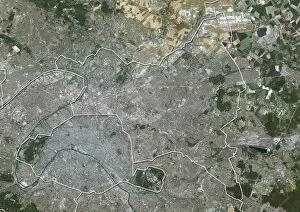
Background imageBoundaries Collection: Paris, France, satellite image

Paris, France, satellite image
Paris, France. North is at top. Natural colour satellite image showing Paris, with the surrounding regions shaded out. France is located in Western Europe

Background imageBoundaries Collection: Hauts-de-Seine, France, satellite image

Hauts-de-Seine, France, satellite image
Hauts-de-Seine, France. North is at top. Natural colour satellite image showing the French department of Hauts-de-Seine, with the surrounding regions shaded out. France is located in Western Europe

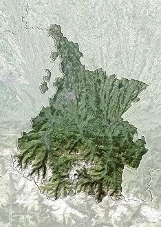
Background imageBoundaries Collection: Hautes-Pyrenees, France, satellite image

Hautes-Pyrenees, France, satellite image
Hautes-Pyrenees, France. North is at top. Natural colour satellite image showing the French department of Hautes-Pyrenees, with the surrounding regions shaded out

Background imageBoundaries Collection: Aveyron, France, satellite image

Aveyron, France, satellite image
Aveyron, France. North is at top. Natural colour satellite image showing the French department of Aveyron, with the surrounding regions shaded out. France is located in Western Europe

Background imageBoundaries Collection: Corse-du-Sud, France, satellite image

Corse-du-Sud, France, satellite image
Corse-du-Sud, France. North is at top. Natural colour satellite image showing the French department of Corse-du-Sud, with the surrounding regions shaded out. France is located in Western Europe

Background imageBoundaries Collection: Wyoming, USA, satellite image

Wyoming, USA, satellite image
Wyoming, USA. North is at top. Natural colour satellite image of the USA, showing the state of Wyoming, with the surrounding states shaded out. The USA consists of 50 states

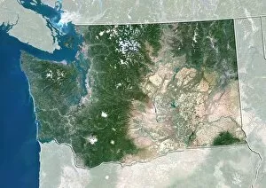
Background imageBoundaries Collection: Washington, USA, satellite image

Washington, USA, satellite image
Washington, USA. North is at top. Natural colour satellite image of the USA, showing the state of Washington, with the surrounding states shaded out. The Pacific Ocean (blue) is also shown

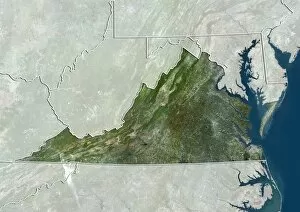
Background imageBoundaries Collection: Virginia, USA, satellite image

Virginia, USA, satellite image
Virginia, USA. North is at top. Natural colour satellite image of the USA, showing the state of Virginia, with the surrounding states shaded out. The Atlantic Ocean (blue) is also shown

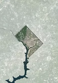
Background imageBoundaries Collection: Washington DC, USA, satellite image

Washington DC, USA, satellite image
Washington DC, USA. North is at top. Natural colour satellite showing Washington, D.C. in the Mid Atlantic region of the USA, with the surrounding states shaded out

Background imageBoundaries Collection: Texas, USA, satellite image

Texas, USA, satellite image
Texas, USA. North is at top. Natural colour satellite image of the USA, showing the state of Texas, with the surrounding states shaded out. The USA consists of 50 states

Background imageBoundaries Collection: Utah, USA, satellite image

Utah, USA, satellite image
Utah, USA. North is at top. Natural colour satellite image of the USA, showing the state of Utah, with the surrounding states shaded out. The USA consists of 50 states

Background imageBoundaries Collection: New Jersey, USA, satellite image

New Jersey, USA, satellite image
New Jersey, USA. North is at top. Natural colour satellite image of the USA, showing the state of New Jersey, with the surrounding states shaded out. The Atlantic Ocean (blue) is also shown


All Professionally Made to Order for Quick Shipping

"Exploring Boundaries: Tracing the Historical Imprints of Scotland's Borders" This captivating satellite image showcases the intricate boundaries that define Scotland, UK. From the iconic London arms and seals to a fascinating map of Europe in 1360, these hints unravel a tale of territorial demarcations. Delving deeper into history, we discover an intriguing map depicting Westerham and Eatonbridge Hundred with the Parish and Ville of Brasted. This ancient document reveals how they were meticulously defined even centuries ago. The tradition of "Beating the Bounds Boats" comes alive through vivid images from 1930, where communities gathered to mark their territory along rivers and coastlines. These rituals symbolized unity while reinforcing geographical limits. They have always been subject to change as demonstrated by a passionate demonstration aiming to keep Horley and Charlwood within Surrey's embrace. The fence lining a country road serves as a reminder that borders can shape landscapes both physically and socially. Traveling back in time, we explore Victorian maps showcasing Great Marlow, Windsor, and Abingdon in 1832. These intricately detailed documents provide insights into how boundaries evolved over time while preserving historical landmarks. In this journey through space and time, we witness how they have shaped our world – defining nations, cultures, traditions – yet also reminding us that they are not fixed but constantly evolving reflections of human endeavors.