Fraud Blocker Skip to main content

From Space Collection (page 20)

"Exploring the vastness of space, we catch a glimpse of our humble abode - the Pale Blue Dot

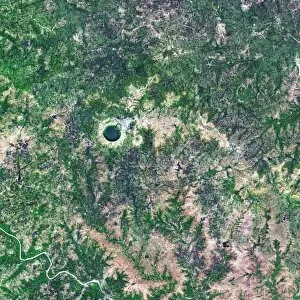
Background imageFrom Space Collection: Serra da Cangalha crater, Brazil

Serra da Cangalha crater, Brazil
Serra da Cangalha crater, satellite image. This impact crater, in Tocantins, Brazil, was formed 220 million years ago. It has a diameter of 12 kilometres. Vegetation is green, bare ground is purple

Background imageFrom Space Collection: Nicholson crater, Canada, satellite image

Nicholson crater, Canada, satellite image
Nicholson crater, satellite image. This crater, in the Northwest Territories, Canada, was formed by a meteorite impact 400 million years ago. Water is dark blue, ice is light blue

Background imageFrom Space Collection: Tenoumer Crater, satellite image

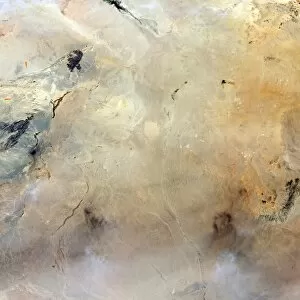
Tenoumer Crater, satellite image. This impact crater is in Mauritania in the Sahara Desert. It is 1.9 kilometres in diameter and has a rim 110 metres high

Background imageFrom Space Collection: Lonar Crater lake, India, satellite image

Lonar Crater lake, India, satellite image
Lonar Crater lake, India, Satellite image. The basin for this saltwater lake was formed by a meteorite impact roughly 50, 000 years ago. The crater is 1.8 kilometres in diameter and 137 metres deep

Background imageFrom Space Collection: Barringer Crater, Arizona

Barringer Crater, Arizona
Barringer Crater, also known as Meteor Crater, Arizona, USA. The crater is about 170 metres deep and 1200 metres in diameter

Background imageFrom Space Collection: Antarctic ozone hole, 2009

Antarctic ozone hole, 2009
Antarctic ozone hole. Satellite image of the ozone hole (blue) over Antarctica (centre) on 10th September 2009. Ozone layer thicknesses are colour coded from purple (lowest) through blue

Background imageFrom Space Collection: Sikhote-Alin meteorite site

Sikhote-Alin meteorite site (centre) seen from space. The Sikhote-Alin meteorite fell at around 10.30am on 12th February 1947, in the Sikhote-Alin Mountains, Siberia, Russia

Background imageFrom Space Collection: Atlantic Ocean, ISS image

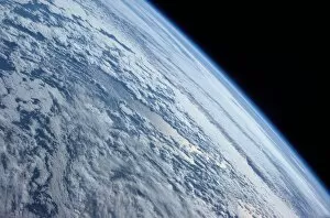
Atlantic Ocean, ISS image
Atlantic Ocean. International Space Station (ISS) image of clouds over the Atlantic Ocean. Image taken by an expedition 7 crew member on 4th October 2003

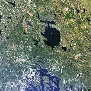
Background imageFrom Space Collection: Lake Yanisyarvi, satellite image

Lake Yanisyarvi, satellite image
Lake Yanisyarvi, Republic of Karelia, Russia. The basin for this lake was formed by a meteorite impact 700 million years ago. It measures 14 kilometres in diameter

Background imageFrom Space Collection: Nordlinger Ries Crater, Germany

Nordlinger Ries Crater, Germany
Nordlinger Ries Crater, satellite image. The crater, whose perimeter is shown in orange, is located in Bravaria, Germany. The city of Nordlinger is located within the crater

Background imageFrom Space Collection: Gosses Bluff crater, Australia

Gosses Bluff crater, Australia
Gosses Bluff crater, seen from spaces. This impact crater is 160 kilometres to the west of Alice Springs, Australia. It is seen between two mountain ranges

Background imageFrom Space Collection: Lhasa, Tibet, satellite image

Lhasa, Tibet, satellite image
Lhasa, Tibet, 3D satellite image. North is towards upper left. Lhasa (elevation 3650 metres) is one of the highest cities in the world

Background imageFrom Space Collection: Aorounga Crater, Chad, satellite image

Aorounga Crater, Chad, satellite image
Aorounga Crater, satellite image. This impact crater is in the Sahara Desert, in Chad. It is one of the best-preserved impact structures in the world

Background imageFrom Space Collection: Russian heatwave, summer 2010

Russian heatwave, summer 2010
Russian heatwave, July 2010. This world satellite map shows global land surface temperature anomalies in the period from 28 July to 4 August 2010

Background imageFrom Space Collection: Wolfe Creek Crater, Australia

Wolfe Creek Crater, Australia
Wolfe Creek Crater, Western Australia. This crater (round area with white centre at upper centre left) measures roughly 880 meters in diameter

Background imageFrom Space Collection: Strait of Gibraltar, satellite image

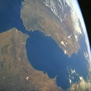
Strait of Gibraltar, satellite image. North is at top, land is brown and water is blue. The Strait of Gibraltar (narrow, blue, upper left) separates Spain (top) from Africa (bottom)

Background imageFrom Space Collection: North Africa at night, ISS image

North Africa at night, ISS image
North Africa at night. International Space Station (ISS) image of Egypt (centre) and the Sinai Peninsula (bottom right) at night. The Mediterranean Sea is across top

Background imageFrom Space Collection: Tabun Khara Obo crater, Mongolia

Tabun Khara Obo crater, Mongolia
Tabun Khara Obo crater, satellite image. This impact crater (upper left, indicated by orange arrows) is in the south east of Mongolia

Background imageFrom Space Collection: Phobos, Martian moon, satellite image

Phobos, Martian moon, satellite image
Phobos. First ever image of Phobos, taken by NASAs Mariner 9 space orbiter in 1971. Phobos, the larger of the two Martian moons, is irregular in shape, measuring 19x21x27 kilometres

Background imageFrom Space Collection: Manicouagan Crater, Canada

Manicouagan Crater, Canada
Manicouagan Crater, satellite image. This crater in Quebec, Canada, was formed by a asteroid impact around 200 million years ago. It is thought the asteroid measured 5 kilometres in diameter

Background imageFrom Space Collection: Pingualuit crater, Canada

Pingualuit crater, Canada
Pingualuit crater, satellite image. This impact crater (blue circle at centre left) is in northern Quebec, Canada. The crater measures 3.4 kilometres in diameter

Background imageFrom Space Collection: Gulf of Mexico hurricane, isobar diagram

Gulf of Mexico hurricane, isobar diagram. The isobars (white lines) connect areas of equal pressure, and are used on meteorological maps to help predict future weather patterns

Background imageFrom Space Collection: European severe storm, isobar diagram

European severe storm, isobar diagram. The isobars (white lines) connect areas of equal pressure, and are used on meteorological maps to help predict future weather patterns

Background imageFrom Space Collection: Fog and snow-covered UK, December 2010

Fog and snow-covered UK, December 2010
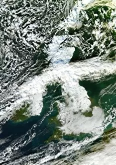
Fog and snow-covered United Kingdom, December 2010. Satellite image of snow (dense white) and fog (greysish white, bottom) covering the UK during the cold spell in December 2010

Background imageFrom Space Collection: Sunset from Earth orbit

Sunset from Earth orbit, seen from the International Space Station (ISS). The glow of the setting Sun is lighting up the atmosphere (blue)

Background imageFrom Space Collection: Hurricane Emily, ISS image

Hurricane Emily, ISS image
Hurricane Emily. International Space Station (ISS) image of Hurricane Emily (eye at lower centre) passing over the southern Gulf of Mexico on 16 July 2005

Background imageFrom Space Collection: Mekong River Delta, satellite image

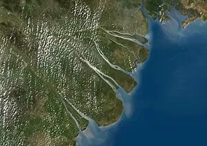
Mekong River Delta, satellite image. This delta is where the Mekong River flows into the South China Sea, on the southern coast of Vietnam

Background imageFrom Space Collection: Earths land cover classification, 2003

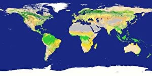
Earths land cover classification, 2003. Produced using data obtained during 2003 from the MODIS instrument on NASAs Terra satellite

Background imageFrom Space Collection: Lake Victoria, satellite image

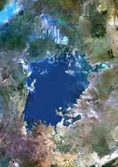
Lake Victoria, satellite image. This African Great Lake is located between Kenya, Uganda and Tanzania. Composite image obtained using data from the Landsat 5 satellite

Background imageFrom Space Collection: Libyan agriculture, satellite image

Libyan agriculture, satellite image. The dark green areas seen in the desert sands are numerous centre pivot irrigation fields. These ones are in the Libyan Desert, in the eastern part of Libya

Background imageFrom Space Collection: British Isles storm and ash plume, 2011

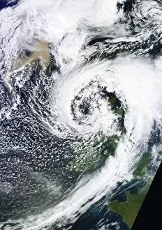
British Isles storm and ash plume, 2011

Background imageFrom Space Collection: Grimsvotn ash plume, May 2011

Grimsvotn ash plume, May 2011, satellite image. This ash cloud (brown, lower right) has been produced by the eruption of the Grimsvotn volcano in Iceland

Background imageFrom Space Collection: Total solar eclipse, from space

Total solar eclipse, from space
Total solar eclipse, seen from space. This image was taken on the morning of 1st August 2008 over the Arctic ocean. The area of totality is the black oval at left

Background imageFrom Space Collection: Noctilucent clouds, ISS image

Noctilucent clouds, ISS image
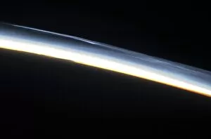
Noctilucent clouds. International Space Station (ISS) image of the limb of the Earth, showing noctilucent clouds (polar mesospheric clouds, across top) in the upper atmosphere

Background imageFrom Space Collection: Las Vegas, satellite image, 2009

Las Vegas, satellite image, 2009
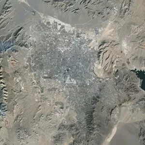
Las Vegas. True colour satellite image of Las Vegas, Nevada, USA. North is at top. The lake at right is Lake Mead, the largest man-made lake in the world

Background imageFrom Space Collection: Crescent Earth with Africa and Europe C009 / 9504

Crescent Earth with Africa and Europe C009 / 9504
Crescent Earth with Africa and Europe in light glow with stars as seen from 40.000 kilometers distance

Background imageFrom Space Collection: Moonrise over Earth

Moonrise over Earth
Moon rise over the Earth horizon

Background imageFrom Space Collection: Exoplanet COROT-7b, artwork

Exoplanet COROT-7b, artwork
Planet from hell Corot-7b. As one can tell from this artists rendition, Corot-7b is about the last planet any spacefarer would want to visit

Background imageFrom Space Collection: Near-Earth asteroids, artwork

Near-Earth asteroids, artwork
A 10-kilometer-sized Asteroid and smaller co-asteroids approaching the Earth, bringing death from space. Here an impact in North America seems to be possible

Background imageFrom Space Collection: TIROS weather satellite image

TIROS weather satellite image
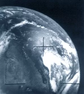
TIROS Earth View of the United States and cloud-covered Mexico. TIROS or Television (Vidicom Camera) Infrared Observation Satellite is a series of early weather satellites launched by NASA

Background imageFrom Space Collection: Hubble Space Telescope

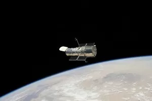
Hubble Space Telescope (HST) in Earth orbit. Image taken from space shuttle Atlantis during mission STS-125, the fifth and final servicing mission to the HST

Background imageFrom Space Collection: Pacific Ocean from space, ISS image

Pacific Ocean from space, ISS image. This image was taken from the International Space Station (ISS) as it orbited some 378 kilometres above the Earth

Background imageFrom Space Collection: Earths rotation

Earths rotation
The Earth in 12 steps, each 30 degrees in the direction of natural rotation, which would be 2 hours

Background imageFrom Space Collection: Greater Manchester, satellite image

Greater Manchester, satellite image
Greater Manchester and surroundings, satellite image. North is at top. The city of Manchester is at centre (grey-white). Liverpool is on the coast at left

Background imageFrom Space Collection: Pine Island Glacier, satellite image

Pine Island Glacier, satellite image
Pine Island Glacier. Satellite image of the Pine Island Glacier on the Antarctic coast. A large ice berg has calved from the glacier into Pine Island bay (bottom centre)

Background imageFrom Space Collection: Crescent Moon from Earth orbit, artwork

Crescent Moon from Earth orbit, artwork
Crescent Moon from Earth orbit, computer artwork. The non-sunlit Earth-facing parts of the Moon are being illuminated by sunlight reflected from the Earth, a phenomenon known as Earthshine

Background imageFrom Space Collection: Mercury, MESSENGER January 2008 flyby

Mercury, MESSENGER January 2008 flyby
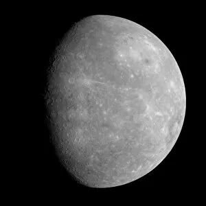
Mercury. MESSENGER image of Mercury, the closest planet to the Sun. At upper right is the giant Caloris basin. The MESSENGER (Mercury Surface, Space Environment)

Background imageFrom Space Collection: Storm over Iceland, satellite image

Storm over Iceland, satellite image
Storm over Iceland. Satellite image showing the swirling clouds (white) of a storm over Iceland. North is at top, water is blue


All Professionally Made to Order for Quick Shipping

"Exploring the vastness of space, we catch a glimpse of our humble abode - the Pale Blue Dot. Voyager 1's iconic image reminds us of Earth's insignificance in the grand scheme of things. " "The breathtaking Earthrise over Moon captured by Apollo 8 serves as a reminder that even from space, our home planet remains an awe-inspiring sight to behold. " "A mesmerizing view of the Whole Earth, also known as Blue Marble 2000, showcases the stunning beauty and fragility of our precious planet. " "From high above, a satellite image reveals the intricate details and natural splendor of the British Isles, offering a unique perspective on this enchanting region. " "As night falls upon the UK, its illuminated cities create a dazzling spectacle when viewed from space. The vibrant lights paint a picture of human activity against the dark canvas of night. " "Gazing down at Europe at night through satellite imagery unveils an interconnected web of bustling metropolises and tranquil landscapes intertwined under twinkling stars. " "Inspired by darkness, Europe at night captivates with its ethereal glow emanating from countless cities scattered across its diverse lands. A testament to humanity's constant motion even after sunset. " "Astonishingly beautiful yet hauntingly mysterious, witnessing Whole Earth at night through satellite imagery evokes contemplation about our place in this vast universe and how we illuminate it with life. " "Jupiter and Io dance gracefully in their celestial ballet as captured by New Horizons' lens. This captivating image transports us beyond our own world into realms where giants roam amidst swirling storms. " "Awe-inspiring from any angle; an exquisite satellite image captures Earth's majestic presence against infinite blackness. A reminder that every corner holds hidden wonders waiting to be discovered. "With remarkable clarity seen from above Scotland within UK is unveiled like never before through detailed satellite imaging—a land steeped in history and adorned with rugged beauty.