Fraud Blocker Skip to main content

From Space Collection (page 13)

"Exploring the vastness of space, we catch a glimpse of our humble abode - the Pale Blue Dot

Background imageFrom Space Collection: Earths atmosphere

Earths atmosphere seen from Apollo 14. Earth is seen at bottom right corner. The atmosphere appears as a bright band (bottom left corner to upper right) as it is lit by the sun

Background imageFrom Space Collection: Aurora from space

Aurora from space
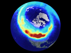
Aurora borealis. Coloured combined ultraviolet and optical image of an aurora borealis (northern lights) display seen from space. The aurorae are seen as a ring of light around the North Pole

Background imageFrom Space Collection: Lambert Glacier, Antarctica

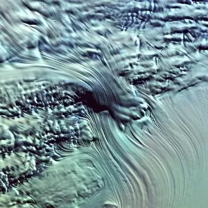
Lambert Glacier, Antarctica

Background imageFrom Space Collection: Coloured satellite image of Hurricane Linda

Coloured satellite image of Hurricane Linda
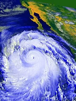
Hurricane Linda. Coloured computer three- dimensional reconstruction, based on satellite data, of Hurricane Linda off the coast of Mexico (top right). North is towards top left

Background imageFrom Space Collection: Coastal lagoons, satellite image

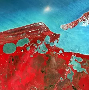
Coastal lagoons, satellite image. North is at top. Vegetation is red and water is blue. This area is on the western coast of Mexicos Yucatan Peninsula

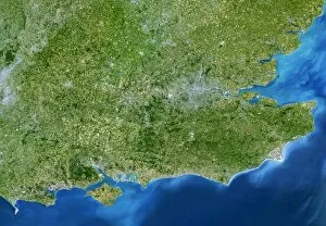
Background imageFrom Space Collection: South-East England

South-East England, satellite image. North is at top. This view is about 280 kilometres across, stretching from Bristol (grey area, centre left) to the eastern coast of Kent (far right)

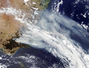
Background imageFrom Space Collection: Australian bush fire smoke

Australian bush fire smoke
Bush fire smoke. Satellite image of smoke from bush fires in Australia being blown out over the Pacific Ocean (blue). The fires surrounded much of the city of Sydney in New South Wales

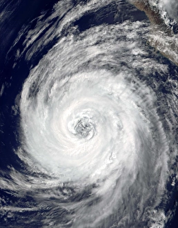
Background imageFrom Space Collection: Tropical Storm Lane

Tropical Storm Lane, true-colour satellite image. This cyclonic storm began as Tropical Depression 14-E on 5 September 2000, over the Pacific Ocean around 200 miles off the Mexican coast

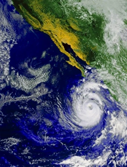
Background imageFrom Space Collection: Satellite image of Hurricane Nora over the Pacific

Satellite image of Hurricane Nora over the Pacific
Hurricane Nora. Satellite image of Hurricane Nora off the coast of Baja California, Mexico. The hurricane is the swirl of clouds surrounding the dark hole (the " eye" ) at lower right

Background imageFrom Space Collection: Tropical cyclones

Tropical cyclones over the Indian Ocean, satellite image. North is at top. The coast of Madagascar is at far left (green). The cyclones are (from left- right): Gerry, Hape, 18S and Fiona

Background imageFrom Space Collection: Thunderstorm over Brazil

Thunderstorm over Brazil. Cumulonimbus storm clouds photographed by the crew of the Space Shuttle Challenger during the STS-41B mission of 3-11 February 1984

Background imageFrom Space Collection: Open cell clouds over the South Atlantic

Open cell clouds over the South Atlantic
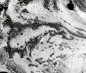
Open cell clouds. Terra satellite image of a cloud formation known as open cell, over the South Atlantic Ocean. This pattern appears on the back of a low pressure system or cyclone

Background imageFrom Space Collection: Jetstream clouds

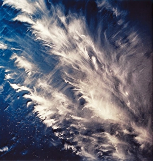
Jetstream clouds seen over north-western Libya. The jetstreams are high-altitude, fast-moving air currents that are a few thousand kilometres long

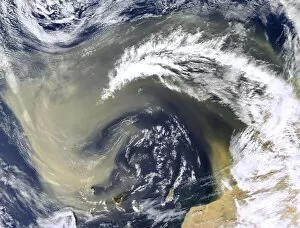
Background imageFrom Space Collection: Sand storm over Canary Islands

Sand storm over Canary Islands
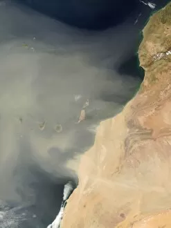
Sand storm. True-colour satellite image of a sand storm from the Sahara Desert, Africa (right), over the Canary Islands (centre to centre left) in the Atlantic Ocean. North is at top

Background imageFrom Space Collection: Forest fires in South America

Forest fires in South America. Satellite image of smoke from thousands of fires (red circles) in South America, near the Brazil-Bolivia border

Background imageFrom Space Collection: Ozone hole, September 2001

Ozone hole, September 2001
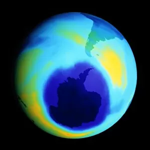
Antarctic ozone hole. Coloured satellite image of reduced atmospheric ozone levels around Antarctica (lower centre, darkest blue) on 17 September 2001

Background imageFrom Space Collection: NOa satellite image of hurricane Fran near USA

NOa satellite image of hurricane Fran near USA

Background imageFrom Space Collection: French coastline

French coastline. True-colour satellite image of the Atlantic coastline of south-west France. North is at top. Vegetation is green and water is blue. A sandy beach (white) stretches up the coast

Background imageFrom Space Collection: Eye of Hurricane Dean, 18 August 2007

Eye of Hurricane Dean, 18 August 2007
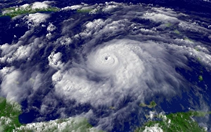
Eye of Hurricane Dean. Clouds swirling around the eye of Hurricane Dean over the Caribbean at noon local time on 18 August 2007

Background imageFrom Space Collection: Jet stream clouds

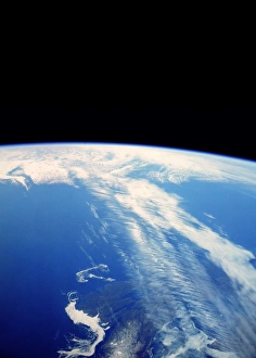
Jet stream clouds over eastern Canada, seen from orbit. North is towards bottom. This band of high- altitude clouds runs from bottom right to centre

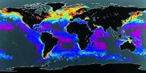
Background imageFrom Space Collection: False-col satellite image of worlds oceans

False-col satellite image of worlds oceans
False-colour satellite image of the worlds oceans, showing the distribution of phytoplankton in the surface water. The colours represent varying phytoplankton densities from red (most dense)

Background imageFrom Space Collection: Dust storm over the Canary Islands

Dust storm over the Canary Islands, Aqua satellite image. Sand has blown north-west from the Sahara desert (bottom right) and is swirling over the Canary Islands (bottom centre)

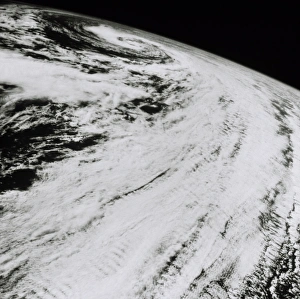
Background imageFrom Space Collection: Storm clouds in North Atlantic, from space, 61-A

Storm clouds in North Atlantic, from space, 61-A
Storm clouds seen from space. This photograph shows the clouds associated with a cyclonic disturbance. This is found near a low pressure region, and used to be called a mid-lattitude cyclone

Background imageFrom Space Collection: Von Karman vortices, Cape Verde islands

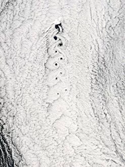
Von Karman vortices, Cape Verde islands
Von Karman vortices. Terra satellite image of von Karman vortices (best seen at top left) in clouds over the Cape Verde Islands off West Africa

Background imageFrom Space Collection: Thunderstorm cloud seen from space

Thunderstorm cloud seen from space
Thunderstorm seen from space. View of a large cumulonimbus cloud cell seen from an orbiting Space Shuttle. The cell has two major updrafts

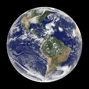
Background imageFrom Space Collection: Earth with 5 hurricanes, satellite image

Earth with 5 hurricanes, satellite image
Earth with five hurricanes, satellite image. North is at top. There are five rotating cloud systems (white) seen across the upper hemisphere of Earth

Background imageFrom Space Collection: Gemini 12 image of the jetstream over the

Gemini 12 image of the jetstream over the
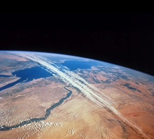
Jetstream. Gemini 12 photograph of the jetstream high over the Sahara Desert in Egypt. The desert is in the foreground, and is cut across by the River Nile

Background imageFrom Space Collection: Coloured satellite image of Hurricane Pauline

Coloured satellite image of Hurricane Pauline
Hurricane Pauline. Coloured computer three- dimensional reconstruction, based on satellite data, of Hurricane Pauline off the coast of Mexico (green). North is towards top

Background imageFrom Space Collection: Chilean glaciers

Chilean glaciers, photographed from the orbiting International Space Station. This is the Cerro Pared Norte coastal mountains in southern Chile

Background imageFrom Space Collection: St Ives, Cornwall, UK, satellite image

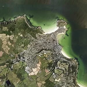
St Ives, Cornwall, UK, satellite image. North is at top. Water is dark green, land is green, brown and grey. Sand is white/pale green

Background imageFrom Space Collection: Heath and moorland fires, UK

Heath and moorland fires, UK
Heath and moorland fires in the UK, Aqua satellite image. April 2003 was a warm, dry month in Northern Europe. This, combined with a strong easterly wind
Background imageFrom Space Collection: False colour image of the Indian Ocean

False colour image of the Indian Ocean
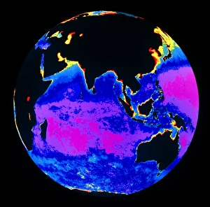
False-colour satellite image of the Indian Ocean and part of the Pacific Ocean, showing the distribution of phytoplankton in the surface water

Background imageFrom Space Collection: Hurricane Emily, 14th July 2005

Hurricane Emily, 14th July 2005
Hurricane Emily in the Caribbean Sea, at 19:15 GMT (20:15 BST) on 14th July 2005. At this stage Emily was a category four hurricane, the second strongest level

Background imageFrom Space Collection: Dust storm over the Red Sea

Dust storm over the Red Sea
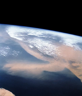
Dust storm spreading out over the Red Sea. This view is looking south, looking toward the mainland of Africa in southern Sudan

Background imageFrom Space Collection: Antarctic ozone hole, 2006

Antarctic ozone hole, 2006
Antarctic ozone hole. Coloured satellite image of the reduced atmospheric ozone layer over Antarctica on 13th September 2007

Background imageFrom Space Collection: Dust plume crossing the Mediterranean

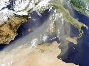
Dust plume crossing the Mediterranean sea, Terra satellite image. Sand and dust from North Africa and the Sahara (bottom) has blown north towards Italy in a large plume

Background imageFrom Space Collection: County Durham, England

County Durham, England
County Durham, UK, satellite image. Vegetation is green, water is blue and urban areas are grey. North is at top. County Durham is a county in north-east England

Background imageFrom Space Collection: Carbon dioxide levels, Atlantic, 2003

Carbon dioxide levels, Atlantic, 2003
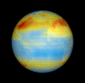
Atmospheric carbon dioxide levels centred on the Atlantic Ocean, satellite data. Carbon dioxide (CO2) is a greenhouse gas that contributes to global warming

Background imageFrom Space Collection: Dust storm over the Arabian Sea

Dust storm over the Arabian Sea and Persian Gulf, Terra and Aqua composite satellite image. Sand and dust from surrounding countries has been picked up by winds, forming a sandstorm

Background imageFrom Space Collection: Arctic ozone distribution

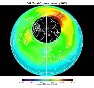
Arctic ozone distribution. Coloured satellite image of average total column ozone levels (amount of ozone in a column of air between the Earths surface and space) over the Arctic during January 2005

Background imageFrom Space Collection: Hurricane Florence from space shuttle

Hurricane Florence from space shuttle
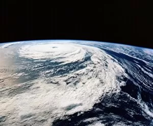
Hurricane Florence. Photograph of the clouds associated with Hurricane Florence, taken from Space Shuttle Atlantis during Mission STS-66 of 3- 14 November 1994

Background imageFrom Space Collection: Von Karman vortices in clouds

Von Karman vortices in clouds
Von Karmen vortices. Aqua satellite image of clouds showing a Von Karmen vortex street (braid- like area, centre) over Jan Mayen Island (at top of street). The wind is blowing from the top

Background imageFrom Space Collection: Mediterranean Basin, satellite image

Mediterranean Basin, satellite image. North is at top. The mediterranean separates the continents of Europe and Africa. The northern Mediterranean borders Spain, France, Italy, Slovenia

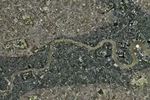
Background imageFrom Space Collection: Flood risk in London, satellite image

Flood risk in London, satellite image
Flood risk in London. Satellite image of central London illustrating the areas at risk of flooding due to a rise in sea-level. North is at top

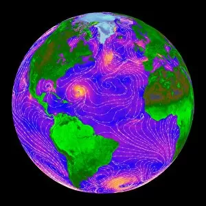
Background imageFrom Space Collection: Atlantic storms, QuikSCAT radar image

Atlantic storms, QuikSCAT radar image
Atlantic storms, radar image. This map, centred on the Atlantic, shows wind speeds measured by radar from the QuikSCAT satellite

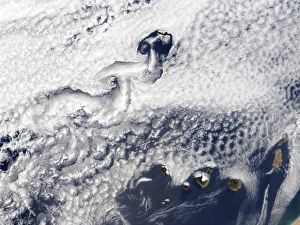
Background imageFrom Space Collection: Clouds disrupted by islands

Clouds disrupted by islands, true-colour satellite image. North is at top. The islands (brown) of the Canary Islands (lower right) and Madeira (upper centre) are disrupting clouds (white)

Background imageFrom Space Collection: View of long cirrus clouds over Atlantic

View of long cirrus clouds over Atlantic
View of long cirrus clouds & transverse bands over the Atlantic, 160 km northwest of Dakar on the westernmost tip of Africa

Background imageFrom Space Collection: Hurricane Emily, 17 July 2005

Hurricane Emily, 17 July 2005
Hurricane Emily. Satellite image of Hurricane Emily (centre) approaching Yucatan (left), Mexico, on 17 July 2005 at 1625 GMT


All Professionally Made to Order for Quick Shipping

"Exploring the vastness of space, we catch a glimpse of our humble abode - the Pale Blue Dot. Voyager 1's iconic image reminds us of Earth's insignificance in the grand scheme of things. " "The breathtaking Earthrise over Moon captured by Apollo 8 serves as a reminder that even from space, our home planet remains an awe-inspiring sight to behold. " "A mesmerizing view of the Whole Earth, also known as Blue Marble 2000, showcases the stunning beauty and fragility of our precious planet. " "From high above, a satellite image reveals the intricate details and natural splendor of the British Isles, offering a unique perspective on this enchanting region. " "As night falls upon the UK, its illuminated cities create a dazzling spectacle when viewed from space. The vibrant lights paint a picture of human activity against the dark canvas of night. " "Gazing down at Europe at night through satellite imagery unveils an interconnected web of bustling metropolises and tranquil landscapes intertwined under twinkling stars. " "Inspired by darkness, Europe at night captivates with its ethereal glow emanating from countless cities scattered across its diverse lands. A testament to humanity's constant motion even after sunset. " "Astonishingly beautiful yet hauntingly mysterious, witnessing Whole Earth at night through satellite imagery evokes contemplation about our place in this vast universe and how we illuminate it with life. " "Jupiter and Io dance gracefully in their celestial ballet as captured by New Horizons' lens. This captivating image transports us beyond our own world into realms where giants roam amidst swirling storms. " "Awe-inspiring from any angle; an exquisite satellite image captures Earth's majestic presence against infinite blackness. A reminder that every corner holds hidden wonders waiting to be discovered. "With remarkable clarity seen from above Scotland within UK is unveiled like never before through detailed satellite imaging—a land steeped in history and adorned with rugged beauty.