Fraud Blocker Skip to main content

Haiti Collection (page 2)

"Haiti: A Tapestry of History, Culture, and Resilience" Step back in time to 1883 with the Haiti and Dominican Republic map

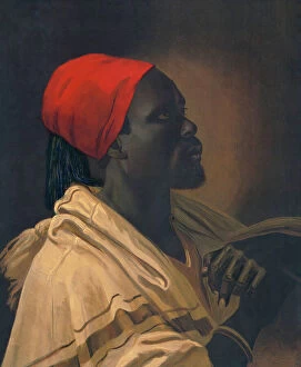
Background imageHaiti Collection: Toussaint Louverture

Toussaint Louverture
3118610 Toussaint Louverture; (add.info.: Portrait of Toussaint Louverture (1743-1803) leader of the Haitian Revolution and President for Life. Dated 18th Century.); Universal History Archive/UIG

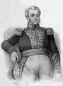
Background imageHaiti Collection: Guy-Joseph Bonnet (engraving)

Guy-Joseph Bonnet (engraving)
2497740 Guy-Joseph Bonnet (engraving); (add.info.: Guy-Joseph Bonnet (1773Ð1843), historian and officer of the army of Haiti.); © Estate of Gerald Bloncourt. All Rights Reserved 2024

Background imageHaiti Collection: Haiti The ancient fortifications of Petity Goave (postcard)

Haiti The ancient fortifications of Petity Goave (postcard)
2721253 Haiti The ancient fortifications of Petity Goave (postcard); (add.info.: 19368N Haiti The ancient fortifications of Petity Goave in Haiti? Collection); © Estate of Gerald Bloncourt

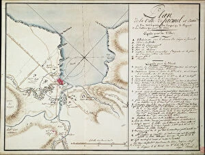
Background imageHaiti Collection: Vicinity of Jacmel, used to indicate lines and positions occupied during the blockade

Vicinity of Jacmel, used to indicate lines and positions occupied during the blockade
7339490 Vicinity of Jacmel, used to indicate lines and positions occupied during the blockade and the batteries established in order to build the besieged defences

Background imageHaiti Collection: French legionnaire soldiers from France. switzerland. Russia. Germany. Poland. Haiti. Turkey

French legionnaire soldiers from France. switzerland. Russia. Germany. Poland. Haiti. Turkey. Morocco. Hungary
5305170 French legionnaire soldiers from France. switzerland. Russia. Germany. Poland. Haiti. Turkey. Morocco. Hungary. Belgium and Italy on parade in Sidi Bel Abbes, Algeria

Background imageHaiti Collection: Geography Atlas: representation of the island of Santo Domingo in the West Indies

Geography Atlas: representation of the island of Santo Domingo in the West Indies
VEN5031371 Geography Atlas: representation of the island of Santo Domingo in the West Indies. Map from an atlas by Antonio del Monte y Tejada (1783-1861), 1860

Background imageHaiti Collection: Geography Atlas: representation of the island of Santo Domingo in the West Indies

Geography Atlas: representation of the island of Santo Domingo in the West Indies. Map from an atlas by J. B
VEN5031350 Geography Atlas: representation of the island of Santo Domingo in the West Indies. Map from an atlas by J. B. Poirson (1761-1831), French geographer, 1803

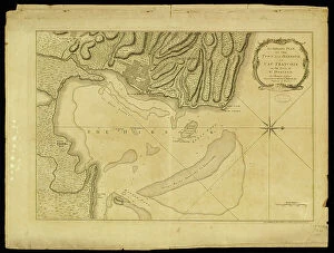
Background imageHaiti Collection: Geography Atlas: representation of Cape Francais (Cap de la Republique)

Geography Atlas: representation of Cape Francais (Cap de la Republique) in Santo Domingo in the West Indies
VEN5031342 Geography Atlas: representation of Cape Francais (Cap de la Republique) in Santo Domingo in the West Indies. Map from an atlas by Thomas Jefferys, geographer of the Prince of Wales, 1760

Background imageHaiti Collection: Geography map: representation of the island of Hispaniola grouping the present-day Haiti

Geography map: representation of the island of Hispaniola grouping the present-day Haiti
VEN5030177 Geography map: representation of the island of Hispaniola grouping the present-day Haiti and Santo Domingo in the West Indies

Background imageHaiti Collection: Haiti, Port au Prince: Portrait of a young creole with a lace bodice, 1900

Haiti, Port au Prince: Portrait of a young creole with a lace bodice, 1900
LUX4712729 Haiti, Port au Prince: Portrait of a young creole with a lace bodice, 1900; (add.info.: Haiti, Port au Prince: Portrait of a young creole with a lace bodice, 1900); Photo © Lux-in-Fine

Background imageHaiti Collection: Flags of forty countries, circa 1890. Colour lithography, 19th century

Flags of forty countries, circa 1890. Colour lithography, 19th century
NWI4851551 Flags of forty countries, circa 1890. Colour lithography, 19th century.; (add.info.: Flags of forty countries, circa 1890)

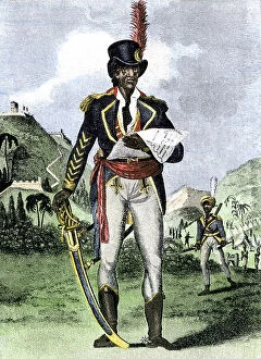
Background imageHaiti Collection: Toussaint Louverture

Toussaint Louverture
3586035 Toussaint Louverture; (add.info.: Portrait of Toussaint Louverture (1743-1803) leader of the Haitian Revolution. Dated 19th Century.); Universal History Archive/UIG

Background imageHaiti Collection: The city of Bombarde (Haiti). Lithography for the book: ' Galerie complete en tableaux fideles des

The city of Bombarde (Haiti). Lithography for the book: " Galerie complete en tableaux fideles des peuples
FLO4635962 The city of Bombarde (Haiti). Lithography for the book: " Galerie complete en tableaux fideles des peuples d'Amerique et d'Australie" by Friedrich Wilhelm Goedsche

Background imageHaiti Collection: Portrait of Jean Jacques Dessalines (1758-1806), Jacques I Emperor of Haiti

Portrait of Jean Jacques Dessalines (1758-1806), Jacques I Emperor of Haiti
NWI4924167 Portrait of Jean Jacques Dessalines (1758-1806), Jacques I Emperor of Haiti. He was one of the leaders of the revolt of Haiti and the first emperor of the First Black Republic in 1804

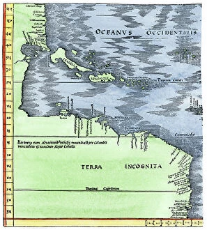
Background imageHaiti Collection: Geographic map of the New World, 1513, admiral map of the Caribbean and unknown lands of North

Geographic map of the New World, 1513, admiral map of the Caribbean and unknown lands of North and South America
NWI4846079 Geographic map of the New World, 1513, admiral map of the Caribbean and unknown lands of North and South America

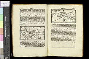
Background imageHaiti Collection: Geography map: double page of an Atlas showing maps and descriptive texts of the islands of

Geography map: double page of an Atlas showing maps and descriptive texts of the islands of Hispagnola
VEN5030442 Geography map: double page of an Atlas showing maps and descriptive texts of the islands of Hispagnola (Santo Domingo and Haiti) and the small Antilles in the Caribbean Sea

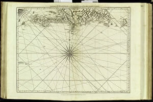
Background imageHaiti Collection: Geography map: representation of the coasts of the island of Hispaniola (Santo Domingo and Haiti)

Geography map: representation of the coasts of the island of Hispaniola (Santo Domingo and Haiti) in the West Indies
VEN5030191 Geography map: representation of the coasts of the island of Hispaniola (Santo Domingo and Haiti) in the West Indies, made by Dutch cartographer Gerard van Keulen (1678-1726) 1709-1713

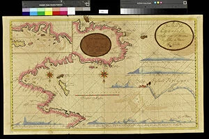
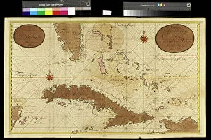
Background imageHaiti Collection: Geography map: representation of the coasts of Florida, the Bahamas Islands

Geography map: representation of the coasts of Florida, the Bahamas Islands
VEN5030120 Geography map: representation of the coasts of Florida, the Bahamas Islands, the island of Cuba and part of the island of Hispaniola (Santo Domingo and Haiti)

Background imageHaiti Collection: Geography Atlas: representation of the island of Hispaniola (Haiti and Santo Domingo)

Geography Atlas: representation of the island of Hispaniola (Haiti and Santo Domingo)
VEN5030000 Geography Atlas: representation of the island of Hispaniola (Haiti and Santo Domingo) and the passage of the Winds (or Under-wind) in the Caribbean archipelago. Below is a Wind Rose

Background imageHaiti Collection: Geography Atlas: representation of the island of Santo Domingo in the West Indies

Geography Atlas: representation of the island of Santo Domingo in the West Indies
VEN5031364 Geography Atlas: representation of the island of Santo Domingo in the West Indies. Map taken from an atlas by Antonio del Monte y Tejada (1783-1861) with portraits of Christopher Columbus

Background imageHaiti Collection: Geography: map of the island of Cuba, the island of Hispaniola (Santo Domingo and Haiti)

Geography: map of the island of Cuba, the island of Hispaniola (Santo Domingo and Haiti), the island of Jamaica
VEN5031283 Geography: map of the island of Cuba, the island of Hispaniola (Santo Domingo and Haiti), the island of Jamaica, the island of Margarita (Margarita) and the island of Saint John

Background imageHaiti Collection: map of Haiti, Santo Domingo - Hispaniola, 18th century (engraving)

map of Haiti, Santo Domingo - Hispaniola, 18th century (engraving)
2902890 map of Haiti, Santo Domingo - Hispaniola, 18th century (engraving); Buyenlarge Archive/UIG

Background imageHaiti Collection: Guy Joseph Bonnet (engraving)

Guy Joseph Bonnet (engraving)
2690588 Guy Joseph Bonnet (engraving); (add.info.: Guy-Joseph Bonnet (1773-1843), historian and officer of the weapon of Haiti. Guy-Joseph Bonnet made a military career. On 27 Aug

Background imageHaiti Collection: Columbus landing on Hispaniola, 1494 (woodcut)

Columbus landing on Hispaniola, 1494 (woodcut)
1578445 Columbus landing on Hispaniola, 1494 (woodcut); (add.info.: Columbus (1451-1506) landing on Hispaniola. From a woodcut of 1494.); Universal History Archive/UIG

Background imageHaiti Collection: Haiti, 1879 : General view of Cap-Haitien, from Marchegalles, engraving

Haiti, 1879 : General view of Cap-Haitien, from Marchegalles, engraving
1729792 Haiti, 1879 : General view of Cap-Haitien, from Marchegalles, engraving; (add.info.: Haiti, 1879 : general view of Cap-Haitien, from Marchegalles, engraving)

Background imageHaiti Collection: Portrait of Francois Dominique Toussaint dit 'Toussaint-Louverture' (Toussaint Louverture)

Portrait of Francois Dominique Toussaint dit "Toussaint-Louverture" (Toussaint Louverture, 1743-1803)
NWI4924129 Portrait of Francois Dominique Toussaint dit "Toussaint-Louverture" (Toussaint Louverture, 1743-1803), Haitian statesman liberating Haiti

Background imageHaiti Collection: Toussaint Louverture

Toussaint Louverture
3586036 Toussaint Louverture; (add.info.: Portrait of Toussaint Louverture (1743-1803) leader of the Haitian Revolution. Dated 19th Century.); Universal History Archive/UIG

Background imageHaiti Collection: Family in Haiti, c.1910 (b/w photo)

Family in Haiti, c.1910 (b/w photo)
7292892 Family in Haiti, c.1910 (b/w photo); (add.info.: Geography. Haiti. Poor family in the countryside of Haiti. Photo, Haiti, ca 1910.); Photo: © Archives Charmet

Background imageHaiti Collection: Francois-Dominique Toussaint L'ouverture

Francois-Dominique Toussaint L'ouverture
2628516 Francois-Dominique Toussaint L'ouverture.; (add.info.: Francois-Dominique Toussaint L'ouverture (20 May 1743 - 7 April 1803), nicknamed The Black Napoleon

Background imageHaiti Collection: The coronation of Jean Jacques Dessalines, 1806 (engraving)

The coronation of Jean Jacques Dessalines, 1806 (engraving)
ELD4831338 The coronation of Jean Jacques Dessalines, 1806 (engraving); (add.info.: The coronation of Jean Jacques Dessalines (1758-1806), Emperor of Haiti. 1806

Background imageHaiti Collection: Hibiscus - National flower of Haiti

Hibiscus - National flower of Haiti
Paperago

Background imageHaiti Collection: U.S.S. Texas, presentation of cross and badge to Ensign Gherardi by the King's... Aug. 8, 1897

U.S.S. Texas, presentation of cross and badge to Ensign Gherardi by the King's... Aug. 8, 1897. Creator: Unknown
U.S.S. Texas, presentation of cross and badge to Ensign Gherardi by the King's daughters, Aug. 8, 1897

Background imageHaiti Collection: Faustin, Emperor of Hayti, in his Coronation Robes, 1856. Creator: Unknown

Faustin, Emperor of Hayti, in his Coronation Robes, 1856. Creator: Unknown
Faustin, Emperor of Hayti, in his Coronation Robes, 1856. Previously to his election as President Soulouque (the present Emperor Faustin) was unknown to fame...His first military service consisted

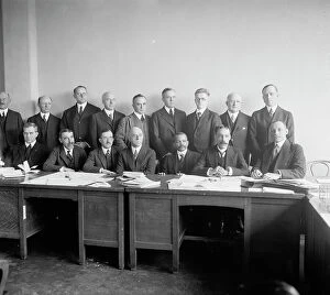
Background imageHaiti Collection: Delegates from Haiti, 1920. Creator: Harris & Ewing. Delegates from Haiti, 1920

Delegates from Haiti, 1920. Creator: Harris & Ewing. Delegates from Haiti, 1920. Creator: Harris & Ewing
Delegates from Haiti, 1920

Background imageHaiti Collection: The Emperor Soulouque, Faustin I. of Haiti, and his Cabinet Ministers, 1859. Creator: Unknown

The Emperor Soulouque, Faustin I. of Haiti, and his Cabinet Ministers, 1859. Creator: Unknown
The Emperor Soulouque, Faustin I. of Haiti, and his Cabinet Ministers, 1859-01-29

Background imageHaiti Collection: Dr. J. E. W. Thompson, Permanent Chairman, 1892. Creator: Unknown

Dr. J. E. W. Thompson, Permanent Chairman, 1892. Creator: Unknown
Dr. J. E. W. Thompson, Permanent Chairman, 1892

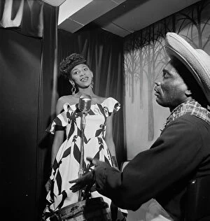
Background imageHaiti Collection: Portrait of Josephine Premice, Village Vanguard, New York, N.Y. ca. July 1947

Portrait of Josephine Premice, Village Vanguard, New York, N.Y. ca. July 1947. Creator: William Paul Gottlieb
Portrait of Josephine Premice, Village Vanguard, New York, N.Y. ca. July 1947

Background imageHaiti Collection: State Sword for the Emperor of Hayti, 1850. Creator: Unknown

State Sword for the Emperor of Hayti, 1850. Creator: Unknown
State Sword for the Emperor of Hayti, 1850. This magnificent sword has been manufactured by Mr. Robert Mole, of Birmingham, for the Emperor

Background imageHaiti Collection: Map of Mexico

Map of Mexico
Antique map of Mexico

Background imageHaiti Collection: 1859 Dufour Map Of Hispaniola Or Santo Domingo

1859 Dufour Map Of Hispaniola Or Santo Domingo
1859, Dufour Map of Hispaniola or Santo Domingo, West Indies, Haiti, Dominican Republic

Background imageHaiti Collection: 1815 Thomson Map Of Porto Rico Virgin Islands

1815 Thomson Map Of Porto Rico Virgin Islands
1815, Thomson Map of Porto Rico, Virgin Islands, Haiti, Dominican Republic, John Thomson, 1777 - 1840, was a Scottish cartographer from Edinburgh, UK

Background imageHaiti Collection: 1800 Stockdale Map Of Hispaniola Or Santo Domingo

1800 Stockdale Map Of Hispaniola Or Santo Domingo
1800, Stockdale Map of Hispaniola or Santo Domingo, West Indies, Haiti, Dominican Republic

Background imageHaiti Collection: Haiti with borders

Haiti with borders
Color satellite image of Haiti and neighbouring country, with borders

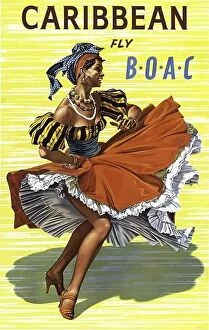
Background imageHaiti Collection: 1960's Vintage BOAC Airline Poster for Caribbean fly BOAC with colorful dancer in typical

1960's Vintage BOAC Airline Poster for Caribbean fly BOAC with colorful dancer in typical Caribbean festive dress

Background imageHaiti Collection: Transport de rhum a St-Domingue Haiti (engraving)

Transport de rhum a St-Domingue Haiti (engraving)
2488090 Transport de rhum a St-Domingue Haiti (engraving); © Estate of Gerald Bloncourt. All Rights Reserved 2023

Background imageHaiti Collection: Map of the northern Mexican archipelago and the West Indies, 1688 (engraving)

Map of the northern Mexican archipelago and the West Indies, 1688 (engraving)
VNK284160 Map of the northern Mexican archipelago and the West Indies, 1688 (engraving) by Coronelli, Vincenzo Maria (1650-1718); Vorontsov Palace, Crimea

Background imageHaiti Collection: Anolis eladioi is a recently described species of anole from the cloud

Anolis eladioi is a recently described species of anole from the cloud and pine forests of Western Sierra de Bahoruco. Male are characterized by 3 brown oceli on each side of the head


All Professionally Made to Order for Quick Shipping

"Haiti: A Tapestry of History, Culture, and Resilience" Step back in time to 1883 with the Haiti and Dominican Republic map, witnessing the intertwined destinies of these Caribbean nations. Explore the legacy of Henri Christophe, a visionary leader who shaped Haiti's history. Marvel at the breathtaking view over Cap Haitien, where the vibrant spirit comes alive. Immerse yourself in Port-au-Prince's bustling market scene, where colors and aromas blend harmoniously. Travel through time to the 1870s Caribbean islands, discovering their enchanting beauty and rich heritage. Visit the iconic Old Barbancourt rum factory established in 1765; its walls whisper tales of craftsmanship passed down through generations. Unveil Toussaint L'Ouverture's portrait from Universal History—a symbol of courage and resistance that forever changed Haiti's destiny. Stand before the majestic Haiti Royal Palace as it stands tall amidst historical turbulence. Experience Wilson Bigaud's captivating vision of heaven painted on a tryptych panel in 1957—an artistic masterpiece that reflects both faith and hope within Port au Prince. Trace your fingers along an ancient map depicting Hispaniola—the island that holds secrets dating back centuries. Finally, let a 17th-century map guide you through the New World—uncovering stories untold and connecting dots across continents. Haiti beckons you with open arms to discover its tapestry woven by history, culture, resilience—a land where past meets present for an unforgettable journey into Central America's heart.