Home > North America > Cuba > Cuba Heritage Sites > Old Havana and its Fortification System
Geography Atlas: representation of the island of Santo Domingo in the West Indies. Map from an atlas by J. B. Poirson (1761-1831), French geographer, 1803. Biblioteca Jose Marti, Havana, Cuba
, French geographer, 1803. Biblioteca Jose Marti, Havana, Cuba")
![]()
Wall Art and Photo Gifts from Fine Art Finder
Geography Atlas: representation of the island of Santo Domingo in the West Indies. Map from an atlas by J. B. Poirson (1761-1831), French geographer, 1803. Biblioteca Jose Marti, Havana, Cuba
VEN5031350 Geography Atlas: representation of the island of Santo Domingo in the West Indies. Map from an atlas by J. B. Poirson (1761-1831), French geographer, 1803. Biblioteca Jose Marti, Havana, Cuba.; (add.info.: Geography Atlas: representation of the island of Santo Domingo in the West Indies. Map from an atlas by J. B. Poirson (1761-1831), French geographer, 1803. Biblioteca Jose Marti, Havana, Cuba.); © Marage Photos
Media ID 38274544
© © Marage Photos / Bridgeman Images
Amerique (continent) Amerique Centrale Amerique Du Nord Caraïbes Caribbean Caribbean Island Carte Geographique Central America Dominium Etats Unis Geographical Map Geographie Haiti Saint Domingue Stockravenna
FEATURES IN THESE COLLECTIONS
> Fine Art Finder
> Artists
> Marcantonio Bassetti
> Maps and Charts
> Early Maps
> North America
> Cuba
> Cuba Heritage Sites
> Old Havana and its Fortification System
> North America
> Cuba
> Havana
> North America
> Cuba
> Maps
> North America
> Cuba
> Related Images
> North America
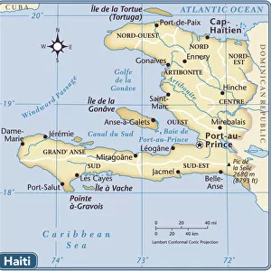
> Haiti
> Maps
> North America
> Haiti
> Related Images
EDITORS COMMENTS
This stunning print captures a representation of the island of Santo Domingo in the West Indies, as depicted in an atlas by French geographer J. B. Poirson from 1803. The intricate details and accuracy of this geographical map showcase the skill and expertise of Poirson in capturing the essence of this Caribbean island.
The map is housed at the Biblioteca Jose Marti in Havana, Cuba, adding to its historical significance and value. It serves as a window into the past, allowing us to explore and understand how this region was perceived during the 19th century.
The engraving beautifully showcases not only Santo Domingo but also surrounding areas such as Haiti, providing a comprehensive view of this part of Central America. The inclusion of various geographical features adds depth and dimension to the map, making it a valuable resource for scholars and enthusiasts alike.
As we gaze upon this piece, we are transported back in time to an era when exploration and discovery were paramount. The attention to detail and craftsmanship evident in this map remind us of the importance of preserving our history and heritage for future generations to appreciate.
MADE IN AUSTRALIA
Safe Shipping with 30 Day Money Back Guarantee
FREE PERSONALISATION*
We are proud to offer a range of customisation features including Personalised Captions, Color Filters and Picture Zoom Tools
SECURE PAYMENTS
We happily accept a wide range of payment options so you can pay for the things you need in the way that is most convenient for you
* Options may vary by product and licensing agreement. Zoomed Pictures can be adjusted in the Cart.