
Islands Collection (page 18)
"Exploring the Enchanting World of Islands: From Falkland to Galapagos" A glimpse into history: The Falkland Islands Royal Engineer briefing map, 1982


All Professionally Made to Order for Quick Shipping
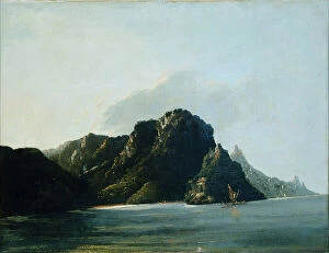
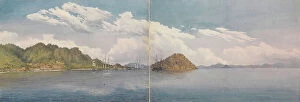
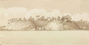
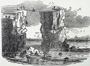
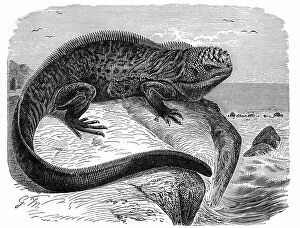
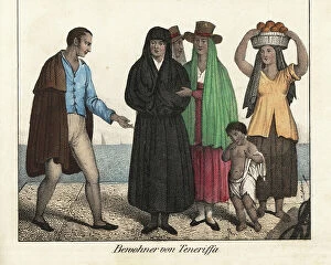
"Exploring the Enchanting World of Islands: From Falkland to Galapagos" A glimpse into history: The Falkland Islands Royal Engineer briefing map, 1982, offers a fascinating insight into the past. Savoring the spirit of Scotland: Visit the Laphroaig Whisky Distillery in Loch Laphroaig, Islay, Argyll and Bute for an authentic taste of Scottish heritage. Devon's hidden gem: Burgh Island in Bigbury-on-Sea is a picturesque paradise that will leave you breathless. Darwin's inspiration unfolds: Embark on an adventure to Darwin's playground - Finch and Galapagos islands - where nature reigns supreme. Tracing ancient civilizations: Journey back in time as you explore Ancient Greece and its colonies around the Aegean Sea, immersing yourself in rich history and culture. Unveiling Ceylon's tea legacy: Delve into Sri Lanka's tea industry plantations with a captivating map showcasing their beauty and significance. Mediterranean marvels await: Mgarr in Gozo, Malta offers stunning views over the Mediterranean Sea that will transport you to another world. Cornwall's coastal charm: Witness Godrevy Island and its iconic lighthouse from Gwithian beach while enjoying the vibrant thrift flowers dotting Cornwall’s rugged coastline. Portree Harbor’s idyllic allure: Discover tranquility at Isle of Skye’s Portree Harbor – a picture-perfect spot nestled amidst Scotland’s breathtaking landscapes. Greek island bliss beckons: Fiskardo in Kefalonia is one of many jewels adorning Greece’s Ionian Islands; immerse yourself in their timeless allure. Channel Islands' natural wonders unfold: Explore Jersey's Corbiere Lighthouse against its dramatic rocky coastline for an unforgettable experience closer to home. A glimpse of St Kilda's charm.