Fraud Blocker Skip to main content

Landmass Collection (page 7)

"Exploring the Dynamic World: Unveiling the Mysteries of Landmass" Embarking on a journey through time and space

Background imageLandmass Collection: Satellite view of Cuba

Satellite view of Cuba
January 1, 2010 - Satellite view of Cuba showing wispy clouds and some fading jet contrails. The waters are jewel-like: turquoise, bright blue, and emerald green near the islands

Background imageLandmass Collection: Afghanistan

Afghanistan
December 26, 2005 - Satellite view of Afghanistan

Background imageLandmass Collection: Satellite view of Venice and the Venetian Lagoon

Satellite view of Venice and the Venetian Lagoon
September 4, 2013 - Satellite view of Venice and the Venetian Lagoon

Background imageLandmass Collection: Cloud-free weather over much of the eastern United States

Cloud-free weather over much of the eastern United States

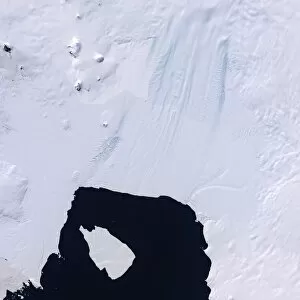
Background imageLandmass Collection: Pine Island Glacier

Pine Island Glacier
Just around the corner from the Antarctic Peninsula, the Pine Island Glacier has been the focus of scientific attention for many years

Background imageLandmass Collection: True-color view of snow, fog, and low clouds in western Europe

True-color view of snow, fog, and low clouds in western Europe
December 20, 2007 - True-color view of snow, fog, and low clouds in western Europe

Background imageLandmass Collection: View from space showing the tropical blue waters of the Persian Gulf

View from space showing the tropical blue waters of the Persian Gulf and then the dust-filled skies as a major dust storm obscures the Gulf and its northern shoreline

Background imageLandmass Collection: Panoramic view of planet Earth and the United States

Panoramic view of planet Earth and the United States as seen from space

Background imageLandmass Collection: Oblique view of Baja California and the Pacific coast of Mexico

Oblique view of Baja California and the Pacific coast of Mexico
November 27, 2011 - Cloud-free skies and a compelling view of the entire length of Baja California and the Pacific coast of Mexico

Background imageLandmass Collection: Sea ice lines the shoreline in eastern Greenland

Sea ice lines the shoreline in eastern Greenland
June 16, 2000 - Ranging in color from snow white to turquoise, sea ice lined the shoreline in eastern Greenland. Although snow and ice abound in this image, both are in retreat for the summer

Background imageLandmass Collection: Topographic Map of Earth

Topographic Map of Earth

Background imageLandmass Collection: Western Australia

Western Australia
May 20, 2008 - Western Australia. Near the center of the image, Australias coastline curves into a long, smooth arc. This is Eighty Mile Beach

Background imageLandmass Collection: An Asian dust storm crosses the Pacific

An Asian dust storm crosses the Pacific
April 7, 2001 - Satellite view of a dust storm as it swirled over China. In April 2001, dust from an Asian storm crossed the Pacific reaching as far east as the Great Lakes and even Maryland

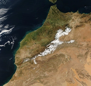
Background imageLandmass Collection: Satellite view of Morocco

Satellite view of Morocco
January 1, 2005 - While green vegetation covers the lowlands of western Morocco, winter visits the Atlas Mountains at its center

Background imageLandmass Collection: Satellite image of the Greek island of Rhodes in the Aegean Sea

Satellite image of the Greek island of Rhodes in the Aegean Sea
August 26, 2011 - Satellite image of the Greek island of Rhodes in the Aegean Sea. Rhodes is the biggest island in the Greek Dodecanese chain

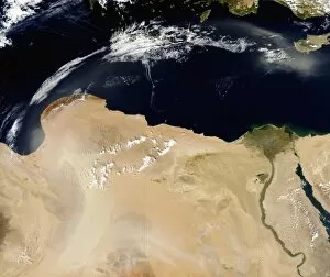
Background imageLandmass Collection: Satellite view of a dust storm over Libya

Satellite view of a dust storm over Libya
October 1, 2010 - Satellite view of a dust storm over Libya

Background imageLandmass Collection: Papua New Guines Manam Volcano releases a thin, faint plume over the Bismarch Sea

Papua New Guines Manam Volcano releases a thin, faint plume over the Bismarch Sea
June 16, 2010 - Papua New Guines Manam Volcano releases a thin, faint plume as clouds cluster at the volcanoas summit. Brown valleys, bare of vegetation, extend downwards from the summit craters

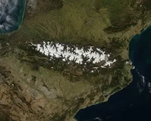
Background imageLandmass Collection: Satellite view of the Pyrenees Mountains

Satellite view of the Pyrenees Mountains
February 23, 2014 - Satellite view of the Pyrenees Mountains

Background imageLandmass Collection: Satellite view of Iceland

Satellite view of Iceland
May 20, 2012 - Satellite view of Iceland encircled by a halo of clouds in late springtime

Background imageLandmass Collection: Southern Florida

Southern Florida
February 2000 - The very low topography of southern Florida is evident in this color-coded shaded relief map generated with data from the Shuttle Radar Topography Mission

Background imageLandmass Collection: Heavy cloud cover over the Pacific Ocean

Heavy cloud cover over the Pacific Ocean
May 15, 2009 - Heavy cloud cover over the Pacific Ocean off the coast of Baja California, Mexico

Background imageLandmass Collection: Arctic sea ice in 2005

Arctic sea ice in 2005
This image shows the minimum sea ice on September 21, 2005

Background imageLandmass Collection: Artists depiction of the size relationship between Earth and Gliese 1214b

Artists depiction of the size relationship between Earth and Gliese 1214b
Artists depiction of the size relationship between Earth and GJ 1214b, also known as Gliese 1214b. Discovered in 2009 in the constellation Ophiuchus, some 40 light-years from Earth

Background imageLandmass Collection: View from space featuring the Bahama Islands and part of peninsular Florida

View from space featuring the Bahama Islands and part of peninsular Florida
July 12, 2011 - View from space featuring The Tongue of the Ocean and several of the 2, 700 islands in the Bahamas chain and part of peninsular Florida

Background imageLandmass Collection: View of the Rocky Mountains

View of the Rocky Mountains
June 12, 2010 - View of the Rocky Mountains. To the south you can see (from left to right): Washington State, Idaho, and Montana in the US

Background imageLandmass Collection: Satellite view of Turkey and the island of Cyprus

Satellite view of Turkey and the island of Cyprus

Background imageLandmass Collection: Full view of the Earth showing topographic data

Full view of the Earth showing topographic data
Full view of the Earth derived from AVHRR and topographic data

Background imageLandmass Collection: Chile and the Patagonian region of Argentina

Chile and the Patagonian region of Argentina
February 16, 2010 - Chile and the Patagonian region of Argentina. In it, you can see the dramatic impact the Andes Mountains have on rainfall and vegetation

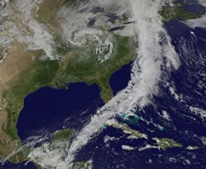
Background imageLandmass Collection: A powerful cold front moving from the central United States to the East Coast

A powerful cold front moving from the central United States to the East Coast
January 30, 2013 - A powerful cold front moving from the central United States to the East Coast. This image shows a line of clouds that stretch from Canada to the U.S

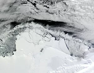
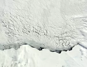
Background imageLandmass Collection: Shackleton Ice Shelf, Antarctica

Shackleton Ice Shelf, Antarctica
March 31, 2010 - Shackleton Ice Shelf, Antarctica

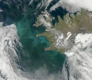
Background imageLandmass Collection: Phytoplankton bloom in the North Atlantic Ocean

Phytoplankton bloom in the North Atlantic Ocean
July 10, 2008 - Phytoplankton bloom. One of the larger regularly observed blooms occurs in the North Atlantic Ocean near Iceland and Greenland in Northern Hemisphere summer

Background imageLandmass Collection: View from space of Lake Ontario

View from space of Lake Ontario
August 23, 2013 - View from space highlighting a late-summer whiting event visible across much of Lake Ontario. Such events are caused by changes in water temperature

Background imageLandmass Collection: Hawaiian Islands

Hawaiian Islands
The state of Hawaii, about three thousand kilometers west of Los Angeles, California, is made up of seven islands. From lower right to upper left, the Island (Hawaii), Maui, Kahoolawe, Lanai

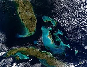
Background imageLandmass Collection: Satellite view of the Bahamas, Florida, and Cuba

Satellite view of the Bahamas, Florida, and Cuba
January 24, 2004 - The Bahamas, Florida, and Cuba. Underwater features are actually more striking than surface features. The Great Bahama Bank

Background imageLandmass Collection: Satellite view of Tahiti

Satellite view of Tahiti
Natural-color image of Tahiti. This island is part of a volcanic chain formed by the northwestward movement of the Pacific Plate over a fixed hotspot

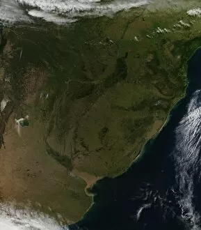
Background imageLandmass Collection: Satellite view of South America

Satellite view of South America
June 6, 2010 - Satellite view of South America. Visible countries are Argentina on the left half of the image, Uruguay near the center of the image, which is surrounded by Brazil to the north

Background imageLandmass Collection: Satellite view of an oil spill is visible across the northern Gulf of Mexico

Satellite view of an oil spill is visible across the northern Gulf of Mexico
June 12, 2010 - Satellite view of an oil spill visible across the northern Gulf of Mexico. Oil appears to have reached beaches and barrier islands in Alabama and the western Panhandle of Florida

Background imageLandmass Collection: Southern United States of America

Southern United States of America

Background imageLandmass Collection: Satellite view of Northern Argentina

Satellite view of Northern Argentina
March 12, 2014 - Satellite view of Northern Argentina

Background imageLandmass Collection: Satellite view of a powerful cold front moving off the United States East Coast

Satellite view of a powerful cold front moving off the United States East Coast
May 16, 2014 - Satellite view of a powerful cold front moving off the United States East Coast. The clouds stretch from Maine south through the Mid-Atlantic down to southern Florida with a tail of

Background imageLandmass Collection: Satellite image of smog over the United Kingdom

Satellite image of smog over the United Kingdom
April 22, 2011 - Satellite image of smog over the United Kingdom

Background imageLandmass Collection: Early spring in the Antarctic

Early spring in the Antarctic
Early spring brings sunshine to the Antarctic, and with sunshine comes the melting and moving of sea ice. The ice layer over the Southern Ocean begins to break away from the coasts of Princess Astrid

Background imageLandmass Collection: Satellite view of Mayon Volcano emitting a thin volcanic plume

Satellite view of Mayon Volcano emitting a thin volcanic plume
December 28, 2009 - Satellite view of Mayon Volcano on the Philippine island of Luzon, emitting a thin volcanic plume. Ash obscures the summit crater and clouds hide lava flows on the volcanoas flanks

Background imageLandmass Collection: Northern Mexico

Northern Mexico
March 1, 2009 - Mirroring the terrain of the United States Inter-Mountain West, northern Mexico has an area of high plains, called the altiplano, between two mountain ranges

Background imageLandmass Collection: Beaufort Sea

Beaufort Sea
July 25, 2006 - Beaufort Sea

Background imageLandmass Collection: Greece and its surrounding countries

Greece and its surrounding countries
August 2, 2006, shows most of Greece, with its jagged coastline, and many islands and peninsulas. Also shown are the countries surrounding Greece to the north, from left to right they are Albania

Background imageLandmass Collection: Northeast United States and Canada

Northeast United States and Canada
August 11, 2002 - Satellite view of the Northeast United States and Canada. At left center edge is New York, with New Jersey to its south and the eastern part of Pennsylvania to the southwest

Background imageLandmass Collection: Satellite view of Krasnaya Polyana, Russia

Satellite view of Krasnaya Polyana, Russia
February 8, 2014 - Satellite view of Krasnaya Polyana, a small town tucked between the Aibiga and Psekhako Ridges in the western Caucasus where the skiing events for the XXII Olympic Games are taking


All Professionally Made to Order for Quick Shipping

"Exploring the Dynamic World: Unveiling the Mysteries of Landmass" Embarking on a journey through time and space, we delve into the captivating phenomenon of continental drift. Through intricate diagrams, we witness the majestic dance of tectonic plates shaping our planet's landmasses. From a satellite view high above New Zealand, we marvel at its unique landforms that bear witness to millions of years of continental movement. The rugged beauty tells tales of ancient collisions and separations. Venturing to England's Northumberland, we encounter an extraordinary creation named Northumberlandia – a colossal sculpture embodying the very essence transformation. Its undulating curves pay homage to nature's ever-changing forms. Turning pages in history, we stumble upon intriguing accounts like Osnabrug Island bearing testimony to explorers' navigational prowess as they charted unknown territories with precision and skill. Ink-stained records reveal glimpses of unidentified islands waiting for their stories to be unraveled. With compass bearings guiding their way, intrepid adventurers set forth towards uncharted horizons. The enchanting profile etched onto paper unveils St. Jago, one among Cape Verde Islands – an exquisite testament to how landmasses emerge from volcanic origins and evolve over eons under nature's watchful eye. A vibrant map takes us back centuries ago when cartographers meticulously depicted Crete's splendorous contours in vivid colors - capturing both its geographical significance and cultural heritage within a single frame. Stepping into Matavai Bay in Otaheite (now Tahiti), brushstrokes bring alive Captain Cook's expedition as he encountered new lands amidst turquoise waters - forever altering our understanding of distant shores. Finally, gazing upon the Isle of Mayo off Cape Verde Islands' coast reveals yet another captivating coastal profile that has witnessed countless waves crashing against its rocky cliffs throughout time immemorial. Landmasses hold secrets untold, their ever-changing nature a testament to the dynamic forces shaping our world.