Fraud Blocker Skip to main content

Landmass Collection (page 5)

"Exploring the Dynamic World: Unveiling the Mysteries of Landmass" Embarking on a journey through time and space

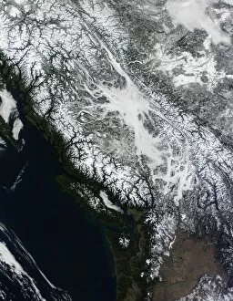
Background imageLandmass Collection: Fog and snow in British Columbia

Fog and snow in British Columbia
February 21, 2010 - True-color view of fog and snow in British Columbia

Background imageLandmass Collection: True-color satellite view of central Athens, Greece

True-color satellite view of central Athens, Greece
July 2, 2004 - True-color image of central Athens, Greece. Main roads run mostly northeast-southwest through this part of the city, and side streets divide densely packed buildings

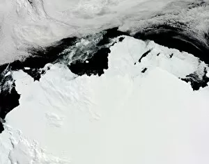
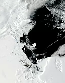
Background imageLandmass Collection: The Queen Mary Coast of Antarctica

The Queen Mary Coast of Antarctica
February 15, 2010 - The Queen Mary Coast of Antarctica. The Queen Mary Coast borders the Davis Sea and lies south of Australia. Across the top of the image is a bank of clouds

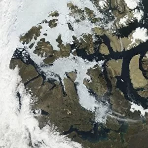
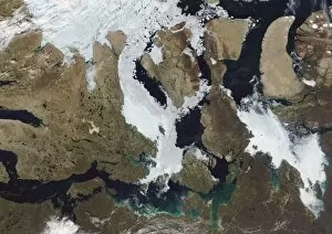
Background imageLandmass Collection: The Northwest Passage

The Northwest Passage
August 27, 2009 - Ice clogged some but not all of the Northwest Passage, and snow had retreated from most of the islands in the Canadian Arctic Archipelago

Background imageLandmass Collection: Satellite view of the Persian Gulf

Satellite view of the Persian Gulf

Background imageLandmass Collection: Kamchatka Peninsula, Eastern Russia

Kamchatka Peninsula, Eastern Russia
January 14, 2009 - Kamchatka Peninsula, Eastern Russia

Background imageLandmass Collection: Satellite view of Honolulu, Oahu, Hawaii

Satellite view of Honolulu, Oahu, Hawaii
March 18, 2001 - Satellite view of Honolulu, Oahu, Hawaii. On the bottom lefthand side of the image is Pearl Harbor. Just to the East of Honolulu is Waikiki Beach

Background imageLandmass Collection: A partial view of Earth showing Australia and the Great Barrier Reef

A partial view of Earth showing Australia and the Great Barrier Reef
A clear view of the southern Great Barrier Reef, salt pans in the Australian desert, and sunglint patterns in the Bismarck Sea

Background imageLandmass Collection: A view of the Caribbean island of Hispaniola from the International Space Station

A view of the Caribbean island of Hispaniola from the International Space Station
September 28, 2009 - A view of the Caribbean island of Hispaniola from the International Space Station. This island is comprised of Haiti (in the center left of the image)

Background imageLandmass Collection: The Mozambique coast

The Mozambique coast
May 15, 2009 - The Mozambique coast

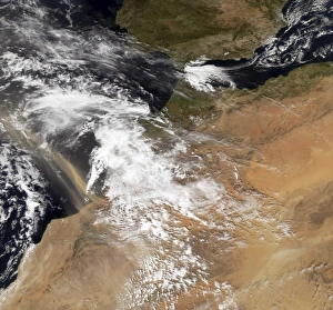
Background imageLandmass Collection: Dust plumes off the Moroccan coast

Dust plumes off the Moroccan coast
February 10, 2008 - Dust plumes hundreds of kilometers long blow off the Moroccan coast. This satellite view captured the dust plumes mixing with clouds over the Atlantic Ocean the same day

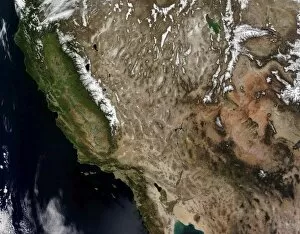
Background imageLandmass Collection: Southwestern United States

Southwestern United States

Background imageLandmass Collection: Antarctica

Antarctica
At the bottom of the globe lies the coldest, windiest, and driest place on Earth: Antarctica. All but about 2 percent of the 14 million-square-kilometer (5.4 million-square-mile)

Background imageLandmass Collection: B-15J iceberg in the Ross Sea, Antarctica

B-15J iceberg in the Ross Sea, Antarctica
January 29, 2007 - B-15J iceberg in the Ross Sea, Antarctica (before breakup)

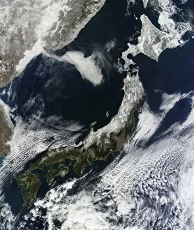
Background imageLandmass Collection: Satellite view of Japan

Satellite view of Japan
February 22, 2011 - Satellite view of Japan

Background imageLandmass Collection: Volcanoes in central Kamchatka Peninsula, eastern Russia

Volcanoes in central Kamchatka Peninsula, eastern Russia
April 2, 2010 - Volcanoes in central Kamchatka Peninsula, eastern Russia

Background imageLandmass Collection: Malta Island

Malta Island
August 12, 2009 - Malta Island is the largest of the three major islands that constitute the Maltese archipelago and Republic of Malta. The island sits in the Mediterranean Sea, south of Sicily

Background imageLandmass Collection: Hurricane Jimena over Baja California

Hurricane Jimena over Baja California
September 1, 2009 - Hurricane Jimena over Baja California

Background imageLandmass Collection: Dust storm in the Middle East

Dust storm in the Middle East
June 18, 2009 - Dust storm in the Middle East

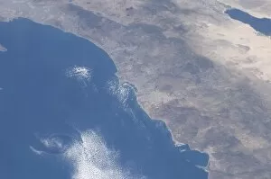
Background imageLandmass Collection: Part of southern California as seen from space

Part of southern California as seen from space
May 13, 2009 - Part of southern California, including the San Diego area, and the border with Mexico can be seen in this STS-125 still photo taken from the Space Shuttle Atlantis as it passed over

Background imageLandmass Collection: View of Central and North America

View of Central and North America

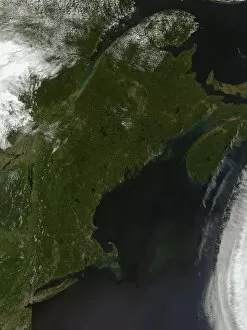
Background imageLandmass Collection: Satellite view of New England

Satellite view of New England

Background imageLandmass Collection: Satellite view of Argentina

Satellite view of Argentina
April 5, 2008 - Satellite view of Argentina

Background imageLandmass Collection: View from space of the wild fires in the western and southwestern United States

View from space of the wild fires in the western and southwestern United States
June 27, 2012 - View from space of the wild fires in the western and southwestern United States. These particular fires, of unknown cause

Background imageLandmass Collection: Snowy and hazy central Russia showing the Ob River

Snowy and hazy central Russia showing the Ob River
November 9, 2009 - Snowy and hazy central Russia. The Ob River dominates much of the image, it runs nearly diagonally across the scene

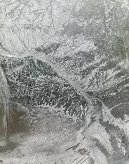
Background imageLandmass Collection: Northeastern China

Northeastern China
January 3, 2009 - Northeastern China

Background imageLandmass Collection: Dust storm in northern China

Dust storm in northern China
May 27, 2008 - Dust storm in northern China at 05:10 UTC

Background imageLandmass Collection: Southern Greenland

Southern Greenland
August 23, 2006 - Southern Greenland

Background imageLandmass Collection: Satellite view of Northern Europe

Satellite view of Northern Europe
April 6, 2002 - This true-color image showcases Northern Europe. Shown are the United Kingdom, the Republic of Ireland, northern France, Belgium, Luxembourg, Western Germany, the Netherlands

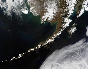
Background imageLandmass Collection: The Aleutian Islands and the Alaskan peninsula

The Aleutian Islands and the Alaskan peninsula
May 26, 2006 - The Aleutian Islands and the Alaskan peninsula

Background imageLandmass Collection: Islands framed by clouds forming a skull

Islands framed by clouds forming a skull

Background imageLandmass Collection: View of the Indian subcontinent during the Late Cretaceous period

View of the Indian subcontinent during the Late Cretaceous period
This is how the Indian subcontinent may have appeared 70 million years ago during the Late Cretaceous period. Looking north

Background imageLandmass Collection: Satellite view of city, village, and highway lights in India

Satellite view of city, village, and highway lights in India
November 12, 2012 - Satellite view of city, village, and highway lights in India

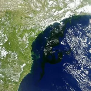
Background imageLandmass Collection: A bloom of microscopic organisms off the coast of Brazil

A bloom of microscopic organisms off the coast of Brazil
January 19, 2014 - Satellite view capturing a bloom of microscopic organisms off the southeastern coast of Brazil. Note how the waters of the South Atlantic are darkened in patches stretching as much

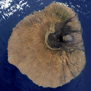
Background imageLandmass Collection: Satellite view of Mount Fogo

Satellite view of Mount Fogo
June 10, 2009 - Satellite view of Mount Fogo, a volcanic island in the Republic of Cape Verde of the westernmost tip of Africa

Background imageLandmass Collection: The Strait of Gibraltar

The Strait of Gibraltar
December 19, 2008 - The Strait of Gibraltar is the waterway between the southern Iberian Peninsula and the western tip of North Africa

Background imageLandmass Collection: Western United States

Western United States
March 12, 2009 - A large portion of the western part of the United States is shown in this image. Also visible are parts of Canada

Background imageLandmass Collection: A global view over Europe and Scandinavia with Arctic sea ice

A global view over Europe and Scandinavia with Arctic sea ice shown on March 9, 2006. Land areas display the average seasonal landcover from March, 2004

Background imageLandmass Collection: True-color satellite view of France

True-color satellite view of France
May 25, 2011 - True-color satellite view of France. To the southeast, the peaks of the Alps are covered with snow

Background imageLandmass Collection: A cloud of tan dust from Saudi Arabia blows over the Red Sea

A cloud of tan dust from Saudi Arabia blows over the Red Sea
October 13, 2010 - A cloud of tan dust from Saudi Arabia blows over the Red Sea just south of the Sinai Peninsula and the Nile Delta

Background imageLandmass Collection: Amazon River in northern Brazil

Amazon River in northern Brazil
June 11, 2002 - The interior portions of the Amazon River in northern Brazil. This false-color image shows the water as dark blue or black

Background imageLandmass Collection: Nunavut, Canada

Nunavut, Canada
July 31, 2006 - Nunavut, Canada

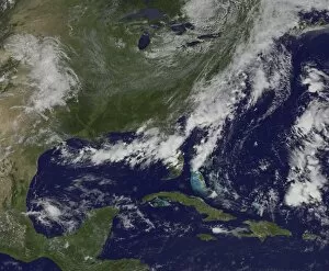
Background imageLandmass Collection: Satellite view of a cold front that brought clouds and thunderstorms to the coast

Satellite view of a cold front that brought clouds and thunderstorms to the coast
July 16, 2014 - Satellite view of a cold front that brought clouds and thunderstorms to the coast. The clouds follow the front which stretches from the Florida panhandle

Background imageLandmass Collection: Planet Earth showing sea ice coverage in 1980

Planet Earth showing sea ice coverage in 1980
Sea ice coverage in 1980. Multi-year ice is shown in bright white, while average sea ice cover is shown in light blue to milky white

Background imageLandmass Collection: Southeastern China

Southeastern China
October 9, 2002 - True-color view of southeastern China. A very large metropolitan area, Guangzhou (Canton), is visible on the southeast coast next to Hong Kong (outlined in black)

Background imageLandmass Collection: Satellite view of Southwestern Alaska

Satellite view of Southwestern Alaska
January 15, 2012 - Snow rested on the land surface while ice rested on the sea surface in southwestern Alaska. Pristine snow blankets the mountains and plains

Background imageLandmass Collection: January 2, 2009 - Cloud simulation of a single day centered over the western Pacific

January 2, 2009 - Cloud simulation of a single day centered over the western Pacific

Background imageLandmass Collection: Heavy snowfall in China

Heavy snowfall in China
November 13, 2009 - Heavy snowfall in China. This image shows part of Hebei and Shanxi Provinces. A cloudbank hovers over part of Hebei Province


All Professionally Made to Order for Quick Shipping

"Exploring the Dynamic World: Unveiling the Mysteries of Landmass" Embarking on a journey through time and space, we delve into the captivating phenomenon of continental drift. Through intricate diagrams, we witness the majestic dance of tectonic plates shaping our planet's landmasses. From a satellite view high above New Zealand, we marvel at its unique landforms that bear witness to millions of years of continental movement. The rugged beauty tells tales of ancient collisions and separations. Venturing to England's Northumberland, we encounter an extraordinary creation named Northumberlandia – a colossal sculpture embodying the very essence transformation. Its undulating curves pay homage to nature's ever-changing forms. Turning pages in history, we stumble upon intriguing accounts like Osnabrug Island bearing testimony to explorers' navigational prowess as they charted unknown territories with precision and skill. Ink-stained records reveal glimpses of unidentified islands waiting for their stories to be unraveled. With compass bearings guiding their way, intrepid adventurers set forth towards uncharted horizons. The enchanting profile etched onto paper unveils St. Jago, one among Cape Verde Islands – an exquisite testament to how landmasses emerge from volcanic origins and evolve over eons under nature's watchful eye. A vibrant map takes us back centuries ago when cartographers meticulously depicted Crete's splendorous contours in vivid colors - capturing both its geographical significance and cultural heritage within a single frame. Stepping into Matavai Bay in Otaheite (now Tahiti), brushstrokes bring alive Captain Cook's expedition as he encountered new lands amidst turquoise waters - forever altering our understanding of distant shores. Finally, gazing upon the Isle of Mayo off Cape Verde Islands' coast reveals yet another captivating coastal profile that has witnessed countless waves crashing against its rocky cliffs throughout time immemorial. Landmasses hold secrets untold, their ever-changing nature a testament to the dynamic forces shaping our world.