Fraud Blocker Skip to main content

Mapping Collection (page 15)

"Exploring the World Through Maps: A Journey of Discovery" Embark on a captivating journey through time and space as we delve into the fascinating world of mapping

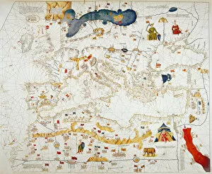
Background imageMapping Collection: Copy of Catalan Map of Europe, North Africa and the Middle East (hand-coloured engraving)

Copy of Catalan Map of Europe, North Africa and the Middle East (hand-coloured engraving)
XCF307352 Copy of Catalan Map of Europe, North Africa and the Middle East (hand-coloured engraving) by Cresques, Abraham (1325-87) (after); Private Collection; French, out of copyright

Background imageMapping Collection: Rye and Winchelsea Castle (ink on paper)

Rye and Winchelsea Castle (ink on paper)
XCF307357 Rye and Winchelsea Castle (ink on paper) by English School; Private Collection; (add.info.: presented to Robert Austen by Captain Greenville Collins; ); English, out of copyright

Background imageMapping Collection: Map of Britain, 1631 (hand-coloured engraving)

Map of Britain, 1631 (hand-coloured engraving)
XCF307356 Map of Britain, 1631 (hand-coloured engraving) by English School, (17th century); Private Collection; English, out of copyright

Background imageMapping Collection: Map of Cochin, India (ink on paper)

Map of Cochin, India (ink on paper)
XCF307358 Map of Cochin, India (ink on paper) by English School; Private Collection; English, out of copyright

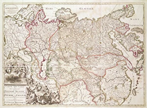
Background imageMapping Collection: Russia, c. 1725 (hand-coloured engraving)

Russia, c. 1725 (hand-coloured engraving)
XCF307355 Russia, c.1725 (hand-coloured engraving) by French School, (18th century); Private Collection; French, out of copyright

Background imageMapping Collection: Map of India and the East Indies (hand-coloured engraving)

Map of India and the East Indies (hand-coloured engraving)
XCF307353 Map of India and the East Indies (hand-coloured engraving) by Wit, Frederick de (1630-1706); Private Collection; Dutch, out of copyright

Background imageMapping Collection: Map of the Adriatic Sea (ink on parchment)

Map of the Adriatic Sea (ink on parchment)
XCF307337 Map of the Adriatic Sea (ink on parchment) by Benincasa, Grazioso (fl.1468); Private Collection; Italian, out of copyright

Background imageMapping Collection: Map of the Central Mediterranean (ink on parchment)

Map of the Central Mediterranean (ink on parchment)
XCF307338 Map of the Central Mediterranean (ink on parchment) by Benincasa, Grazioso (fl.1468); Private Collection; Italian, out of copyright

Background imageMapping Collection: Map of the Western Mediterranean (ink on parchment)

Map of the Western Mediterranean (ink on parchment)
XCF307339 Map of the Western Mediterranean (ink on parchment) by Benincasa, Grazioso (fl.1468); Private Collection; Italian, out of copyright

Background imageMapping Collection: Map of the French Atlantic Coast and of England (ink on parchment)

Map of the French Atlantic Coast and of England (ink on parchment)
XCF307336 Map of the French Atlantic Coast and of England (ink on parchment) by Benincasa, Grazioso (fl.1468); Private Collection; Italian, out of copyright

Background imageMapping Collection: Typus Orbis Terrarum, map of the world, from Orteliuss Theatrum Orbis Terrarum

Typus Orbis Terrarum, map of the world, from Orteliuss Theatrum Orbis Terrarum
XCF307306 Typus Orbis Terrarum, map of the world, from Orteliuss Theatrum Orbis Terrarum, Antwerp, 1570 (hand-coloured engraving) by Ortelius, Abraham (1527-98); Private Collection; Flemish

Background imageMapping Collection: Map of the Black Sea (ink on parchment)

Map of the Black Sea (ink on parchment)
XCF307301 Map of the Black Sea (ink on parchment) by Benincasa, Grazioso (fl.1468); Private Collection; Italian, out of copyright

Background imageMapping Collection: Map of the Eastern Mediterranean (ink on parchment)

Map of the Eastern Mediterranean (ink on parchment)
XCF307300 Map of the Eastern Mediterranean (ink on parchment) by Benincasa, Grazioso (fl.1468); Private Collection; Italian, out of copyright

Background imageMapping Collection: Map of Buckinghamshire (colour litho)

Map of Buckinghamshire (colour litho)
XCF306036 Map of Buckinghamshire (colour litho) by English School; Private Collection; English, out of copyright

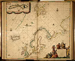
Background imageMapping Collection: Map of Northern Europe (hand coloured engraving)

Map of Northern Europe (hand coloured engraving)
XCF306037 Map of Northern Europe (hand coloured engraving) by Keulen, Johannes van (1654-1715); Private Collection; Dutch, out of copyright

Background imageMapping Collection: Map of Europe, 1841 (colour litho)

Map of Europe, 1841 (colour litho)
XCF306031 Map of Europe, 1841 (colour litho) by German School, (19th century); Private Collection; German, out of copyright

Background imageMapping Collection: A New Map of the County of Buckinghamshire, 1816 (colour litho)

A New Map of the County of Buckinghamshire, 1816 (colour litho)
XCF306035 A New Map of the County of Buckinghamshire, 1816 (colour litho) by English School, (19th century); Private Collection; English, out of copyright

Background imageMapping Collection: The Road from London to Arundel (colour engraving)

The Road from London to Arundel (colour engraving)
XCF306034 The Road from London to Arundel (colour engraving) by Ogilby, John (1600-1676); Private Collection; English, out of copyright

Background imageMapping Collection: Map of Sussex (hand coloured engraving)

Map of Sussex (hand coloured engraving)
XCF306033 Map of Sussex (hand coloured engraving) by English School; Private Collection; English, out of copyright

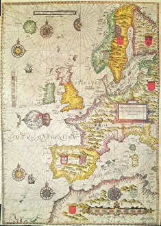
Background imageMapping Collection: A Generall carde, and description of the sea coastes of Europe, and navigation in

A Generall carde, and description of the sea coastes of Europe, and navigation in
XCF306029 A Generall carde, and description of the sea coastes of Europe, and navigation in this book conteyned (hand coloured engraving) by Hondius, Jodocus (1567-1611); Private Collection; Dutch

Background imageMapping Collection: Map of the North Sea, c. 1675 (hand coloured engraving)

Map of the North Sea, c. 1675 (hand coloured engraving)
XCF306028 Map of the North Sea, c.1675 (hand coloured engraving) by Wit, Frederick de (1630-1706); Private Collection; Dutch, out of copyright

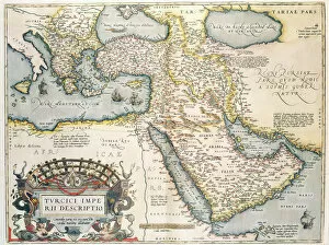
Background imageMapping Collection: Map of the Middle East, from Theatrvm Orbis Terrarvm, 1570 (hand coloured engraving)

Map of the Middle East, from Theatrvm Orbis Terrarvm, 1570 (hand coloured engraving)
XCF306026 Map of the Middle East, from Theatrvm Orbis Terrarvm, 1570 (hand coloured engraving) by Ortelius, Abraham (1527-98); Private Collection; Flemish, out of copyright

Background imageMapping Collection: Walliss New Map of Europe Divided into its Empires Kingdoms &c, 1789 (hand coloured

Walliss New Map of Europe Divided into its Empires Kingdoms &c, 1789 (hand coloured
XCF306027 Walliss New Map of Europe Divided into its Empires Kingdoms &c, 1789 (hand coloured engraving) by English School, (18th century); Private Collection; English, out of copyright

Background imageMapping Collection: Map of the world, based on descriptions and co-ordinates given in Geographia

Map of the world, based on descriptions and co-ordinates given in Geographia
XCF306025 Map of the world, based on descriptions and co-ordinates given in Geographia, first published in Ulm, Germany (hand coloured engraving) by Ptolemy (Claudius Ptolemaeus of Alexandria)

Background imageMapping Collection: Sussex, engraved by Jodocus Hondius (1563-1612) from John Speeds Theatre of

Sussex, engraved by Jodocus Hondius (1563-1612) from John Speeds Theatre of
XCF306015 Sussex, engraved by Jodocus Hondius (1563-1612) from John Speeds Theatre of the Empire of Great Britain, pub. by John Sudbury and George Humble

Background imageMapping Collection: Map of Africa (hand coloured engraving)

Map of Africa (hand coloured engraving)
XCF306018 Map of Africa (hand coloured engraving) by Schenk, Pieter (1660-1718/19); Private Collection; Dutch, out of copyright

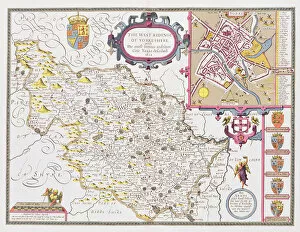
Background imageMapping Collection: The West Ridinge of Yorkeshyre, engraved by Jodocus Hondius (1563-1612) from John

The West Ridinge of Yorkeshyre, engraved by Jodocus Hondius (1563-1612) from John
XCF306017 The West Ridinge of Yorkeshyre, engraved by Jodocus Hondius (1563-1612) from John Speeds Theatre of the Empire of Great Britain, 1611-12 (hand-coloured copper engraving) by Speed

Background imageMapping Collection: Kent, engraved by Jodocus Hondius (1563-1612) from John Speeds Theatre of the

Kent, engraved by Jodocus Hondius (1563-1612) from John Speeds Theatre of the
XCF306016 Kent, engraved by Jodocus Hondius (1563-1612) from John Speeds Theatre of the Empire of Great Britain, pub. by John Sudbury and George Humble

Background imageMapping Collection: Map of Ireland in the sixth century, from the book The Church of England: A

Map of Ireland in the sixth century, from the book The Church of England: A
KW293340 Map of Ireland in the sixth century, from the book The Church of England: A History for the People, published c.1910 (litho) by English School

Background imageMapping Collection: Map of Aegyptus Antiqua (Ancient Egypt), drawn and engraved by Sydney Hall, c. 1826

Map of Aegyptus Antiqua (Ancient Egypt), drawn and engraved by Sydney Hall, c. 1826
KW293339 Map of Aegyptus Antiqua (Ancient Egypt), drawn and engraved by Sydney Hall, c.1826 (coloured engraving) by Hall, Sydney (fl.1826); Private Collection; Ken Welsh; English, out of copyright

Background imageMapping Collection: Wiltshire, engraved by Jodocus Hondius (1563-1612) from John Speeds Theatre

Wiltshire, engraved by Jodocus Hondius (1563-1612) from John Speeds Theatre
XCF291067 Wiltshire, engraved by Jodocus Hondius (1563-1612) from John Speeds Theatre of the Empire of Great Britain, pub

Background imageMapping Collection: Berkshire, engraved by Jodocus Hondius (1563-1612) from John Speeds Theatre

Berkshire, engraved by Jodocus Hondius (1563-1612) from John Speeds Theatre
XCF291066 Berkshire, engraved by Jodocus Hondius (1563-1612) from John Speeds Theatre of the Empire of Great Britain, pub

Background imageMapping Collection: Map of the Magellan Straits, Patagonia (colour engraving)

Map of the Magellan Straits, Patagonia (colour engraving)
XCF291059 Map of the Magellan Straits, Patagonia (colour engraving) by Dutch School, (17th century); Private Collection; (add.info.: Judocus Hondius (1563-1612); ); Dutch, out of copyright

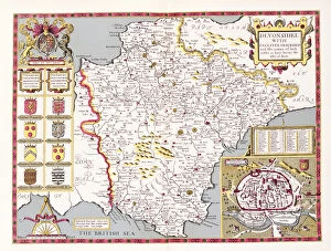
Background imageMapping Collection: Devonshire, engraved by Jodocus Hondius (1563-1612) from John Speeds Theatre

Devonshire, engraved by Jodocus Hondius (1563-1612) from John Speeds Theatre
XCF291053 Devonshire, engraved by Jodocus Hondius (1563-1612) from John Speeds Theatre of the Empire of Great Britain, pub

Background imageMapping Collection: A Map of the coastline of Brittany, 1588

A Map of the coastline of Brittany, 1588
XCF291052 A Map of the coastline of Brittany, 1588 by European School, (16th century); Private Collection; European, out of copyright

Background imageMapping Collection: Pascatway River in New England, c. 1660-85 (ink on paper)

Pascatway River in New England, c. 1660-85 (ink on paper)
XCF291047 Pascatway River in New England, c.1660-85 (ink on paper) by English School, (17th century); 40x54 cm; Private Collection; (add.info.: drawn by a surveyor whose initials are J.S)

Background imageMapping Collection: Mappa Mundi, 1502 (gouache and pen & ink on paper)

Mappa Mundi, 1502 (gouache and pen & ink on paper)
XCF290906 Mappa Mundi, 1502 (gouache and pen & ink on paper) by Cosa, Juan de la (1460-1510); Museo Naval, Madrid, Spain; (add.info)

Background imageMapping Collection: Map of Ireland from The History of Ireland by Thomas Wright, published c

Map of Ireland from The History of Ireland by Thomas Wright, published c
KW468249 Map of Ireland from The History of Ireland by Thomas Wright, published c.1854 (colour litho) by English School, (19th century); Private Collection; Ken Welsh; English, out of copyright

Background imageMapping Collection: Map of America, 1878 (colour litho)

Map of America, 1878 (colour litho)
KW348149 Map of America, 1878 (colour litho) by English School, (19th century); Private Collection; (add.info.: reduced facsimile of a map from the Spanish Atlas published in Messina in 1582; this)

Background imageMapping Collection: Plan of Lisle, 1736 (engraving)

Plan of Lisle, 1736 (engraving)
XJF328617 Plan of Lisle, 1736 (engraving) by Lediard, Thomas (1685-1743); Private Collection; (add.info.: An Exact Plan of Lisle, is humbly dedicated to His Grace Scroo Eggerton, Duke of Bridgwater)

Background imageMapping Collection: Map of Ireland (hand coloured engraving)

Map of Ireland (hand coloured engraving)
XCF286477 Map of Ireland (hand coloured engraving) by English School; Private Collection; English, out of copyright

Background imageMapping Collection: The Road from London to Holy-Head (colour engraving)

The Road from London to Holy-Head (colour engraving)
XCF286474 The Road from London to Holy-Head (colour engraving) by Ogilby, John (1600-1676); Private Collection; English, out of copyright

Background imageMapping Collection: Map of Lancaster divided into hundreds, 1610 (colour engraving)

Map of Lancaster divided into hundreds, 1610 (colour engraving)
XCF286473 Map of Lancaster divided into hundreds, 1610 (colour engraving) by English School, (17th century); Private Collection; English, out of copyright

Background imageMapping Collection: Map of Sussex (colour litho)

Map of Sussex (colour litho)
XCF286472 Map of Sussex (colour litho) by English School; Private Collection; English, out of copyright

Background imageMapping Collection: Map of Sussex (colour engraving)

Map of Sussex (colour engraving)
XCF286471 Map of Sussex (colour engraving) by English School; Private Collection; English, out of copyright

Background imageMapping Collection: Map of Surrey, described and divided into hundreds (engraving)

Map of Surrey, described and divided into hundreds (engraving)
XCF286470 Map of Surrey, described and divided into hundreds (engraving) by English School; Private Collection; English, out of copyright

Background imageMapping Collection: A Map of the North Pole (colour engraving)

A Map of the North Pole (colour engraving)
XCF285173 A Map of the North Pole (colour engraving) by Seller, John (1632-97); Private Collection; (add.info.: The list of those worthy persons that have attempted the discovery of a North East)

Background imageMapping Collection: Map of Afghanistan, 1898 (colour engraving)

Map of Afghanistan, 1898 (colour engraving)
XCF285172 Map of Afghanistan, 1898 (colour engraving) by English School, (19th century); Private Collection; English, out of copyright


All Professionally Made to Order for Quick Shipping

"Exploring the World Through Maps: A Journey of Discovery" Embark on a captivating journey through time and space as we delve into the fascinating world of mapping. From the iconic Wimbledon tennis complex in the UK to the enchanting Theatre of the Empire of Great Britain, these maps offer glimpses into diverse landscapes and historical narratives. Transport yourself back to 1560 Mexico with Alonso de Santa Cruz's Map of Tenochtitlan, where you can trace the ancient streets and waterways that once thrived in this vibrant city. Or marvel at Durer's intricate world map from 1515, which showcases an era when cartography was still in its infancy but held immense potential for exploration. Step foot onto 16th-century Florence with a meticulously detailed plan that captures every nook and cranny of this Renaissance gem. Meanwhile, an Italian map from 1537 unveils Corfu's allure nestled within Greece's Ionian Sea – a testament to both artistic skill and geographical accuracy. As we venture further into history, a stunning 17th-century European map unfolds before our eyes, revealing political boundaries that have since evolved but continue to shape our present-day understanding. Witness Dubrovnik's pre-1667 earthquake charm through an intricately crafted depiction that preserves its architectural grandeur. The allure extends beyond terrestrial realms as well; explore Bermuda’s beauty through a vividly colored engraving or immerse yourself in Roman glory with "A New Map of the Roman Empire. " These maps not only guide us geographically but also provide insights into cultural heritage and societal dynamics. Finally, let us contemplate White Matter Fibres' artwork from 1930 – an abstract representation reminding us that mapping transcends physical borders too. It invites us to explore neural pathways within our own minds while appreciating how cartography has become intertwined with human cognition throughout history. Intricate lines, vibrant colors, and meticulous details come together on these maps, inviting us to embark on a visual and intellectual adventure.