Fraud Blocker Skip to main content

Mapping Collection (page 13)

"Exploring the World Through Maps: A Journey of Discovery" Embark on a captivating journey through time and space as we delve into the fascinating world of mapping

Background imageMapping Collection: German military rocket camera, WW1

German military rocket camera, WW1
A German military rocket camera with a Zeiss lens being fired into the air in the early weeks of the First World War. It was designed to map enemy territory to facilitate invasion

Background imageMapping Collection: Map of the Moon

Map of the Moon Date: circa 1900

Background imageMapping Collection: Marine compass

Marine compass

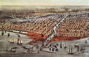
Background imageMapping Collection: Chicago As it Was, c. 1880

Chicago As it Was, c. 1880
XJL62055 Chicago As it Was, c.1880 by Currier, N. (1813-88) and Ives, J.M. (1824-95); Yale University Art Gallery, New Haven, CT

Background imageMapping Collection: British map of the Siege of Yorktown, 1781 (pen & ink on paper)

British map of the Siege of Yorktown, 1781 (pen & ink on paper)
BAL4915 British map of the Siege of Yorktown, 1781 (pen & ink on paper) by Hills, John (fl. 1781); Private Collection; (add.info.: Lieutenant John Hills of the 23rd Foot; ); British, out of copyright

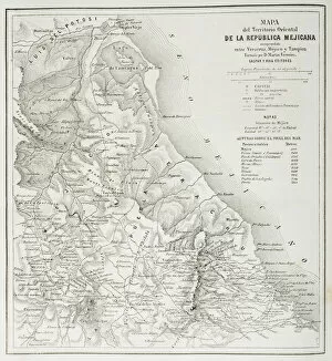
Background imageMapping Collection: Map of the eatern territories of the Republic of Mexico as they were in 1862

Map of the eatern territories of the Republic of Mexico as they were in 1862
KW403239 Map of the eatern territories of the Republic of Mexico as they were in 1862, from The Universal Museum, published 1862 (engraving) by Spanish School

Background imageMapping Collection: Map of London in the 11th century, from A Short History of the English People by J

Map of London in the 11th century, from A Short History of the English People by J
KW392537 Map of London in the 11th century, from A Short History of the English People by J. R. Green, published 1893 (litho) by English School

Background imageMapping Collection: Map of Oxford, England, 12th to 13th century, from A Short History of the English

Map of Oxford, England, 12th to 13th century, from A Short History of the English
KW392538 Map of Oxford, England, 12th to 13th century, from A Short History of the English People by J. R. Green, published 1893 (litho) by English School

Background imageMapping Collection: Map of Scotland in 1290, from A Short History of the English People by J

Map of Scotland in 1290, from A Short History of the English People by J
KW392520 Map of Scotland in 1290, from A Short History of the English People by J. R. Green, published 1893 (colour litho) by English School, (19th century); Private Collection; Ken Welsh; English

Background imageMapping Collection: Map illustrating the Welsh wars of William Rufus and Henry I, from A Short History

Map illustrating the Welsh wars of William Rufus and Henry I, from A Short History
KW392517 Map illustrating the Welsh wars of William Rufus and Henry I, from A Short History of the English People by J. R

Background imageMapping Collection: Map of Britain in 665, from The Northumbrian Kingdom 588 to 685 in A Short History

Map of Britain in 665, from The Northumbrian Kingdom 588 to 685 in A Short History
KW392505 Map of Britain in 665, from The Northumbrian Kingdom 588 to 685 in A Short History of the English People by J. R

Background imageMapping Collection: Plan of London in the 13th century, from A Short History of the English People by J

Plan of London in the 13th century, from A Short History of the English People by J
KW392511 Plan of London in the 13th century, from A Short History of the English People by J. R. Green, published 1893 (litho) by English School

Background imageMapping Collection: Map of the dominions of the Angevins c. 1170, from A Short History of the English People by J

Map of the dominions of the Angevins c. 1170, from A Short History of the English People by J
KW392507 Map of the dominions of the Angevins c.1170, from A Short History of the English People by J. R. Green, published 1893 (colour litho) by English School

Background imageMapping Collection: Map of Britain in 792, from The Three Kingdoms 685 to 828 in A Short History

Map of Britain in 792, from The Three Kingdoms 685 to 828 in A Short History
KW392506 Map of Britain in 792, from The Three Kingdoms 685 to 828 in A Short History of the English People by J. R. Green, published 1893 (litho) by English School

Background imageMapping Collection: Map of Britain in 640, from The Northumbrian Kingdom in A Short History of the

Map of Britain in 640, from The Northumbrian Kingdom in A Short History of the
KW392504 Map of Britain in 640, from The Northumbrian Kingdom in A Short History of the English People by J. R. Green, published 1893 (litho) by English School

Background imageMapping Collection: Map of Britain in 634, from The Northumbrian Kingdom 588 to 685 in A Short History

Map of Britain in 634, from The Northumbrian Kingdom 588 to 685 in A Short History
KW392503 Map of Britain in 634, from The Northumbrian Kingdom 588 to 685 in A Short History of the English People by J. R

Background imageMapping Collection: Map of Britain in 626, from The Northumbrian Kingdom 588 to 685 in A Short History

Map of Britain in 626, from The Northumbrian Kingdom 588 to 685 in A Short History
KW392502 Map of Britain in 626, from The Northumbrian Kingdom 588 to 685 in A Short History of the English People by J. R

Background imageMapping Collection: Map of Roman Kent, England, from A Short History of the English People by J

Map of Roman Kent, England, from A Short History of the English People by J
KW392501 Map of Roman Kent, England, from A Short History of the English People by J. R. Green, published 1893 (litho) by English School, (19th century); Private Collection; Ken Welsh; English

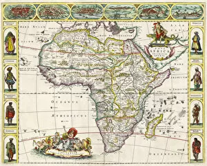
Background imageMapping Collection: Map of Africa, from Nova Africa Descriptio, published in Amsterdam in the 1660s by

Map of Africa, from Nova Africa Descriptio, published in Amsterdam in the 1660s by
KW378949 Map of Africa, from Nova Africa Descriptio, published in Amsterdam in the 1660s by Dutch cartographer Frederik de Wit (colour litho) by Dutch School

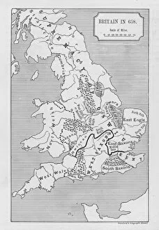
Background imageMapping Collection: Map of Britain in 658, produced by Stanfords Geographical Establishment (litho)

Map of Britain in 658, produced by Stanfords Geographical Establishment (litho)
XJF377153 Map of Britain in 658, produced by Stanfords Geographical Establishment (litho) by English School; Private Collection; (add.info.: showing the supremacy of Oswiu (612-670)

Background imageMapping Collection: Palestine and the Promised Land, from the Theatrum Orbis Terrarum, 1603

Palestine and the Promised Land, from the Theatrum Orbis Terrarum, 1603
XOT366567 Palestine and the Promised Land, from the Theatrum Orbis Terrarum, 1603 (coloured engraving) by Ortelius, Abraham (1527-98) (after); Private Collection; (add.info)

Background imageMapping Collection: Map of the Voyage of the Argonauts, from the Theatrum Orbis Terrarum, 1603

Map of the Voyage of the Argonauts, from the Theatrum Orbis Terrarum, 1603
XOT366562 Map of the Voyage of the Argonauts, from the Theatrum Orbis Terrarum, 1603 (coloured engraving) by Ortelius, Abraham (1527-98) (after); Private Collection; (add.info)

Background imageMapping Collection: The seventeen regions of the Belgian lion, c. 1583 (coloured engraving)

The seventeen regions of the Belgian lion, c. 1583 (coloured engraving)
XOT366574 The seventeen regions of the Belgian lion, c.1583 (coloured engraving) by Visscher, Claes Jansz (c.1550-c.1612); Private Collection; Netherlandish, out of copyright

Background imageMapping Collection: The Theatre of War in Italy, 1720 (coloured engraving)

The Theatre of War in Italy, 1720 (coloured engraving)
XOT366572 The Theatre of War in Italy, 1720 (coloured engraving) by Mortier, Pierre (Pieter) (1661-1711); Private Collection; (add.info)

Background imageMapping Collection: The Expedition of Alexander the Great, from the Theatrum Orbis Terrarum

The Expedition of Alexander the Great, from the Theatrum Orbis Terrarum
XOT366559 The Expedition of Alexander the Great, from the Theatrum Orbis Terrarum, 1603 (coloured engraving) by Ortelius, Abraham (1527-98) (after); Private Collection; (add.info)

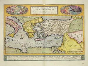
Background imageMapping Collection: Peregrinationis Divi Pauli Typus Corographicus page from the Atlas Major

Peregrinationis Divi Pauli Typus Corographicus page from the Atlas Major
XOT366482 Peregrinationis Divi Pauli Typus Corographicus page from the Atlas Major, 1662 (coloured engraving) by Blaeu, Joan (1596-1673); Private Collection; (add.info)

Background imageMapping Collection: Countries travelled by the apostles and showing the journeys of St. Paul between Asia and Europe

Countries travelled by the apostles and showing the journeys of St. Paul between Asia and Europe
KW360496 Countries travelled by the apostles and showing the journeys of St. Paul between Asia and Europe (colour litho) by English School

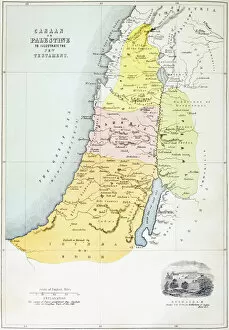
Background imageMapping Collection: Canaan, or Palestine at the time of the New testament (colour litho)

Canaan, or Palestine at the time of the New testament (colour litho)
KW360492 Canaan, or Palestine at the time of the New testament (colour litho) by English School, (19th century); Private Collection; (add.info.: from The Holy Bible, published by William Collins)

Background imageMapping Collection: Countries between Egypt and Canaan (colour litho)

Countries between Egypt and Canaan (colour litho)
KW360488 Countries between Egypt and Canaan (colour litho) by English School, (19th century); Private Collection; (add.info)

Background imageMapping Collection: Map showing the geography of the Hebrews and exhibiting the dispersion of the descendents of Noah

Map showing the geography of the Hebrews and exhibiting the dispersion of the descendents of Noah
KW360487 Map showing the geography of the Hebrews and exhibiting the dispersion of the descendents of Noah (colour litho) by English School

Background imageMapping Collection: Map of Spain and Portugal showing the political divisions in the country at the death

Map of Spain and Portugal showing the political divisions in the country at the death
KW359980 Map of Spain and Portugal showing the political divisions in the country at the death of Alfonso III, King of Leon

Background imageMapping Collection: Map of Turkey, Arabia and Persia, after Guillaume de L Isle, revised by John Senex

Map of Turkey, Arabia and Persia, after Guillaume de L Isle, revised by John Senex
KW359928 Map of Turkey, Arabia and Persia, after Guillaume de L Isle, revised by John Senex, from the New General Atlas of 1721 by D. Browne, T. Taylor, J. Darby, J, Senex, W

Background imageMapping Collection: Map of Flanders, after cartographer Matthias Quad from his Fasciculus Geographicus

Map of Flanders, after cartographer Matthias Quad from his Fasciculus Geographicus
KW359932 Map of Flanders, after cartographer Matthias Quad from his Fasciculus Geographicus, later hand colouring (coloured engraving) by Bussemacher

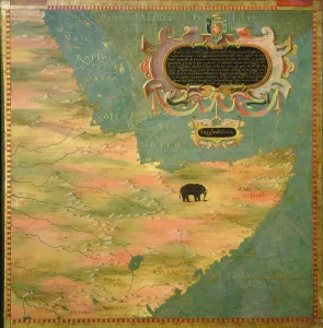
Background imageMapping Collection: The Troglodyte Region (oil on panel)

The Troglodyte Region (oil on panel)
XOT351157 The Troglodyte Region (oil on panel) by Bonsignori, Stefano (fl.1575); Palazzo Vecchio (Cappella dei Priori) Florence, Italy; Italian, out of copyright

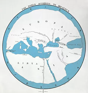
Background imageMapping Collection: The world according to Hecataeus, published by John Murray (colour litho)

The world according to Hecataeus, published by John Murray (colour litho)
XCF349757 The world according to Hecataeus, published by John Murray (colour litho) by English School, (19th century); Private Collection; (add.info)

Background imageMapping Collection: View of Jerusalem, 1570 ? (engraving) (b / w photo)

View of Jerusalem, 1570 ? (engraving) (b / w photo)
XIR345970 View of Jerusalem, 1570 ? (engraving) (b/w photo) by Duperac, Etienne (1525-1601); Bibliotheque Nationale, Paris, France; (add.info.: vue de Hierusalem; Stefano du Perac; ); French

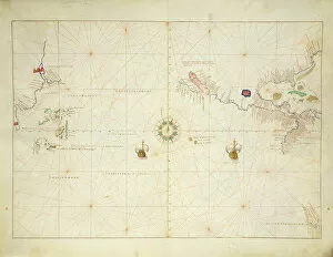
Background imageMapping Collection: The Pacific Ocean, from an Atlas of the World in 33 Maps, Venice, 1st September 1553

The Pacific Ocean, from an Atlas of the World in 33 Maps, Venice, 1st September 1553
XOT330960 The Pacific Ocean, from an Atlas of the World in 33 Maps, Venice, 1st September 1553 (ink on vellum) (see also 330962) by Agnese, Battista (1514-64); 29x49 cm; Museo Correr, Venice

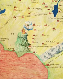
Background imageMapping Collection: Mount Sinai and the Red Sea, from an Atlas of the World in 33 Maps, Venice, 1st September 1553

Mount Sinai and the Red Sea, from an Atlas of the World in 33 Maps, Venice, 1st September 1553
XOT330964 Mount Sinai and the Red Sea, from an Atlas of the World in 33 Maps, Venice, 1st September 1553 (ink on vellum) (detail from 330963) by Agnese, Battista (1514-64); Museo Correr, Venice

Background imageMapping Collection: The Holy Land, from an Atlas of the World in 33 Maps, Venice, 1st September 1553

The Holy Land, from an Atlas of the World in 33 Maps, Venice, 1st September 1553
XOT330966 The Holy Land, from an Atlas of the World in 33 Maps, Venice, 1st September 1553 (ink on vellum) (see also 330965) by Agnese, Battista (1514-64); 29x49 cm; Museo Correr, Venice

Background imageMapping Collection: India and Malaysia, from an Atlas of the World in 33 Maps, Venice, 1st September 1553

India and Malaysia, from an Atlas of the World in 33 Maps, Venice, 1st September 1553
XOT330958 India and Malaysia, from an Atlas of the World in 33 Maps, Venice, 1st September 1553 (ink on vellum) (detail from 330955) by Agnese, Battista (1514-64); Museo Correr, Venice

Background imageMapping Collection: The Indian Ocean, from an Atlas of the World in 33 Maps, Venice, 1st September 1553

The Indian Ocean, from an Atlas of the World in 33 Maps, Venice, 1st September 1553
XOT330955 The Indian Ocean, from an Atlas of the World in 33 Maps, Venice, 1st September 1553 (ink on vellum) (see also 330956) by Agnese, Battista (1514-64); 29x49 cm; Museo Correr, Venice

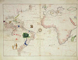
Background imageMapping Collection: The New World, from an Atlas of the World in 33 Maps, Venice, 1st September 1553

The New World, from an Atlas of the World in 33 Maps, Venice, 1st September 1553
XOT330959 The New World, from an Atlas of the World in 33 Maps, Venice, 1st September 1553 (ink on vellum) (see also 330961) by Agnese, Battista (1514-64); 29x49 cm; Museo Correr, Venice

Background imageMapping Collection: The Middle East, from an Atlas of the World in 33 Maps, Venice, 1st September 1553

The Middle East, from an Atlas of the World in 33 Maps, Venice, 1st September 1553
XOT330963 The Middle East, from an Atlas of the World in 33 Maps, Venice, 1st September 1553 (ink on vellum) (see also 330964) by Agnese, Battista (1514-64); 29x49 cm; Museo Correr, Venice

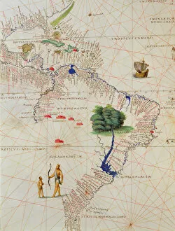
Background imageMapping Collection: South America, from an Atlas of the World in 33 Maps, Venice, 1st September 1553

South America, from an Atlas of the World in 33 Maps, Venice, 1st September 1553
XOT330961 South America, from an Atlas of the World in 33 Maps, Venice, 1st September 1553 (ink on vellum) (detail from 330959) by Agnese, Battista (1514-64); Museo Correr, Venice, Italy; Italian

Background imageMapping Collection: Madagascar, from an Atlas of the World in 33 Maps, Venice, 1st September 1553 (ink on vellum)

Madagascar, from an Atlas of the World in 33 Maps, Venice, 1st September 1553 (ink on vellum)
XOT330957 Madagascar, from an Atlas of the World in 33 Maps, Venice, 1st September 1553 (ink on vellum) (detail from 330955) by Agnese, Battista (1514-64); Museo Correr, Venice, Italy; Italian

Background imageMapping Collection: Northern Europe, from an Atlas of the World in 33 maps, Venice, 1st September 1553

Northern Europe, from an Atlas of the World in 33 maps, Venice, 1st September 1553
XOT330951 Northern Europe, from an Atlas of the World in 33 maps, Venice, 1st September 1553 (ink on vellum) (see also 330952) by Agnese, Battista (1514-64); 29x49 cm; Museo Correr, Venice

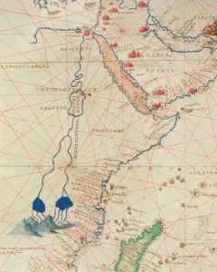
Background imageMapping Collection: Part of Africa, from an Atlas of the World in 33 Maps, Venice, 1st September 1553

Part of Africa, from an Atlas of the World in 33 Maps, Venice, 1st September 1553
XOT330956 Part of Africa, from an Atlas of the World in 33 Maps, Venice, 1st September 1553 (ink on vellum) (detail from 330955) by Agnese, Battista (1514-64); Museo Correr, Venice, Italy; Italian

Background imageMapping Collection: Europe and Central Asia, from an Atlas of the World in 33 Maps, Venice, 1st September 1553

Europe and Central Asia, from an Atlas of the World in 33 Maps, Venice, 1st September 1553
XOT330953 Europe and Central Asia, from an Atlas of the World in 33 Maps, Venice, 1st September 1553 (ink on vellum) (see also 330954) by Agnese, Battista (1514-64); 29x49 cm; Museo Correr, Venice


All Professionally Made to Order for Quick Shipping

"Exploring the World Through Maps: A Journey of Discovery" Embark on a captivating journey through time and space as we delve into the fascinating world of mapping. From the iconic Wimbledon tennis complex in the UK to the enchanting Theatre of the Empire of Great Britain, these maps offer glimpses into diverse landscapes and historical narratives. Transport yourself back to 1560 Mexico with Alonso de Santa Cruz's Map of Tenochtitlan, where you can trace the ancient streets and waterways that once thrived in this vibrant city. Or marvel at Durer's intricate world map from 1515, which showcases an era when cartography was still in its infancy but held immense potential for exploration. Step foot onto 16th-century Florence with a meticulously detailed plan that captures every nook and cranny of this Renaissance gem. Meanwhile, an Italian map from 1537 unveils Corfu's allure nestled within Greece's Ionian Sea – a testament to both artistic skill and geographical accuracy. As we venture further into history, a stunning 17th-century European map unfolds before our eyes, revealing political boundaries that have since evolved but continue to shape our present-day understanding. Witness Dubrovnik's pre-1667 earthquake charm through an intricately crafted depiction that preserves its architectural grandeur. The allure extends beyond terrestrial realms as well; explore Bermuda’s beauty through a vividly colored engraving or immerse yourself in Roman glory with "A New Map of the Roman Empire. " These maps not only guide us geographically but also provide insights into cultural heritage and societal dynamics. Finally, let us contemplate White Matter Fibres' artwork from 1930 – an abstract representation reminding us that mapping transcends physical borders too. It invites us to explore neural pathways within our own minds while appreciating how cartography has become intertwined with human cognition throughout history. Intricate lines, vibrant colors, and meticulous details come together on these maps, inviting us to embark on a visual and intellectual adventure.