Fraud Blocker Skip to main content

Mapping Collection (page 9)

"Exploring the World Through Maps: A Journey of Discovery" Embark on a captivating journey through time and space as we delve into the fascinating world of mapping

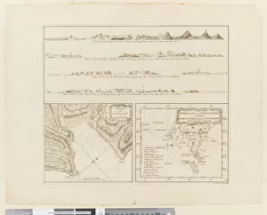
Background imageMapping Collection: ii. (a) Four profiles of the coast of Terra del Fuego (b

ii. (a) Four profiles of the coast of Terra del Fuego (b
5670247 ii. (a) Four profiles of the coast of Terra del Fuego (b) A plan of Success Bay in Strait le Maire (c) A chart of the S.E. part of Terra del Fuego, engraved by T. Borven and J

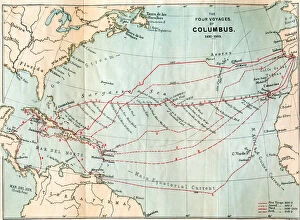
Background imageMapping Collection: The Four Voyages of Christopher Columbus, from Life of Christopher Columbus

The Four Voyages of Christopher Columbus, from Life of Christopher Columbus
1772340 The Four Voyages of Christopher Columbus, from Life of Christopher Columbus by Clements R. Markham, published 1892 (colour litho) by English School

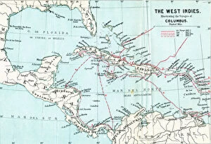
Background imageMapping Collection: Map of the West Indies illustrating the voyages of Christopher Columbus

Map of the West Indies illustrating the voyages of Christopher Columbus
1772337 Map of the West Indies illustrating the voyages of Christopher Columbus, from Life of Christopher Columbus by Clements R

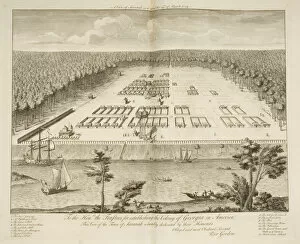
Background imageMapping Collection: A View of Savannah as it stood on the 29th March 1734, engraved by P

A View of Savannah as it stood on the 29th March 1734, engraved by P
3964033 A View of Savannah as it stood on the 29th March 1734, engraved by P. Fourdrinier, London, c.1735 (engraving) by Gordon

Background imageMapping Collection: Map of the Gulf of Naples and surrounding area from Campi Phlegraei

Map of the Gulf of Naples and surrounding area from Campi Phlegraei
1275091 Map of the Gulf of Naples and surrounding area from Campi Phlegraei: Observations on the Volcanoes of the Two Sicilies, by Sir William Hamilton (1730-1803)

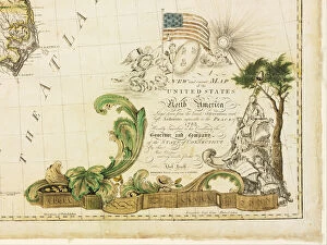
Background imageMapping Collection: Americas first national map, 1784 (hand-coloured engraving)

Americas first national map, 1784 (hand-coloured engraving)
1268149 Americas first national map, 1784 (hand-coloured engraving) by Buell, Abel (1742-1822); 115.2x128.6 cm; Private Collection; (add.info)

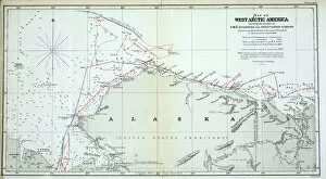
Background imageMapping Collection: Map of West Arctic America showing the tracks of HMS Enterprise

Map of West Arctic America showing the tracks of HMS Enterprise
939906 Map of West Arctic America showing the tracks of HMS Enterprise and Investigator in 1850-1854 (colour litho) by English School

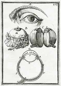
Background imageMapping Collection: Illustration from 'La Geometrie Pratique'1702, (engraving)

Illustration from "La Geometrie Pratique"1702, (engraving)
937190 Illustration from " La Geometrie Pratique" 1702, (engraving) by Mallet, Alain Manesson (1630-1706); Private Collection; (add.info)

Background imageMapping Collection: Map of Philadelphia County, 1819 (colour litho)

Map of Philadelphia County, 1819 (colour litho)
3058567 Map of Philadelphia County, 1819 (colour litho) by American School, (19th century); Free Library of Philadelphia; eFree Library of Philadelphia; American, out of copyright

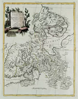
Background imageMapping Collection: Russian Lapland with Governments of Olonecholi, Carelia, Bielozero and Ingria in European Russia

Russian Lapland with Governments of Olonecholi, Carelia, Bielozero and Ingria in European Russia
3658103 Russian Lapland with Governments of Olonecholi, Carelia, Bielozero and Ingria in European Russia, from Tome III of the " New Atlas", engraved by G

Background imageMapping Collection: Plan of the defence of Seetabuldee Hill, illustration from Cassell

Plan of the defence of Seetabuldee Hill, illustration from Cassell
876378 Plan of the defence of Seetabuldee Hill, illustration from Cassells Illustrated History of India by James Grant, pub

Background imageMapping Collection: Nova orbis terrarum, from Tabulae Rudolphinae by Johannes Kepler

Nova orbis terrarum, from Tabulae Rudolphinae by Johannes Kepler
3618828 Nova orbis terrarum, from Tabulae Rudolphinae by Johannes Kepler, 1627-30 (engraving) by German School, (17th century); 44x72 cm; (add.info)

Background imageMapping Collection: Two exceptional terrestrial and celestial globes, supported by Hercules and Atlas

Two exceptional terrestrial and celestial globes, supported by Hercules and Atlas
3482920 Two exceptional terrestrial and celestial globes, supported by Hercules and Atlas, Augsburg, 1697-99 (silver & silver-gilt) by Drentwett

Background imageMapping Collection: Two exceptional terrestrial and celestial globes, supported by Hercules and Atlas

Two exceptional terrestrial and celestial globes, supported by Hercules and Atlas
3482919 Two exceptional terrestrial and celestial globes, supported by Hercules and Atlas, Augsburg, 1697-99 (silver & silver-gilt) by Drentwett

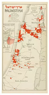
Background imageMapping Collection: Map of Palestine, 1926 (colour litho)

Map of Palestine, 1926 (colour litho)
3482908 Map of Palestine, 1926 (colour litho) by Trietsch, Davis (1870-1935); Private Collection; (add.info.: PalAastina-Wirtschafts-Atlas. Berlin: Orient-Verlag, [1926])

Background imageMapping Collection: Two exceptional terrestrial and celestial globes, supported by Hercules and Atlas

Two exceptional terrestrial and celestial globes, supported by Hercules and Atlas
3482893 Two exceptional terrestrial and celestial globes, supported by Hercules and Atlas, Augsburg, 1697-99 (silver & silver-gilt) by Drentwett

Background imageMapping Collection: Large pair of library globes, the terrestrial 1645 / 48, the celestial after c

Large pair of library globes, the terrestrial 1645 / 48, the celestial after c
3482882 Large pair of library globes, the terrestrial 1645/48, the celestial after c.1630 (plaster, wood & engraved paper) by Blaeu

Background imageMapping Collection: Map of French territories under tax, 1709, from 'Le Theatre du Monde'

Map of French territories under tax, 1709, from "Le Theatre du Monde"
LRI3518462 Map of French territories under tax, 1709, from " Le Theatre du Monde" by Jean-Baptiste Nolin, published 1717 (hand-coloured engraving) by French School

Background imageMapping Collection: Large pair of library globes, the terrestrial 1645 / 48, the celestial after c

Large pair of library globes, the terrestrial 1645 / 48, the celestial after c
3482888 Large pair of library globes, the terrestrial 1645/48, the celestial after c.1630 (plaster, wood & engraved paper) by Blaeu

Background imageMapping Collection: Totius Orbis Cogniti Universalis Descriptio, Antwerp, 1593 (engraving)

Totius Orbis Cogniti Universalis Descriptio, Antwerp, 1593 (engraving)
3554905 Totius Orbis Cogniti Universalis Descriptio, Antwerp, 1593 (engraving) by Jode, Cornelis de (1568-1600); 45.1x59.2 cm; Private Collection; (add.info)

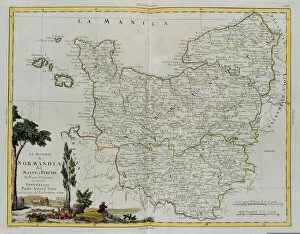
Background imageMapping Collection: Governances of Normandy, from Volume I of the 'Newest Atlas', engraved by G

Governances of Normandy, from Volume I of the "Newest Atlas", engraved by G
3518735 Governances of Normandy, from Volume I of the " Newest Atlas", engraved by G. Zuliani, published by Antonio Zatta, Venice, 1777 (hand-coloured engraving) by Italian School

Background imageMapping Collection: Map of the Battle of Marengo, published by William Blackwood and Sons, Edinburgh & London

Map of the Battle of Marengo, published by William Blackwood and Sons, Edinburgh & London
746920 Map of the Battle of Marengo, published by William Blackwood and Sons, Edinburgh & London, 1848 (hand-coloured engraving) by Johnston

Background imageMapping Collection: Map of the Battle of Trafalgar, published by William Blackwood and Sons

Map of the Battle of Trafalgar, published by William Blackwood and Sons
746913 Map of the Battle of Trafalgar, published by William Blackwood and Sons, Edinburgh & London, 1848 (hand-coloured engraving) by Johnston

Background imageMapping Collection: Map of the Battle of Friedland, published by William Blackwood and Sons

Map of the Battle of Friedland, published by William Blackwood and Sons
746905 Map of the Battle of Friedland, published by William Blackwood and Sons, Edinburgh & London, 1848 (hand-coloured engraving) by Johnston

Background imageMapping Collection: Map of the Battle of Medina de Rio-Seco, published by William Blackwood and Sons

Map of the Battle of Medina de Rio-Seco, published by William Blackwood and Sons
746903 Map of the Battle of Medina de Rio-Seco, published by William Blackwood and Sons, Edinburgh & London, 1848 (hand-coloured engraving) by Johnston

Background imageMapping Collection: Map of the Battles of Smolensko and Valtelina, published by William Blackwood and Sons

Map of the Battles of Smolensko and Valtelina, published by William Blackwood and Sons
746895 Map of the Battles of Smolensko and Valtelina, published by William Blackwood and Sons, Edinburgh & London, 1848 (hand-coloured engraving) by Johnston

Background imageMapping Collection: Map of the Siege of the Castle of Burgos, published by William Blackwood and Sons

Map of the Siege of the Castle of Burgos, published by William Blackwood and Sons
746893 Map of the Siege of the Castle of Burgos, published by William Blackwood and Sons, Edinburgh & London, 1848 (hand-coloured engraving) by Johnston

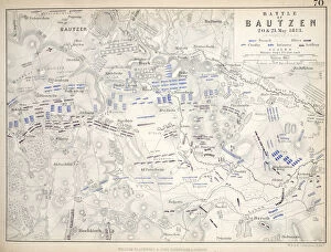
Background imageMapping Collection: Map of the Battle of Bautzen, published by William Blackwood and Sons, Edinburgh & London

Map of the Battle of Bautzen, published by William Blackwood and Sons, Edinburgh & London
746889 Map of the Battle of Bautzen, published by William Blackwood and Sons, Edinburgh & London, 1848 (hand-coloured engraving) by Johnston

Background imageMapping Collection: Map of the Battle of Fere Champenoise and the Battle of Arcis-Sur-Aube

Map of the Battle of Fere Champenoise and the Battle of Arcis-Sur-Aube
746878 Map of the Battle of Fere Champenoise and the Battle of Arcis-Sur-Aube, published by William Blackwood and Sons, Edinburgh & London, 1848 (hand-coloured engraving) by Johnston

Background imageMapping Collection: Detail of a Map of Vienna showing 135 Alsergrund where Mozart

Detail of a Map of Vienna showing 135 Alsergrund where Mozart
2906733 Detail of a Map of Vienna showing 135 Alsergrund where Mozart and his family lived during 1788 (etching & engraving) by Huber

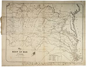
Background imageMapping Collection: Map of the Seat of War, made in Savannah, Georgia, 1861 (litho)

Map of the Seat of War, made in Savannah, Georgia, 1861 (litho)
696120 Map of the Seat of War, made in Savannah, Georgia, 1861 (litho) by Grant, M. B. (fl.1861); 47.5x60.5 cm; Gilder Lehrman Collection, New York, USA; (add.info.: Compiled and drawn by M. B)

Background imageMapping Collection: Manuscript Civil War map of General Shermans Atlanta campaign, c. 1864 (litho)

Manuscript Civil War map of General Shermans Atlanta campaign, c. 1864 (litho)
696117 Manuscript Civil War map of General Shermans Atlanta campaign, c.1864 (litho) by Stevens, Asbury L. (1843-c.1890) and Snell, J.P

Background imageMapping Collection: Map of Yorktown, Virginia, October 1781 (litho)

Map of Yorktown, Virginia, October 1781 (litho)
696028 Map of Yorktown, Virginia, October 1781 (litho) by British School, (18th Century); 28.3x37.5 cm; Gilder Lehrman Collection, New York, USA; (add.info.: Drawn map of Yorktown, Virginia)

Background imageMapping Collection: Historical map of Berlin, published by Verlag von Gebrueder Rocca

Historical map of Berlin, published by Verlag von Gebrueder Rocca
AGD355562 Historical map of Berlin, published by Verlag von Gebrueder Rocca, Berlin 1838 (coloured engraving) by Moellendorf, W.v

Background imageMapping Collection: Map of the United States, 1816 (engraving)

Map of the United States, 1816 (engraving)
497563 Map of the United States, 1816 (engraving) by Melish, John (1771-1822); Gilder Lehrman Collection, New York, USA; eGilder Lehrman Institute of American History; American, out of copyright

Background imageMapping Collection: Map of South East Asia (ink & w / c on paper)

Map of South East Asia (ink & w / c on paper)
LIT389755 Map of South East Asia (ink & w/c on paper) by French School; Photo eLuca Tettoni; French, out of copyright

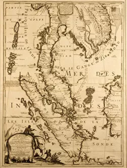
Background imageMapping Collection: Map of South East Asia, 1687 (ink on paper)

Map of South East Asia, 1687 (ink on paper)
LIT389754 Map of South East Asia, 1687 (ink on paper) by French School, (17th century); Photo eLuca Tettoni; French, out of copyright

Background imageMapping Collection: Map of Lower Egypt and part of Syria, published by William Blackwood and Sons

Map of Lower Egypt and part of Syria, published by William Blackwood and Sons
746929 Map of Lower Egypt and part of Syria, published by William Blackwood and Sons, Edinburgh & London, 1848 (hand-coloured engraving) by Johnston

Background imageMapping Collection: Map of the Battle of the Nile, published by William Blackwood and Sons

Map of the Battle of the Nile, published by William Blackwood and Sons
746928 Map of the Battle of the Nile, published by William Blackwood and Sons, Edinburgh & London, 1848 (hand-coloured engraving) by Johnston

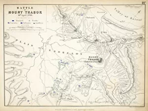
Background imageMapping Collection: Map of the Battle of Mount Thabor, published by William Blackwood and Sons

Map of the Battle of Mount Thabor, published by William Blackwood and Sons
746927 Map of the Battle of Mount Thabor, published by William Blackwood and Sons, Edinburgh & London, 1848 (hand-coloured engraving) by Johnston

Background imageMapping Collection: Map of the Siege of St. Jean d Acre, published by William Blackwood and Sons

Map of the Siege of St. Jean d Acre, published by William Blackwood and Sons
746925 Map of the Siege of St. Jean d Acre, published by William Blackwood and Sons, Edinburgh & London, 1848 (hand-coloured engraving) by Johnston

Background imageMapping Collection: Map of the Battle of Marengo, published by William Blackwood and Sons, Edinburgh & London

Map of the Battle of Marengo, published by William Blackwood and Sons, Edinburgh & London
746921 Map of the Battle of Marengo, published by William Blackwood and Sons, Edinburgh & London, 1848 (hand-coloured engraving) by Johnston

Background imageMapping Collection: Map of Boston : Dec. 1, 1908 (litho)

Map of Boston : Dec. 1, 1908 (litho)
6256297 Map of Boston : Dec. 1, 1908 (litho) by American School, (20th century); 84x124 cm; Boston Public Library, Boston, Massachusetts

Background imageMapping Collection: Official map of Boston, c. 1895 (colour litho)

Official map of Boston, c. 1895 (colour litho)
6256296 Official map of Boston, c.1895 (colour litho) by American School, (19th century); 70x92 cm; Boston Public Library, Boston, Massachusetts, USA; (add.info.: Creator: Geo. H)


All Professionally Made to Order for Quick Shipping

"Exploring the World Through Maps: A Journey of Discovery" Embark on a captivating journey through time and space as we delve into the fascinating world of mapping. From the iconic Wimbledon tennis complex in the UK to the enchanting Theatre of the Empire of Great Britain, these maps offer glimpses into diverse landscapes and historical narratives. Transport yourself back to 1560 Mexico with Alonso de Santa Cruz's Map of Tenochtitlan, where you can trace the ancient streets and waterways that once thrived in this vibrant city. Or marvel at Durer's intricate world map from 1515, which showcases an era when cartography was still in its infancy but held immense potential for exploration. Step foot onto 16th-century Florence with a meticulously detailed plan that captures every nook and cranny of this Renaissance gem. Meanwhile, an Italian map from 1537 unveils Corfu's allure nestled within Greece's Ionian Sea – a testament to both artistic skill and geographical accuracy. As we venture further into history, a stunning 17th-century European map unfolds before our eyes, revealing political boundaries that have since evolved but continue to shape our present-day understanding. Witness Dubrovnik's pre-1667 earthquake charm through an intricately crafted depiction that preserves its architectural grandeur. The allure extends beyond terrestrial realms as well; explore Bermuda’s beauty through a vividly colored engraving or immerse yourself in Roman glory with "A New Map of the Roman Empire. " These maps not only guide us geographically but also provide insights into cultural heritage and societal dynamics. Finally, let us contemplate White Matter Fibres' artwork from 1930 – an abstract representation reminding us that mapping transcends physical borders too. It invites us to explore neural pathways within our own minds while appreciating how cartography has become intertwined with human cognition throughout history. Intricate lines, vibrant colors, and meticulous details come together on these maps, inviting us to embark on a visual and intellectual adventure.