
Maryland State Collection
"Discover the Rich History and Charm of Maryland State" Step back in time with a journey through the captivating history of Maryland State


All Professionally Made to Order for Quick Shipping
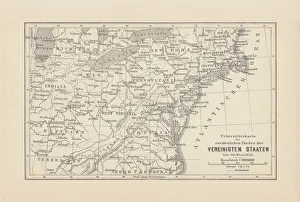
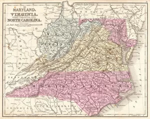
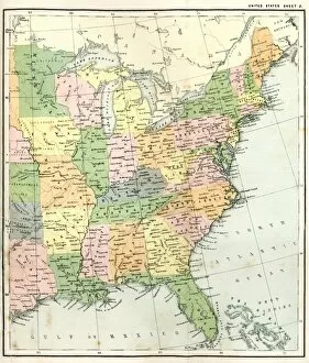
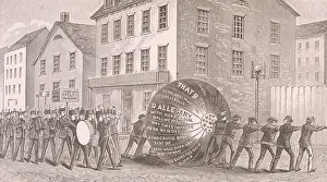
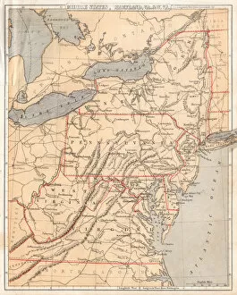
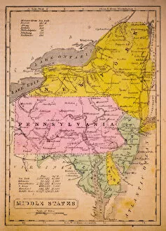
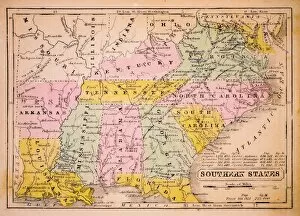
"Discover the Rich History and Charm of Maryland State" Step back in time with a journey through the captivating history of Maryland State. From its early days as one of the original thirteen colonies to its present-day significance, this region has played a pivotal role in shaping the United States. Take a glimpse into the past with antique maps such as "New York Maryland Pennsylvania map 1881" and "Map of Northeast United States, published in 1882. " These intricate illustrations offer a window into how this area was perceived over a century ago. Delve deeper into Maryland's story with maps like "Map of Maryland Virginia North Carolina 1867" and "Antique Map of Eastern USA. " These depictions showcase not only the geographical layout but also highlight neighboring states that have influenced its development. Immerse yourself in local traditions by exploring historical events captured on maps such as "Illustration Of Tippecanoe Procession, MD, 1840. " This visual representation transports you to an era when parades filled the streets, celebrating significant milestones within communities. For those interested in regional context, maps like "North Eastern States USA map 1881, " "Virginia North Carolina map 1881, " and even older versions like "Middle states USA map 1869" provide insights into how these areas were interconnected during different periods. Witness how borders evolved over time through maps like "MId-atlantic states usa map 1867" or delve further back with gems like "New Jersey, Pennsylvania, Delaware and Maryland 1852 Map" and “Middle States 1852 Map. ” These vintage cartographic treasures illustrate changes that occurred throughout history. Maryland State is more than just lines on paper; it represents resilience, progress, and unity. As you explore these historic visuals from yesteryears' cartographers' pens, let your imagination transport you to an era where pioneers carved their path towards building what we now know as Maryland State.