Fraud Blocker Skip to main content

Mediterranean Sea Collection (page 14)

The Mediterranean Sea, a timeless expanse of beauty and history, has witnessed the rise and fall of empires throughout the ages

Background imageMediterranean Sea Collection: Près d'Alger, c.1859. Creator: Felix Francois Georges Philibert Ziem

Près d'Alger, c.1859. Creator: Felix Francois Georges Philibert Ziem
Pres d'Alger, c.1859

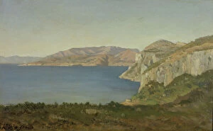
Background imageMediterranean Sea Collection: Cape of Sorrento, 1912. Creator: Henry Brokman

Cape of Sorrento, 1912. Creator: Henry Brokman
Cape of Sorrento, 1912

Background imageMediterranean Sea Collection: Scutolo, 'the wonder of wonders', 1912. Creator: Henry Brokman. Scutolo, 'the wonder of wonders'

Scutolo, "the wonder of wonders", 1912. Creator: Henry Brokman. Scutolo, "the wonder of wonders"
Scutolo, "the wonder of wonders", 1912

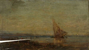
Background imageMediterranean Sea Collection: Little coast of Sorrento (grey), 1912. Creator: Henry Brokman

Little coast of Sorrento (grey), 1912. Creator: Henry Brokman
Little coast of Sorrento (grey), 1912

Background imageMediterranean Sea Collection: Devant Martigues, la voile jaune, c.1875. Creator: Felix Francois Georges Philibert Ziem

Devant Martigues, la voile jaune, c.1875. Creator: Felix Francois Georges Philibert Ziem
Devant Martigues, la voile jaune, c.1875

Background imageMediterranean Sea Collection: Coast of Sorrento, blue and silver, 1913. Creator: Henry Brokman

Coast of Sorrento, blue and silver, 1913. Creator: Henry Brokman
Coast of Sorrento, blue and silver, 1913

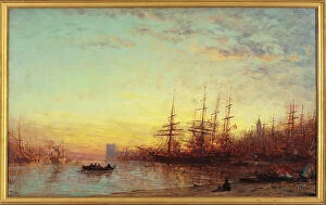
Background imageMediterranean Sea Collection: Le port de Marseille au coucher du soleil, between 1890 and 1895

Le port de Marseille au coucher du soleil, between 1890 and 1895. Creator: Felix Francois Georges Philibert Ziem
Le port de Marseille au coucher du soleil, between 1890 and 1895

Background imageMediterranean Sea Collection: Mediterranean Seascape with Port, n.d. Creator: Nicholas Pocock

Mediterranean Seascape with Port, n.d. Creator: Nicholas Pocock
Mediterranean Seascape with Port, n.d. Attributed to Nicholas Pocock

Background imageMediterranean Sea Collection: Nice, from the West, 1854. Creator: Unknown

Nice, from the West, 1854. Creator: Unknown
Nice, from the West, 1854. The town of Nice on the French Riviera. Nice Maritime, now forming part of the Sardinian States, anciently appertained to the Counts of Provence...Numerous visitors

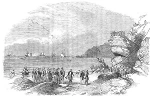
Background imageMediterranean Sea Collection: Laying down the Mediterranean Electric Telegraph Cable at Spezia, 1854. Creator: Unknown

Laying down the Mediterranean Electric Telegraph Cable at Spezia, 1854. Creator: Unknown
Laying down the Mediterranean Electric Telegraph Cable at Spezia, 1854. Cable-laying between Italy and Corsica. The Mediterranean Electric Telegraph

Background imageMediterranean Sea Collection: Vessels passing the bar at the Rosetta Mouth of the Nile, 1854. Creator: Unknown

Vessels passing the bar at the Rosetta Mouth of the Nile, 1854. Creator: Unknown
Vessels passing the bar at the Rosetta Mouth of the Nile, 1854. Ships off the north coast of Egypt. As we approached the bar of sand, which constantly shifts its position

Background imageMediterranean Sea Collection: The Cote d'Azur, bay on the Mediterranean, between 1890 and 1915. Creator: Henri-Joseph Harpignies

The Cote d'Azur, bay on the Mediterranean, between 1890 and 1915. Creator: Henri-Joseph Harpignies
The Cote d'Azur, bay on the Mediterranean, between 1890 and 1915

Background imageMediterranean Sea Collection: Portici - the Recent Residence of the Pope, sketched from the Sea, 1850. Creator: Unknown

Portici - the Recent Residence of the Pope, sketched from the Sea, 1850. Creator: Unknown
Portici - the Recent Residence of the Pope, sketched from the Sea, 1850. The Palace of Portici [abode of Pius IX] lies at four miles distance, by railway, from Naples

Background imageMediterranean Sea Collection: Harbor of Naples, n.d. Creator: Unknown

Harbor of Naples, n.d. Creator: Unknown
Harbor of Naples, n.d

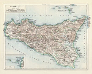
Background imageMediterranean Sea Collection: Topographic map of Sicily, Italy, lithograph, published in 1897

Topographic map of Sicily, Italy, lithograph, published in 1897
Topographic map of Sicily, Italy - largest island in the Mediterranean Sea. Lithograph, published in 1897

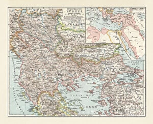
Background imageMediterranean Sea Collection: Historical map of the Ottoman Empire (Turkey), European part, 1897

Historical map of the Ottoman Empire (Turkey), European part, 1897
Historical map of European part of the Ottoman Empire (Turkey) at the end of the 19th century. Lithograph, published in 1897
Background imageMediterranean Sea Collection: Topographic map of Spain and Portugal, lithograph, published in 1897

Topographic map of Spain and Portugal, lithograph, published in 1897
Topographic map of Spain and Portugal. Lithograph, published in 1897

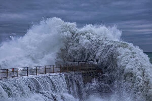
Background imageMediterranean Sea Collection: Big sea wave

Big sea wave
Roberto Zanleone

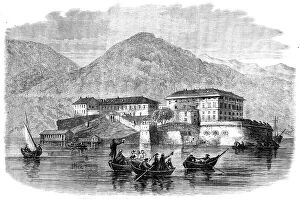
Background imageMediterranean Sea Collection: Garibaldi's quarters at Varignano, Spezia - from a sketch by M. Beaucé, 1862. Creator: Smyth

Garibaldi's quarters at Varignano, Spezia - from a sketch by M. Beaucé, 1862. Creator: Smyth
Garibaldi's quarters at Varignano, Spezia - from a sketch by M. Beauce, 1862. Varignano [the gaol of "The Prisoner of Italy"] is situated on an inlet of the Gulf of Spezia...Fort

Background imageMediterranean Sea Collection: View of the Gulf of Spezia: showing the house at Varignano in which Garibaldi is confined, 1862

View of the Gulf of Spezia: showing the house at Varignano in which Garibaldi is confined, 1862. Creator: Unknown
View of the Gulf of Spezia [in Italy]: showing the house at Varignano in which Garibaldi is confined, 1862. The Gulf of Spezia...takes its name from the town of Spezia, which lies at its head

Background imageMediterranean Sea Collection: The Prestenizza beacon on the island of Cherso, 1886. Creator: Gottfried Seelos

The Prestenizza beacon on the island of Cherso, 1886. Creator: Gottfried Seelos
The Prestenizza beacon on the island of Cherso, 1886. The picture shows the strait between Istria and the northeast coast of the island of Cres with the Lighthouse near Porozina on Cres that still

Background imageMediterranean Sea Collection: The Arrival of His Royal Highness the Prince of Wales at Alexandria, Egypt, 1862. Creator: Smyth

The Arrival of His Royal Highness the Prince of Wales at Alexandria, Egypt, 1862. Creator: Smyth
The Arrival of His Royal Highness the Prince of Wales at Alexandria, Egypt, 1862. The future King Edward VII goes to Africa. Engraving of a drawing sent by M. Conseil

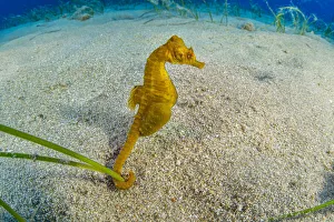
Background imageMediterranean Sea Collection: Short-snouted seahorse (Hippocampus hippocampus) male, Ponza Island, Italy

Short-snouted seahorse (Hippocampus hippocampus) male, Ponza Island, Italy, Tyrrhenian Sea, Mediterranean Sea

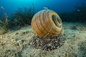
Background imageMediterranean Sea Collection: Giant tun (Tonna galea) a species of marine gastropod mollusc that is one of the biggest

Giant tun (Tonna galea) a species of marine gastropod mollusc that is one of the biggest sea snails in the Mediterranean, photographed off Vis Island, Croatia, Adriatic Sea

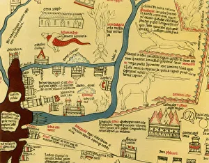
Background imageMediterranean Sea Collection: Hereford World Map, c. 1280, 1944. Creator: Richard de Bello

Hereford World Map, c. 1280, 1944. Creator: Richard de Bello
Hereford World Map, c.1280, (1944). Detail showing the Mediterranean coast and the Nile Delta in northern Egypt. The lighthouse at Alexandria, complete with flames

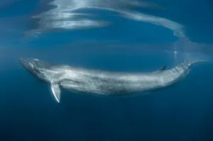
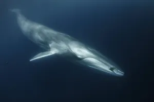
Background imageMediterranean Sea Collection: Fin whale (Balaenoptera physalus) just below surface, south Barcelona coast, Spain

Fin whale (Balaenoptera physalus) just below surface, south Barcelona coast, Spain, Mediterranean Sea

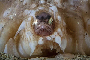
Background imageMediterranean Sea Collection: Fin whale (Balaenoptera physalus) with ctenophore in front of its mouth, south Barcelona coast

Fin whale (Balaenoptera physalus) with ctenophore in front of its mouth, south Barcelona coast, Spain, Mediterranean Sea

Background imageMediterranean Sea Collection: Pearlfish (Carapus acus) in anus of Sea cucumber (Stichopus regalis)

Pearlfish (Carapus acus) in anus of Sea cucumber (Stichopus regalis). These species have a commensal relationship, with the fish living in the gut of the sea cucumber. Catalonia, Spain

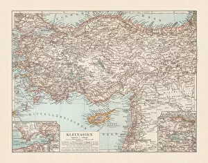
Background imageMediterranean Sea Collection: Old topographic map of Asia Minor (Turkey), lithograph, published 1897

Old topographic map of Asia Minor (Turkey), lithograph, published 1897
Old topographic map of Asia Minor (Turkey). Lithograph, published 1897

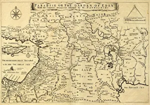
Background imageMediterranean Sea Collection: Middle East Ancient Map, Garden of Eden, 1675

Middle East Ancient Map, Garden of Eden, 1675
This may appear to be a straightforward map of the Middle East. However, closer inspection will reveal some extraordinary details, a number of descriptions on the map refer to stories from the Bible

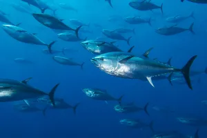
Background imageMediterranean Sea Collection: School of large Atlantic bluefin tuna (Thunnus thynnus) captive in growing pen

School of large Atlantic bluefin tuna (Thunnus thynnus) captive in growing pen. Depsite looking much smaller in the photo, these fish were 1.5m (5ft) long. Malta. Mediterranean Sea

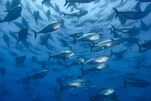
Background imageMediterranean Sea Collection: RF - School of large Atlantic bluefin tuna (Thunnus thynnus) captive in a growing pen

RF - School of large Atlantic bluefin tuna (Thunnus thynnus) captive in a growing pen. Depsite looking much smaller in the photo, these fish were 1.5m (5ft) long. Malta. Mediterranean Sea

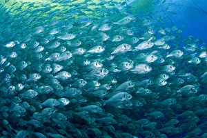
Background imageMediterranean Sea Collection: Thousand of Gilt-head bream (Sparus aurata) inside a sea cage used for aquaculture

Thousand of Gilt-head bream (Sparus aurata) inside a sea cage used for aquaculture, Ponza Island, Italy, Tyrrhenian Sea, Mediterranean

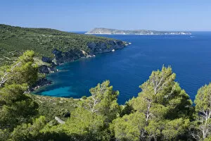
Background imageMediterranean Sea Collection: Stupiste cape, Vis Island, Croatia, Adriatic Sea, Mediterranean

Stupiste cape, Vis Island, Croatia, Adriatic Sea, Mediterranean

Background imageMediterranean Sea Collection: old map of central europe

old map of central europe
an old map form 1870, showing central europe countries

Background imageMediterranean Sea Collection: Italy with mask

Italy with mask
Color satellite image of Italy, with mask

Background imageMediterranean Sea Collection: Italy with borders

Italy with borders
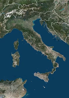
Color satellite image of Italy and neighbouring countries, with borders

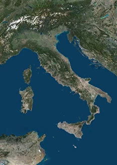
Background imageMediterranean Sea Collection: Italy

Italy
Color satellite image of Italy and neighbouring countries

Background imageMediterranean Sea Collection: Italy with borders and mask

Italy with borders and mask
Color satellite image of Italy, with borders and mask

Background imageMediterranean Sea Collection: Greece with borders and mask

Greece with borders and mask
Color satellite image of Greece and neighbouring countries, with borders and mask

Background imageMediterranean Sea Collection: Greece and neighbouring countries

Greece and neighbouring countries
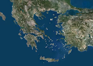
Color satellite image of Greece and neighbouring countries

Background imageMediterranean Sea Collection: Greece with mask

Greece with mask
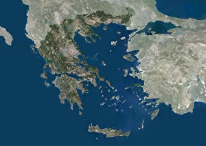
Color satellite image of Greece, with mask

Background imageMediterranean Sea Collection: Greece with borders

Greece with borders
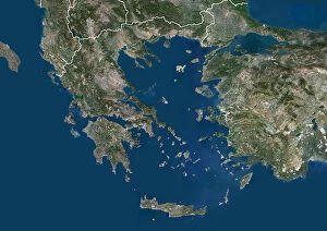
Color satellite image of Greece and neighbouring countries, with borders

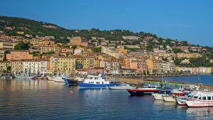
Background imageMediterranean Sea Collection: Europe, Italy, Tuscany. the harbour of Porto Santo Stefano

Europe, Italy, Tuscany. the harbour of Porto Santo Stefano

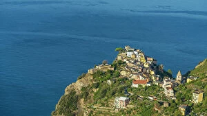
Background imageMediterranean Sea Collection: Europe, Italy, Liguria, the village of Corniglia, Cinque Terre, seen from the footpath

Europe, Italy, Liguria, the village of Corniglia, Cinque Terre, seen from the footpath

Background imageMediterranean Sea Collection: Europe, Italy, Liguria, A glimps of Cervo and its church from the hiking path

Europe, Italy, Liguria, A glimps of Cervo and its church from the hiking path

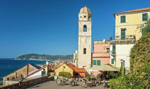
Background imageMediterranean Sea Collection: Europe, Italy, Liguria, The piazza of the church of Cervo

Europe, Italy, Liguria, The piazza of the church of Cervo

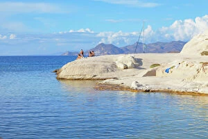
Background imageMediterranean Sea Collection: Sarakiniko beach, Sarakiniko, Milos Island, Greece

Sarakiniko beach, Sarakiniko, Milos Island, Greece


All Professionally Made to Order for Quick Shipping

The Mediterranean Sea, a timeless expanse of beauty and history, has witnessed the rise and fall of empires throughout the ages. As we explore its rich tapestry through various maps and lithographs, we are transported to different eras that have shaped our world. Let's begin our journey with a Map of Cyprus from 1880, revealing the island's strategic location in the heart of this ancient sea. It serves as a gateway to Apostle Paul's Missionary Journeys depicted in an 1886 lithograph. These journeys spread Christianity across lands touched by the Mediterranean's gentle waves. Moving forward in time, we encounter a Map of the Byzantine Empire in the 9th Century. This empire once dominated these shores with its grandeur and influence. Further west lies Portugal on another map, reminding us of their maritime prowess during Europe's Age of Exploration. As we delve deeper into history, Medieval Europe at the start of the Crusades comes alive before us. The clash between East and West reverberates across these waters as kingdoms vie for control amidst religious fervor. Sicily unveils itself through a map from 1895 – an island steeped in diverse cultures due to its strategic position within this sea. Ancient Palestine emerges next with maps showcasing kingdoms like Judah and Israel; lands where stories from biblical times unfolded against this breathtaking backdrop. Greece takes center stage as we witness it at the beginning of one of history's most famous conflicts -the Peloponnesian War (431-404 BC). City-states battle for supremacy while leaving an indelible mark on Western civilization. A View of Old Town City Dubrovnik captures our attention next; its medieval walls standing strong against time’s relentless march. This Croatian gem reminds us how coastal cities flourished along these shores since antiquity.