Fraud Blocker Skip to main content

Mediterranean Sea Collection (page 7)

The Mediterranean Sea, a timeless expanse of beauty and history, has witnessed the rise and fall of empires throughout the ages

Background imageMediterranean Sea Collection: Map of Sicily, c.1900 (engraving)

Map of Sicily, c.1900 (engraving)
533317 Map of Sicily, c.1900 (engraving); (add.info.: Map of Sicily, Italy, circa 1902, from the 10th edition of Encyclopaedia Britannica.); Encyclopaedia Britannica/UIG.

Background imageMediterranean Sea Collection: Map of Turkey, c.1900 (engraving)

Map of Turkey, c.1900 (engraving)
533006 Map of Turkey, c.1900 (engraving); (add.info.: Map showing the historical boundaries of Turkey in Asia, circa 1902)

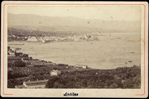
Background imageMediterranean Sea Collection: France, Provence-Alpes-Cote d'Azur, Alpes-Maritimes (06), Antibes

France, Provence-Alpes-Cote d'Azur, Alpes-Maritimes (06), Antibes: General view of the port of Antibes, 1880
LUX4705476 France, Provence-Alpes-Cote d'Azur, Alpes-Maritimes (06), Antibes: General view of the port of Antibes, 1880; (add.info.: France, Provence-Alpes-Cote d'Azur, Alpes-Maritimes (06)

Background imageMediterranean Sea Collection: France, Provence-Alpes-Cote d'Azur, Alpes-Maritimes (06), Cannes

France, Provence-Alpes-Cote d'Azur, Alpes-Maritimes (06), Cannes: the villa of the towers in Cannes, 1885
LUX4705442 France, Provence-Alpes-Cote d'Azur, Alpes-Maritimes (06), Cannes: the villa of the towers in Cannes, 1885; (add.info.: France, Provence-Alpes-Cote d'Azur, Alpes-Maritimes (06)

Background imageMediterranean Sea Collection: Map of the island of Santorini (Greece), 1420 (parchment)

Map of the island of Santorini (Greece), 1420 (parchment)
MMM5474136 Map of the island of Santorini (Greece), 1420 (parchment) by Buondelmonti, Cristoforo (1385-1430); National Maritime Museum, London

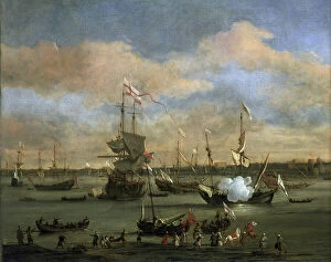
Background imageMediterranean Sea Collection: British trading ship in a port in the Mediterranean Sea. Oil on canvas, 1694

British trading ship in a port in the Mediterranean Sea. Oil on canvas, 1694, by Willem van de Velde (1633-1707)
MMM5459847 British trading ship in a port in the Mediterranean Sea. Oil on canvas, 1694, by Willem van de Velde (1633-1707)

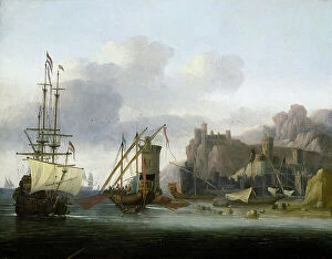
Background imageMediterranean Sea Collection: Bosphorus navigation

Bosphorus navigation
MMM5459746 Bosphorus navigation by Croos, Jacob van der (fl. 1655); National Maritime Museum, London, UK; (add.info.: Navigation in the Bosphorus (Detroit between the Black Sea and the Sea of Marmara)

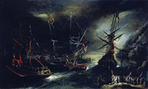
Background imageMediterranean Sea Collection: Embarkation of Spanish troops, a Dutch interpretation of a Spanish expedition

Embarkation of Spanish troops, a Dutch interpretation of a Spanish expedition
MMM5459391 Embarkation of Spanish troops, a Dutch interpretation of a Spanish expedition, depicted on an imaginary coast of the Mediterranean Sea by Eertvelt

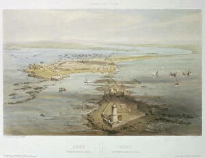
Background imageMediterranean Sea Collection: Spain has a bird's eye view. Cadiz seen above the Farola. Lithography (39x55.2 cm) by A

Spain has a bird's eye view. Cadiz seen above the Farola. Lithography (39x55.2 cm) by A. Guesdon, 19th century
MMM5483750 Spain has a bird's eye view. Cadiz seen above the Farola. Lithography (39x55.2 cm) by A. Guesdon, 19th century.; National Maritime Museum, London

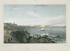
Background imageMediterranean Sea Collection: Andalusia, Cadiz (Spain) View taken from Pointe de la Vache. Lithography (38x52 cm) by Chapuy

Andalusia, Cadiz (Spain) View taken from Pointe de la Vache. Lithography (38x52 cm) by Chapuy, 19th century
MMM5483742 Andalusia, Cadiz (Spain) View taken from Pointe de la Vache. Lithography (38x52 cm) by Chapuy, 19th century.; National Maritime Museum, London, UK; (add.info.: Andalusia)

Background imageMediterranean Sea Collection: Map of Asia Minor, c.86 BC

Map of Asia Minor, c.86 BC
7177183 Map of Asia Minor, c.86 BC.; Private Collection; (add.info.: Map of Asia Minor, c.86 BC. From Cassell's Illustrated Universal History, published 1883.); Photo © Ken Welsh

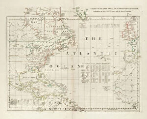
Background imageMediterranean Sea Collection: Chart of the Atlantic Ocean, with the British, French & Spanish settlements in North America

Chart of the Atlantic Ocean, with the British, French & Spanish settlements in North America and the West Indies
7295390 Chart of the Atlantic Ocean, with the British, French & Spanish settlements in North America and the West Indies, 1753 (engraving) by Jefferys

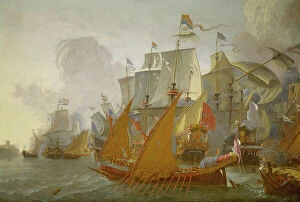
Background imageMediterranean Sea Collection: The Battle of Leghorn, 4 March 1653, mid 17th century (oil on canvas)

The Battle of Leghorn, 4 March 1653, mid 17th century (oil on canvas)
7337609 The Battle of Leghorn, 4 March 1653, mid 17th century (oil on canvas) by Diest, Willem van (1610-1663); 68.5x78.5 cm; National Maritime Museum, London

Background imageMediterranean Sea Collection: An English ship in action with Barbary pirates, 1678 (oil painting)

An English ship in action with Barbary pirates, 1678 (oil painting)
7337749 An English ship in action with Barbary pirates, 1678 (oil painting) by Velde, Willem van de, the Younger (1633-1707); 109.2x198.1 cm; National Maritime Museum, London

Background imageMediterranean Sea Collection: Action between the Dutch fleet and barbary pirates, c.1670 (oil painting)

Action between the Dutch fleet and barbary pirates, c.1670 (oil painting)
7337743 Action between the Dutch fleet and barbary pirates, c.1670 (oil painting) by Verschuier, Lieve (1630-86); 144.8x214.6 cm; National Maritime Museum, London

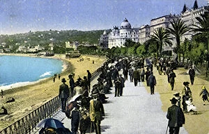
Background imageMediterranean Sea Collection: Belle epoque: view on the Promenade des Anglais in Nice Postcard around 1910 Private collection

Belle epoque: view on the Promenade des Anglais in Nice Postcard around 1910 Private collection
ELD4944719 Belle epoque: view on the Promenade des Anglais in Nice Postcard around 1910 Private collection; (add.info.: Belle epoque)

Background imageMediterranean Sea Collection: France, Provence-Alpes-Cote d'Azur, Alpes-Maritimes (06), Nice: The entrance to the port, 1880

France, Provence-Alpes-Cote d'Azur, Alpes-Maritimes (06), Nice: The entrance to the port, 1880
LUX4706029 France, Provence-Alpes-Cote d'Azur, Alpes-Maritimes (06), Nice: The entrance to the port, 1880; (add.info.: France, Provence-Alpes-Cote d'Azur, Alpes-Maritimes (06)

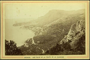
Background imageMediterranean Sea Collection: Monaco: View taken from the Corniche road, 1885

Monaco: View taken from the Corniche road, 1885
LUX4705886 Monaco: View taken from the Corniche road, 1885; (add.info.: Monaco: View taken from the Corniche road, 1885); Photo © Lux-in-Fine.

Background imageMediterranean Sea Collection: Geographic atlas: detail of the portulan of Francois Ollive representing Barbarie (Algeria, Tunisia)

Geographic atlas: detail of the portulan of Francois Ollive representing Barbarie (Algeria, Tunisia)
JEB4874959 Geographic atlas: detail of the portulan of Francois Ollive representing Barbarie (Algeria, Tunisia, Tripolitan) and Morocco

Background imageMediterranean Sea Collection: Panoramic View of La Ciotat, Bouches du Rhone Painting by Jean Baptiste Marie Romegas (1800-1867)

Panoramic View of La Ciotat, Bouches du Rhone Painting by Jean Baptiste Marie Romegas (1800-1867)
JEB4864882 Panoramic View of La Ciotat, Bouches du Rhone Painting by Jean Baptiste Marie Romegas (1800-1867) Dim 130x195 cm 1852 Musee Ciotaden, La ciotat; Musee Ciotaden, La Ciotat

Background imageMediterranean Sea Collection: Geographic atlas: detail of Augustin Roussin's portulan representing the coast near Marseille, 1630

Geographic atlas: detail of Augustin Roussin's portulan representing the coast near Marseille, 1630
JEB4874848 Geographic atlas: detail of Augustin Roussin's portulan representing the coast near Marseille, 1630. Municipal library of Marseille.; (add.info.: Geographic atlas)

Background imageMediterranean Sea Collection: Geographic atlas: portulan or nautical map of the Mediterranean Sea and its coasts (Africa)

Geographic atlas: portulan or nautical map of the Mediterranean Sea and its coasts (Africa, Barbaria, Europe)
JEB4874770 Geographic atlas: portulan or nautical map of the Mediterranean Sea and its coasts (Africa, Barbaria, Europe, Middle East). Nautical chart of Augustin Roussin, 1630

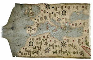
Background imageMediterranean Sea Collection: Portulan of the Mediterranean Sea and its coasts (Africa, Barbary, Europe, Middle East)

Portulan of the Mediterranean Sea and its coasts (Africa, Barbary, Europe, Middle East)
JEB4874759 Portulan of the Mediterranean Sea and its coasts (Africa, Barbary, Europe, Middle East). Nautical chart by Joan Oliva on parchment, 1593 preserved at the Municipal Library of Marseille

Background imageMediterranean Sea Collection: Geographic atlas: portulan or nautical map of the Mediterranean Sea and its coasts (Africa)

Geographic atlas: portulan or nautical map of the Mediterranean Sea and its coasts (Africa, Barbaria, Europe)
JEB4874690 Geographic atlas: portulan or nautical map of the Mediterranean Sea and its coasts (Africa, Barbaria, Europe, Middle East)

Background imageMediterranean Sea Collection: Exit from the port Pointe du Dauphin. Museum of History, Marseille 19th century

Exit from the port Pointe du Dauphin. Museum of History, Marseille 19th century
JEB4849170 Exit from the port Pointe du Dauphin. Museum of History, Marseille 19th century; (add.info.: Exit from the port Pointe du Dauphin)

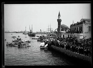
Background imageMediterranean Sea Collection: Greece, Chania, CR: the port, boarding of French troops - view of the port

Greece, Chania, CR: the port, boarding of French troops - view of the port
LUX4764805 Greece, Chania, CR: the port, boarding of French troops - view of the port and shuttles to take soldiers to the ship waiting for them offshore, 1909; (add.info.: Greece, Chania)

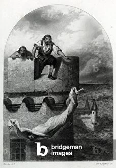
Background imageMediterranean Sea Collection: A dead prisoner of the chateau d'If prison thrown in the sea, 18th century Engraving from 'Les

A dead prisoner of the chateau d'If prison thrown in the sea, 18th century Engraving from "Les
ELD4959727 A dead prisoner of the chateau d'If prison thrown in the sea, 18th century Engraving from "Les Prisons-de-l'Europe" d'Alboize et Maquet

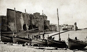
Background imageMediterranean Sea Collection: View of the city of Collioures in the Eastern Pyrenees - postcard ca. 1910

View of the city of Collioures in the Eastern Pyrenees - postcard ca. 1910
ELD4953705 View of the city of Collioures in the Eastern Pyrenees - postcard ca. 1910; Private Collection; (add.info.: View of the city of Collioures in the Eastern Pyrenees - postcard ca)

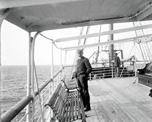
Background imageMediterranean Sea Collection: Algeria: on the Mediterranean Sea, en route to Algeria on 'Marseille'

Algeria: on the Mediterranean Sea, en route to Algeria on 'Marseille'
LUX4780977 Algeria: on the Mediterranean Sea, en route to Algeria on 'Marseille', a passenger on the bridge looks at the sea

Background imageMediterranean Sea Collection: Algeria: on the Mediterranee, en route to Algeria on the 'Marseille', passengers on the bridge

Algeria: on the Mediterranee, en route to Algeria on the 'Marseille', passengers on the bridge
LUX4780960 Algeria: on the Mediterranee, en route to Algeria on the 'Marseille', passengers on the bridge, 1903 - liner: Le Marseille; (add.info.: Algeria: on the Mediterranee)

Background imageMediterranean Sea Collection: Greece, Crete, Chania: evacuation of French troops July 24, 1909

Greece, Crete, Chania: evacuation of French troops July 24, 1909
LUX4762926 Greece, Crete, Chania: evacuation of French troops July 24, 1909; (add.info.: Greece, Crete, Chania: evacuation of French troops July 24, 1909); Photo © Lux-in-Fine.

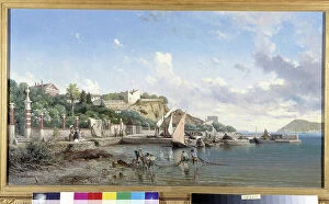
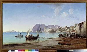
Background imageMediterranean Sea Collection: Scene of Mediterranean port. Painting by Jean Baptiste Lallemand (1710-1803), 18th century

Scene of Mediterranean port. Painting by Jean Baptiste Lallemand (1710-1803), 18th century
JEB4883045 Scene of Mediterranean port. Painting by Jean Baptiste Lallemand (1710-1803), 18th century. Mandatory mention: Collection fondation regards de Provence
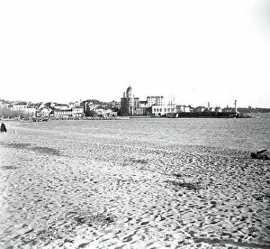
Background imageMediterranean Sea Collection: The entrance to the port of Marseille, view of the Pharo Painting by Edouard Jacques Dufeu

The entrance to the port of Marseille, view of the Pharo Painting by Edouard Jacques Dufeu (1840-1900)
JEB4892493 The entrance to the port of Marseille, view of the Pharo Painting by Edouard Jacques Dufeu (1840-1900) 19th century Mandatory mention: Collection foundation regards of Provence

Background imageMediterranean Sea Collection: View of the port of La Joliette from the Pharo Painting by Joseph Garibaldi (1863-1941)

View of the port of La Joliette from the Pharo Painting by Joseph Garibaldi (1863-1941) 1898 Mandatory mention
JEB4897482 View of the port of La Joliette from the Pharo Painting by Joseph Garibaldi (1863-1941) 1898 Mandatory mention: Collection foundation regards of Provence

Background imageMediterranean Sea Collection: The corniche of Tamaris at the Seyne sur Mer in the Var Painting by Vincent Courdouan (1810-1893)

The corniche of Tamaris at the Seyne sur Mer in the Var Painting by Vincent Courdouan (1810-1893)
JEB4894931 The corniche of Tamaris at the Seyne sur Mer in the Var Painting by Vincent Courdouan (1810-1893) 1874 Mandatory mention: Collection foundation regards of Provence

Background imageMediterranean Sea Collection: Pecheurs on the shore of the Ciotat Painting by Vincent Courdouan (1810-1893) 1882 Mandatory mention

Pecheurs on the shore of the Ciotat Painting by Vincent Courdouan (1810-1893) 1882 Mandatory mention
JEB4901748 Pecheurs on the shore of the Ciotat Painting by Vincent Courdouan (1810-1893) 1882 Mandatory mention: Collection foundation regards of Provence

Background imageMediterranean Sea Collection: Port mediterraneen, 1910

Port mediterraneen, 1910
LUX4809366 Port mediterraneen, 1910; (add.info.: Port mediterraneen, 1910); Photo © Lux-in-Fine.
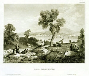
Background imageMediterranean Sea Collection: Turkey, Bosphorus, waterway between the Black Sea and Sea of Marmara, c.1840 (engraving)

Turkey, Bosphorus, waterway between the Black Sea and Sea of Marmara, c.1840 (engraving)
UTD4918564 Turkey, Bosphorus, waterway between the Black Sea and Sea of Marmara, c.1840 (engraving); (add.info.: Turkey, Bosphorus, waterway between the Black Sea and Sea of Marmara)

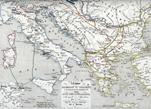
Background imageMediterranean Sea Collection: Map of the Byzantine Empire at the times of Justinian I and Ostrogothic Kingdom founded by

Map of the Byzantine Empire at the times of Justinian I and Ostrogothic Kingdom founded by Theoderic the Great
ELD4928064 Map of the Byzantine Empire at the times of Justinian I and Ostrogothic Kingdom founded by Theoderic the Great) Engraving from Houze's "Atlas Universale"

Background imageMediterranean Sea Collection: Trafalgar' under the Upper Barracca, Malta, 27 March 1852, 1852 (pen, ink, wash, watercolour)

Trafalgar' under the Upper Barracca, Malta, 27 March 1852, 1852 (pen, ink, wash, watercolour)
7342253 Trafalgar' under the Upper Barracca, Malta, 27 March 1852, 1852 (pen, ink, wash, watercolour) by Mends, George Pechell (1815-71); 25.5x37.2 cm; National Maritime Museum, London

Background imageMediterranean Sea Collection: Map containing the island and kingdom of Sicily, with a part of Naples

Map containing the island and kingdom of Sicily, with a part of Naples, and other adjacent coasts including
7339456 Map containing the island and kingdom of Sicily, with a part of Naples, and other adjacent coasts including the Tyrrhenean Sea, 1676 (coloured engraving) by Seller

Background imageMediterranean Sea Collection: Chart of the Atlantic Ocean, Mediterranean and Black Sea, c.1535 (vellum, paper)

Chart of the Atlantic Ocean, Mediterranean and Black Sea, c.1535 (vellum, paper)
7342734 Chart of the Atlantic Ocean, Mediterranean and Black Sea, c.1535 (vellum, paper) by Reinel, Pedro (fl.c.1519); 42.8x64.2 cm; National Maritime Museum, London

Background imageMediterranean Sea Collection: Chart of Mediterranean and north east Atlantic, 1555 (vellum)

Chart of Mediterranean and north east Atlantic, 1555 (vellum)
7340472 Chart of Mediterranean and north east Atlantic, 1555 (vellum) by Lopes, Sebastião (16th century); 67x90 cm; National Maritime Museum, London

Background imageMediterranean Sea Collection: 'Immortalite' Gibraltar, 4 April 1861, 19th century (graphite)

'Immortalite' Gibraltar, 4 April 1861, 19th century (graphite)
7341738 'Immortalite' Gibraltar, 4 April 1861, 19th century (graphite) by Cooke, Edward William (1811-80); 10.6x17.8 cm; National Maritime Museum, London

Background imageMediterranean Sea Collection: Map of Italy, c.1900 (engraving)

Map of Italy, c.1900 (engraving)
532983 Map of Italy, c.1900 (engraving); (add.info.: Map of Italy, with insets of Rome and Venice, circa 1902, from the 10th edition of Encyclopaedia Britannica.); Encyclopaedia Britannica/UIG.

Background imageMediterranean Sea Collection: Map of Marseille, France, c.1900 (engraving)

Map of Marseille, France, c.1900 (engraving)
533294 Map of Marseille, France, c.1900 (engraving); (add.info.: Map of Marseille, France, circa 1902, from the 10th edition of Encyclopaedia Britannica.); Encyclopaedia Britannica/UIG.

Background imageMediterranean Sea Collection: Map of Crete, c.1900 (engraving)

Map of Crete, c.1900 (engraving)
533320 Map of Crete, c.1900 (engraving); (add.info.: Map of Crete, Greece, circa 1902, From the 10th edition of Encyclopaedia Britannica.); Encyclopaedia Britannica/UIG.

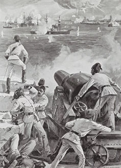
Background imageMediterranean Sea Collection: Bombardment of Alexandria, 1882 (litho)

Bombardment of Alexandria, 1882 (litho)
8663987 Bombardment of Alexandria, 1882 (litho) by English School, (20th century); Private Collection; (add.info.: British naval bombardment of Alexandria, Egypt, Anglo-Egyptian War, 1882)


All Professionally Made to Order for Quick Shipping

The Mediterranean Sea, a timeless expanse of beauty and history, has witnessed the rise and fall of empires throughout the ages. As we explore its rich tapestry through various maps and lithographs, we are transported to different eras that have shaped our world. Let's begin our journey with a Map of Cyprus from 1880, revealing the island's strategic location in the heart of this ancient sea. It serves as a gateway to Apostle Paul's Missionary Journeys depicted in an 1886 lithograph. These journeys spread Christianity across lands touched by the Mediterranean's gentle waves. Moving forward in time, we encounter a Map of the Byzantine Empire in the 9th Century. This empire once dominated these shores with its grandeur and influence. Further west lies Portugal on another map, reminding us of their maritime prowess during Europe's Age of Exploration. As we delve deeper into history, Medieval Europe at the start of the Crusades comes alive before us. The clash between East and West reverberates across these waters as kingdoms vie for control amidst religious fervor. Sicily unveils itself through a map from 1895 – an island steeped in diverse cultures due to its strategic position within this sea. Ancient Palestine emerges next with maps showcasing kingdoms like Judah and Israel; lands where stories from biblical times unfolded against this breathtaking backdrop. Greece takes center stage as we witness it at the beginning of one of history's most famous conflicts -the Peloponnesian War (431-404 BC). City-states battle for supremacy while leaving an indelible mark on Western civilization. A View of Old Town City Dubrovnik captures our attention next; its medieval walls standing strong against time’s relentless march. This Croatian gem reminds us how coastal cities flourished along these shores since antiquity.