Fraud Blocker Skip to main content

Mediterranean Sea Collection (page 2)

The Mediterranean Sea, a timeless expanse of beauty and history, has witnessed the rise and fall of empires throughout the ages

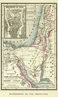
Background imageMediterranean Sea Collection: Wanderings of the Israelites Map Engraving

Wanderings of the Israelites Map Engraving
Engraved illustration of Wanderings of the Israelites Map Engraving from The Popular Pictorial Bible, Containing the Old and New Testaments, Published in 1862. Copyright has expired on this artwork

Background imageMediterranean Sea Collection: Undersea exploration in 16th-century Europe

Undersea exploration in 16th-century Europe
Underwater diver and man-at-arms, France, 1532. Hand-colored woodcut of a 19th century illustration

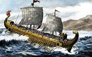
Background imageMediterranean Sea Collection: A trireme, used by the ancient Greeks and Romans

A trireme, used by the ancient Greeks and Romans
A trireme, with three banks of oars, used by the ancient Greeks and Romans. Hand-colored halftone reproduction of a 19th-century illustration

Background imageMediterranean Sea Collection: PANC2A-00003

PANC2A-00003
Map of the empire of Alexander the Great in 323 BC. Printed color lithograph of a 19th-century illustration

Background imageMediterranean Sea Collection: Ancient Mesopotamia

Ancient Mesopotamia
Map of the ancient Tigris and Euphrates region. Printed color 19th-century illustration

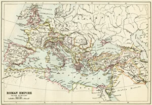
Background imageMediterranean Sea Collection: Roman Empire, circa 200 AD

Roman Empire, circa 200 AD
Map of the Roman Empire in the third century. Printed color lithograph of a 19th-century illustration
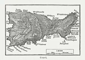
Background imageMediterranean Sea Collection: Map of Capri, Italian island, wood engraving published in 1897

Map of Capri, Italian island, wood engraving published in 1897
Map of Capri, Italian island. Wood engraving, published in 1897
Background imageMediterranean Sea Collection: Monterosso al Mare

Monterosso al Mare panoramic view in a cloudy day. Unesco World heritage site

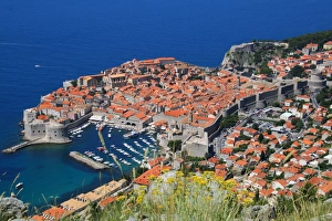
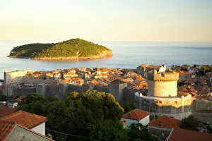
Background imageMediterranean Sea Collection: View of Old Town, the walled city of Dubrovnik, UNESCO World Heritage Site, Dalmatia, Croatia

View of Old Town, the walled city of Dubrovnik, UNESCO World Heritage Site, Dalmatia, Croatia
Dubrovnik is one of the most prominent tourist destinations in the Mediterranean Sea, a seaport on the Dalmation coast. In 1979, the city of Dubrovnik joined the UNESCO list of World Heritage Sites

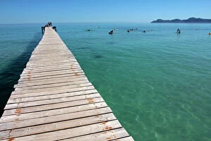
Background imageMediterranean Sea Collection: Pier at Platja d Alcudia, Mallorca, Balearic Islands, Spain, Mediterranean, Europe

Pier at Platja d Alcudia, Mallorca, Balearic Islands, Spain, Mediterranean, Europe

Background imageMediterranean Sea Collection: Antibes, Old Town, Alpes Maritime, Cote d Azur, France

Antibes, Old Town, Alpes Maritime, Cote d Azur, France

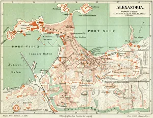
Background imageMediterranean Sea Collection: Plan of the old city Alexandria 1895

Plan of the old city Alexandria 1895
Meyers Konversations-Lexikon. Ein Nachschlagewerk des allgemeinen Wissens, 5th edition 17 volumes Bibliographisches Institut - Leipzig 1895-1897

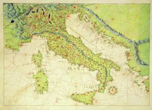
Background imageMediterranean Sea Collection: Italy, from an Atlas of the World in 33 Maps, Venice, 1st September 1553 (ink on vellum)

Italy, from an Atlas of the World in 33 Maps, Venice, 1st September 1553 (ink on vellum)
XOT330948 Italy, from an Atlas of the World in 33 Maps, Venice, 1st September 1553 (ink on vellum) by Agnese, Battista (1514-64); Museo Correr, Venice, Italy; Italian, out of copyright

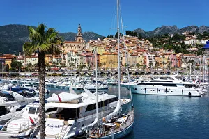
Background imageMediterranean Sea Collection: Old Town and Marina, Menton, Cote d Azur, French Riviera, Provence, France, Mediterranean, Europe

Old Town and Marina, Menton, Cote d Azur, French Riviera, Provence, France, Mediterranean, Europe

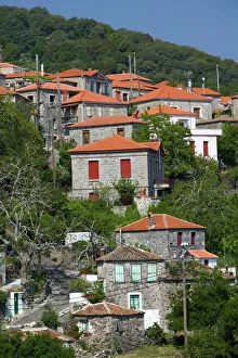
Background imageMediterranean Sea Collection: GREECE, Northeastern Aegean Islands, LESVOS (Mytilini), Sykaminia: Hillside Town View

GREECE, Northeastern Aegean Islands, LESVOS (Mytilini), Sykaminia: Hillside Town View

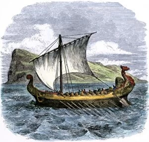
Background imageMediterranean Sea Collection: Phoenician ship in the Mediterranean

Phoenician ship in the Mediterranean
Phoenician galley passing the Rock of Gibraltar. Hand-colored woodcut of a 19th-century illustration

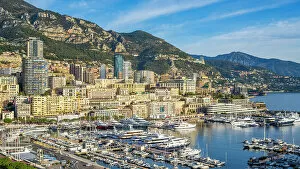
Background imageMediterranean Sea Collection: Europe, Principality of Monaco. The harbour of Monte Carlo and the skyline of Monaco

Europe, Principality of Monaco. The harbour of Monte Carlo and the skyline of Monaco

Background imageMediterranean Sea Collection: Siracusa, Sicily. Aerial view of Ortigia island at sunrise with the Cathedral

Siracusa, Sicily. Aerial view of Ortigia island at sunrise with the Cathedral and the Duomo square

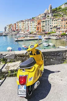
Background imageMediterranean Sea Collection: Yellow Vespa scooter parked near harbour, Portovenere, La Spezia district, Liguria, Italy

Yellow Vespa scooter parked near harbour, Portovenere, La Spezia district, Liguria, Italy

Background imageMediterranean Sea Collection: Angular roughshark (Oxynotus centrina) a deepsea species living at 80-300m depth

Angular roughshark (Oxynotus centrina) a deepsea species living at 80-300m depth, caught by fishermen and released, Costa Brava, Catalunya, Spain, Mediterranean Sea

Background imageMediterranean Sea Collection: old map of europe

old map of europe
an old map form 1883, showing european countries

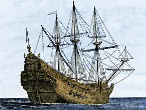
Background imageMediterranean Sea Collection: Carrack, a merchant ship of the late 1400s

Carrack, a merchant ship of the late 1400s
Armed Genoese carrack, a merchant ship of the 1400s and 1500s. Hand-colored woodcut of a 19th-century illustration

Background imageMediterranean Sea Collection: Ancient Phoenician traders in port

Ancient Phoenician traders in port
Phoenician sailors trading goods in an ancient Mediterranean seaport. Hand-colored woodcut of a 19th-century illustration

Background imageMediterranean Sea Collection: Israel, Jerusalem, Old City, souvenir plates

Israel, Jerusalem, Old City, souvenir plates

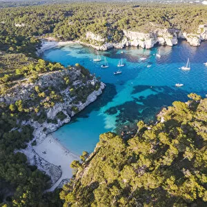
Background imageMediterranean Sea Collection: Aerial view of Cala Macarella and Cala Macarelleta, Menorca, Balearic Islands, Spain

Aerial view of Cala Macarella and Cala Macarelleta, Menorca, Balearic Islands, Spain

Background imageMediterranean Sea Collection: Caicco Saling boat in Zagare bay, Loc. Baia delle Zagare, Mattinata village, Gargano National Park

Caicco Saling boat in Zagare bay, Loc. Baia delle Zagare, Mattinata village, Gargano National Park, Foggia district, Apulia, Italy

Background imageMediterranean Sea Collection: Topographic map of Europe, lithograph, published in 1897

Topographic map of Europe, lithograph, published in 1897
Topographic map of Europe. Lithograph, published in 1897

Background imageMediterranean Sea Collection: Boys on the Beach, 1909. Artist: Sorolla y Bastida, Joaquin (1863-1923)

Boys on the Beach, 1909. Artist: Sorolla y Bastida, Joaquin (1863-1923)
Boys on the Beach, 1909. Found in the collection of the Museo del Prado, Madrid

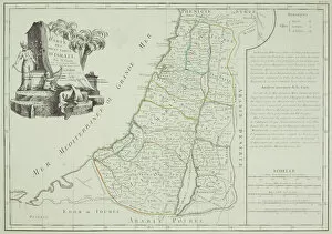
Background imageMediterranean Sea Collection: Historical map of Palestine with the twelve tribes of Israel

Historical map of Palestine with the twelve tribes of Israel. Colored steel engraving, published in 1886

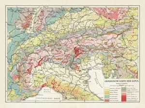
Background imageMediterranean Sea Collection: Geological map of the European Alps, lithograph, published in 1897

Geological map of the European Alps, lithograph, published in 1897
Geological map of the European Alps. Lithograph, published in 1897

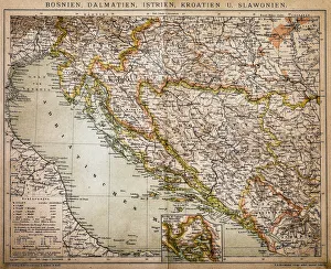
Background imageMediterranean Sea Collection: Bosnia, dalmatia, istria, croatia, slavonia

Bosnia, dalmatia, istria, croatia, slavonia
Antique illustration of a Bosnia, dalmatia, istria, croatia, slavonia map

Background imageMediterranean Sea Collection: Kizil Kule, Red Tower, with the ramparts and the harbour, Alanya, Turkish Riviera

Kizil Kule, Red Tower, with the ramparts and the harbour, Alanya, Turkish Riviera, Province of Antalya, Mediterranean Region, Turkey

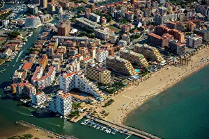
Background imageMediterranean Sea Collection: Aerial view, high-rise buildings, holiday resort on the beach, Roses, Golf de Roses, Catalonia

Aerial view, high-rise buildings, holiday resort on the beach, Roses, Golf de Roses, Catalonia, Spain

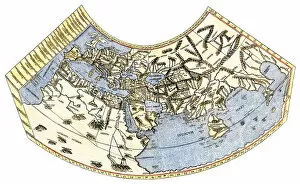
Background imageMediterranean Sea Collection: EXPL2A-00014

EXPL2A-00014
Ptolemys map of the world, illustrating a concept of the flat earth. Hand-colored 19th-century woodcut reproduction

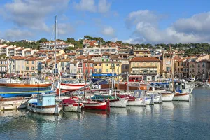
Background imageMediterranean Sea Collection: Harbor of Cassis, Bouches-du-Rhone, Provence-Alpes-Cote d'Azur, France

Harbor of Cassis, Bouches-du-Rhone, Provence-Alpes-Cote d'Azur, France

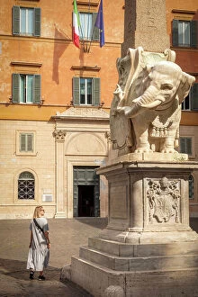
Background imageMediterranean Sea Collection: Europe, Italy, Rome. The Elephant and Obelisk on the Piazza della Minerva

Europe, Italy, Rome. The Elephant and Obelisk on the Piazza della Minerva

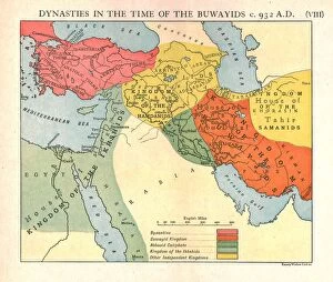
Background imageMediterranean Sea Collection: Dynasties in the time of the Buwayids, circa 932 A. D. c1915. Creator: Emery Walker Ltd

Dynasties in the time of the Buwayids, circa 932 A. D. c1915. Creator: Emery Walker Ltd
Dynasties in the time of the Buwayids, circa 932 A.D. c1915. Map of civilisations in the Middle East during the 10th century: Byzantine, Buwayid Kingdom, Abbasid Caliphate, Kingdom of the Ikhshids

Background imageMediterranean Sea Collection: Sidi Fredj, Algiers Province, Algeria

Sidi Fredj, Algiers Province, Algeria

Background imageMediterranean Sea Collection: Clocktower of Notre-Dame-des-Anges church and the ChAteau Royal de Collioure, Collioure

Clocktower of Notre-Dame-des-Anges church and the ChAteau Royal de Collioure, Collioure
Clocktower of Notre-Dame-des-Anges church and the Chateau Royal de Collioure, Collioure, Pyrenees-Orientales, Languedoc-Roussillon, France

Background imageMediterranean Sea Collection: Panoramic of beach at sunrise, Cala Macarelleta, Menorca, Balearic Islands, Spain

Panoramic of beach at sunrise, Cala Macarelleta, Menorca, Balearic Islands, Spain

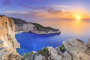
Background imageMediterranean Sea Collection: Greece, Ionian Islands, Zakynthos, Navagio (shipwreck) beach

Greece, Ionian Islands, Zakynthos, Navagio (shipwreck) beach

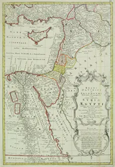
Background imageMediterranean Sea Collection: Antique map of the Middle East with Egypt, Syria, and Israel

Antique map of the Middle East with Egypt, Syria, and Israel. Date unknown

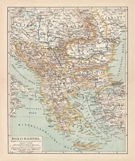
Background imageMediterranean Sea Collection: Balkan Peninsula in 1878, lithograph

Balkan Peninsula in 1878, lithograph
Ancient map Balkan. The political classification of the Balkan Peninsula after the Treaty of Berlin in 1878. Lithograph, published in 1878

Background imageMediterranean Sea Collection: Antique map of Israel

Antique map of Israel

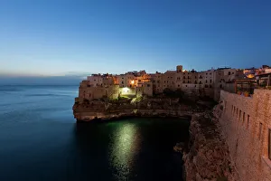
Background imageMediterranean Sea Collection: View of Polignano a Mare in the morning, Puglia region, also known as Apulia, Southern Italy

View of Polignano a Mare in the morning, Puglia region, also known as Apulia, Southern Italy, Italy, Europe

Background imageMediterranean Sea Collection: Walled City of Dubrovnik, Southeastern Tip of Croatia, Dalmation Coast, Adriatic Sea, Croatia

Walled City of Dubrovnik, Southeastern Tip of Croatia, Dalmation Coast, Adriatic Sea, Croatia, Eastern Europe

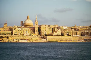
Background imageMediterranean Sea Collection: View of Valletta city (Malta) from the bay

View of Valletta city (Malta) from the bay in Sliema. Warm light, sunset

Background imageMediterranean Sea Collection: Europe, Italy, Amalfi Drive. Colorful wildflowers grow along the Amalfi Drive, or

Europe, Italy, Amalfi Drive. Colorful wildflowers grow along the Amalfi Drive, or Costiera Amalfitana, a World Heritage Site, in Italy


All Professionally Made to Order for Quick Shipping

The Mediterranean Sea, a timeless expanse of beauty and history, has witnessed the rise and fall of empires throughout the ages. As we explore its rich tapestry through various maps and lithographs, we are transported to different eras that have shaped our world. Let's begin our journey with a Map of Cyprus from 1880, revealing the island's strategic location in the heart of this ancient sea. It serves as a gateway to Apostle Paul's Missionary Journeys depicted in an 1886 lithograph. These journeys spread Christianity across lands touched by the Mediterranean's gentle waves. Moving forward in time, we encounter a Map of the Byzantine Empire in the 9th Century. This empire once dominated these shores with its grandeur and influence. Further west lies Portugal on another map, reminding us of their maritime prowess during Europe's Age of Exploration. As we delve deeper into history, Medieval Europe at the start of the Crusades comes alive before us. The clash between East and West reverberates across these waters as kingdoms vie for control amidst religious fervor. Sicily unveils itself through a map from 1895 – an island steeped in diverse cultures due to its strategic position within this sea. Ancient Palestine emerges next with maps showcasing kingdoms like Judah and Israel; lands where stories from biblical times unfolded against this breathtaking backdrop. Greece takes center stage as we witness it at the beginning of one of history's most famous conflicts -the Peloponnesian War (431-404 BC). City-states battle for supremacy while leaving an indelible mark on Western civilization. A View of Old Town City Dubrovnik captures our attention next; its medieval walls standing strong against time’s relentless march. This Croatian gem reminds us how coastal cities flourished along these shores since antiquity.