Fraud Blocker Skip to main content

Old Antique View Collection (#42)

"Exploring the Past: A Glimpse into Old Antique Views" Step back in time with these captivating antique maps

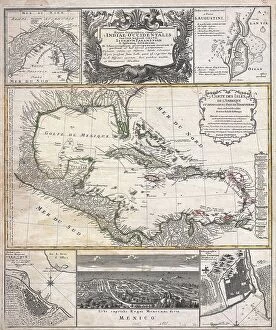
Background imageOld Antique View Collection: 1747 Ruyter Map Of Florida Mexico And The West Indies

1747 Ruyter Map Of Florida Mexico And The West Indies
1747, Ruyter Map of Florida, Mexico and the West Indies

Background imageOld Antique View Collection: 1747 La Feuille Map Of Andalusia Spain Sevilla

1747 La Feuille Map Of Andalusia Spain Sevilla
1747, La Feuille Map of Andalusia, Spain, Sevilla

Background imageOld Antique View Collection: 1750 Bellin Map Of Cape Town South Africa Topography

1750 Bellin Map Of Cape Town South Africa Topography
1750, Bellin Map of Cape Town, South Africa

Background imageOld Antique View Collection: 1747 La Feuille Map Of Alsace France Topography

1747 La Feuille Map Of Alsace France Topography
1747, La Feuille Map of Alsace, France

Background imageOld Antique View Collection: 1747 La Feuille Map Of Scandinavia Sweden Norway

1747 La Feuille Map Of Scandinavia Sweden Norway
1747, La Feuille Map of Scandinavia, Sweden, Norway, Finland

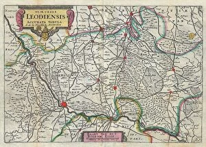
Background imageOld Antique View Collection: 1747 La Feuille Map Of Liege Belgium Leodiensis

1747 La Feuille Map Of Liege Belgium Leodiensis
1747, La Feuille Map of Liege, Belgium, Leodiensis

Background imageOld Antique View Collection: 1747 La Feuille Map Of Amsterdam And Vicinity

1747 La Feuille Map Of Amsterdam And Vicinity
1747, La Feuille Map of Amsterdam and Vicinity, the Netherlands

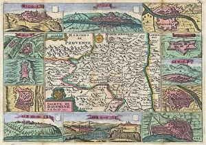
Background imageOld Antique View Collection: 1747 La Feuille Map Of Dauphine And Hautes-Alpes

1747 La Feuille Map Of Dauphine And Hautes-Alpes
1747, La Feuille Map of Dauphine and Hautes-Alpes, France

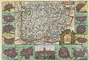
Background imageOld Antique View Collection: 1747 La Feuille Map Of Bavaria Germany Topography

1747 La Feuille Map Of Bavaria Germany Topography
1747, La Feuille Map of Bavaria, Germany

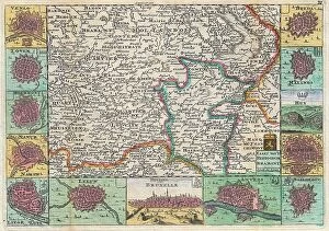
Background imageOld Antique View Collection: 1747 La Feuille Map Of Brabant Vicinity Of Brussels

1747 La Feuille Map Of Brabant Vicinity Of Brussels
1747, La Feuille Map of Brabant, vicinity of Brussels, Belgium

Background imageOld Antique View Collection: 1747 Homann Heirs Map Of Austria And Bohemia

1747 Homann Heirs Map Of Austria And Bohemia
1747, Homann Heirs Map of Austria and Bohemia, Czech Republic

Background imageOld Antique View Collection: 1747 Bowen Map Of The North Atlantic Islands

1747 Bowen Map Of The North Atlantic Islands
1747, Bowen Map of the North Atlantic Islands, Greenland, Iceland, Faroe Islands, Maelstrom

Background imageOld Antique View Collection: 1745 Anson View Of The Port Of Acapulco Mexico

1745 Anson View Of The Port Of Acapulco Mexico
1745, Anson View of the Port of Acapulco, Mexico

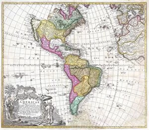
Background imageOld Antique View Collection: 1746 Homann Heirs Map Of South And North America

1746 Homann Heirs Map Of South And North America
1746, Homann Heirs Map of South and North America

Background imageOld Antique View Collection: 1741 Homann View And Map Of London England And Environs

1741 Homann View And Map Of London England And Environs
1741, Homann View and Map of London, England and Environs

Background imageOld Antique View Collection: 1747 Bowen Map Of The Southeastern United States

1747 Bowen Map Of The Southeastern United States
1747, Bowen Map of the Southeastern United States, Carolina, Georgia, Florida

Background imageOld Antique View Collection: 1741 Covens And Mortier Map Of The Northern Hemisphere

1741 Covens And Mortier Map Of The Northern Hemisphere
1741, Covens and Mortier Map of the Northern Hemisphere, North Pole, Arctic

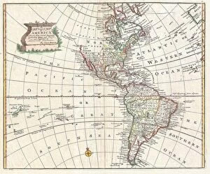
Background imageOld Antique View Collection: 1747 Bowen Map Of North America And South America

1747 Bowen Map Of North America And South America
1747, Bowen Map of North America and South America, Western Hemisphere

Background imageOld Antique View Collection: 1739 Bretez Turgot View And Map Of Paris France

1739 Bretez Turgot View And Map Of Paris France
1739, Bretez, Turgot View and Map of Paris, France

Background imageOld Antique View Collection: 1747 Bowen Map Of New Jersey Pennsylvania New York And New England

1747 Bowen Map Of New Jersey Pennsylvania New York And New England
1747, Bowen Map of New Jersey, Pennsylvania, New York and New England

Background imageOld Antique View Collection: 1739 Bretez Turgot View And Map Of Paris France

1739 Bretez Turgot View And Map Of Paris France
1739, Bretez, Turgot View and Map of Paris, France, c. 1900

Background imageOld Antique View Collection: 1745 Anson Map Or Chart Of Zihuatanejo Harbor

1745 Anson Map Or Chart Of Zihuatanejo Harbor
1745, Anson Map or Chart of Zihuatanejo Harbor, Mexico

Background imageOld Antique View Collection: 1737 Homann Heirs Map Of New England Georgia And Carolina

1737 Homann Heirs Map Of New England Georgia And Carolina
1737, Homann Heirs Map of New England, Georgia and Carolina, and Virginia and Maryland

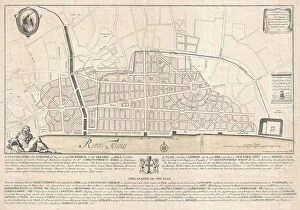
Background imageOld Antique View Collection: 1744 Wren Map Of London England Topography Cartography

1744 Wren Map Of London England Topography Cartography
1744, Wren Map of London, England

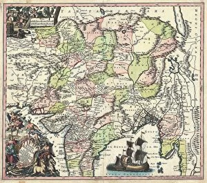
Background imageOld Antique View Collection: 1740 Seutter Map Of India Pakistan Tibet And Afghanistan

1740 Seutter Map Of India Pakistan Tibet And Afghanistan
1740, Seutter Map of India, Pakistan, Tibet and Afghanistan

Background imageOld Antique View Collection: 1741 Homann Heirs Map Of Ancient Greece And The Eastern Mediterranean

1741 Homann Heirs Map Of Ancient Greece And The Eastern Mediterranean
1741, Homann Heirs Map of Ancient Greece and the Eastern Mediterranean

Background imageOld Antique View Collection: 1732 Herman Moll Map Of The West Indies Florida

1732 Herman Moll Map Of The West Indies Florida
1732, Herman Moll Map of the West Indies, Florida, Mexico, and the Caribbean

Background imageOld Antique View Collection: 1741 Covens And Mortier Map Of The Southern Hemisphere

1741 Covens And Mortier Map Of The Southern Hemisphere
1741, Covens and Mortier Map of the Southern Hemisphere, South Pole, Antarctic

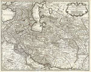
Background imageOld Antique View Collection: 1730 Ottens Map Of Persia Iran Iraq Turkey Topography

1730 Ottens Map Of Persia Iran Iraq Turkey Topography
1730, Ottens Map of Persia, Iran, Iraq, Turkey

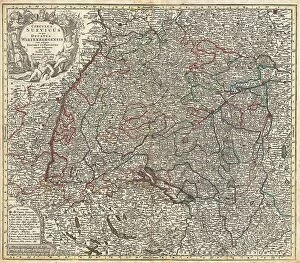
Background imageOld Antique View Collection: 1740 Seutter Map Of Swabia And Wirtenberg Germany

1740 Seutter Map Of Swabia And Wirtenberg Germany
1740, Seutter Map of Swabia and Wirtenberg, Germany

Background imageOld Antique View Collection: 1730 Homann Map Of The Upper Rhine Frankfurt

1730 Homann Map Of The Upper Rhine Frankfurt
1730, Homann Map of the Upper Rhine, Frankfurt, Cassel, Coblentz, Darmstadt

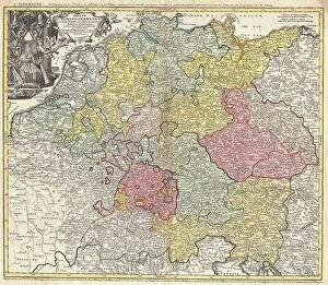
Background imageOld Antique View Collection: 1740 Homann Map Of The Holy Roman Empire Germanic Empire

1740 Homann Map Of The Holy Roman Empire Germanic Empire
1740, Homann Map of the Holy Roman Empire, Germanic Empire

Background imageOld Antique View Collection: 1730 Homann Map Of The Lower Rhine Frankfort

1730 Homann Map Of The Lower Rhine Frankfort
1730, Homann Map of the Lower Rhine, Frankfort, Cologne, Coln, Heidelberg, etc

Background imageOld Antique View Collection: 1739 Bretez Turgot View And Map Of Paris France

1739 Bretez Turgot View And Map Of Paris France
1739, Bretez, Turgot View and Map of Paris, France, c. 1900

Background imageOld Antique View Collection: 1730 Homann Map Of Scandinavia Norway Sweden

1730 Homann Map Of Scandinavia Norway Sweden
1730, Homann Map of Scandinavia, Norway, Sweden, Denmark, Finland and the Baltics

Background imageOld Antique View Collection: 1738 Ratelband Map Of The Balkans Bosnia Serbia

1738 Ratelband Map Of The Balkans Bosnia Serbia
1738, Ratelband Map of the Balkans, Bosnia, Serbia, Bulgaria, Rumania

Background imageOld Antique View Collection: 1737 Homann Heirs D'Anville Map Of Florida And The West Indies

1737 Homann Heirs D'Anville Map Of Florida And The West Indies
1737, Homann Heirs, D'Anville Map of Florida and the West Indies

Background imageOld Antique View Collection: 1730 Seutter Map Of Turkey Ottoman Empire Persia And Arabia

1730 Seutter Map Of Turkey Ottoman Empire Persia And Arabia
1730, Seutter Map of Turkey, Ottoman Empire, Persia and Arabia

Background imageOld Antique View Collection: 1729 Moll Map Of New York New England And Pennsylvania

1729 Moll Map Of New York New England And Pennsylvania
1729, Moll Map of New York, New England, and Pennsylvania, First Postal Map of New England

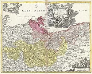
Background imageOld Antique View Collection: 1720 Homann Map Of Brandenberg And Pomerania

1720 Homann Map Of Brandenberg And Pomerania
1720, Homann Map of Brandenberg and Pomerania, Germany

Background imageOld Antique View Collection: 1716 Homann Map Of Burgundy France Topography

1716 Homann Map Of Burgundy France Topography
1716, Homann Map of Burgundy, France

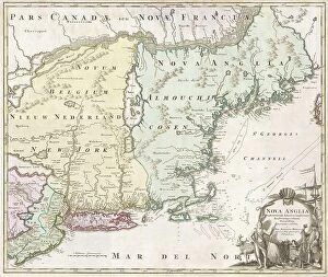
Background imageOld Antique View Collection: 1716 Homann Map Of New England Nova Anglia Topography

1716 Homann Map Of New England Nova Anglia Topography
1716, Homann Map of New England Nova Anglia

Background imageOld Antique View Collection: 1710 De La Feuille Map Of The Netherlands Belgium And Luxembourg

1710 De La Feuille Map Of The Netherlands Belgium And Luxembourg
1710, De La Feuille Map of the Netherlands, Belgium and Luxembourg

Background imageOld Antique View Collection: 1721 Chatelain Plan Or Map Of Rome Italy Topography

1721 Chatelain Plan Or Map Of Rome Italy Topography
1721, Chatelain Plan or Map of Rome, Italy

Background imageOld Antique View Collection: 1730 Covens And Mortier Map Of Germany Folding Case Map

1730 Covens And Mortier Map Of Germany Folding Case Map
1730, Covens and Mortier Map of Germany, Folding Case Map

Background imageOld Antique View Collection: 1724 De L'Isle Map Of Persia Iran Iraq Afghanistan

1724 De L'Isle Map Of Persia Iran Iraq Afghanistan
1724, De L'Isle Map of Persia, Iran, Iraq, Afghanistan

Background imageOld Antique View Collection: 1720 Weigel Map Of The Caucuses Including Armenia

1720 Weigel Map Of The Caucuses Including Armenia
1720, Weigel Map of the Caucuses including Armenia, Georgia, and Azerbaijan

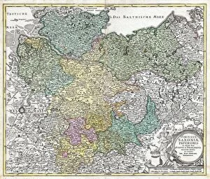
Background imageOld Antique View Collection: 1730 Homann Map Of Lower Saxond Berlin Lubeck

1730 Homann Map Of Lower Saxond Berlin Lubeck
1730, Homann Map of Lower Saxond, Berlin Lubeck, Hamburg, Bremen


All Professionally Made to Order for Quick Shipping

"Exploring the Past: A Glimpse into Old Antique Views" Step back in time with these captivating antique maps, offering a window into historical landscapes and distant lands. In 1768, James Craig crafted his remarkable Map of New Town, Edinburgh, Scotland. This First Plan of New Town showcases the city's evolution and topography during that era. Travel further back to 1794 when Delisle presented his intricate Map of Southern Ancient Greece, Greek Isles, and Crete. With its detailed depiction of topography, this map reveals the ancient world as it once stood. Take a celestial journey with an 1886 Telescopic View and Map of the Moon. Unveiling lunar topography through cartography and geography, this mesmerizing piece offers insights into our closest neighbor in space. Dating back to 1658, Visscher's Map of North America and South America provides a glimpse into early cartographic endeavors. Explore the vastness of these continents while appreciating their diverse landforms. The Colton Map of Scandinavia from 1855 invites us to discover Norway, Sweden, Finland - countries rich in history and natural beauty. Its meticulous attention to detail showcases both topographical features and geographical nuances. Delve deeper into history with Spruner's 1865 Map of Greece depicting Macedonia and Thrace before the Peloponnesian War. This invaluable resource unveils ancient territories' intricate topographies that shaped civilizations. For those fascinated by urban landscapes, Crutchley's Pocket Map or Plan of London from 1848 is a treasure trove for explorers seeking insight into England's capital city at that time. John Pinkerton presents us with an exquisite glimpse at The British Isles on his renowned map from 1818. Discover England, Scotland & Ireland through Pinkerton’s lens as he captures their unique geographies meticulously. Journey eastward with Colton’s stunningly detailed 1855 Map of Persia, Afghanistan, and Arabia.