Fraud Blocker Skip to main content

Old Antique View Collection (page 43)

"Exploring the Past: A Glimpse into Old Antique Views" Step back in time with these captivating antique maps

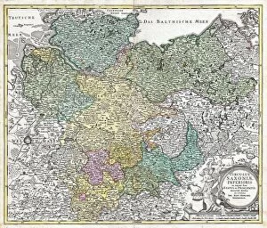
Background imageOld Antique View Collection: 1730 Homann Map Of Lower Saxond Berlin Lubeck

1730 Homann Map Of Lower Saxond Berlin Lubeck
1730, Homann Map of Lower Saxond, Berlin Lubeck, Hamburg, Bremen

Background imageOld Antique View Collection: 1720 Homann Map Of Transylvania Romania Topography

1720 Homann Map Of Transylvania Romania Topography
1720, Homann Map of Transylvania, Romania

Background imageOld Antique View Collection: 1720 Homann Map Of Northern Italy Danubii Fluminis

1720 Homann Map Of Northern Italy Danubii Fluminis
1720, Homann Map of Northern Italy Danubii Fluminis

Background imageOld Antique View Collection: 1720 Homann Map Of Franconia Germany Bavaria

1720 Homann Map Of Franconia Germany Bavaria
1720, Homann Map of Franconia, Germany, Bavaria, Bamberg, Wurtzburg, Nuremberg

Background imageOld Antique View Collection: 1710 Ottens Map Of Southeast Asia Singapore Thailand

1710 Ottens Map Of Southeast Asia Singapore Thailand
1710, Ottens Map of Southeast Asia, Singapore, Thailand, Siam, Malaysia, Sumatra, Borneo

Background imageOld Antique View Collection: 1728 Homann Map Of Bavaria Germany Topography

1728 Homann Map Of Bavaria Germany Topography
1728, Homann Map of Bavaria, Germany

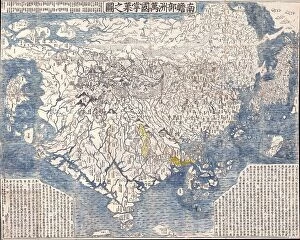
Background imageOld Antique View Collection: 1710 First Japanese Buddhist Map Of The World Showing Europe

1710 First Japanese Buddhist Map Of The World Showing Europe
1710, First Japanese Buddhist Map of the World Showing Europe, America, and Africa

Background imageOld Antique View Collection: 1725 Homann Map Of The Caspian Sea And Kamchatka

1725 Homann Map Of The Caspian Sea And Kamchatka
1725, Homann Map of the Caspian Sea and Kamchatka, as Yedso

Background imageOld Antique View Collection: 1710 De La Feuille Map Of Transylvania And Moldova

1710 De La Feuille Map Of Transylvania And Moldova
1710, De La Feuille Map of Transylvania and Moldova

Background imageOld Antique View Collection: 1715 Homann Map Of Carolina Virginia Maryland And New Jersey

1715 Homann Map Of Carolina Virginia Maryland And New Jersey
1715, Homann Map of Carolina, Virginia, Maryland and New Jersey

Background imageOld Antique View Collection: 1710 Homann Map Of Denmark Iutiae Topography

1710 Homann Map Of Denmark Iutiae Topography
1710, Homann Map of Denmark Iutiae

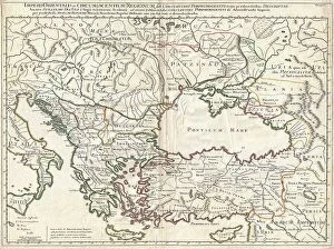
Background imageOld Antique View Collection: 1715 De L'Isle Map Of The Eastern Roman Empire Under Constantine

1715 De L'Isle Map Of The Eastern Roman Empire Under Constantine
1715, De L'Isle Map of the Eastern Roman Empire under Constantine, Asia Minor, Black Sea, Balkans

Background imageOld Antique View Collection: 1710 First Japanese Buddhist Map Of The World Showing Europe

1710 First Japanese Buddhist Map Of The World Showing Europe
1710, First Japanese Buddhist Map of the World Showing Europe, America, and Africa

Background imageOld Antique View Collection: 1708 De L'Isle Map Of North America Covens And Mortier Ed

1708 De L'Isle Map Of North America Covens And Mortier Ed
1708, De L'Isle Map of North America, Covens and Mortier ed.

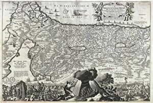
Background imageOld Antique View Collection: 1702 Visscher Stoopendaal Map Of Israel Palestine Or The Holy Land

1702 Visscher Stoopendaal Map Of Israel Palestine Or The Holy Land
1702, Visscher Stoopendaal Map of Israel, Palestine or the Holy Land

Background imageOld Antique View Collection: 1700 Cellarius Map Of Asia Europe And Africa According To Strabo

1700 Cellarius Map Of Asia Europe And Africa According To Strabo
1700, Cellarius Map of Asia, Europe and Africa according to Strabo

Background imageOld Antique View Collection: 1696 Danckerts Map Of Florida The West Indies

1696 Danckerts Map Of Florida The West Indies
1696, Danckerts Map of Florida, the West Indies, and the Caribbean

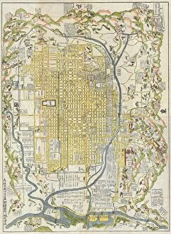
Background imageOld Antique View Collection: 1696 Genroku 9 Early Edo Japanese Map Of Kyoto

1696 Genroku 9 Early Edo Japanese Map Of Kyoto
1696, Genroku 9, early Edo Japanese Map of Kyoto, Japan

Background imageOld Antique View Collection: 1696 Coronelli Map Of The Great Lakes Most Accurate Map Of The Great Lakes In The 17th Century

1696 Coronelli Map Of The Great Lakes Most Accurate Map Of The Great Lakes In The 17th Century
1696, Coronelli Map of the Great Lakes, Most Accurate Map of the Great Lakes in the 17th Century

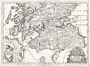
Background imageOld Antique View Collection: 1690 Coronelli Map Of Southern Scotland Edinburg And Glasgow

1690 Coronelli Map Of Southern Scotland Edinburg And Glasgow
1690, Coronelli Map of Southern Scotland, Edinburg and Glasgow

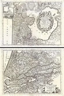
Background imageOld Antique View Collection: 1690 Coronelli Map Of Holland Or The Netherlands

1690 Coronelli Map Of Holland Or The Netherlands
1690, Coronelli Map of Holland or the Netherlands, 2 sheets

Background imageOld Antique View Collection: 1690 Coronelli Map Of Ethiopia Abyssinia And The Source Of The Blue Nile

1690 Coronelli Map Of Ethiopia Abyssinia And The Source Of The Blue Nile
1690, Coronelli Map of Ethiopia, Abyssinia, and the Source of the Blue Nile

Background imageOld Antique View Collection: 1688 Hennepin First Book And Map Of North America

1688 Hennepin First Book And Map Of North America
1688, Hennepin First Book and Map of North America, first printed map to name Louisiana

Background imageOld Antique View Collection: 1688 Coronelli Globe Gore Map Of NE North America

1688 Coronelli Globe Gore Map Of NE North America
1688, Coronelli Globe Gore Map of NE North America, the West Indies, and NE South America

Background imageOld Antique View Collection: 1683 Mortier Map Of North America The West Indies

1683 Mortier Map Of North America The West Indies
1683, Mortier Map of North America, the West Indies, and the Atlantic Ocean

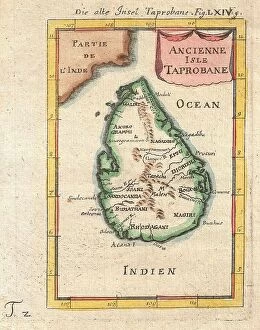
Background imageOld Antique View Collection: 1686 Mallet Map Of Ceylon Or Sri Lanka Taprobane

1686 Mallet Map Of Ceylon Or Sri Lanka Taprobane
1686, Mallet Map of Ceylon or Sri Lanka, Taprobane

Background imageOld Antique View Collection: 1665 Kircher Map Of The World Earliest Map Of World To Show Currents

1665 Kircher Map Of The World Earliest Map Of World To Show Currents
1665, Kircher Map of the World, Earliest Map of World to Show Currents

Background imageOld Antique View Collection: 1658 Jansson Map Of The Indian Ocean Erythrean Sea In Antiquity

1658 Jansson Map Of The Indian Ocean Erythrean Sea In Antiquity
1658, Jansson Map of the Indian Ocean, Erythrean Sea in Antiquity

Background imageOld Antique View Collection: 1662 Jansson And Hornius Map Of The Holy Land

1662 Jansson And Hornius Map Of The Holy Land
1662, Jansson and Hornius Map of the Holy Land, Israel, and Palestine

Background imageOld Antique View Collection: 1657 Visscher Map Of The Holy Land Or The Earthly Paradise

1657 Visscher Map Of The Holy Land Or The Earthly Paradise
1657, Visscher Map of the Holy Land or the Earthly Paradise

Background imageOld Antique View Collection: 1657 Jansson Map Of Germany Germania Topography

1657 Jansson Map Of Germany Germania Topography
1657, Jansson Map of Germany, Germania

Background imageOld Antique View Collection: 1656 Sanson Map Of Guiana Venezuela And El Dorado

1656 Sanson Map Of Guiana Venezuela And El Dorado
1656, Sanson Map of Guiana, Venezuela, and El Dorado

Background imageOld Antique View Collection: 1652 Gomboust Map Of Paris France C. 1900 Taride Reissue

1652 Gomboust Map Of Paris France C. 1900 Taride Reissue
1652, Gomboust Map of Paris, France, c. 1900 Taride reissue

Background imageOld Antique View Collection: 1652 Merian Panoramic View Or Map Of Rome Italy

1652 Merian Panoramic View Or Map Of Rome Italy
1652, Merian Panoramic View or Map of Rome, Italy

Background imageOld Antique View Collection: 1652 Gomboust 9 Panel Map Of Paris France C. 1900 Taride Reissue

1652 Gomboust 9 Panel Map Of Paris France C. 1900 Taride Reissue
1652, Gomboust 9 Panel Map of Paris, France, c. 1900 Taride reissue

Background imageOld Antique View Collection: 1650 Jansson Wind Rose Anemographic Chart Or Map Of The Winds

1650 Jansson Wind Rose Anemographic Chart Or Map Of The Winds
1650, Jansson Wind Rose, Anemographic Chart, or Map of the Winds

Background imageOld Antique View Collection: 1650 Fuller Map Of Jerusalem Israel Palestine

1650 Fuller Map Of Jerusalem Israel Palestine
1650, Fuller Map of Jerusalem, Israel, Palestine, Holy Land

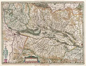
Background imageOld Antique View Collection: 1644 Jansson Map Of Alsace Basel And Strasbourg

1644 Jansson Map Of Alsace Basel And Strasbourg
1644, Jansson Map of Alsace, Basel and Strasbourg

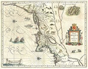
Background imageOld Antique View Collection: 1635 Blaeu Map Of New England And New York 1st Depiction Of Manhattan As An Island

1635 Blaeu Map Of New England And New York 1st Depiction Of Manhattan As An Island
1635, Blaeu Map of New England and New York, 1st depiction of Manhattan as an Island

Background imageOld Antique View Collection: 1635 Blaeu Map Guiana Venezuela And El Dorado

1635 Blaeu Map Guiana Venezuela And El Dorado
1635, Blaeu Map Guiana, Venezuela, and El Dorado

Background imageOld Antique View Collection: 1631 Blaeu Map Of The British Isles England Scotland

1631 Blaeu Map Of The British Isles England Scotland
1631, Blaeu Map of the British Isles, England, Scotland, Ireland

Background imageOld Antique View Collection: 1630 Blaeu Map Of Capitanata Foggia Italy Topography

1630 Blaeu Map Of Capitanata Foggia Italy Topography
1630, Blaeu Map of Capitanata, Foggia, Italy

Background imageOld Antique View Collection: 1697 Pufendorf View Of Krakow Cracow Poland Topography

1697 Pufendorf View Of Krakow Cracow Poland Topography
1697, Pufendorf View of Krakow, Cracow, Poland

Background imageOld Antique View Collection: 1698 De Bruijin View Of Rama Israel Palestine

1698 De Bruijin View Of Rama Israel Palestine
1698, de Bruijin View of Rama, Israel, Palestine, Holy Land

Background imageOld Antique View Collection: 1606 Mercator Map Of Holland The Netherlands

1606 Mercator Map Of Holland The Netherlands
1606, Mercator Map of Holland, The Netherlands

Background imageOld Antique View Collection: 1606 Mercator Hondius Map Of The Arctic First Map Of The North Pole

1606 Mercator Hondius Map Of The Arctic First Map Of The North Pole
1606, Mercator Hondius Map of the Arctic, First Map of the North Pole

Background imageOld Antique View Collection: 1584 Ortelius Map Of Crete Candia And 10 Greek Islands

1584 Ortelius Map Of Crete Candia And 10 Greek Islands
1584, Ortelius Map of Crete, Candia and 10 Greek Islands, Abraham Ortelius, also Orthellius, 1527 - 1598, Flemish, Netherlandish cartographer and geographer

Background imageOld Antique View Collection: 1597 Ptolemy Magini Keschedt Map Of Pakistan

1597 Ptolemy Magini Keschedt Map Of Pakistan
1597, Ptolemy, Magini, Keschedt Map of Pakistan, Iran and Afghanistan


All Professionally Made to Order for Quick Shipping

"Exploring the Past: A Glimpse into Old Antique Views" Step back in time with these captivating antique maps, offering a window into historical landscapes and distant lands. In 1768, James Craig crafted his remarkable Map of New Town, Edinburgh, Scotland. This First Plan of New Town showcases the city's evolution and topography during that era. Travel further back to 1794 when Delisle presented his intricate Map of Southern Ancient Greece, Greek Isles, and Crete. With its detailed depiction of topography, this map reveals the ancient world as it once stood. Take a celestial journey with an 1886 Telescopic View and Map of the Moon. Unveiling lunar topography through cartography and geography, this mesmerizing piece offers insights into our closest neighbor in space. Dating back to 1658, Visscher's Map of North America and South America provides a glimpse into early cartographic endeavors. Explore the vastness of these continents while appreciating their diverse landforms. The Colton Map of Scandinavia from 1855 invites us to discover Norway, Sweden, Finland - countries rich in history and natural beauty. Its meticulous attention to detail showcases both topographical features and geographical nuances. Delve deeper into history with Spruner's 1865 Map of Greece depicting Macedonia and Thrace before the Peloponnesian War. This invaluable resource unveils ancient territories' intricate topographies that shaped civilizations. For those fascinated by urban landscapes, Crutchley's Pocket Map or Plan of London from 1848 is a treasure trove for explorers seeking insight into England's capital city at that time. John Pinkerton presents us with an exquisite glimpse at The British Isles on his renowned map from 1818. Discover England, Scotland & Ireland through Pinkerton’s lens as he captures their unique geographies meticulously. Journey eastward with Colton’s stunningly detailed 1855 Map of Persia, Afghanistan, and Arabia.