
Old Map Of Birmingham Collection
Step back in time with these fascinating old maps of Birmingham


All Professionally Made to Order for Quick Shipping
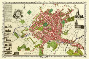
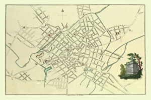
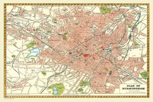
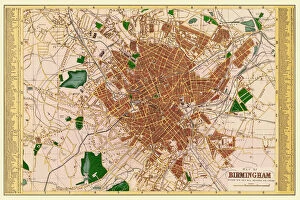
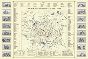
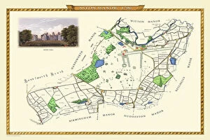
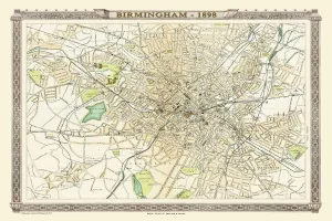
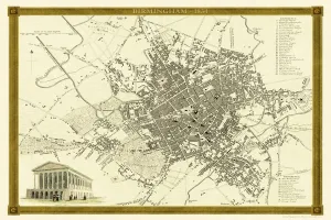
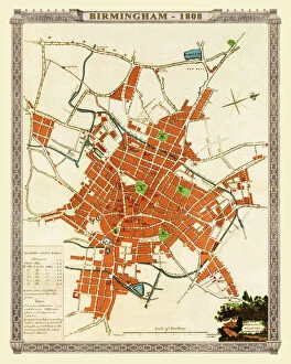
Step back in time with these fascinating old maps of Birmingham. 🗺️✨ Travel to the year 1851 and explore the city through the eyes of John Tallis, as his meticulously detailed "Old Map of Birmingham" takes you on a journey through its streets and landmarks. Or perhaps you'd prefer to venture even further back, to 1795, when C. Pye's map offers a glimpse into an earlier version of this bustling metropolis. Marvel at how much has changed over the years. For those interested in specific areas within Birmingham, Thomas Hanson's survey from 1750 provides an intricate look at the city during its early stages of development. Aston Manor is also highlighted in a separate map from 1796, showcasing its proximity to Birmingham. Fast forward to later years - experience Birmingham as it was in 1883 according to one cartographer or immerse yourself in the Royal Atlas by Bartholomew from 1898 for a comprehensive view. The Comprehensive Gazetteer Atlas of England and Wales presents us with another perspective on Birmingham in 1893, while Fullarton & Co's map from 1866 captures the essence of that era. Delve deeper into history with James Drake's depiction from 1832 or John Dower and William Orr's collaboration on their map dating back to 1834. These documents offer glimpses into different periods that have shaped this vibrant city. Finally, we have two maps capturing snapshots of life in Birmingham during earlier times - one from1816 and another from1808 - providing valuable insights into how this remarkable place has evolved throughout centuries. These old maps are not just pieces of paper; they hold stories waiting to be discovered. Step into our past and uncover hidden treasures as you navigate through these historical depictions of our beloved city.