Fraud Blocker Skip to main content

Routes Collection (page 4)

"Tracing the Pathways: Exploring Routes through Time and Space" Embark on a captivating journey as we delve into the fascinating world of routes

Background imageRoutes Collection: SS 'Orizaba'and SS 'Oroya'(litho)

SS "Orizaba"and SS "Oroya"(litho)
3651323 SS " Orizaba" and SS " Oroya" (litho) by English School, (19th century); Private Collection; (add.info.: SS " Orizaba" and SS " Oroya")

Background imageRoutes Collection: Athens, General View (litho)

Athens, General View (litho)
3651303 Athens, General View (litho) by English School, (19th century); Private Collection; (add.info.: Athens, General View)

Background imageRoutes Collection: Chart of the Thames and Approaches, Tilbury Dock to North Foreland (litho)

Chart of the Thames and Approaches, Tilbury Dock to North Foreland (litho)
3651382 Chart of the Thames and Approaches, Tilbury Dock to North Foreland (litho) by English School, (19th century); Private Collection; (add.info.: Chart of the Thames and Approaches)

Background imageRoutes Collection: Map of the World (on Mercators Projection), shewing the Hours of Universal Time at Mean Midnight

Map of the World (on Mercators Projection), shewing the Hours of Universal Time at Mean Midnight of the Prime Meridian
3651364 Map of the World (on Mercators Projection), shewing the Hours of Universal Time at Mean Midnight of the Prime Meridian and Proposed Time Standards (colour litho) by English School

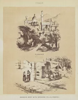
Background imageRoutes Collection: Italy, Florence, Bankers Shop with Grinding Mills, Pompeii (litho)

Italy, Florence, Bankers Shop with Grinding Mills, Pompeii (litho)
3651308 Italy, Florence, Bankers Shop with Grinding Mills, Pompeii (litho) by English School, (19th century); Private Collection; (add.info.: Italy, Florence, Bankers Shop with Grinding Mills)

Background imageRoutes Collection: Italy, Lago Maggiore, Lago Di Como (litho)

Italy, Lago Maggiore, Lago Di Como (litho)
3651306 Italy, Lago Maggiore, Lago Di Como (litho) by English School, (19th century); Private Collection; (add.info.: Italy, Lago Maggiore, Lago Di Como)

Background imageRoutes Collection: Sydney, Town Hall (litho)

Sydney, Town Hall (litho)
3651292 Sydney, Town Hall (litho) by English School, (19th century); Private Collection; (add.info.: Sydney, Town Hall. Illustration for the Orient Line Guide edited by W J Loftie (3rd edn)

Background imageRoutes Collection: Map of world shipping routes (colour litho)

Map of world shipping routes (colour litho)
3630297 Map of world shipping routes (colour litho) by German School, (19th century); Private Collection; (add.info.: Map of world shipping routes)

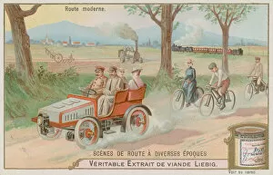
Background imageRoutes Collection: A Modern 19th Century Road (chromolitho)

A Modern 19th Century Road (chromolitho)
735168 A Modern 19th Century Road (chromolitho) by European School, (19th century); Private Collection; (add.info.: A Modern 19th Century Road)

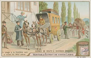
Background imageRoutes Collection: Border Toll on Road of 19th Century (chromolitho)

Border Toll on Road of 19th Century (chromolitho)
735167 Border Toll on Road of 19th Century (chromolitho) by European School, (19th century); Private Collection; (add.info.: Border Toll on Road of 19th Century)

Background imageRoutes Collection: Poster advertising the North German Lloyd Line, 1907 (colour litho)

Poster advertising the North German Lloyd Line, 1907 (colour litho)
SFP409447 Poster advertising the North German Lloyd Line, 1907 (colour litho) by Eckenbrecher, Karl Paul Themistocles von (1842-1921); Cauer Collection, Germany; German, out of copyright

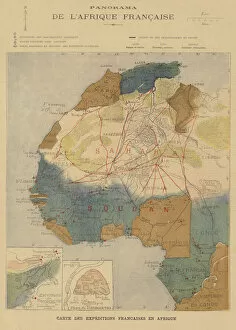
Background imageRoutes Collection: French Africa (colour litho)

French Africa (colour litho)
2818487 French Africa (colour litho) by French School, (19th century); Private Collection; (add.info.: French Africa. Map showing the routes of expeditions)

Background imageRoutes Collection: Map showing the journeys of the explorers Georg August Schweinfurth, Samuel Baker, David Livingstone

Map showing the journeys of the explorers Georg August Schweinfurth, Samuel Baker, David Livingstone
5996980 Map showing the journeys of the explorers Georg August Schweinfurth, Samuel Baker, David Livingstone, Henry Morton Stanley and Verney Lovett Cameron in Africa

Background imageRoutes Collection: Map of the world showing the cocoa producing countries (litho)

Map of the world showing the cocoa producing countries (litho)
6009012 Map of the world showing the cocoa producing countries (litho) by English School, (20th century); Private Collection; (add.info.: Map of the world showing the cocoa producing countries)

Background imageRoutes Collection: Air routes, Vital links in the chain of modern Europes trade centres (litho)

Air routes, Vital links in the chain of modern Europes trade centres (litho)
6008251 Air routes, Vital links in the chain of modern Europes trade centres (litho) by English School, (20th century); Private Collection; (add.info.: Air routes)

Background imageRoutes Collection: Chart of the English Channel (coloured engraving)

Chart of the English Channel (coloured engraving)
5996473 Chart of the English Channel (coloured engraving) by English School, (19th century); Private Collection; (add.info.: Chart of the English Channel)

Background imageRoutes Collection: Voyages of the Great Explorers (colour litho)

Voyages of the Great Explorers (colour litho)
3622866 Voyages of the Great Explorers (colour litho) by American School, (19th century); Private Collection; (add.info.: Voyages of the Great Explorers)

Background imageRoutes Collection: Steamboat advert, from The Daily Missouri, 1840 (engraving)

Steamboat advert, from The Daily Missouri, 1840 (engraving)
PNP247890 Steamboat advert, from The Daily Missouri, 1840 (engraving) by American School, (19th century); Private Collection; Peter Newark American Pictures; American, out of copyright

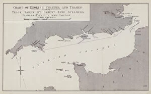
Background imageRoutes Collection: Chart of English Channel and Thames showing Track taken by Orient Line Steamers between Plymouth

Chart of English Channel and Thames showing Track taken by Orient Line Steamers between Plymouth and London (litho)
3651367 Chart of English Channel and Thames showing Track taken by Orient Line Steamers between Plymouth and London (litho) by English School

Background imageRoutes Collection: Orient Line Passengers Track, Wind, and Current Chart (colour litho)

Orient Line Passengers Track, Wind, and Current Chart (colour litho)
3651366 Orient Line Passengers Track, Wind, and Current Chart (colour litho) by English School, (19th century); Private Collection; (add.info.: Orient Line Passengers Track, Wind, and Current Chart)

Background imageRoutes Collection: Northern Constellations from the Pole to Declination 40 N (litho)

Northern Constellations from the Pole to Declination 40 N (litho)
3651360 Northern Constellations from the Pole to Declination 40 N (litho) by English School, (19th century); Private Collection; (add.info.: Northern Constellations from the Pole to Declination 40 N)

Background imageRoutes Collection: Italy, Etna, from Taormina (litho)

Italy, Etna, from Taormina (litho)
3651320 Italy, Etna, from Taormina (litho) by English School, (19th century); Private Collection; (add.info.: Italy, Etna, from Taormina)

Background imageRoutes Collection: England, Eddystone Lighthouse (litho)

England, Eddystone Lighthouse (litho)
3651317 England, Eddystone Lighthouse (litho) by English School, (19th century); Private Collection; (add.info.: England, Eddystone Lighthouse)

Background imageRoutes Collection: Italy, Naples (litho)

Italy, Naples (litho)
3651313 Italy, Naples (litho) by English School, (19th century); Private Collection; (add.info.: Italy, Naples. Illustration for the Orient Line Guide edited by W J Loftie (3rd edn, Sampson Low)

Background imageRoutes Collection: Italy, Temple of Neptune, Paestum (litho)

Italy, Temple of Neptune, Paestum (litho)
3651310 Italy, Temple of Neptune, Paestum (litho) by English School, (19th century); Private Collection; (add.info.: Italy, Temple of Neptune, Paestum)

Background imageRoutes Collection: Palestine, An Old Street in Jerusalem (litho)

Palestine, An Old Street in Jerusalem (litho)
3651304 Palestine, An Old Street in Jerusalem (litho) by English School, (19th century); Private Collection; (add.info.: Palestine, An Old Street in Jerusalem)

Background imageRoutes Collection: Sketches in Central America, proposed Routes for the Isthmus Canal (engraving)

Sketches in Central America, proposed Routes for the Isthmus Canal (engraving)
1099825 Sketches in Central America, proposed Routes for the Isthmus Canal (engraving) by English School, (19th century); Private Collection; (add.info.: Sketches in Central America)

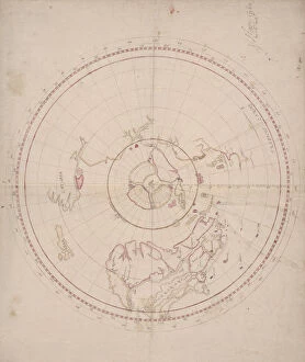
Background imageRoutes Collection: Humfray Gylbert knight his charte, c. 1582 (vellum)

Humfray Gylbert knight his charte, c. 1582 (vellum)
660771 Humfray Gylbert knight his charte, c.1582 (vellum) by Dee, John (1527-1609); 50x62 cm; Free Library of Philadelphia; (add.info.: Sir Humphrey Gilbert (c)

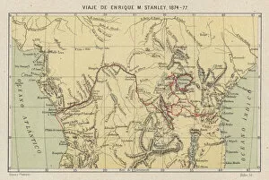
Background imageRoutes Collection: Map showing the journeys of the explorer Henry Morton Stanley in Africa, 1874-1877 (chromolitho)

Map showing the journeys of the explorer Henry Morton Stanley in Africa, 1874-1877 (chromolitho)
5996982 Map showing the journeys of the explorer Henry Morton Stanley in Africa, 1874-1877 (chromolitho) by English School

Background imageRoutes Collection: Map of the world showing the wine producing countries (litho)

Map of the world showing the wine producing countries (litho)
6009036 Map of the world showing the wine producing countries (litho) by English School, (20th century); Private Collection; (add.info.: Map of the world showing the wine producing countries)

Background imageRoutes Collection: Map of the world showing the coffee producing countries (litho)

Map of the world showing the coffee producing countries (litho)
6009014 Map of the world showing the coffee producing countries (litho) by English School, (20th century); Private Collection; (add.info.: Map of the world showing the coffee producing countries)

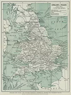
Background imageRoutes Collection: England and Wales, Map showing products, commercial centres and transport routes (litho)

England and Wales, Map showing products, commercial centres and transport routes (litho)
6008306 England and Wales, Map showing products, commercial centres and transport routes (litho) by English School, (20th century); Private Collection; (add.info.: England and Wales)

Background imageRoutes Collection: Trade routes from the East (litho)

Trade routes from the East (litho)
6013432 Trade routes from the East (litho) by English School, (20th century); Private Collection; (add.info.: Trade routes from the East)

Background imageRoutes Collection: Advertisement (litho)

Advertisement (litho)
3651356 Advertisement (litho) by English School, (19th century); Private Collection; (add.info.: Advertisement. Illustration for the Orient Line Guide edited by W J Loftie (3rd edn, Sampson Low)

Background imageRoutes Collection: SS 'Ormuz'(litho)

SS "Ormuz"(litho)
3651329 SS " Ormuz" (litho) by English School, (19th century); Private Collection; (add.info.: SS " Ormuz")

Background imageRoutes Collection: SS 'Ormuz', Promenade Deck (litho)

SS "Ormuz", Promenade Deck (litho)
3651328 SS " Ormuz", Promenade Deck (litho) by English School, (19th century); Private Collection; (add.info.: SS " Ormuz", Promenade Deck)

Background imageRoutes Collection: SS 'Orient'(litho)

SS "Orient"(litho)
3651295 SS " Orient" (litho) by English School, (19th century); Private Collection; (add.info.: SS " Orient." Illustration for the Orient Line Guide edited by W J Loftie (3rd edn)

Background imageRoutes Collection: Melbourne, Post Office (litho)

Melbourne, Post Office (litho)
3651291 Melbourne, Post Office (litho) by English School, (19th century); Private Collection; (add.info.: Melbourne, Post Office)

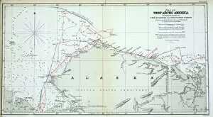
Background imageRoutes Collection: Map of West Arctic America showing the tracks of HMS Enterprise

Map of West Arctic America showing the tracks of HMS Enterprise
939906 Map of West Arctic America showing the tracks of HMS Enterprise and Investigator in 1850-1854 (colour litho) by English School

Background imageRoutes Collection: Map showing the voyages of Christopher Columbus, 1492-1504 (coloured engraving)

Map showing the voyages of Christopher Columbus, 1492-1504 (coloured engraving)
3646171 Map showing the voyages of Christopher Columbus, 1492-1504 (coloured engraving) by German School, (19th century); Private Collection; (add.info)

Background imageRoutes Collection: Places mentioned in the Acts of the Apostles, illustrating St Pauls travels, shewing also his

Places mentioned in the Acts of the Apostles, illustrating St Pauls travels, shewing also his... (engraving)
2812883 Places mentioned in the Acts of the Apostles, illustrating St Pauls travels, shewing also his... (engraving) by English School

Background imageRoutes Collection: Emigrants guide to Pikes Peak, 1859 (litho)

Emigrants guide to Pikes Peak, 1859 (litho)
PNP246272 Emigrants guide to Pikes Peak, 1859 (litho) by American School, (19th century); Private Collection; Peter Newark American Pictures; American, out of copyright

Background imageRoutes Collection: Map of the world showing the rice producing countries (litho)

Map of the world showing the rice producing countries (litho)
6009018 Map of the world showing the rice producing countries (litho) by English School, (20th century); Private Collection; (add.info.: Map of the world showing the rice producing countries)

Background imageRoutes Collection: Map of the world showing the sugar producing countries (litho)

Map of the world showing the sugar producing countries (litho)
6009017 Map of the world showing the sugar producing countries (litho) by English School, (20th century); Private Collection; (add.info.: Map of the world showing the sugar producing countries)

Background imageRoutes Collection: England, The Tower of London (litho)

England, The Tower of London (litho)
3651341 England, The Tower of London (litho) by English School, (19th century); Private Collection; (add.info.: England, The Tower of London)

Background imageRoutes Collection: Advertisement (litho)

Advertisement (litho)
3651333 Advertisement (litho) by English School, (19th century); Private Collection; (add.info.: Advertisement. Illustration for the Orient Line Guide edited by W J Loftie (3rd edn, Sampson Low)

Background imageRoutes Collection: SS 'Orizaba'and SS 'Oroya', First Saloon (litho)

SS "Orizaba"and SS "Oroya", First Saloon (litho)
3651322 SS " Orizaba" and SS " Oroya", First Saloon (litho) by English School, (19th century); Private Collection; (add.info.: SS " Orizaba" and SS " Oroya")

Background imageRoutes Collection: Italy, The Capitol, Rome (litho)

Italy, The Capitol, Rome (litho)
3651307 Italy, The Capitol, Rome (litho) by English School, (19th century); Private Collection; (add.info.: Italy, The Capitol, Rome)


All Professionally Made to Order for Quick Shipping

"Tracing the Pathways: Exploring Routes through Time and Space" Embark on a captivating journey as we delve into the fascinating world of routes, where maps serve as gateways to exploration. From the intricate British Railways network map of the 1950s to the enchanting Trans-Siberian Railway depicted in a vintage engraving from J. Bartholomew & Co. , these routes unveil tales of connectivity and adventure. Transport yourself back to c. 1920 with a mesmerizing map showcasing the legendary Trans-Siberian Railway, an engineering marvel that spans continents and cultures. Meanwhile, an intriguing glimpse into Afghanistan's past unfolds through a historical map from the 1860s, revealing ancient trade routes etched across its rugged terrain. As air travel took flight, Cobham Air Routes Poster captures our imagination with promises of soaring above clouds towards new horizons. The Pacific Line Poster invites us aboard luxurious ocean liners that once sailed vast distances, connecting distant lands like never before. Unveiling global possibilities, Pan American Airways route map showcases intercontinental connections that revolutionized travel in ways unimaginable just decades ago. Spithead & Shoreham Air Ferries Poster takes us closer to home but no less thrillingly; it reminds us how even short flights can open up worlds of opportunity. Beyond land and sky lies another dimension – underwater passages guarded by WW1 naval blockades that shaped history's course forevermore. Compagnie Generale Transatlantique beckons adventurers towards transoceanic voyages while Belgian Railway Poster entices explorers to uncover hidden treasures amidst Flanders' rolling hills. Intriguingly different yet equally captivating are Antarctic exploration route maps which reveal brave souls who dared venture into icy unknowns for scientific discovery and human triumph against nature's harshest elements. Lastly, immerse yourself in Franco-British Exhibition - London Underground plan.