Fraud Blocker Skip to main content

Routes Collection (page 7)

"Tracing the Pathways: Exploring Routes through Time and Space" Embark on a captivating journey as we delve into the fascinating world of routes

Background imageRoutes Collection: Advertisement, Great Rock Island Route, Chicago, USA

Advertisement, Great Rock Island Route, Chicago, USA
Advertisement for the Great Rock Island Route, Chicago, USA, with a map of railway routes in the Chicago area. Date: 1885

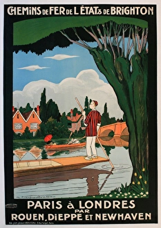
Background imageRoutes Collection: Poster, railway service from Paris to London

Poster, railway service from Paris to London, via Rouen, Dieppe and Newhaven. Showing a man on a punt and a couple in a rowing boat. Date: early 20th century

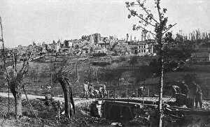
Background imageRoutes Collection: Maintaining lines of communication (roads) - on Aisne Front

Maintaining lines of communication (roads) - on Aisne Front
WW1 - Maintaining lines of communication (roads) - on Aisne Front Date: 1918

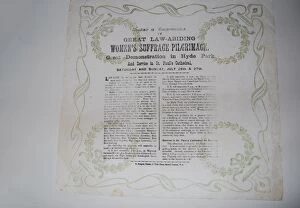
Background imageRoutes Collection: Womens Suffrage Pilgrimage N. U. W. S.s 1913

Womens Suffrage Pilgrimage N. U. W. S.s 1913
A souvenir commemorating the Great Law Abiding Womens Suffrage Pilgrimage, Great Demonstration in Hyde Park and Service in St. Pauls Cathedral, Saturday and Sunday, July 26th & 27th, 1913

Background imageRoutes Collection: Postcard, Greetings from Hungary

Postcard, Greetings from Hungary
Postcard with map of Europe and airline routes to and from Budapest, Greetings from Hungary (Hungarian Air Transport). Date: circa 1960s

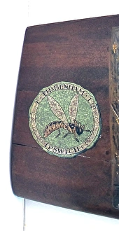
Background imageRoutes Collection: Wooden Propeller manufactured by Frederick Tibbenham

Wooden Propeller manufactured by Frederick Tibbenham of Ipswich (the companys transfer sign of a bumble bee was used on every propeller that the company made)

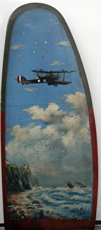
Background imageRoutes Collection: Wooden Propeller painted with either an RE8 or a BE2E

Wooden Propeller painted with either an RE8 or a BE2E on a spotting and reconnaissance mission leaving English coastline over the North Sea.. J. Willey J

Background imageRoutes Collection: British roads damaged by military traffic, WW1

British roads damaged by military traffic, WW1
A map of the Southern counties of Britain prepared by the Automobile Association and the Motor Union to indicate the stretches of road extensively damaged by the passage of military traffic

Background imageRoutes Collection: Imperial Trans-Antarctic Expedition 1914 -1917

Imperial Trans-Antarctic Expedition 1914 -1917
The Imperial Trans-Antarctic Expedition: how and whence the expedition proposes to start. Showing the proposed methods of transport from the Weddell Sea Base to the South Pole. Date: 1914

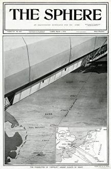
Background imageRoutes Collection: Zeppelin airship flights by night, by G. H. Davis

Zeppelin airship flights by night, by G. H. Davis
The possibilities of Zeppelin airship flights by night. Showing a 360 mile route from Heligoland to Selby, and an inset map with various routes marked

Background imageRoutes Collection: U-boat warfare 1939-1945 by G. H. Davis

U-boat warfare 1939-1945 by G. H. Davis
U-boat warfare 1939-1945: a survey of changing German submarines and tactics in a never-ceasing battle during the Second World War

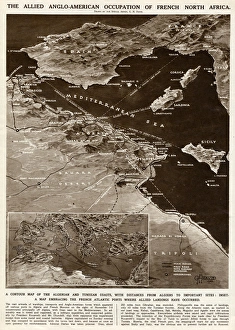
Background imageRoutes Collection: Allied occupation of French North Africa by G. H. Davis

Allied occupation of French North Africa by G. H. Davis
The Allied Anglo-American occupation of French North Africa during the Second World War. A contour map of the Algerian and Tunisian coasts, with distances from Algiers to important sites

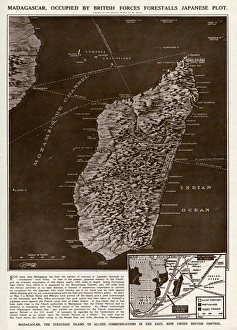
Background imageRoutes Collection: Madagascar strategic island by G. H. Davis

Madagascar strategic island by G. H. Davis
Madagascar, the strategic island to Allied communications in the East, occupied by British forces, forestalls a Japanese plot during the Second World War

Background imageRoutes Collection: Malta, target of German bombers, by G. H. Davis

Malta, target of German bombers, by G. H. Davis
A British stronghold in the Mediterranean during the Second World War: Malta, the target of German dive-bombers. The British naval and air base commanding the Sicilian Straits

Background imageRoutes Collection: Strategic factors in the north by G. H. Davis

Strategic factors in the north by G. H. Davis
Strategic factors in the north: Swedish iron ore; Norways coast. A pictorial map of Scandinavia, showing the iron fields and their ports of shipment

Background imageRoutes Collection: Outstanding flying achievements

Outstanding flying achievements: a pictorial record of the recent advances in speed, distance, height and endurance. Date: circa 1930s

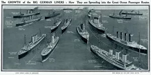
Background imageRoutes Collection: Growth of big German liners by G. H. Davis

Growth of big German liners by G. H. Davis
The growth of the big German liners: how they are spreading into the great ocean passenger routes. A comparison of German and British examples

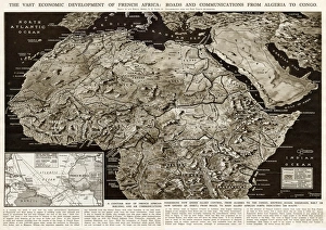
Background imageRoutes Collection: Development of French Africa by G. H. Davis

Development of French Africa by G. H. Davis
The vast economic development of French Africa: roads and communications from Algeria to Congo. A contour map of French African possessions under Allied control at this stage of the Second World War

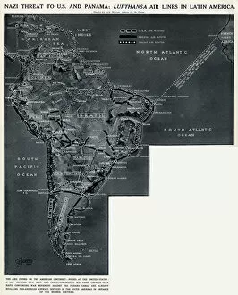
Background imageRoutes Collection: Lufthansa airlines in Latin America by G. H. Davis

Lufthansa airlines in Latin America by G. H. Davis
German threat to America and Panama: Lufthansa airlines in Latin America. A map showing how German-controlled airlines, capable of a converging war movement against the Panama Canal

Background imageRoutes Collection: Planes Used and Ordered by the B. O. A. C by G. H. Davis

Planes Used and Ordered by the B. O. A. C by G. H. Davis
A diagram listing the number, origin, routes and current supply of a number of different plane models to the B.O.A.C (British Overseas Airways Corporation)

Background imageRoutes Collection: Routes of travel in the United States map 1875

Routes of travel in the United States map 1875
The Independent Course Comprehensive Geography by James Monteith, A.S. Barnes & Co, New York & Chicago 1875

Background imageRoutes Collection: View of Bangkok City and the Surroundings, Thailand

View of Bangkok City and the Surroundings, Thailand
Bangkok is the capital and most populous city of Thailand. The city occupies 1, 568.7 square kilometres (605.7 sq mi) in the Chao Phraya River delta in Central Thailand

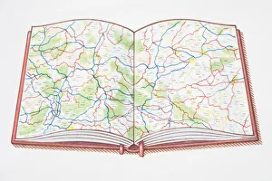
Background imageRoutes Collection: Open atlas, showing road map across double page

Open atlas, showing road map across double page

Background imageRoutes Collection: Source Size = 1824 x 2744

Source Size = 1824 x 2744
The Rebellion in the Soudan (Sudan): Map Showing Upper Egypt and the Seat of the Revolt, the Routes Across the Desert to Khartoum, and the Towns where Egyptian Garrisons are Beleaguered

Background imageRoutes Collection: Source Size = 1869 x 1685

Source Size = 1869 x 1685
Map Showing the Place where Baker Pasha was Defeated, February 4, 1884, and the Routes from the Coast of the Red Sea to Sinkat and Tokar

Background imageRoutes Collection: Dutch Trade map of the Baltic Sea (hand-coloured engraving)

Dutch Trade map of the Baltic Sea (hand-coloured engraving)
XCF307399 Dutch Trade map of the Baltic Sea (hand-coloured engraving) by Dutch School, (17th century); Private Collection; Dutch, out of copyright

Background imageRoutes Collection: The Road from London to Arundel (colour engraving)

The Road from London to Arundel (colour engraving)
XCF306034 The Road from London to Arundel (colour engraving) by Ogilby, John (1600-1676); Private Collection; English, out of copyright

Background imageRoutes Collection: The Road from London to Holy-Head (colour engraving)

The Road from London to Holy-Head (colour engraving)
XCF286474 The Road from London to Holy-Head (colour engraving) by Ogilby, John (1600-1676); Private Collection; English, out of copyright

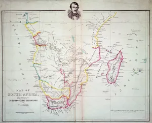
Background imageRoutes Collection: Map of South Africa illustrating Dr. Livingstones discoveries (colour litho)

Map of South Africa illustrating Dr. Livingstones discoveries (colour litho)
XCF275038 Map of South Africa illustrating Dr. Livingstones discoveries (colour litho) by English School; Private Collection; (add.info)

Background imageRoutes Collection: Overland Route to India (engraving)

Overland Route to India (engraving)
XCF275015 Overland Route to India (engraving) by Rapkin, John (fl.1839-77); Private Collection; British, out of copyright

Background imageRoutes Collection: The Road from London to Aberistwith on the Sea Coast, from Britannia, Volume the First

The Road from London to Aberistwith on the Sea Coast, from Britannia, Volume the First
XYC258600 The Road from London to Aberistwith on the Sea Coast, from Britannia, Volume the First, 1675 (engraving) by Ogilby, John (1600-1676); 31.5x43.5 cm; Yale Center for British Art

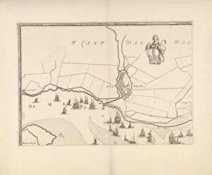
Background imageRoutes Collection: Map of Brielle and the banks of the Meuse, The Netherlands, Jacob Quack, 1665

Map of Brielle and the banks of the Meuse, The Netherlands, Jacob Quack, 1665

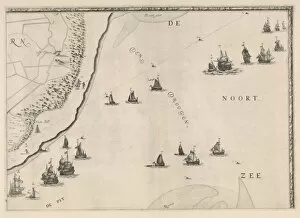
Background imageRoutes Collection: Map of the North Sea and the coast of Holland, Jacob Quack, 1665

Map of the North Sea and the coast of Holland, Jacob Quack, 1665

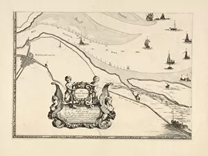
Background imageRoutes Collection: Map of Mssluis and the banks of the Meuse, The Netherlands, print maker: Joost

Map of Mssluis and the banks of the Meuse, The Netherlands, print maker: Joost van Geel attributed to, Jacob Quack, 1665

Background imageRoutes Collection: Buddhist banner depicting Dizang and the Six Roads to Rebirth, from Dunhuang (painting

Buddhist banner depicting Dizang and the Six Roads to Rebirth, from Dunhuang (painting
XIR157742 Buddhist banner depicting Dizang and the Six Roads to Rebirth, from Dunhuang (painting on silk) by Chinese School, (10th century); 76x59 cm; Musee Guimet, Paris

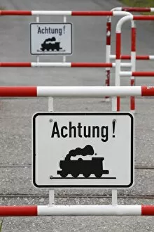
Background imageRoutes Collection: Railroad crossing

Railroad crossing

Background imageRoutes Collection: Railway tracks

Railway tracks

Background imageRoutes Collection: St-Pierre-d Albigny, Savoie department, France

St-Pierre-d Albigny, Savoie department, France
St-Pierre-d Albigny, Savoie department, Rhone-Alpes region, France - Route des Beauges - The Hotel du Col du Frene and view of the Arclusaz. Date: circa 1908

Background imageRoutes Collection: Turkish Railway Network - Celebrating 10 Years of the Republ

Turkish Railway Network - Celebrating 10 Years of the Republ
Turkish Railway Network - Celebrating 10 Years of the Turkish Republic in 1933 - with 2000km of railway track laid. The portrait shows Prime Minister Ismet Inonu (Prime Minister between 1925 and 1937)

Background imageRoutes Collection: Bridleway Only, No public rights for motor vehicles sign, Pennine Bridleway, Yorkshire Dales N. P

Bridleway Only, No public rights for motor vehicles sign, Pennine Bridleway, Yorkshire Dales N. P
Bridleway Only, No public rights for motor vehicles sign, Pennine Bridleway, Yorkshire Dales N.P. North Yorkshire, England, May

Background imageRoutes Collection: Pennine Bridleway sign, Yorkshire Dales N. P. North Yorkshire, England, May

Pennine Bridleway sign, Yorkshire Dales N. P. North Yorkshire, England, May
Pennine Bridleway sign, Yorkshire Dales N.P. North Yorkshire, England, May

Background imageRoutes Collection: Public footpath sign at edge of arable field, with footpath through cereal crop, Mendlesham

Public footpath sign at edge of arable field, with footpath through cereal crop, Mendlesham, Suffolk, England, April

Background imageRoutes Collection: Walkers crossing bridge near farmyard on Coast to Coast Walk, Ravenseat, Keld, Richmond, Swaledale

Walkers crossing bridge near farmyard on Coast to Coast Walk, Ravenseat, Keld, Richmond, Swaledale, Yorkshire Dales N.P. North Yorkshire, England, April

Background imageRoutes Collection: Danger, Beware of fast tides, hidden channels and quick sands warning sign beside road

Danger, Beware of fast tides, hidden channels and quick sands warning sign beside road from coastal village, only community on U.K

Background imageRoutes Collection: Footpath to Edale sign on farm, Edale, Peak District N. P. Derbyshire, England, August

Footpath to Edale sign on farm, Edale, Peak District N. P. Derbyshire, England, August
Footpath to Edale sign on farm, Edale, Peak District N.P. Derbyshire, England, August

Background imageRoutes Collection: Pennine Way and Public Footpath signs on farm, Edale, Peak District N. P

Pennine Way and Public Footpath signs on farm, Edale, Peak District N. P. Derbyshire, England, August
Pennine Way and Public Footpath signs on farm, Edale, Peak District N.P. Derbyshire, England, August

Background imageRoutes Collection: Stone building for walkers beside footpath, Edale, Peak District N. P. Derbyshire, England, August

Stone building for walkers beside footpath, Edale, Peak District N. P. Derbyshire, England, August
Stone building for walkers beside footpath, Edale, Peak District N.P. Derbyshire, England, August

Background imageRoutes Collection: London control zone and associated national airways

London control zone and associated national airways, London Airport inbound and outbound routes. 15 August 1951. Date: 1951


All Professionally Made to Order for Quick Shipping

"Tracing the Pathways: Exploring Routes through Time and Space" Embark on a captivating journey as we delve into the fascinating world of routes, where maps serve as gateways to exploration. From the intricate British Railways network map of the 1950s to the enchanting Trans-Siberian Railway depicted in a vintage engraving from J. Bartholomew & Co. , these routes unveil tales of connectivity and adventure. Transport yourself back to c. 1920 with a mesmerizing map showcasing the legendary Trans-Siberian Railway, an engineering marvel that spans continents and cultures. Meanwhile, an intriguing glimpse into Afghanistan's past unfolds through a historical map from the 1860s, revealing ancient trade routes etched across its rugged terrain. As air travel took flight, Cobham Air Routes Poster captures our imagination with promises of soaring above clouds towards new horizons. The Pacific Line Poster invites us aboard luxurious ocean liners that once sailed vast distances, connecting distant lands like never before. Unveiling global possibilities, Pan American Airways route map showcases intercontinental connections that revolutionized travel in ways unimaginable just decades ago. Spithead & Shoreham Air Ferries Poster takes us closer to home but no less thrillingly; it reminds us how even short flights can open up worlds of opportunity. Beyond land and sky lies another dimension – underwater passages guarded by WW1 naval blockades that shaped history's course forevermore. Compagnie Generale Transatlantique beckons adventurers towards transoceanic voyages while Belgian Railway Poster entices explorers to uncover hidden treasures amidst Flanders' rolling hills. Intriguingly different yet equally captivating are Antarctic exploration route maps which reveal brave souls who dared venture into icy unknowns for scientific discovery and human triumph against nature's harshest elements. Lastly, immerse yourself in Franco-British Exhibition - London Underground plan.