Fraud Blocker Skip to main content

Routes Collection (page 2)

"Tracing the Pathways: Exploring Routes through Time and Space" Embark on a captivating journey as we delve into the fascinating world of routes

Background imageRoutes Collection: WW2 - The Motor Launches of E-Boat Alley

WW2 - The Motor Launches of E-Boat Alley. (2/2) Date: 1942

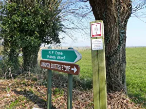
Background imageRoutes Collection: Ypres Battlefield Markers and signs

Ypres Battlefield Markers and signs
Over the 40 years that we have been writing about these battlefields, there has been many attempts to signpost the places of interest

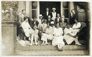
Background imageRoutes Collection: Isle of Wight Guesthouse - Occupants and Staff

Isle of Wight Guesthouse - Occupants and Staff
The guests and some of the staff of an unamed Guesthouse. The sign on the right of the doorway reads: Orders received for Meguyers Omnibus which suggests this photograph was possibly taken

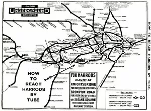
Background imageRoutes Collection: Map of London Underground railway, for Harrods

Map of London Underground railway, for Harrods
Map of the London Underground railway, How to Reach Harrods by Tube. Date: circa 1909

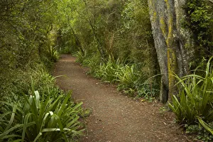
Background imageRoutes Collection: Walking track through remnant forest in Thompsons Bush, Invercargill, Southland, South Island

Walking track through remnant forest in Thompsons Bush, Invercargill, Southland, South Island, New Zealand

Background imageRoutes Collection: Physical Chart of Indian Ocean (Currents, Temperatures ?)

Physical Chart of Indian Ocean (Currents, Temperatures ?)
Physical Chart of Indian Ocean (Currents, Temperatures, Trade Routes)

Background imageRoutes Collection: Physical Chart of Atlantic Ocean (Currents, Temperatures ?)

Physical Chart of Atlantic Ocean (Currents, Temperatures ?)
Physical Chart of Atlantic Ocean (Currents, Temperatures, Trade Routes)

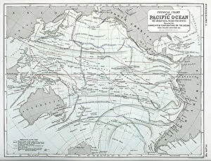
Background imageRoutes Collection: Physical Chart of Pacific Ocean (Currents, Temperatures ?)

Physical Chart of Pacific Ocean (Currents, Temperatures ?)
Physical Chart of Pacific Ocean (Currents, Temperatures, Trade Routes)

Background imageRoutes Collection: North Atlantic Trade Routes

North Atlantic Trade Routes

Background imageRoutes Collection: Steamer routes from Oban 1860s

Steamer routes from Oban 1860s

Background imageRoutes Collection: Intourist poster, Visit the USSR

Intourist poster, Visit the USSR Date: 1970

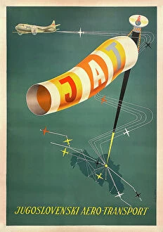
Background imageRoutes Collection: Poster, JAT, Yugoslav Airlines

Poster, JAT, Yugoslav Airlines Date: 20th century

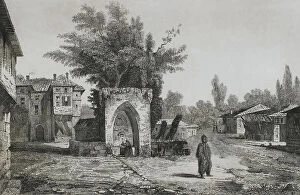
Background imageRoutes Collection: Turkey. Caravanserai of Kuchuk Chemetche

Turkey. Caravanserai of Kuchuk Chemetche
Ottoman Empire. Turkey. Caravanserai of Kuchuk Chemetche. Engraving by Lemaitre, Vormser and Lepetit. Historia de Turquia by Joseph Marie Jouannin (1783-1844) and Jules Van Gaver, 1840

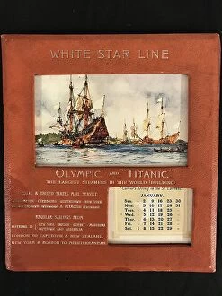
Background imageRoutes Collection: White Star Line, RMS Olympic and Titanic - calendar

White Star Line, RMS Olympic and Titanic - calendar
Rare White Star Line calendar with impressed lettering Olympic and Titanic, the largest steamers in the World'. The transatlantic Southampton to New York route is advertised as are several other

Background imageRoutes Collection: White Star Line - three pocket books

White Star Line - three pocket books
White Star Line - three rare pocket books. (1) 1893 hardbound booklet of tide tables, sailings, passages, etc. published by Ismay, Imrie & Co

Background imageRoutes Collection: RMS Titanic - shipping chart of North Atlantic

RMS Titanic - shipping chart of North Atlantic for the month of April 1912, Sheet 133, Meteorological Office, London. The chart is in colour and displays wind, sea current, sea temperature

Background imageRoutes Collection: British and Norwegian bases in the South Pole

British and Norwegian bases in the South Pole. The routes taken by Captain Amunsden and Captain Scott. The Norwegian base was on the Bay of Whales, the British Base was at Roberston Bay

Background imageRoutes Collection: Route taken to the South Pole by different expeditions

Route taken to the South Pole by different expeditions
Route taken to the South Pole by Captain Roald Amunsden. He led the first expedition to traverse the Northwest Passage by sea, from 1903 to 1906, and the first expedition to the South Pole in 1911

Background imageRoutes Collection: United States, New York State. Little Falls

United States, New York State. Little Falls. Mohawk River valley rapids and rocks. A canal was constructed around the rapids about 1795. Engraving by Milbert. Panorama Universal

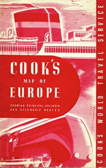
Background imageRoutes Collection: Thomas Cook's Map of Europe 1955

Thomas Cook's Map of Europe 1955 Date: 1955

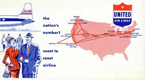
Background imageRoutes Collection: Passenger ticket wallet, United Airlines

Passenger ticket wallet, United Airlines (back) Date: 1953

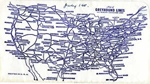
Background imageRoutes Collection: Greyhound Lines, ticket wallet, USA routes map

Greyhound Lines, ticket wallet, USA routes map
Greyhound Lines, back of ticket wallet, USA routes map Date: 1953

Background imageRoutes Collection: Greyhound Lines, ticket wallet including USA routes map

Greyhound Lines, ticket wallet including USA routes map
Greyhound Lines, back of ticket wallet including USA routes map Date: 1953

Background imageRoutes Collection: Advert, Fly BEA, British European Airways

Advert, Fly BEA, British European Airways at the new low fares Date: 1953

Background imageRoutes Collection: Raymond Baxter interviewing Captain James Linton A. F. C

Raymond Baxter interviewing Captain James Linton A. F. C
Raymond Baxter interviewing Captain James Linton A.F.C, a BOAC Comet pilot: discussing the recent introduction of the de Havilland Comet and Boeing 707 on trans-Atlantic airline routes

Background imageRoutes Collection: Melbourne and Tasmanian Mail Routes - Australia

Melbourne and Tasmanian Mail Routes - Australia
Detailed map showing Melbourne and Tasmanian Mail Routes across the Bass Strait from Melbourne, Victoria to Burnie, Tasmania - Australia. Date: circa 1910s

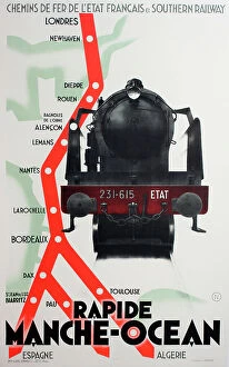
Background imageRoutes Collection: Poster, railway from London to France. Spain, North Africa

Poster, railway from London to France. Spain, North Africa
Poster, railway routes from London to France, Spain and North Africa Date: circa 1930

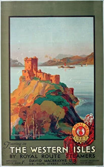
Background imageRoutes Collection: Poster, Scotland, Touring in the Western Isles by Royal Route Steamers, Urquhart Castle

Poster, Scotland, Touring in the Western Isles by Royal Route Steamers, Urquhart Castle, Loch Ness, Caledonian Canal. Date: circa 1928

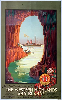
Background imageRoutes Collection: Poster, Scotland, The Western Highlands and Islands, showing a visit to Fingal's Cave from RMS

Poster, Scotland, The Western Highlands and Islands, showing a visit to Fingal's Cave from RMS Columba, The Royal Route. Date: circa 1928

Background imageRoutes Collection: Poster, Scotland, Western Highlands and Islands, map. Date: circa 1939

Poster, Scotland, Western Highlands and Islands, map. Date: circa 1939

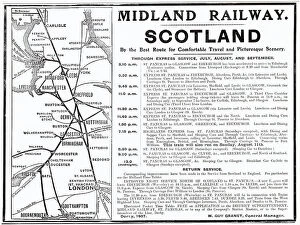
Background imageRoutes Collection: Improved night service from North of Scotland to St. Pancras, London. Date: 1907

Improved night service from North of Scotland to St. Pancras, London. Date: 1907

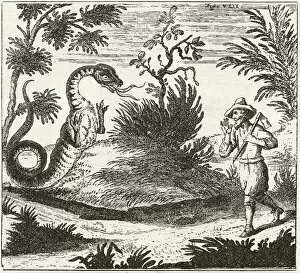
Background imageRoutes Collection: Author-explorer Schenchzer meeting a dragon in the Swiss Alps

Author-explorer Schenchzer meeting a dragon in the Swiss Alps, after a drawing from his book Routes in the Swiss Alps
878609 Author-explorer Schenchzer meeting a dragon in the Swiss Alps, after a drawing from his book Routes in the Swiss Alps, written 1702-1711. From The Strand Magazine published 1897

Background imageRoutes Collection: Europe and the Mediterranean Lands about 1097 (colour litho)

Europe and the Mediterranean Lands about 1097 (colour litho)
6016341 Europe and the Mediterranean Lands about 1097 (colour litho) by Shepherd, William R. (1871-1934); Private Collection; (add.info.: Europe and the Mediterranean Lands about 1097)

Background imageRoutes Collection: Portolan chart of the Mediterranean Coast, depicting the different stages of the Voyage

Portolan chart of the Mediterranean Coast, depicting the different stages of the Voyage
JEB940232 Portolan chart of the Mediterranean Coast, depicting the different stages of the Voyage of Ulysses, as told in Homers Odyssey, 1593 (parchment) by French School

Background imageRoutes Collection: Southern Signs of the Zodiac and Constellations between Declinations 45 N and 45's (litho)

Southern Signs of the Zodiac and Constellations between Declinations 45 N and 45's (litho)
3651363 Southern Signs of the Zodiac and Constellations between Declinations 45 N and 45's (litho) by English School, (19th century); Private Collection; (add.info)

Background imageRoutes Collection: Southern Constellations from the Pole to Declination 40 N (litho)

Southern Constellations from the Pole to Declination 40 N (litho)
3651361 Southern Constellations from the Pole to Declination 40 N (litho) by English School, (19th century); Private Collection; (add.info.: Southern Constellations from the Pole to Declination 40 N)

Background imageRoutes Collection: Italy, Excavations of Pompeii (litho)

Italy, Excavations of Pompeii (litho)
3651312 Italy, Excavations of Pompeii (litho) by English School, (19th century); Private Collection; (add.info.: Italy, Excavations of Pompeii)

Background imageRoutes Collection: Melbourne Harbour (litho)

Melbourne Harbour (litho)
3651311 Melbourne Harbour (litho) by English School, (19th century); Private Collection; (add.info.: Melbourne Harbour. Illustration for the Orient Line Guide edited by W J Loftie (3rd edn)

Background imageRoutes Collection: SS 'Austral'(litho)

SS "Austral"(litho)
3651298 SS " Austral" (litho) by English School, (19th century); Private Collection; (add.info.: SS " Austral." Illustration for the Orient Line Guide edited by W J Loftie)

Background imageRoutes Collection: Sydney Harbour (litho)

Sydney Harbour (litho)
3651293 Sydney Harbour (litho) by English School, (19th century); Private Collection; (add.info.: Sydney Harbour. Illustration for the Orient Line Guide edited by W J Loftie (3rd edn, Sampson Low)

Background imageRoutes Collection: Advertisement (litho)

Advertisement (litho)
3651348 Advertisement (litho) by English School, (19th century); Private Collection; (add.info.: Advertisement. Illustration for the Orient Line Guide edited by W J Loftie (3rd edn, Sampson Low)

Background imageRoutes Collection: England, Windsor Castle from the Thames (litho)

England, Windsor Castle from the Thames (litho)
3651337 England, Windsor Castle from the Thames (litho) by English School, (19th century); Private Collection; (add.info.: England, Windsor Castle from the Thames)

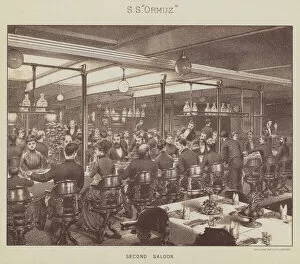
Background imageRoutes Collection: SS 'Ormuz', Second Saloon (litho)

SS "Ormuz", Second Saloon (litho)
3651325 SS " Ormuz", Second Saloon (litho) by English School, (19th century); Private Collection; (add.info.: SS " Ormuz", Second Saloon)

Background imageRoutes Collection: Italy, The Amphitheatre, Pozzuoli (litho)

Italy, The Amphitheatre, Pozzuoli (litho)
3651315 Italy, The Amphitheatre, Pozzuoli (litho) by English School, (19th century); Private Collection; (add.info.: Italy, The Amphitheatre, Pozzuoli)

Background imageRoutes Collection: The frontier crossing traffic at the border crossing points between the capital of the German

The frontier crossing traffic at the border crossing points between the capital of the German Democratic Republic
3638394 The frontier crossing traffic at the border crossing points between the capital of the German Democratic Republic, Berlin, and West Berlin

Background imageRoutes Collection: Plan of Chicago, Chicago, Illinois, Railroad Circuits Diagram

Plan of Chicago, Chicago, Illinois, Railroad Circuits Diagram
5862232 Plan of Chicago, Chicago, Illinois, Railroad Circuits Diagram, 1909 (colored ink and paint on a printed map) by Burnham, Daniel Hudson (1846-1912); 77x62 cm; The Art Institute of Chicago, IL

Background imageRoutes Collection: Four Routes to Paris (engraving)

Four Routes to Paris (engraving)
1097687 Four Routes to Paris (engraving) by English School, (19th century); Private Collection; (add.info.: Four Routes to Paris)

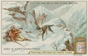
Background imageRoutes Collection: A Medieval Road Over the Alps in Winter (chromolitho)

A Medieval Road Over the Alps in Winter (chromolitho)
735164 A Medieval Road Over the Alps in Winter (chromolitho) by European School, (19th century); Private Collection; (add.info.: A Medieval Road Over the Alps in Winter)


All Professionally Made to Order for Quick Shipping

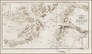
"Tracing the Pathways: Exploring Routes through Time and Space" Embark on a captivating journey as we delve into the fascinating world of routes, where maps serve as gateways to exploration. From the intricate British Railways network map of the 1950s to the enchanting Trans-Siberian Railway depicted in a vintage engraving from J. Bartholomew & Co. , these routes unveil tales of connectivity and adventure. Transport yourself back to c. 1920 with a mesmerizing map showcasing the legendary Trans-Siberian Railway, an engineering marvel that spans continents and cultures. Meanwhile, an intriguing glimpse into Afghanistan's past unfolds through a historical map from the 1860s, revealing ancient trade routes etched across its rugged terrain. As air travel took flight, Cobham Air Routes Poster captures our imagination with promises of soaring above clouds towards new horizons. The Pacific Line Poster invites us aboard luxurious ocean liners that once sailed vast distances, connecting distant lands like never before. Unveiling global possibilities, Pan American Airways route map showcases intercontinental connections that revolutionized travel in ways unimaginable just decades ago. Spithead & Shoreham Air Ferries Poster takes us closer to home but no less thrillingly; it reminds us how even short flights can open up worlds of opportunity. Beyond land and sky lies another dimension – underwater passages guarded by WW1 naval blockades that shaped history's course forevermore. Compagnie Generale Transatlantique beckons adventurers towards transoceanic voyages while Belgian Railway Poster entices explorers to uncover hidden treasures amidst Flanders' rolling hills. Intriguingly different yet equally captivating are Antarctic exploration route maps which reveal brave souls who dared venture into icy unknowns for scientific discovery and human triumph against nature's harshest elements. Lastly, immerse yourself in Franco-British Exhibition - London Underground plan.