Fraud Blocker Skip to main content

Territory Collection (page 2)

"Exploring the Rich Tapestry of Territory

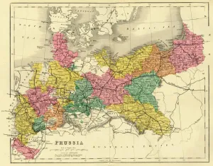
Background imageTerritory Collection: Map of Prussia, c1872. Creator: Unknown

Map of Prussia, c1872. Creator: Unknown
Map of Prussia, c1872. Showing the various regions including Holstein, Hanover, Westphalia, Lower Rhine, Lorraine, Nassau, Cassel, Saxony, Brandedburg, Silesia, Pomerania, West Prussia

Background imageTerritory Collection: Empire Day - May 24th, 1909

Empire Day - May 24th, 1909
One King. One Fleet. One Flag. One Empire. Celebration postcard to commemorate Empire Day - May 24th, 1909. Members of the British Empire celebrate beneath a statue of Queen Victoria above a
Background imageTerritory Collection: Elbow Beach Surf Club, Bermuda

Elbow Beach Surf Club, Bermuda Date: late 1950s

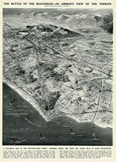
Background imageTerritory Collection: Nettuno-Anzio Front, Italy, by G. H. Davis

Nettuno-Anzio Front, Italy, by G. H. Davis
The battle of the beachhead -- an airmans view of the terrain. A pictorial map of the Nettuno-Anzio Front, showing roads, with the Alban Hills in the background

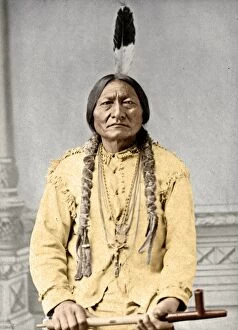
Background imageTerritory Collection: SITTING BULL (c1831-1890). Sioux Native American leader. Photographed by David F

SITTING BULL (c1831-1890). Sioux Native American leader. Photographed by David F. Barry, 1885

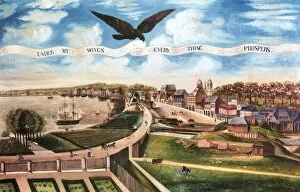
Background imageTerritory Collection: LOUISIANA PURCHASE, 1803. Under My Wings, Everything Prospers. View of the city of New Orleans

LOUISIANA PURCHASE, 1803. Under My Wings, Everything Prospers. View of the city of New Orleans, celebrating President Jeffersons Louisana Purchase. Oil on canvas, 1803, by Boqueto de Woiserie

Background imageTerritory Collection: Moses Weinberger (center) with bartenders Mack O Brien (left)

Moses Weinberger (center) with bartenders Mack O Brien (left) and Ike Reed at the entrance to the Same Old Moses Saloon
OKLAHOMA: SALOON, c1900. Moses Weinberger (center) with bartenders Mack O Brien (left) and Ike Reed at the entrance to the Same Old Moses Saloon at 211 West Harrison Avenue in Guthrie, Oklahoma

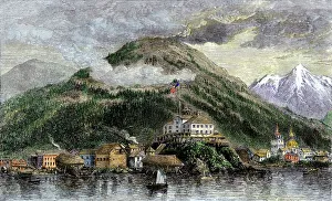
Background imageTerritory Collection: New Archangel, Russian town in Alaska, now called Sitka

New Archangel, Russian town in Alaska, now called Sitka
Sitka, or New Archangel, capital of Alaska in 1869, when purchased from Russia. Hand-colored woodcut of a 19th-century illustration

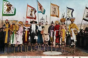
Background imageTerritory Collection: Festival Stilt Dance and Dancers - Dalian, Manchukuo, China

Festival Stilt Dance and Dancers - Dalian, Manchukuo, China
Manchukuo - a puppet state of the Empire of Japan in Northeast China and Inner Mongolia from 1932 until 1945. It was founded as a republic, but in 1934 it became a constitutional monarchy

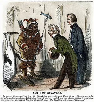
Background imageTerritory Collection: CARTOON: ALASKA PURCHASE, 1867. An American cartoon on the Alaska purchase showing

CARTOON: ALASKA PURCHASE, 1867. An American cartoon on the Alaska purchase showing Secretary of State William H. Seward and President Andrew Johnson welcoming the representatives of the new territory

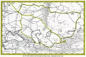
Background imageTerritory Collection: Map of Soviet Central Asia

Map of Soviet Central Asia - showing marked tour routes. Date: 1933

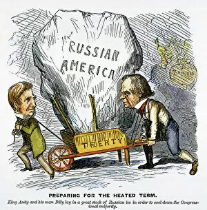
Background imageTerritory Collection: Preparing for the heated term. American cartoon, 1867, on the purchase of Alaska by Billy

Preparing for the heated term. American cartoon, 1867, on the purchase of Alaska by Billy
ALASKA PURCHASE CARTOON. Preparing for the heated term. American cartoon, 1867, on the purchase of Alaska by Billy (Secretary of State William H)

Background imageTerritory Collection: MAP: UNITED STATES, 1820. Engraved map of the United States, 1820

MAP: UNITED STATES, 1820. Engraved map of the United States, 1820, drawing on the geographical discoveries of the Lewis & Clark expedition

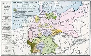
Background imageTerritory Collection: Germany before World War I

Germany before World War I
Map of the German Empire before World War I, circa 1912. Printed color lithograph

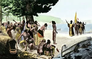
Background imageTerritory Collection: EXPL2A-00128

EXPL2A-00128
Landing of Jean Nicolet on the Wisconsin shore of Lake Michigan, 1634, the first European to reach that region. Hand-colored halftone of a 19th-century illustration

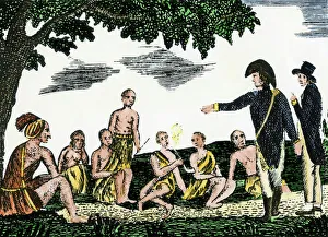
Background imageTerritory Collection: Native Americans meet Lewis and Clark at Council Bluffs

Native Americans meet Lewis and Clark at Council Bluffs
Lewis and Clark meeting with Native Americans at Council Bluffs, Iowa. Hand-colored woodcut by Patrick Goss, a member of the expedition

Background imageTerritory Collection: Civil War territory map, 1861

Civil War territory map, 1861
Map showing Confederate-held territory at the end of 1861. Hand-colored woodcut of a 19th-century illustration

Background imageTerritory Collection: EVNT2A-00048

EVNT2A-00048
British capturing Quebec in the Battle of the Plains of Abraham, French and Indian War, 1759. Hand-colored woodcut

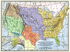
Background imageTerritory Collection: US territorial acquisition during the 1800s

US territorial acquisition during the 1800s
Map showiing the territorial growth of the continental US 1776 to 1899. Hand-colored woodcut of a 19th-century illustration

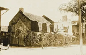
Background imageTerritory Collection: The oldest house in Kahnawake

The oldest house in Kahnawake
The oldest house in The Kahnawake Mohawk Territory - an Indian reserve on the south shore of the St. Lawrence River in Quebec, Canada, across from Montreal - built in 1721

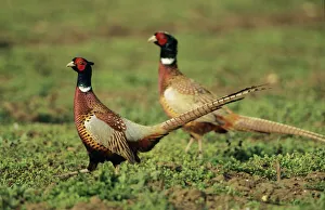
Background imageTerritory Collection: Cock Pheasant - territorial dispute between rivals

Cock Pheasant - territorial dispute between rivals
USH-856 Cock PHEASANT - Territorial dispute between rivals Phasianus colchicus Duncan Usher Please note that prints are for personal display purposes only and may not be reproduced in any way

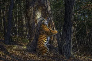
Background imageTerritory Collection: Siberian tiger (Panthera tigris altaica) female territorial marking by rubbing cheek

Siberian tiger (Panthera tigris altaica) female territorial marking by rubbing cheek against ancient Manchurian fir tree, Land of the Leopard National Park, Far East Russia, November

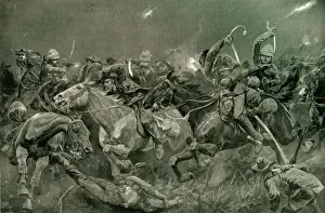
Background imageTerritory Collection: The Night Charge of the 19th Hussars Near Lydenberg on Nov. 7th 1900, 1901. Creator

The Night Charge of the 19th Hussars Near Lydenberg on Nov. 7th 1900, 1901. Creator
The Night Charge of the 19th Hussars Near Lydenberg on Nov. 7th 1900, 1901. From " South Africa and the Transvaal War, Vol. VI", by Louis Creswicke. [T. C. & E. C. Jack, Edinburgh, 1901]

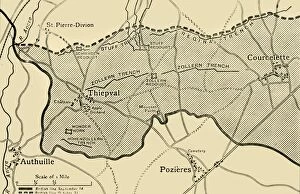
Background imageTerritory Collection: Map showing approximately the area gained on the Thiepval Ridge... 1916, (c1920)

Map showing approximately the area gained on the Thiepval Ridge... 1916, (c1920)
Map showing approximately the area gained on the Thiepval Ridge between September 14 and October 31, 1916, (c1920). The British line in northern France during the Battle of the Somme

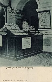
Background imageTerritory Collection: Graca & Cos stall - Hong Kong

Graca & Cos stall - Hong Kong - important printers and vendors of postcards, stamps and stationary. Date: circa 1905

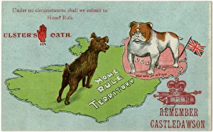
Background imageTerritory Collection: Ulsters Oath - The Bulldog will not submit to Home Rule

Ulsters Oath - The Bulldog will not submit to Home Rule
Remember Castledawson (a UVF (Ulster Volunteer Force) stronghold in County Derry) written on a staunchly Unionist postcard entitled Ulsters Oath - " Under no cirsumstances shall we submit to

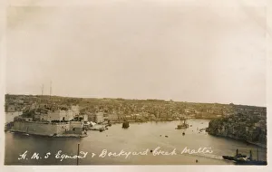
Background imageTerritory Collection: Valletta, Malta - HMS Egmont and Dockyard Creek

Valletta, Malta - HMS Egmont and Dockyard Creek. Date: 1923

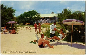
Background imageTerritory Collection: Ariel Sands, Beach Club, Bermuda

Ariel Sands, Beach Club, Bermuda Date: late 1950s

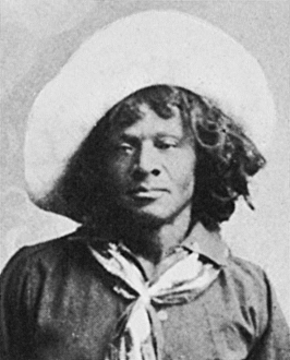
Background imageTerritory Collection: NAT LOVE b. 1854. Deadwood Dick. African American cowboy

NAT LOVE b. 1854. Deadwood Dick. African American cowboy

Background imageTerritory Collection: The Landing, Plymouth, Montserrat, British West Indies

The Landing, Plymouth, Montserrat, British West Indies
The Landing at Plymouth, Montserrat, British West Indies. In July 1995, Montserrats Soufriere Hills volcano, dormant for centuries

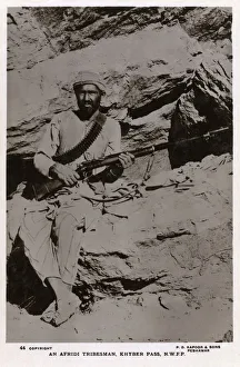
Background imageTerritory Collection: Afridi Tribesman of the Khyber Pass, NWFP

Afridi Tribesman of the Khyber Pass, NWFP
Afridi Tribesman (Afreedis / Abaorteans) - a Pashtun (Pathan) tribe from the Khyber Pass region posing with his long rifle. Date: circa 1920s

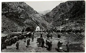
Background imageTerritory Collection: NWFP - Khyber Pass - Supplies taken to Fort Maud

NWFP - Khyber Pass - Supplies taken to Fort Maud - situated exactly halfway from India (as was then) to Afghanistan. Date: circa 1910

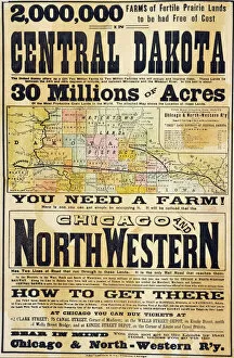
Background imageTerritory Collection: 0008627

0008627
RAILWAY POSTER, 1870s. A Chicago and North-Western Railway poster of the 1870s promoting free homestead lands in the Dakota Territory

Background imageTerritory Collection: MAP: VANCOUVER ISLAND, 1859. Map of Vancouver Island and Washington Territory

MAP: VANCOUVER ISLAND, 1859. Map of Vancouver Island and Washington Territory, shwoing San Juan Island and the disputed territory. Map, 1859

Background imageTerritory Collection: A Bermuda Sign post

A Bermuda Sign post Date: circa 1930s

Background imageTerritory Collection: CANADA: MAP, 1872. Map of the boundary between British and American territory on the Pacific coast

CANADA: MAP, 1872. Map of the boundary between British and American territory on the Pacific coast, settled by the decision of the Emperor of Germany by arbitration in 1872

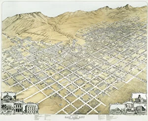
Background imageTerritory Collection: VIEW OF SALT LAKE CITY, UTAH. Salt Lake City, Utah Territory. Lithograph, 1870

VIEW OF SALT LAKE CITY, UTAH. Salt Lake City, Utah Territory. Lithograph, 1870

Background imageTerritory Collection: PEXP2A-00057

PEXP2A-00057
Johnny Appleseed addressing a preacher among settlers of Ohio Territory. Hand-colored woodcut of a 19th-century illustration

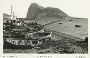
Background imageTerritory Collection: The Rock of Gibraltar from the beach

The Rock of Gibraltar from the beach. Date: 1935

Background imageTerritory Collection: Map of Wurttemberg, historical German territory

Map of Wurttemberg, historical German territory
Illustration of a Map of Wurttemberg, historical German territory

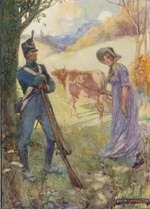
Background imageTerritory Collection: Driving A Cow Before Her, Laura Secord Passed The American Sentries, c1909, (c1920)

Driving A Cow Before Her, Laura Secord Passed The American Sentries, c1909, (c1920). Artist: Joseph Ratcliffe Skelton
Driving A Cow Before Her, Laura Secord Passed The American Sentries, c1909, (c1920). Laura Secord (1775-1868) Canadian heroine of the War of 1812

Background imageTerritory Collection: Picture No. 11992774

Picture No. 11992774
Pied Butcherbird - On a dead branch - Alice Springs - Northern Territory - Australia Pied Butcherbird - On a dead branch - Alice Springs - Northern Territory - Australia Date:

Background imageTerritory Collection: Picture No. 11992768

Picture No. 11992768
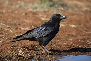
Little Crow - About to drink at a pool - Papunya Aboriginal Community - Northern Territory - Australia Little Crow - About to drink at a pool - Papunya Aboriginal Community - Northern Territory

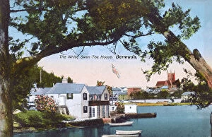
Background imageTerritory Collection: The White Swan Tea House, Hamilton, Bermuda

The White Swan Tea House, Hamilton, Bermuda. Date: circa 1910s

Background imageTerritory Collection: Brumbies (Wild horses) introduced by settlers from the late 18th century have a disastrous impact

Brumbies (Wild horses) introduced by settlers from the late 18th century have a disastrous impact on the environment
JPF-13183 Brumbies (Wild horses) Kakadu National Park (World Heritage Area), Northern Territory, Australia Equus caballus introduced by settlers from the late 18th century have a disastrous impact

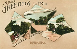
Background imageTerritory Collection: Bermuda - Palms at Paget, Grasmere view and Oleanders

Bermuda - Palms at Paget, Grasmere view and Oleanders
Bermuda - with three inset leaf-shaped images depicting: Royals Palms at Paget, the view from Grasmere and Oleanders in bloom. Date: 1912

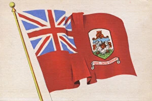
Background imageTerritory Collection: The Flag of Bermuda

The Flag of Bermuda Date: circa 1930s

Background imageTerritory Collection: British Cat Protects

British Cat Protects
" Wouldn t you like to see the back of me?" - the British cat protects his territory 1915


All Professionally Made to Order for Quick Shipping

"Exploring the Rich Tapestry of Territory: From Ancient Empires to Majestic Landscapes" Embark on a captivating journey through time and space as we delve into the concept of territory. Let us begin our expedition with a glance at Scotland in the 1870s, where an intricate map unravels tales of clans and their territorial disputes. Shifting our focus eastward, we encounter a mesmerizing Map of the Ancient Persian Empire. Marvel at its vast expanse, once ruled by mighty kings who sought to expand their dominion across ancient lands. Transporting ourselves to Britain in 597 AD, another map reveals how territories evolved over centuries. Witness the birth of kingdoms and empires that shaped this island nation's history. As dusk descends upon Uluru, Ayers Rock in Australia, soak in nature's splendor while contemplating indigenous peoples' connection to their ancestral territories. The sunset paints vibrant hues across this sacred land. Journeying back to Europe, let us explore Ireland through a map from the 1870s. Discover its lush landscapes and ponder upon historical struggles for control over this enchanting island. Expand your horizons further with the World Map Empire McVitie; marvel at how various nations carved out their territories during different eras – each stroke representing power dynamics and conquests. Venturing into antiquity, immerse yourself in Alexander the Great's empire through an awe-inspiring map. Uncover his audacious quest for dominance as he conquered vast stretches of land under his rule. Witnessing nature's wonders takes flight as we observe a majestic Red Kite soaring above its nest territory in Lower Saxony, Germany. A symbol of freedom within defined boundaries - it reminds us that even wildlife has territorial instincts ingrained within them. Turning towards spiritual realms brings us face-to-face with Palestine and Holy Land on an intricately detailed map. Contemplate millennia-old conflicts rooted deeply in territorial claims and religious significance.