Greetings Card > Animals > Mammals > Muridae > Western Mouse
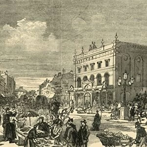
Greetings Card : Descriptive map of London poverty, 1889 (engraving)
")
")

![]()
Cards from Fine Art Finder
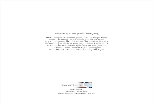
Descriptive map of London poverty, 1889 (engraving)
586450 Descriptive map of London poverty, 1889 (engraving) by English School, (19th century); Private Collection; (add.info.: Descriptive map of London poverty, 1889; south-western sheet comprising the Parish of Chelsea and parts of Fulham, Kensington, St Georges Hanover Square, Strand, Lambeth and the Battersea portion of Wandsworth); Look and Learn / Peter Jackson Collection; English, out of copyright
Media ID 22691056
© Look and Learn / Peter Jackson Collection / Bridgeman Images
1889 Battersea Chelsea Contrast Differences Fulham Income Kensington Lambeth Parish Parts Portion Rich Sheet Slums South Western Strand Wandsworth Comprising Descriptive
Greetings Card (7"x5")
Step into the past with our captivating selection of Media Storehouse Greeting Cards. This design features an enchanting 1889 descriptive map of London poverty, an evocative engraving from Bridgeman Images at Fine Art Finder. Delve into the history of England's bustling capital city with this intricately detailed, 19th-century masterpiece. Perfect for those who appreciate the richness of history and the beauty of fine art, these cards are a thoughtful and unique way to express your sentiments. Add a touch of nostalgia and historical depth to your correspondence with our exquisite Media Storehouse Greeting Cards.
Folded Greeting Cards (12.5x17.5 cm) have a laminate finish and are supplied with an envelope. The front and inside can be personalised with text in a selection of fonts, layouts and colours.
Greetings Cards suitable for Birthdays, Weddings, Anniversaries, Graduations, Thank You and much more
Estimated Product Size is 12.5cm x 17.5cm (4.9" x 6.9")
These are individually made so all sizes are approximate
Artwork printed orientated as per the preview above, with landscape (horizontal) or portrait (vertical) orientation to match the source image.
FEATURES IN THESE COLLECTIONS
> Fine Art Finder
> Artists
> English School
> Fine Art Finder
> Temp Classification
> Animals
> Mammals
> Muridae
> Western Mouse
> Arts
> Landscape paintings
> Waterfall and river artworks
> River artworks
> Europe
> United Kingdom
> England
> London
> Boroughs
> Hammersmith and Fulham
> Europe
> United Kingdom
> England
> London
> Boroughs
> Kensington and Chelsea
> Europe
> United Kingdom
> England
> London
> Boroughs
> Lambeth
> Europe
> United Kingdom
> England
> London
> Boroughs
> Wandsworth
> Europe
> United Kingdom
> England
> London
> River Thames
> Europe
> United Kingdom
> England
> London
> Slums
> Europe
> United Kingdom
> England
> London
> Towns
> Battersea
> Europe
> United Kingdom
> England
> London
> Towns
> Chelsea
EDITORS COMMENTS
This print showcases a descriptive map of London poverty from 1889, providing a striking visual representation of the stark contrasts within the city. Engraved by an anonymous English School artist in the 19th century, this historical piece offers a glimpse into the social and economic disparities that plagued Victorian London. The focus of this particular engraving is on the south-western sheet comprising Chelsea, Fulham, Kensington, St Georges Hanover Square, Strand, Lambeth, and Wandsworth's Battersea portion. The map vividly illustrates how income inequality was deeply entrenched in these areas during that time. As you examine this image closely, you can't help but notice the glaring differences between rich and poor neighborhoods. The slums are depicted with intricate detail alongside more affluent parts of London. This contrast serves as a powerful reminder of the immense challenges faced by those living in poverty while their wealthier counterparts enjoyed comfortable lives just across town. The river Thames meanders through this descriptive map like a silent witness to these inequalities. It stands as a symbol of both division and connection – separating communities yet binding them together through shared experiences. Through its detailed depiction of various districts and parishes such as Chelsea and Kensington, this engraving provides valuable insight into London's social fabric at that time. It invites us to reflect on our own society's progress in addressing poverty and reminds us not to overlook those who continue to struggle amidst affluence. This print from Fine Art Finder captures an important moment in history when
MADE IN AUSTRALIA
Safe Shipping with 30 Day Money Back Guarantee
FREE PERSONALISATION*
We are proud to offer a range of customisation features including Personalised Captions, Color Filters and Picture Zoom Tools
SECURE PAYMENTS
We happily accept a wide range of payment options so you can pay for the things you need in the way that is most convenient for you
* Options may vary by product and licensing agreement. Zoomed Pictures can be adjusted in the Cart.