Greetings Card > Europe > Belgium > Maps
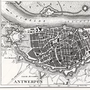
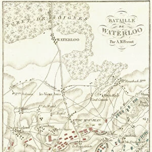
Greetings Card : Map of Antwerp


![]()
Cards from Mary Evans Picture Library
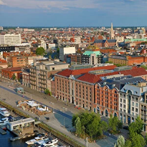
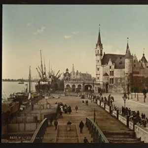
Map of Antwerp
Map of the city of Antwerp, Belgium Date: 19th century
Mary Evans Picture Library makes available wonderful images created for people to enjoy over the centuries
Media ID 7404439
© Mary Evans Picture Library 2015 - https://copyrighthub.org/s0/hub1/creation/maryevans/MaryEvansPictureID/10474595
Greetings Card (7"x5")
"Discover the charm of Antwerp with our exquisite range of greeting cards from Media Storehouse. Featuring a captivating 19th century map of the city from Mary Evans Prints Online, these cards transport you to the heart of Belgium's historic port city. Ideal for special occasions or just to brighten someone's day, these beautifully designed cards are a thoughtful way to share your affection and appreciation for Antwerp's rich history and culture. Order yours today and let the journey begin!"
Folded Greeting Cards (12.5x17.5 cm) have a laminate finish and are supplied with an envelope. The front and inside can be personalised with text in a selection of fonts, layouts and colours.
Greetings Cards suitable for Birthdays, Weddings, Anniversaries, Graduations, Thank You and much more
Estimated Product Size is 12.5cm x 17.5cm (4.9" x 6.9")
These are individually made so all sizes are approximate
Artwork printed orientated as per the preview above, with landscape (horizontal) or portrait (vertical) orientation to match the source image.
FEATURES IN THESE COLLECTIONS
> Europe
> Belgium
> Related Images
> Maps and Charts
> Related Images
> Mary Evans Prints Online
> National Archives
EDITORS COMMENTS
1. Title: "A Glance into the Past: Exploring Antwerp's 19th Century Urban Landscape through this Detailed Map" This antique map print invites us to take a journey back in time and explore the urban landscape of Antwerp, Belgium, as it appeared in the 19th century. The intricate details of this map, created during the Romantic era, reveal the city's rich history and architectural heritage. Antwerp, located in the Flemish Region of Belgium, was a significant trading hub during the 16th and 17th centuries. This map showcases the city's growth and expansion during the 19th century, as new neighborhoods emerged and the city's infrastructure was modernized. The map's meticulous design includes various points of interest such as churches, city gates, fortifications, and important public buildings. The intricate depiction of the Scheldt River and its tributaries highlights the city's strategic location and its role as a major port. The map's borders extend beyond the city limits, revealing the surrounding countryside and nearby towns, providing a broader context of the region's geography and topography. The inclusion of a detailed key and scale at the bottom of the map ensures that viewers can easily locate and identify various features. This map print is a testament to the meticulous craftsmanship and cartographic skills of the mapmakers of the time. It offers a unique perspective into the past, allowing us to appreciate the evolution of Antwerp's urban landscape and the historical context that shaped it. Whether you're an avid history buff, a curious traveler, or simply someone who appreciates the beauty of antique maps, this 19th-century map of Antwerp is an essential addition to your collection. It offers a glimpse into the past, inviting us to explore the stories and secrets that lie hidden within its intricate lines and details.
MADE IN AUSTRALIA
Safe Shipping with 30 Day Money Back Guarantee
FREE PERSONALISATION*
We are proud to offer a range of customisation features including Personalised Captions, Color Filters and Picture Zoom Tools
SECURE PAYMENTS
We happily accept a wide range of payment options so you can pay for the things you need in the way that is most convenient for you
* Options may vary by product and licensing agreement. Zoomed Pictures can be adjusted in the Cart.