Greetings Card > Europe > Russia > Maps
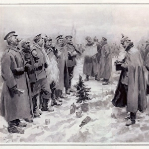
Greetings Card : A sketch map of the infamous Dardanelles Operations and Gallipoli Campaign


![]()
Cards from Mary Evans Picture Library
A sketch map of the infamous Dardanelles Operations and Gallipoli Campaign
A sketch map of the infamous Dardanelles Operations and Gallipoli Campaign, an Allied expedition to gain control of the Dardanelles to open up a Black Sea route to Russia. Date: 1915
Mary Evans Picture Library makes available wonderful images created for people to enjoy over the centuries
Media ID 20952827
© Mary Evans Picture Library
Allied Campaign Control Dardanelles Gain Gallipoli Infamous Operations Route
Greetings Card (7"x5")
Step back in time with our commemorative greeting cards from Media Storehouse. This thoughtful design features a captivating sketch map of the Dardanelles Operations and Gallipoli Campaign from Mary Evans Prints Online. Dated 1915, this evocative image takes you back to the infamous Allied expedition to gain control of the Dardanelles and open up a Black Sea route to Russia. Perfect for history enthusiasts or anyone looking to send a unique and meaningful message, this card is sure to leave a lasting impression.
Folded Greeting Cards (12.5x17.5 cm) have a laminate finish and are supplied with an envelope. The front and inside can be personalised with text in a selection of fonts, layouts and colours.
Greetings Cards suitable for Birthdays, Weddings, Anniversaries, Graduations, Thank You and much more
Estimated Product Size is 17.5cm x 12.5cm (6.9" x 4.9")
These are individually made so all sizes are approximate
Artwork printed orientated as per the preview above, with landscape (horizontal) or portrait (vertical) orientation to match the source image.
FEATURES IN THESE COLLECTIONS
> Asia
> Turkey
> Related Images
> Europe
> Russia
> Related Images
> Historic
> World War I and II
> Historical events
> Maps and Charts
> Related Images
> Maps and Charts
> World
> Mary Evans Prints Online
> New Images May
EDITORS COMMENTS
This evocative sketch map from 1915 offers a glimpse into the complex and infamous Dardanelles Operations and Gallipoli Campaign during the First World War. The Allied powers, determined to open up a Black Sea route to Russia and undermine the Central Powers' control, launched an expedition to seize the strategic Dardanelles straits. The campaign began with the failed attempt to force the Dardanelles by naval bombardment, followed by an unsuccessful amphibious assault on the Gallipoli peninsula. The map illustrates the key locations of the ensuing eight-month-long stalemate, including the beaches where the Allied troops landed, the trenches and fortifications that marked the front lines, and the critical heights that changed hands numerous times. The map also highlights the important naval bases and fortifications on both sides, underscoring the naval nature of the campaign. The brutal and costly battle finally ended in December 1915 with the Allied withdrawal, leaving a profound impact on the course of the war and shaping the legacy of the Gallipoli Campaign as one of the most significant military campaigns in history.
MADE IN AUSTRALIA
Safe Shipping with 30 Day Money Back Guarantee
FREE PERSONALISATION*
We are proud to offer a range of customisation features including Personalised Captions, Color Filters and Picture Zoom Tools
SECURE PAYMENTS
We happily accept a wide range of payment options so you can pay for the things you need in the way that is most convenient for you
* Options may vary by product and licensing agreement. Zoomed Pictures can be adjusted in the Cart.