Home > Africa > Guinea > Maps
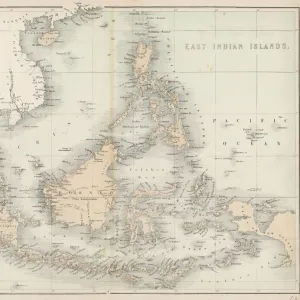
'Map, Afrique Occidentale; L'Ouest Africain, 1914. Creator: Unknown

![]()
Wall Art and Photo Gifts from Heritage Images
'Map, Afrique Occidentale; L'Ouest Africain, 1914. Creator: Unknown
'Map, Afrique Occidentale; L'Ouest Africain, 1914. From "Grande Geographie Bong Illustree", 1914
Heritage Images features heritage image collections
Media ID 36295115
© The Print Collector/Heritage Images
Atlantic Ocean Cartography Colonies Colony Gulf Gulf Of Guinea Map Making Mapmaking Ocean Scramble For Africa West Africa West African
FEATURES IN THESE COLLECTIONS
> Africa
> Guinea
> Related Images
> Maps and Charts
> British Empire Maps
EDITORS COMMENTS
This map print, titled 'Map, Afrique Occidentale; L'Ouest Africain' from the 1914 issue of 'Grande Geographie Bong Illustree,' showcases the West African region during the height of European colonialism. The map is a testament to the intense scramble for African territories by European powers, particularly Britain and France, in the early 20th century. The map's intricate details reveal the colonial boundaries of various countries, with British and French territories prominently marked. The Atlantic Ocean and the Gulf of Guinea are depicted with annotations indicating major ports and coastal features. The geographical features are rendered in rich colors and hues, adding to the visual appeal of the map. The map's creation during the 1910s, a period of intense colonial expansion, underscores the significance of cartography during this time. Mapmaking played a crucial role in the colonization process, allowing European powers to assert their control over new territories and facilitate the movement of resources and people. Despite the map's European origins, it also highlights the diverse cultural and geographical richness of West Africa. The map's title, 'Afrique Occidentale; L'Ouest Africain,' reflects the European perspective of the region, but it also underscores the interconnectedness of the world during this period. The map's creator remains unknown, but it is a valuable historical artifact that provides insights into the political and geographical landscape of West Africa during a pivotal moment in world history. This map print is a reminder of the complex and multifaceted nature of colonialism and the enduring impact it had on the world.
MADE IN AUSTRALIA
Safe Shipping with 30 Day Money Back Guarantee
FREE PERSONALISATION*
We are proud to offer a range of customisation features including Personalised Captions, Color Filters and Picture Zoom Tools
SECURE PAYMENTS
We happily accept a wide range of payment options so you can pay for the things you need in the way that is most convenient for you
* Options may vary by product and licensing agreement. Zoomed Pictures can be adjusted in the Cart.