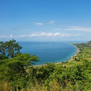
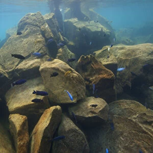
Home > Africa > Malawi > Lakes > Lake Nyasa
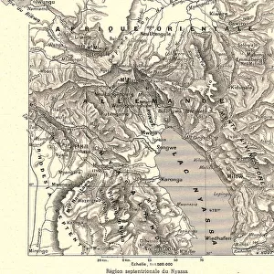
'Region septentrionale du Nyassa; Afrique Australe, 1914. Creator: Unknown

![]()
Wall Art and Photo Gifts from Heritage Images
'Region septentrionale du Nyassa; Afrique Australe, 1914. Creator: Unknown
'Region septentrionale du Nyassa; Afrique Australe, 1914. From "Grande Geographie Bong Illustree", 1914
Heritage Images features heritage image collections
Media ID 36296949
© The Print Collector/Heritage Images
Cartography East Africa Geological Map Map Making Mapmaking Nyasaland Lake Malawi Lake Nyasa
FEATURES IN THESE COLLECTIONS
> Africa
> Malawi
> Lakes
> Lake Nyasa
> Africa
> Malawi
> Lakes
> Related Images
> Africa
> Malawi
> Related Images
> Europe
> France
> Lakes
> Related Images
> Maps and Charts
> Geological Map
EDITORS COMMENTS
This vintage map print, titled "Region septentrionale du Nyassa; Afrique Australe" from the year 1914, showcases a geographical representation of the northern part of Lake Nyasa, also known as Lake Malawi, located in East Africa. The map was published in the renowned French geographical journal "Grande Geographie Illustree." The map is a testament to the cartographic advancements of the early 20th century, with intricate detailing of the region's geographical features, including the lake's shoreline, islands, and surrounding terrain. The map's color palette, with its earthy tones and muted hues, adds to its antique charm. The map's title translates to "Northern Region of Nyassa; Southern Africa," and during that time, the area was known as Nyasaland, which was a protectorate of the United Kingdom. The French interest in mapping this region could be attributed to the colonial expansion and exploration of Africa by European powers during the late 19th and early 20th centuries. The map's border is adorned with intricate illustrations of various African wildlife, including elephants, zebras, and giraffes, adding to the visual appeal of the print. The map's scale and detail make it an essential historical document for scholars, cartographers, and anyone interested in the history of Africa and its exploration. The print's provenance is unknown, but it serves as a reminder of the rich cartographic history and the exploration and discovery of new lands that characterized the early 20th century. This map print is a beautiful addition to any collection of vintage maps, Africana, or geographical memorabilia.
MADE IN AUSTRALIA
Safe Shipping with 30 Day Money Back Guarantee
FREE PERSONALISATION*
We are proud to offer a range of customisation features including Personalised Captions, Color Filters and Picture Zoom Tools
SECURE PAYMENTS
We happily accept a wide range of payment options so you can pay for the things you need in the way that is most convenient for you
* Options may vary by product and licensing agreement. Zoomed Pictures can be adjusted in the Cart.