Jigsaw Puzzle > Fine Art Storehouse > Map
Jigsaw Puzzle : Map of United States and Mexico 1897


![]()
Jigsaw Puzzles from Fine Art Storehouse
Map of United States and Mexico 1897
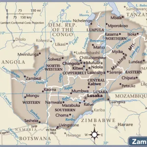
Map of United States and Mexico
Unleash your creativity and transform your space into a visual masterpiece!
THEPALMER
Media ID 13613727
© Roberto A Sanchez
Atlantic Ocean Backgrounds Dictionary Direction Grunge Grunge Image Technique Mexico Monoprint North America Sepia Toned Drawing Art Product Retro Styled
Jigsaw Puzzle (500 Pieces)
Discover the historical connection between the United States and Mexico with our captivating jigsaw puzzle from ThePalmer's "Map of United States and Mexico 1897" collection, available at Media Storehouse. This intricately detailed puzzle, brought to you from the Fine Art Storehouse, invites you to explore the geography and borders of the two nations as they were depicted over a century ago. Immerse yourself in a fun and educational experience as you piece together this beautiful and historic puzzle.
500 piece puzzles are custom made in Australia and hand-finished on 100% recycled 1.6mm thick laminated puzzle boards. There is a level of repetition in jigsaw shapes with each matching piece away from its pair. The completed puzzle measures 40x51cm and is delivered packaged in an attractive presentation box specially designed to fit most mail slots with a unique magnetic lid
Jigsaw Puzzles are an ideal gift for any occasion
Estimated Product Size is 50.7cm x 40.3cm (20" x 15.9")
These are individually made so all sizes are approximate
Artwork printed orientated as per the preview above, with landscape (horizontal) or portrait (vertical) orientation to match the source image.
FEATURES IN THESE COLLECTIONS
> Fine Art Storehouse
> The Magical World of Illustration
> Palmer Illustrated Collection
> Fine Art Storehouse
> Map
> Historical Maps
> Fine Art Storehouse
> Map
> USA Maps
EDITORS COMMENTS
This print titled "Map of United States and Mexico 1897" takes us on a journey back in time to explore the intricate details of cartography. With its retro styled, antique aesthetic, this engraved image transports us to an era where maps were meticulously crafted by hand. The illustration showcases the artistry involved in creating such maps, with etching and lithograph techniques bringing out every contour and line. The sepia toned color palette adds a touch of nostalgia, reminding us of the rich history these countries hold. As we study this map, we are reminded of the vastness and diversity that North America offers. From the Atlantic Ocean stretching along the eastern coast to cities dotting both sides of the border between USA and Mexico, it highlights how physical geography shapes our world. The attention to detail is remarkable; each city is carefully labeled, allowing us to trace our fingers across borders as if exploring new territories ourselves. This piece serves as a reminder that even in today's digital age, there is something enchanting about holding a physical map in our hands. "The Map of United States and Mexico 1897" by THEPALMER captures not only geographical information but also evokes a sense of wonderment for those who appreciate old-world craftsmanship. It invites us to reflect on how far we have come while honoring the artistry that came before us.
MADE IN AUSTRALIA
Safe Shipping with 30 Day Money Back Guarantee
FREE PERSONALISATION*
We are proud to offer a range of customisation features including Personalised Captions, Color Filters and Picture Zoom Tools
SECURE PAYMENTS
We happily accept a wide range of payment options so you can pay for the things you need in the way that is most convenient for you
* Options may vary by product and licensing agreement. Zoomed Pictures can be adjusted in the Cart.