Jigsaw Puzzle > Europe > France > Paris > Maps
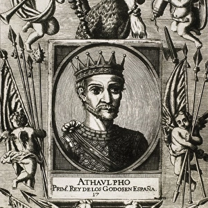
Jigsaw Puzzle : Europe physical map 1887


![]()
Jigsaw Puzzles from Fine Art Storehouse
Europe physical map 1887
Map from La Premiere Annee de Geographie par P. Foncin - Paris 1887
Unleash your creativity and transform your space into a visual masterpiece!
THEPALMER
Media ID 19834471
© 2014 Roberto Adrian Photography
Jigsaw Puzzle (500 Pieces)
Discover the rich history of Europe with our captivating jigsaw puzzle from Media Storehouse, featuring the intricately detailed "Europe Physical Map 1887" by THEPALMER from Fine Art Storehouse. This vintage map, hailing from La Premiere Annee de Geographie par P. Foncin - Paris 1887, invites you on a journey back in time. With its intricate borders and classic cartography, this puzzle is a delightful challenge for puzzle enthusiasts and history buffs alike. Engage your mind, exercise your problem-solving skills, and bring a piece of the past into your home with this exquisite jigsaw puzzle.
500 piece puzzles are custom made in Australia and hand-finished on 100% recycled 1.6mm thick laminated puzzle boards. There is a level of repetition in jigsaw shapes with each matching piece away from its pair. The completed puzzle measures 40x51cm and is delivered packaged in an attractive presentation box specially designed to fit most mail slots with a unique magnetic lid
Jigsaw Puzzles are an ideal gift for any occasion
Estimated Product Size is 50.7cm x 40.3cm (20" x 15.9")
These are individually made so all sizes are approximate
Artwork printed orientated as per the preview above, with landscape (horizontal) or portrait (vertical) orientation to match the source image.
FEATURES IN THESE COLLECTIONS
> Fine Art Storehouse
> Map
> Historical Maps
> Europe
> France
> Paris
> Maps
> Europe
> Related Images
> Maps and Charts
> Related Images
EDITORS COMMENTS
This print showcases a remarkable piece of history - the Europe physical map from 1887. A true gem for geography enthusiasts and history buffs alike, this map is a testament to the meticulous craftsmanship of its time. The fine details and intricate design are beautifully preserved in this high-quality print by THEPALMER, available exclusively at Fine Art Storehouse. As we gaze upon this vintage map, we are transported back to an era where exploration and discovery were at their peak. Every contour of Europe's diverse landscape comes alive through vibrant colors and precise cartographic techniques. From the majestic Alps to the vast plains of Russia, each region is meticulously labeled with cities, rivers, mountains, and borders. The significance of this historical artifact cannot be overstated. It not only serves as a visual representation of Europe's physical features but also offers valuable insights into how our understanding of geography has evolved over time. This particular edition was published in Paris in 1887 as part of "La Premiere Annee de Geographie" by P. Foncin. Whether you're an avid traveler or simply appreciate the beauty found within maps, this stunning print will make a striking addition to any space. Let it ignite your curiosity about European landscapes past and present while adding a touch of vintage charm to your home or office décor.
MADE IN AUSTRALIA
Safe Shipping with 30 Day Money Back Guarantee
FREE PERSONALISATION*
We are proud to offer a range of customisation features including Personalised Captions, Color Filters and Picture Zoom Tools
SECURE PAYMENTS
We happily accept a wide range of payment options so you can pay for the things you need in the way that is most convenient for you
* Options may vary by product and licensing agreement. Zoomed Pictures can be adjusted in the Cart.