Jigsaw Puzzle > Europe > Russia > Maps
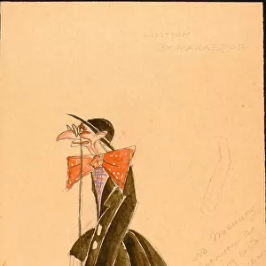
Jigsaw Puzzle : Map of Muscovy by Ptolemy (Octava Europe Tabula). Artist: Anonymous master
. Artist: Anonymous master")
. Artist: Anonymous master")


![]()
Jigsaw Puzzles from Heritage Images
Map of Muscovy by Ptolemy (Octava Europe Tabula). Artist: Anonymous master
Map of Muscovy by Ptolemy (Octava Europe Tabula). Private Collection
Heritage Images features heritage image collections
Media ID 15022236
© Fine Art Images
Anonymous Master Cartography Claudius Ptolemaeus Claudius Ptolemy Early Rus Grand Duchy Of Moscow History Of Russia Maps Moscow Principality Muscovy Ptolemy Russian History Ptolemaeus
Jigsaw Puzzle (500 Pieces)
Discover the rich history and intrigue of old maps with our exquisite collection of jigsaw puzzles from Media Storehouse. This puzzle, featuring the "Map of Muscovy by Ptolemy (Octava Europe Tabula)" is a true masterpiece. Originating from a private collection, this ancient map, created by the renowned cartographer Ptolemy, showcases the geographical knowledge of the time, with detailed depictions of Muscovy and its surrounding regions. Assemble this puzzle to bring the mysteries of the past into your home, providing hours of engaging and rewarding entertainment for puzzle enthusiasts and history buffs alike.
500 piece puzzles are custom made in Australia and hand-finished on 100% recycled 1.6mm thick laminated puzzle boards. There is a level of repetition in jigsaw shapes with each matching piece away from its pair. The completed puzzle measures 40x51cm and is delivered packaged in an attractive presentation box specially designed to fit most mail slots with a unique magnetic lid
Jigsaw Puzzles are an ideal gift for any occasion
Estimated Product Size is 50.7cm x 40.3cm (20" x 15.9")
These are individually made so all sizes are approximate
Artwork printed orientated as per the preview above, with landscape (horizontal) or portrait (vertical) orientation to match the source image.
FEATURES IN THESE COLLECTIONS
> Europe
> Russia
> Related Images
> Maps and Charts
> Early Maps
> Maps and Charts
> Related Images
EDITORS COMMENTS
This print showcases the "Map of Muscovy by Ptolemy (Octava Europe Tabula)" created by an anonymous master. The map, which is part of a private collection, offers a fascinating glimpse into Russian history and the early Rus period. The intricate woodcut design highlights the Moscow Principality and the Grand Duchy of Moscow during this era. It provides valuable insights into how these regions were perceived geographically at that time. Claudius Ptolemy, a renowned cartographer from ancient Greece, is credited with creating this map. His expertise in geography and cartography allowed him to accurately depict various parts of Europe, including Muscovy. This fine art image not only serves as a historical document but also showcases the skill and craftsmanship of the anonymous master who brought Ptolemy's vision to life through their woodcut technique. As we delve into Russian history through this remarkable piece, it becomes evident that maps are not merely tools for navigation but windows into our past. They enable us to understand how societies evolved over time and provide invaluable context for studying different cultures.
MADE IN AUSTRALIA
Safe Shipping with 30 Day Money Back Guarantee
FREE PERSONALISATION*
We are proud to offer a range of customisation features including Personalised Captions, Color Filters and Picture Zoom Tools
SECURE PAYMENTS
We happily accept a wide range of payment options so you can pay for the things you need in the way that is most convenient for you
* Options may vary by product and licensing agreement. Zoomed Pictures can be adjusted in the Cart.