Jigsaw Puzzle > Africa > Egypt > Maps
Jigsaw Puzzle : MAP / AFRICA / EGYPT / COAST


![]()
Jigsaw Puzzles from Mary Evans Picture Library
MAP / AFRICA / EGYPT / COAST
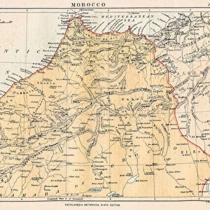
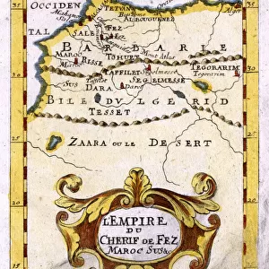
Map of Egypt: the coastline near Alexandria, at the time of the Battle of the Nile (1 August 1798) Date: 1798
Mary Evans Picture Library makes available wonderful images created for people to enjoy over the centuries
Media ID 20155191
© Bubblepunk
1798 Alexandria Coastline Maps Nile
Jigsaw Puzzle (500 Pieces)
Discover the rich history and culture of ancient Egypt with our captivating jigsaw puzzle from Media Storehouse, featuring a detailed map of Egypt's coastline near Alexandria. This intriguing puzzle, sourced from Mary Evans Prints Online, takes you back in time to the Battle of the Nile in 1798. Immerse yourself in the intricacies of this 500-piece puzzle, perfect for history enthusiasts and puzzle lovers alike. Get ready to embark on an educational and entertaining journey, piecing together this stunning representation of Egypt's coastal landscape.
500 piece puzzles are custom made in Australia and hand-finished on 100% recycled 1.6mm thick laminated puzzle boards. There is a level of repetition in jigsaw shapes with each matching piece away from its pair. The completed puzzle measures 40x51cm and is delivered packaged in an attractive presentation box specially designed to fit most mail slots with a unique magnetic lid
Jigsaw Puzzles are an ideal gift for any occasion
Estimated Product Size is 50.7cm x 40.3cm (20" x 15.9")
These are individually made so all sizes are approximate
Artwork printed orientated as per the preview above, with landscape (horizontal) or portrait (vertical) orientation to match the source image.
FEATURES IN THESE COLLECTIONS
> Africa
> Egypt
> Alexandria
> Africa
> Egypt
> Related Images
> Africa
> Related Images
> Historic
> Battles
> Related Images
> Maps and Charts
> Related Images
> Mary Evans Prints Online
> Egypt
> Mary Evans Prints Online
> New Images July 2020
EDITORS COMMENTS
This map print depicts the coastline of Egypt, specifically the area around Alexandria, during the historic time of the Battle of the Nile on August 1, 1798. The map, dated 1798, provides a detailed view of the Egyptian coast, with the delta region and the Nile River prominently featured. The Battle of the Nile was a pivotal moment in the Napoleonic Wars, as it marked the decisive defeat of the French Navy under the command of Napoleon Bonaparte by the British Royal Navy, under Admiral Horatio Nelson. This naval battle took place in the waters off the Egyptian coast, preventing the French troops from reinforcing their army in Egypt and ultimately leading to the withdrawal of the French forces from the region. The map serves as a fascinating historical artifact, offering a glimpse into the geography of the region during a time of great significance in world history. The intricate details of the map, from the labeled towns and landmarks to the precise depiction of the coastline, make it an essential resource for scholars, historians, and anyone with an interest in the history of Egypt and the wider world.
MADE IN AUSTRALIA
Safe Shipping with 30 Day Money Back Guarantee
FREE PERSONALISATION*
We are proud to offer a range of customisation features including Personalised Captions, Color Filters and Picture Zoom Tools
SECURE PAYMENTS
We happily accept a wide range of payment options so you can pay for the things you need in the way that is most convenient for you
* Options may vary by product and licensing agreement. Zoomed Pictures can be adjusted in the Cart.