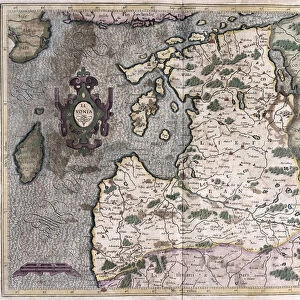
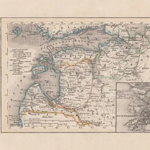
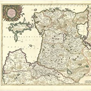
Map Ducatuum Livoniae et Curlandiae novissima tabula
Map, Ducatuum Livoniae et Curlandiae novissima tabula in quibus sunt Estonia Litlandia et aliae minores provinciae per Justum Danckerts Amstelodami, Justus Danckerts (1635-1701), Copperplate print
Liszt Collection of nineteenth-century engravings and images to browse and enjoy
MADE IN AUSTRALIA Safe Shipping with 30 Day Money Back Guarantee
FREE PERSONALISATION* We are proud to offer a range of customisation features including Personalised Captions, Color Filters and Picture Zoom Tools
SECURE PAYMENTS We happily accept a wide range of payment options so you can pay for the things you need in the way that is most convenient for you
* Options may vary by product and licensing agreement. Zoomed Pictures can be adjusted in the Cart.
redeem
Beautiful Photo Prints and Gifts
image
Professionally Printed
thumb_up
Professional quality finish
diamond
Made with high-grade materials
inventory_2
Carefully packed to aid safe arrival
Related Images
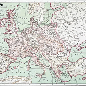
MAP OF EUROPE, c1812. A 19th century German map of Europe during the reign of Napoleon I
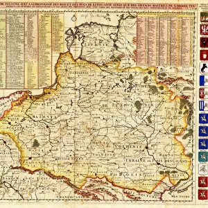
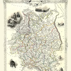
Map of Poland includes portions of Livonia and Grand Duchy of Moscow par Chatelain, Henri Abraham (1684-1743). Etching, watercolour, 1714, Private Collection
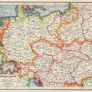
Map of Europe according to the Peace Treaties 1918 - 1924. From The Evolution of Modern Europe, 1453 - 1932, published 1933
Map of Estonia and Livonia - Anonymous master - 1745 - Copper engraving, watercolour - Academy of Sciences, Saint Petersburg
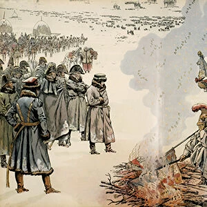
The Emperor of Russia relieving Poland, 1855. Creator: Cham (Amedé