Fraud Blocker Skip to main content

Home > Maps and Charts > France

France Collection (page 19)

France is a country located in Western Europe and has a total area of 643,801 square kilometers and a population of approximately 67 million people

11,167 items

Background imageFrance Collection: universal geography: department of the Haute Saone (70), beg of 20th century (lithograph)

universal geography: department of the Haute Saone (70), beg of 20th century (lithograph)
DUV5617982 universal geography: department of the Haute Saone (70), beg of 20th century (lithograph); 9,5x6,5 cm; (add.info.: advertising images for the brand Louit.); Photo © Duvallon

Background imageFrance Collection: Admiral in the French Navy, 1844 (print)

Admiral in the French Navy, 1844 (print)
5912650 Admiral in the French Navy, 1844 (print); (add.info.: Uniform of an admiral or amiral in the French Navy, 1844. Handcoloured woodblock print by Pauquet after Andre Castan from Eugene Panini's)

Background imageFrance Collection: Plan of the positions of the Franco-Spanish fleets at the start of the Battle of Trafalgar (1805)

Plan of the positions of the Franco-Spanish fleets at the start of the Battle of Trafalgar (1805)
MMM5482391 Plan of the positions of the Franco-Spanish fleets at the start of the Battle of Trafalgar (1805). 19th century watercolor.; National Maritime Museum, London

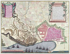
Background imageFrance Collection: Map of the Siege of Barcelona in April 1706 (colour litho)

Map of the Siege of Barcelona in April 1706 (colour litho)
6317519 Map of the Siege of Barcelona in April 1706 (colour litho) by English School, (18th century); (add.info.: Print by Pieter van Call after a work by Alexander Forbes.); Photo © Ken Welsh

Background imageFrance Collection: 17th century View of the city of Nancy, France showing the walled city

17th century View of the city of Nancy, France showing the walled city
5304740 17th century View of the city of Nancy, France showing the walled city.; (add.info.: 17th century View of the city of Nancy, France showing the walled city.); Universal History Archive/UIG

Background imageFrance Collection: Map of the railway from Paris to Saint Germain by Perrot. Benoit Paul Emile CLAPEYRON (1799-1864)

Map of the railway from Paris to Saint Germain by Perrot. Benoit Paul Emile CLAPEYRON (1799-1864)
XEE5028713 Map of the railway from Paris to Saint Germain by Perrot. Benoit Paul Emile CLAPEYRON (1799-1864) He was one of the main promoters of the railway from Paris to Saint-Germain; (add.info)

Background imageFrance Collection: Geography Atlas: representation of the island of Santo Domingo in the West Indies

Geography Atlas: representation of the island of Santo Domingo in the West Indies. Map from an atlas by J. B

VEN5031350 Geography Atlas: representation of the island of Santo Domingo in the West Indies. Map from an atlas by J. B. Poirson (1761-1831), French geographer, 1803

Background imageFrance Collection: Postcard, in Colors, 1915_4_10: War of 14 -18, Card back: ' Le 10/04/15

Postcard, in Colors, 1915_4_10: War of 14 -18, Card back: " Le 10/04/15
ICA4942916 Postcard, in Colors, 1915_4_10: War of 14 -18, Card back: " Le 10/04/15. I send you this map of the Hautes Cimes des Vosges a memory of this cursed war that I hope will end soon

Background imageFrance Collection: Map of France at the times of king Charles V (Map of France at the times of king Charles V)

Map of France at the times of king Charles V (Map of France at the times of king Charles V)
ELD4930341 Map of France at the times of king Charles V (Map of France at the times of king Charles V) Plate from Houze's "Atlas Universel"

Background imageFrance Collection: Map of France under King Henry III between 1547 and 1589 (Map of France at the times of king Henry)

Map of France under King Henry III between 1547 and 1589 (Map of France at the times of king Henry III)
ELD4930178 Map of France under King Henry III between 1547 and 1589 (Map of France at the times of king Henry III) Plate from Houze's "Atlas Universel"

Background imageFrance Collection: Map of France under King Louis XIII between 1589 and 1643 (Map of France at the times of king)

Map of France under King Louis XIII between 1589 and 1643 (Map of France at the times of king Louis XIII)
ELD4930158 Map of France under King Louis XIII between 1589 and 1643 (Map of France at the times of king Louis XIII) Plate from Houze's "Atlas Universel"

Background imageFrance Collection: France: genre scene showing a bourgeois girl being read the future by maps, 1865

France: genre scene showing a bourgeois girl being read the future by maps, 1865
LUX4817873 France: genre scene showing a bourgeois girl being read the future by maps, 1865; (add.info.: France: genre scene showing a bourgeois girl being read the future by maps)

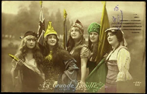
Background imageFrance Collection: First World War: Patriotic Map showing five young women representing the Allied countries in their

First World War: Patriotic Map showing five young women representing the Allied countries in their symbolic dress
LUX4745083 First World War: Patriotic Map showing five young women representing the Allied countries in their symbolic dress, 1915

Background imageFrance Collection: First World War: Patriotic map showing a soldier brought back in an ambulance

First World War: Patriotic map showing a soldier brought back in an ambulance and titled a wounded officer, 1916
LUX4744783 First World War: Patriotic map showing a soldier brought back in an ambulance and titled a wounded officer, 1916; (add.info.: World War I - War 14-18 (1914-1918) - World War I (WWI or WW1)

Background imageFrance Collection: First World War: Patriotic map showing an Alsatian who thinks of the French soldier coming to

First World War: Patriotic map showing an Alsatian who thinks of the French soldier coming to the Delivre with their
LUX4744772 First World War: Patriotic map showing an Alsatian who thinks of the French soldier coming to the Delivre with their troops and aircraft

Background imageFrance Collection: First World War: Patriotic map showing a soldier on leave joining his fiance with a bouquet of

First World War: Patriotic map showing a soldier on leave joining his fiance with a bouquet of flowers, 1917
LUX4745299 First World War: Patriotic map showing a soldier on leave joining his fiance with a bouquet of flowers, 1917; (add.info.: World War I - War 14-18 (1914-1918) - World War I (WWI or WW1)

Background imageFrance Collection: First World War: Patriotic map showing a soldier arms comfortably at a table in his trench

First World War: Patriotic map showing a soldier arms comfortably at a table in his trench and waiting patiently
LUX4745269 First World War: Patriotic map showing a soldier arms comfortably at a table in his trench and waiting patiently and tiredly for the end of the war by declaring

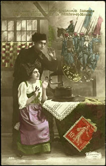
Background imageFrance Collection: First World War: Patriotic Map showing a couple of Alsatian listening to a gramophone Samber

First World War: Patriotic Map showing a couple of Alsatian listening to a gramophone Samber and Meuse music, 1916
LUX4744624 First World War: Patriotic Map showing a couple of Alsatian listening to a gramophone Samber and Meuse music, 1916; (add.info)

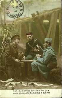
Background imageFrance Collection: First World War: Patriotic map showing in a buccolic trench an English

First World War: Patriotic map showing in a buccolic trench an English and Belgian French soldier playing the map
LUX4744615 First World War: Patriotic map showing in a buccolic trench an English and Belgian French soldier playing the map between battles

Background imageFrance Collection: First World War: Patriotic map showing a soldier on leave and his fiance looking out the window a

First World War: Patriotic map showing a soldier on leave and his fiance looking out the window a Zeppelin hunted by
LUX4745197 First World War: Patriotic map showing a soldier on leave and his fiance looking out the window a Zeppelin hunted by spotlights and the DCA, 1916

Background imageFrance Collection: Patriotic map showing France with an olive branch thinking of the statue of the triumph arch

Patriotic map showing France with an olive branch thinking of the statue of the triumph arch representing
LUX4743873 Patriotic map showing France with an olive branch thinking of the statue of the triumph arch representing the Marseillaise and titled France has its victorious heros

Background imageFrance Collection: Patriotic Map Celebrating the Capture of Mulhouse, 1914

Patriotic Map Celebrating the Capture of Mulhouse, 1914
LUX4743645 Patriotic Map Celebrating the Capture of Mulhouse, 1914; (add.info.: Patriotic Map Celebrating the Capture of Mulhouse, 1914); Photo © Lux-in-Fine

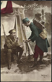
Background imageFrance Collection: Patriotic map showing a French soldier giving tobacco to an English soldier smoking the pipe

Patriotic map showing a French soldier giving tobacco to an English soldier smoking the pipe
LUX4743611 Patriotic map showing a French soldier giving tobacco to an English soldier smoking the pipe and titled "cordial accord"

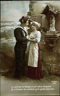
Background imageFrance Collection: Patriotic map showing a couple of sailors praying to the Virgin of Brittany before the start of

Patriotic map showing a couple of sailors praying to the Virgin of Brittany before the start of battle, 1915
LUX4743552 Patriotic map showing a couple of sailors praying to the Virgin of Brittany before the start of battle, 1915; (add.info)

Background imageFrance Collection: Patriotic map showing a little boy thinks of his father fighting for France with a sword

Patriotic map showing a little boy thinks of his father fighting for France with a sword and sending him a map, 1914
LUX4743394 Patriotic map showing a little boy thinks of his father fighting for France with a sword and sending him a map

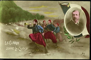
Background imageFrance Collection: First World War: Patriotic map showing the medallion effigy of Paul Deroulede surrounds soldiers

First World War: Patriotic map showing the medallion effigy of Paul Deroulede surrounds soldiers sounding the charge in
LUX4744877 First World War: Patriotic map showing the medallion effigy of Paul Deroulede surrounds soldiers sounding the charge in honor of his poem: 'The bugle sounds the charge'

Background imageFrance Collection: First World War: Patriotic map showing in a tricolor basket a lucky cat, 1915, 'I bring happiness'

First World War: Patriotic map showing in a tricolor basket a lucky cat, 1915, 'I bring happiness'
LUX4745340 First World War: Patriotic map showing in a tricolor basket a lucky cat, 1915, 'I bring happiness'; (add.info.: World War I - War 14-18 (1914-1918) - World War I (WWI or WW1)

Background imageFrance Collection: First World War: Patriotic map showing an English soldier at the front

First World War: Patriotic map showing an English soldier at the front and titled Glory to our Ally, 1916
LUX4744763 First World War: Patriotic map showing an English soldier at the front and titled Glory to our Ally, 1916; (add.info.: World War I - War 14-18 (1914-1918) - World War I (WWI or WW1)

Background imageFrance Collection: First World War: Patriotic Map showing two French sailors in uniform to go to battle declaring

First World War: Patriotic Map showing two French sailors in uniform to go to battle declaring
LUX4745238 First World War: Patriotic Map showing two French sailors in uniform to go to battle declaring: 'the squadron is waiting for us below, high hearts are going to fight'

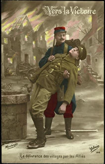
Background imageFrance Collection: First World War: Patriotic Map showing a French soldier rescuing a Belgian soldier during a battle

First World War: Patriotic Map showing a French soldier rescuing a Belgian soldier during a battle in a village, 1914
LUX4744522 First World War: Patriotic Map showing a French soldier rescuing a Belgian soldier during a battle in a village, 1914

Background imageFrance Collection: First World War: Patriotic map showing a traveler pigeon wearing a fold in a tricolor ribbon

First World War: Patriotic map showing a traveler pigeon wearing a fold in a tricolor ribbon
LUX4745096 First World War: Patriotic map showing a traveler pigeon wearing a fold in a tricolor ribbon, entitled 'Messenger of Love and Glory'

Background imageFrance Collection: First World War: Patriotic map showing the republicizing victory for 1915, 1915

First World War: Patriotic map showing the republicizing victory for 1915, 1915
LUX4744473 First World War: Patriotic map showing the republicizing victory for 1915, 1915; (add.info.: World War I - War 14-18 (1914-1918) - World War I (WWI or WW1)

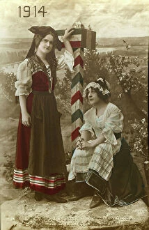
Background imageFrance Collection: First World War: Patriotic map showing a young Lorraine and a young Alsatian in local costume

First World War: Patriotic map showing a young Lorraine and a young Alsatian in local costume eagerly awaiting
LUX4744376 First World War: Patriotic map showing a young Lorraine and a young Alsatian in local costume eagerly awaiting the arrival of the French

Background imageFrance Collection: First World War: Patriotic map showing in a medallion an Alsatian in traditional dress

First World War: Patriotic map showing in a medallion an Alsatian in traditional dress
LUX4744309 First World War: Patriotic map showing in a medallion an Alsatian in traditional dress and in a headdress behind a French flag, 1915

Background imageFrance Collection: First World War: Patriotic map showing a soldier in uniform telling during a leave a story of

First World War: Patriotic map showing a soldier in uniform telling during a leave a story of these battles, 1915
LUX4744243 First World War: Patriotic map showing a soldier in uniform telling during a leave a story of these battles, 1915

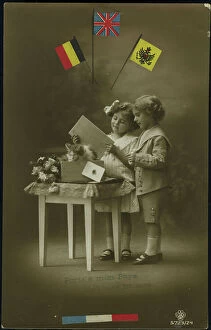
Background imageFrance Collection: First World War: Patriotic map showing a little boy and a little girl sends to their father at

First World War: Patriotic map showing a little boy and a little girl sends to their father at the forehead a wooden
LUX4744189 First World War: Patriotic map showing a little boy and a little girl sends to their father at the forehead a wooden crate with a card and kitten

Background imageFrance Collection: First World War: Patriotic map showing the image of a relief gun an artillery scene

First World War: Patriotic map showing the image of a relief gun an artillery scene
LUX4744140 First World War: Patriotic map showing the image of a relief gun an artillery scene and titled Remembrance of the 57th Infantry Regiment

Background imageFrance Collection: First World War: Patriotic Map showing the arrival of the hairy on leave by train

First World War: Patriotic Map showing the arrival of the hairy on leave by train and titled en Vitesse, 1918
LUX4744135 First World War: Patriotic Map showing the arrival of the hairy on leave by train and titled en Vitesse, 1918; (add.info.: World War I - War 14-18 (1914-1918) - World War I (WWI or WW1)

Background imageFrance Collection: First World War: Patriotic map showing a little girl praying in front of the photograph of her

First World War: Patriotic map showing a little girl praying in front of the photograph of her father in uniform
LUX4744120 First World War: Patriotic map showing a little girl praying in front of the photograph of her father in uniform hanging on the wall

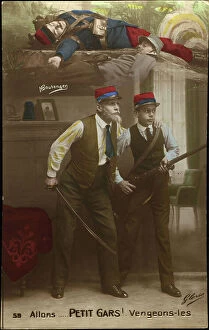
Background imageFrance Collection: First World War: Patriotic map showing a grandfather driving his grandson to avenge the French

First World War: Patriotic map showing a grandfather driving his grandson to avenge the French soldiers who died in
LUX4744067 First World War: Patriotic map showing a grandfather driving his grandson to avenge the French soldiers who died in battle and titled Alons Petity Guy Venges Them, 1915

Background imageFrance Collection: First World War: Patriotic Map showing a soldier rising the war

First World War: Patriotic Map showing a soldier rising the war and titled Remembrance of the 63rd Infantry Regiment
LUX4744042 First World War: Patriotic Map showing a soldier rising the war and titled Remembrance of the 63rd Infantry Regiment and with the names of the campaigns carried out

Background imageFrance Collection: Patriotic map showing France advising a soldier in uniform and titled Victory Inspiration, 1915

Patriotic map showing France advising a soldier in uniform and titled Victory Inspiration, 1915
LUX4743880 Patriotic map showing France advising a soldier in uniform and titled Victory Inspiration, 1915; (add.info.: Patriotic map showing France advising a soldier in uniform)

Background imageFrance Collection: First World War: Patriotic map showing in a battlefield landscape scene glowing a sunrise with a

First World War: Patriotic map showing in a battlefield landscape scene glowing a sunrise with a soldier in uniform
LUX4743941 First World War: Patriotic map showing in a battlefield landscape scene glowing a sunrise with a soldier in uniform on guard and titled Dawn of Glory, 1915

Background imageFrance Collection: Plan of the Suez Canal (Egypt), with portraits of Ferdinand de Lesseps (1805-1894)

Plan of the Suez Canal (Egypt), with portraits of Ferdinand de Lesseps (1805-1894)
CSO4983168 Plan of the Suez Canal (Egypt), with portraits of Ferdinand de Lesseps (1805-1894), Ismail Pasha (1830-1895) Khedive of Egypt and Sudan

Background imageFrance Collection: Battle of Sedan, 1870. Map

Battle of Sedan, 1870. Map
7301610 Battle of Sedan, 1870. Map.; Private Collection; (add.info.: The Battle of Sedan 1 - 2 September 1870 during the Franco-Prussian War 1870 - 1871)

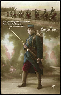
Background imageFrance Collection: First World War: France, Patriotic Map showing under a platoon of cyclists a soldier guarding with

First World War: France, Patriotic Map showing under a platoon of cyclists a soldier guarding with his rifle
LUX4740460 First World War: France, Patriotic Map showing under a platoon of cyclists a soldier guarding with his rifle and bayonet and titled "On the Front"

Background imageFrance Collection: Geographic map of the French Empire and Kingdom of Italy in 1809

Geographic map of the French Empire and Kingdom of Italy in 1809 (Map of french empire and kingdom of Italy)
ELD4925058 Geographic map of the French Empire and Kingdom of Italy in 1809 (Map of french empire and kingdom of Italy, 1809) Engraving from " Atlas Universel" by Houze

Background imageFrance Collection: Map of France at the times of King Philip I of France death, 1108 Engraving from ' Atlas

Map of France at the times of King Philip I of France death, 1108 Engraving from " Atlas Universel" by Houze
ELD4921663 Map of France at the times of King Philip I of France death, 1108 Engraving from " Atlas Universel" by Houze 1851 Private collection; (add.info)


All Professionally Made to Order for Quick Shipping


-

France Collection

France is a country located in Western Europe and has a total area of 643,801 square kilometers and a population of approximately 67 million people. The capital city is Paris, which is also the largest city in the country. France is known for its rich history, culture, cuisine, fashion and art and has diverse landscapes ranging from mountains to beaches and forests to vineyards. The economy is one of the largest in the world with major industries including tourism, agriculture, aerospace and technology. The country also has an extensive transportation network consisting of highways, railways and airports connecting it to other parts of Europe and beyond.
+

Our beautiful Wall Art and Photo Gifts include Framed Prints, Photo Prints, Poster Prints, Canvas Prints, Jigsaw Puzzles, Metal Prints and so much more

The France collection from Media Storehouse is a stunning array of wall art and framed prints featuring maps and charts of various regions in France. Our collection showcases the beauty of French geography, highlighting its diverse landscapes, cities, rivers, mountains, and coastlines. From vintage maps to contemporary designs, our collection offers a wide range of styles to suit any taste or decor. Each print is expertly crafted using high-quality materials that ensure longevity and durability. The prints are available in different sizes to fit any space or wall size. Whether you're looking for an eye-catching focal point for your living room or office or want to add some French charm to your bedroom or kitchen walls, the France collection has something for everyone. Our collection is perfect for anyone who loves France's rich history and culture or wants to bring a touch of French elegance into their home.
+

What are France (Maps and Charts) art prints?

France art prints are high-quality reproductions of historical maps and charts depicting various regions of France. These prints showcase the intricate details and artistic styles of cartographers from different eras, providing a unique glimpse into the country's rich history. These art prints are perfect for those who appreciate vintage aesthetics or have an interest in geography, history, or French culture. They can be used to decorate homes, offices, classrooms, or any space that could benefit from a touch of sophistication and intellectual curiosity. We offer a wide selection of France art prints in various sizes and formats to suit different preferences. You can choose between framed or unframed options depending on their needs. With our commitment to quality printing techniques using archival materials ensures that these art prints will last for years without fading or deteriorating over time.
+

What France (Maps and Charts) art prints can I buy from Media Storehouse?

We offer a wide variety of France Maps and Charts art prints that are perfect for adding a touch of sophistication to any room. These art prints feature detailed maps and charts depicting the geography, history, culture, and landmarks of France. Whether you're looking for vintage or contemporary designs, we have something to suit every taste. Some popular options include antique maps of Paris, historical charts detailing the French Revolution, colorful illustrations showcasing famous French cities like Marseille or Lyon, and intricate topographical maps highlighting the diverse landscapes of France. These high-quality art prints are available in various sizes and formats such as canvas prints or framed prints. They make great gifts for anyone who loves travel or is interested in French culture. With so many beautiful options to choose from at Media Storehouse, you're sure to find the perfect addition to your home decor collection.
+

How do I buy France (Maps and Charts) art prints?

To buy France art prints from Media Storehouse, you can browse our extensive collection of artwork online. Once you have found the print that you would like to purchase, simply add it to your cart and proceed to checkout. During the checkout process, you will be prompted to enter your shipping information and payment details. We offer a range of sizes for their art prints, so make sure to select the size that best fits your needs. Additionally, we offer various framing options if you would like your print framed before delivery. Once your order has been placed, Media Storehouse will carefully package and ship your artwork directly to you. Their high-quality printing process ensures that each print is produced with vibrant colors and sharp detail. Whether as a gift or for personal use in decorating your home or office space, buying France art prints from Media Storehouse is an easy way to add beautiful artwork inspired by French culture into any setting.
+

How much do France (Maps and Charts) art prints cost?

We offer a wide range of France art prints at varying prices. Our collection includes vintage maps, antique charts, and contemporary illustrations that capture the beauty and history of France. The cost of our art prints depends on various factors such as size, framing options, and printing materials. We use high-quality paper stock to ensure that our art prints are long-lasting and retain their vibrant colors for years to come. Our you can choose from different sizes ranging from small to large formats depending on their preferences. Our France art prints make great gifts for friends or family members who love travel or have an interest in geography. They also add character to any living space or office setting with their unique designs. The cost of our France art prints is reasonable considering the quality of our products. We strive to provide affordable yet exceptional artwork that meets the needs of all our customers without compromising on quality.
+

How will my France (Maps and Charts) art prints be delivered to me?

We take great care in ensuring that your France art prints are delivered to you safely and securely. We use high-quality packaging materials to protect your artwork during transit, so you can be sure that it will arrive in pristine condition. All of our art prints are carefully rolled and placed into a sturdy cardboard tube for shipping. This ensures that the print is protected from any damage or creases during transportation. The tube is then sealed with tape to prevent any moisture or dust from entering. Once your order has been dispatched, you will receive an email notification with tracking information so you can keep track of its progress. Our delivery partners are reliable and experienced in handling delicate items like art prints, so you can rest assured that your order is in good hands. We strive to provide a seamless delivery experience for all our customers, ensuring their satisfaction with every purchase they make through us.