Fraud Blocker Skip to main content

Home > Maps and Charts > Spain

Spain Collection (page 5)

Spain is a country located in southwestern Europe

1,431 items

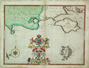
Background imageSpain Collection: The battle off the Isle of Wight on 4 August, 1588, c.1590 (coloured engraving)

The battle off the Isle of Wight on 4 August, 1588, c.1590 (coloured engraving)
7340031 The battle off the Isle of Wight on 4 August, 1588, c.1590 (coloured engraving) by Adams, Robert (1540-95) (after); 38x50 cm; National Maritime Museum, London

Background imageSpain Collection: St Augustine, 1588 (engraving)

St Augustine, 1588 (engraving)
7340020 St Augustine, 1588 (engraving) by Boazio, Baptista (fl.1588-1606); National Maritime Museum, London, UK; (add.info.: Creator)

Background imageSpain Collection: Coronadoes, South American Pacific coast, 1685 (manuscript)

Coronadoes, South American Pacific coast, 1685 (manuscript)
7339776 Coronadoes, South American Pacific coast, 1685 (manuscript) by Hack, William (17th Century); 40x50 cm; National Maritime Museum, London

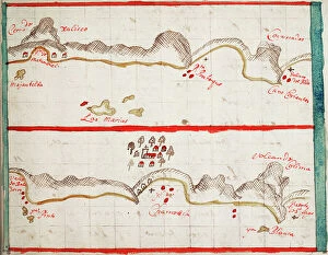
Background imageSpain Collection: Pisagoa and Yqueque, Chile, 1685 (manuscript)

Pisagoa and Yqueque, Chile, 1685 (manuscript)
7339764 Pisagoa and Yqueque, Chile, 1685 (manuscript) by Hack, William (17th Century); 41x50 cm; National Maritime Museum, London

Background imageSpain Collection: Lima, 1685 (bound sheet)

Lima, 1685 (bound sheet)
7339760 Lima, 1685 (bound sheet) by Hack, William (17th Century); 40x50 cm; National Maritime Museum, London, UK; (add.info.: Creator: William Hack South America, the Pacific Coast and Peru)

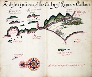
Background imageSpain Collection: Map of Lima and Callao, 1685 (bound sheet)

Map of Lima and Callao, 1685 (bound sheet)
7339759 Map of Lima and Callao, 1685 (bound sheet) by Hack, William (17th Century); 40x50 cm; National Maritime Museum, London, UK; (add.info.: Creator: William Hack South America)

Background imageSpain Collection: Views of Cerro Mongon, 1685 (bound sheet)

Views of Cerro Mongon, 1685 (bound sheet)
7339751 Views of Cerro Mongon, 1685 (bound sheet) by Hack, William (17th Century); 40x50 cm; National Maritime Museum, London, UK; (add.info.: Creator: William Hack South America)

Background imageSpain Collection: Truxilo, 1685 (bound sheet)

Truxilo, 1685 (bound sheet)
7339745 Truxilo, 1685 (bound sheet) by Hack, William (17th Century); 40x50 cm; National Maritime Museum, London, UK; (add.info.: Creator: William Hack South America, the Pacific Coast)

Background imageSpain Collection: Zana, 1685 (bound sheet)

Zana, 1685 (bound sheet)
7339740 Zana, 1685 (bound sheet) by Hack, William (17th Century); 40x50 cm; National Maritime Museum, London, UK; (add.info.: Creator: William Hack South America, the Pacific Coast and Peru)

Background imageSpain Collection: Malaca, 1685 (bound sheet)

Malaca, 1685 (bound sheet)
7339734 Malaca, 1685 (bound sheet) by Hack, William (17th Century); 40x50 cm; National Maritime Museum, London, UK; (add.info.: Creator: William Hack South America, the Pacific Coast, Peru)

Background imageSpain Collection: Guayaquil R, 1685 (bound sheet)

Guayaquil R, 1685 (bound sheet)
7339733 Guayaquil R, 1685 (bound sheet) by Hack, William (17th Century); 40x50 cm; National Maritime Museum, London, UK; (add.info.: Creator: William Hack South America, the Pacific Coast)

Background imageSpain Collection: Passao, 1685 (bound sheet)

Passao, 1685 (bound sheet)
7339726 Passao, 1685 (bound sheet) by Hack, William (17th Century); 40x50 cm; National Maritime Museum, London, UK; (add.info.: Creator: William Hack South America, the Pacific Coast)

Background imageSpain Collection: Coaque and Borrachos, 1685 (bound sheet)

Coaque and Borrachos, 1685 (bound sheet)
7339725 Coaque and Borrachos, 1685 (bound sheet) by Hack, William (17th Century); 40x50 cm; National Maritime Museum, London, UK; (add.info.: Creator: William Hack South America)

Background imageSpain Collection: Cojimies, 1685 (bound sheet)

Cojimies, 1685 (bound sheet)
7339724 Cojimies, 1685 (bound sheet) by Hack, William (17th Century); 40x50 cm; National Maritime Museum, London, UK; (add.info.: Creator: William Hack South America, the Pacific Coast and Ecuador)

Background imageSpain Collection: Manglares, Bahia de Ancon de Sardinas, 1685 (bound sheet)

Manglares, Bahia de Ancon de Sardinas, 1685 (bound sheet)
7339722 Manglares, Bahia de Ancon de Sardinas, 1685 (bound sheet) by Hack, William (17th Century); 40x50 cm; National Maritime Museum, London, UK; (add.info.: Creator: William Hack South America)

Background imageSpain Collection: Corientes, 1685 (bound sheet)

Corientes, 1685 (bound sheet)
7339720 Corientes, 1685 (bound sheet) by Hack, William (17th Century); 40x50 cm; National Maritime Museum, London, UK; (add.info.: Creator: William Hack South America, the Pacific Coast and Colombia)

Background imageSpain Collection: Bonaventura, 1685 (bound sheet)

Bonaventura, 1685 (bound sheet)
7339719 Bonaventura, 1685 (bound sheet) by Hack, William (17th Century); 40x50 cm; National Maritime Museum, London, UK; (add.info.: Creator: William Hack South America, the Pacific Coast)

Background imageSpain Collection: Anagadas, 1685 (bound sheet)

Anagadas, 1685 (bound sheet)
7339718 Anagadas, 1685 (bound sheet) by Hack, William (17th Century); 40x50 cm; National Maritime Museum, London, UK; (add.info.: Creator: William Hack South America, Pacific Coast)

Background imageSpain Collection: Garachine Views, 1685 (bound sheet)

Garachine Views, 1685 (bound sheet)
7339715 Garachine Views, 1685 (bound sheet) by Hack, William (17th Century); 40x50 cm; National Maritime Museum, London, UK; (add.info.: Creator: William Hack North America)

Background imageSpain Collection: The Bay of Chiriqui, 1685 (bound sheet)

The Bay of Chiriqui, 1685 (bound sheet)
7339703 The Bay of Chiriqui, 1685 (bound sheet) by Hack, William (17th Century); 40x50 cm; National Maritime Museum, London, UK; (add.info.: Creator: William Hack North America, the Pacific Coast)

Background imageSpain Collection: The High Land of Cape Guyones, 1685 (bound sheet)

The High Land of Cape Guyones, 1685 (bound sheet)
7339697 The High Land of Cape Guyones, 1685 (bound sheet) by Hack, William (17th Century); 40x50 cm; National Maritime Museum, London, UK; (add.info.: Creator: William Hack North America)

Background imageSpain Collection: Hill of Leon, 1685 (bound sheet)

Hill of Leon, 1685 (bound sheet)
7339694 Hill of Leon, 1685 (bound sheet) by Hack, William (17th Century); 40x50 cm; National Maritime Museum, London, UK; (add.info.: Creator: William Hack North America)

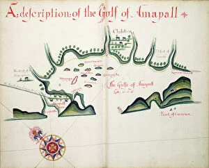
Background imageSpain Collection: A description of the Gulf of Ampall, 1685 (bound sheet)

A description of the Gulf of Ampall, 1685 (bound sheet)
7339689 A description of the Gulf of Ampall, 1685 (bound sheet) by Hack, William (17th Century); 40x50 cm; National Maritime Museum, London, UK; (add.info.: Creator: William Hack North America)

Background imageSpain Collection: Tonela and Moncalco, 1685 (bound sheet)

Tonela and Moncalco, 1685 (bound sheet)
7339685 Tonela and Moncalco, 1685 (bound sheet) by Hack, William (17th Century); 40x50 cm; National Maritime Museum, London, UK; (add.info.: Creator: William Hack North America, the Pacific Coast)

Background imageSpain Collection: A description of Guamalula & the Indians town, 1685 (bound sheet)

A description of Guamalula & the Indians town, 1685 (bound sheet)
7339675 A description of Guamalula & the Indians town, 1685 (bound sheet) by Hack, William (17th Century); 40x50 cm; National Maritime Museum, London

Background imageSpain Collection: Concepcion, 1682 (manuscript)

Concepcion, 1682 (manuscript)
7339610 Concepcion, 1682 (manuscript) by Ringrose, Basil (c.1653-83); 16x20 cm; National Maritime Museum, London, UK; (add.info.: Creator)

Background imageSpain Collection: Valparaiso, 1682 (manuscript)

Valparaiso, 1682 (manuscript)
7339609 Valparaiso, 1682 (manuscript) by Ringrose, Basil (c.1653-83); 16x20 cm; National Maritime Museum, London, UK; (add.info.: Creator)

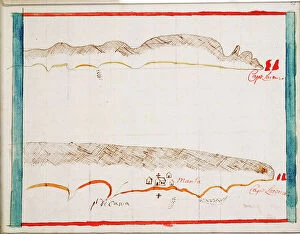
Background imageSpain Collection: Cabo San Lorenzo and Manta, 1682 (coloured manuscript)

Cabo San Lorenzo and Manta, 1682 (coloured manuscript)
7339603 Cabo San Lorenzo and Manta, 1682 (coloured manuscript) by Ringrose, Basil (c.1653-83); 16x20 cm; National Maritime Museum, London, UK; (add.info.: Creator: Basil Ringrose Bound sheet. Col)

Background imageSpain Collection: Map of El Viejo, 1682 (paper)

Map of El Viejo, 1682 (paper)
7339597 Map of El Viejo, 1682 (paper) by Ringrose, Basil (c.1653-83); 16x20 cm; National Maritime Museum, London, UK; (add.info.: Creator: Basil Ringrose The map also shows Nicaragua)

Background imageSpain Collection: Cabo Corrientes, Mexico, 1682 (coloured manuscript)

Cabo Corrientes, Mexico, 1682 (coloured manuscript)
7339595 Cabo Corrientes, Mexico, 1682 (coloured manuscript) by Ringrose, Basil (c.1653-83); 16x20 cm; National Maritime Museum, London

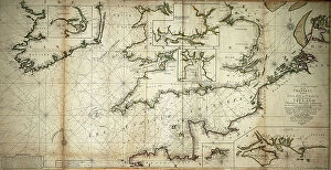
Background imageSpain Collection: A new and correct large draught of the Channell between England

A new and correct large draught of the Channell between England and France with the coast of Ireland St
7339560 A new and correct large draught of the Channell between England and France with the coast of Ireland St. Georges & Bristoll Channell and several of the most noteable harbours at large

Background imageSpain Collection: Chart plotting the routes from France and Spain, of the outward

Chart plotting the routes from France and Spain, of the outward and return voyages to the West Indies and East Indies
7339501 Chart plotting the routes from France and Spain, of the outward and return voyages to the West Indies and East Indies, with branches for different destinations, 1686 (engraving) by Val, P

Background imageSpain Collection: South China Sea, 1757 (engraving)

South China Sea, 1757 (engraving)
7339394 South China Sea, 1757 (engraving) by Spanish School, (18th century); 31.5x42 cm; National Maritime Museum, London, UK; (add.info.: Creator: Pedro Manuel de Arandia; Laur)

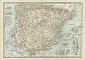
Background imageSpain Collection: Map of Spain with Portugal and Andorra, c.1900 (engraving)

Map of Spain with Portugal and Andorra, c.1900 (engraving)
532952 Map of Spain with Portugal and Andorra, c.1900 (engraving); (add.info.: Map of Spain with Portugal and Andorra, with insets of the Azores Islands, Canary Islands, and Madeira Island)

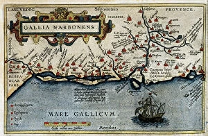
Background imageSpain Collection: Map of the Mediterranean French odds (Galia Narbonense), 1570 (engraving)

Map of the Mediterranean French odds (Galia Narbonense), 1570 (engraving)
AIS5366577 Map of the Mediterranean French odds (Galia Narbonense), 1570 (engraving); (add.info.: Strong water in colors, 1570, by Christophe Plantin (1514 or 1520-1589), Antwerp (Netherlands)

Background imageSpain Collection: Map of Callao & Lima, 1778 (print)

Map of Callao & Lima, 1778 (print)
7339807 Map of Callao & Lima, 1778 (print) by Surville, Luis de (fl.1777); 35x46 cm; National Maritime Museum, London, UK; (add.info.: Creator)

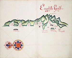
Background imageSpain Collection: English Gulf, South American Pacific Coast, 1685 (manuscript)

English Gulf, South American Pacific Coast, 1685 (manuscript)
7339777 English Gulf, South American Pacific Coast, 1685 (manuscript) by Hack, William (17th Century); 40x50 cm; National Maritime Museum, London

Background imageSpain Collection: Osorno and Carimapo, South American Pacific coast, 1685 (manuscript)

Osorno and Carimapo, South American Pacific coast, 1685 (manuscript)
7339775 Osorno and Carimapo, South American Pacific coast, 1685 (manuscript) by Hack, William (17th Century); 40x50 cm; National Maritime Museum, London

Background imageSpain Collection: Tirao [and] Tolten, 1685 (manuscript)

Tirao [and] Tolten, 1685 (manuscript)
7339774 Tirao [and] Tolten, 1685 (manuscript) by Hack, William (17th Century); 40.5x5 cm; National Maritime Museum, London

Background imageSpain Collection: Map of Chile compiled by Jesuits, 1646 (engraving)

Map of Chile compiled by Jesuits, 1646 (engraving)
7339494 Map of Chile compiled by Jesuits, 1646 (engraving) by Unknown Artist, (17th century); 35x46 cm; National Maritime Museum, London

Background imageSpain Collection: The track of the Armada around Britain and Ireland, 1590 (print, paper, engraving)

The track of the Armada around Britain and Ireland, 1590 (print, paper, engraving)
7340786 The track of the Armada around Britain and Ireland, 1590 (print, paper, engraving) by Adams, Robert (1540-95) (after); 54.5x79.5 cm; National Maritime Museum, London

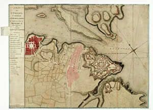
Background imageSpain Collection: A plan of St Philips Castle and fortifications in the island of Minorca, 1780 (paper)

A plan of St Philips Castle and fortifications in the island of Minorca, 1780 (paper)
7340466 A plan of St Philips Castle and fortifications in the island of Minorca, 1780 (paper) by Faden, William (1750-1836); 47.5x63 cm; National Maritime Museum, London

Background imageSpain Collection: Nieuwe pascaert, van de suyt syde van Yrlandt beginnende van Blasques tot ande Hoeck van Waterfoort

Nieuwe pascaert, van de suyt syde van Yrlandt beginnende van Blasques tot ande Hoeck van Waterfoort
7340067 Nieuwe pascaert, van de suyt syde van Yrlandt beginnende van Blasques tot ande Hoeck van Waterfoort. A chart bound in van Keulen's Great and Newly Enlarged Sea Atlas or Waterworld

Background imageSpain Collection: Pas-caert van de Canael, tusschen Engelandt en Vranckryck, van Pleymuyen tot an de Sorlinges

Pas-caert van de Canael, tusschen Engelandt en Vranckryck, van Pleymuyen tot an de Sorlinges
7340065 Pas-caert van de Canael, tusschen Engelandt en Vranckryck, van Pleymuyen tot an de Sorlinges, als mede van Portbimel tot aen Heyssant, 1682 (engraving) by Keulen

Background imageSpain Collection: Pas-caert van Texel tot aen de Hoofden, 1661 (print, paper)

Pas-caert van Texel tot aen de Hoofden, 1661 (print, paper)
7340060 Pas-caert van Texel tot aen de Hoofden, 1661 (print, paper) by Doncker, Hendrick (c.1626-99); 46.5x57.5 cm; National Maritime Museum, London

Background imageSpain Collection: A general chart of the northern navigation, 1675 (coloured engraving)

A general chart of the northern navigation, 1675 (coloured engraving)
7340043 A general chart of the northern navigation, 1675 (coloured engraving) by Seller, John (1632-97); 43.5x54 cm; National Maritime Museum, London

Background imageSpain Collection: El Viejo, 1682 (paper)

El Viejo, 1682 (paper)
7340748 El Viejo, 1682 (paper) by Ringrose, Basil (c.1653-83); 16x20 cm; National Maritime Museum, London, UK; (add.info.: Creator: Basil Ringrose From a book of sailing directions of 110ff)

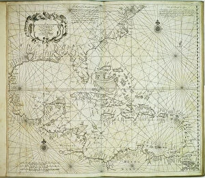
Background imageSpain Collection: The Carybsche Eylanden of Barbados to the bend of Mexico, 1656 (engraving)

The Carybsche Eylanden of Barbados to the bend of Mexico, 1656 (engraving)
7340058 The Carybsche Eylanden of Barbados to the bend of Mexico, 1656 (engraving) by Colom, Arnold (1624-68) & Colom, Jacob Aertsz (1600-73); 55x64 cm; National Maritime Museum, London


All Professionally Made to Order for Quick Shipping


-

Spain Collection

Spain is a country located in southwestern Europe, bordered by Portugal to the west and France to the northeast and has a population of approximately 47 million people and its capital city is Madrid. Spain's geography includes mountain ranges such as the Pyrenees and Sierra Nevada, as well as coastal regions along both the Mediterranean Sea and Atlantic Ocean. The country has a diverse economy with industries including tourism, agriculture, manufacturing, and services. Spain is known for its rich history and culture, including famous landmarks like La Sagrada Familia in Barcelona and flamenco dancing in Andalusia.
+

Our beautiful Wall Art and Photo Gifts include Framed Prints, Photo Prints, Poster Prints, Canvas Prints, Jigsaw Puzzles, Metal Prints and so much more

The Spain collection from Media Storehouse is a stunning assortment of wall art and framed prints that showcase the beauty, history, and culture of Spain. Our collection features an array of maps and charts that depict different regions, cities, landmarks, and historical events in Spain. These pieces are perfect for those who love to travel or have a passion for geography. From vintage-style maps to contemporary designs, the Spain collection offers something for everyone's taste. Each piece is printed on high-quality paper using archival inks to ensure long-lasting color vibrancy. The frames are made with premium materials such as wood or metal to provide durability while complementing the artwork. Whether you're looking for a unique gift or want to add some character to your home decor, our collection has plenty of options. With its rich history and diverse landscapes, Spain is truly a country worth exploring - let these beautiful maps and charts take you there.
+

What are Spain (Maps and Charts) art prints?

Spain art prints are a collection of high-quality, visually stunning prints that showcase the beauty and intricacies of Spain's geography. These prints feature detailed maps and charts that highlight the country's diverse regions, cities, landmarks, and topography. They are perfect for anyone who loves to explore new places or has an interest in history, geography or travel. These art prints are created using state-of-the-art printing technology on premium quality paper to ensure their longevity and durability. They come in various sizes to suit different preferences and can be framed or mounted according to individual taste. Whether you're looking for a unique piece of wall decor for your home or office space or want to gift someone with a special memento from Spain, these art prints offer something for everyone. With their intricate details and vibrant colors, they capture the essence of this beautiful country like no other medium can.
+

What Spain (Maps and Charts) art prints can I buy from Media Storehouse?

We offer a wide variety of Spain art prints for purchase. These prints range from vintage maps of Spain to modern charts depicting the country's geography, landmarks, and attractions. Some popular options include antique city plans of Madrid or Barcelona, detailed topographical maps highlighting the Pyrenees Mountains or Andalusian coastlines, and colorful illustrations showcasing Spanish culture such as flamenco dancing or bullfighting. In addition to traditional paper prints, Media Storehouse also offers canvas and framed options for many of their Spain pieces. You can choose from a range of sizes to fit their space needs, whether they are looking for a small accent piece or a large statement print. We provide an extensive selection of high-quality Spain art prints that cater to various tastes and preferences.
+

How do I buy Spain (Maps and Charts) art prints?

To buy Spain art prints from Media Storehouse, you can browse our extensive collection of artwork online. Simply search for "Spain Maps and Charts" in the search bar on our website to find a range of options available. Once you have found the print that you like, select the size and format that suits your needs. We offer a variety of printing options including canvas, framed prints, posters, and photographic prints. You can choose between different sizes as well as finishes such as gloss or matte. Once you have made your selection, add it to your cart and proceed to checkout where you will be prompted to enter your payment details. After completing the purchase process, your order will be processed by our team who will ensure that it is printed according to your specifications before being shipped out for delivery. Buying Spain art prints from Media Storehouse is an easy process with plenty of options available for customization so that you can get exactly what you want.
+

How much do Spain (Maps and Charts) art prints cost?

We offer a wide range of Spain art prints at varying prices. Our collection includes vintage maps, antique charts, and contemporary designs that capture the beauty and history of this fascinating country. The cost of our Spain art prints depends on various factors such as size, framing options, and printing materials. We use high-quality paper stock to ensure that our prints are long-lasting and vibrant in color. Our you can choose from different sizes ranging from small to large formats depending on their preferences. We also offer custom framing services for those who want to display their artwork in style. Our Spain art prints are perfect for home or office decor, gifts for friends or family members who love travel or history buffs interested in exploring the rich cultural heritage of Spain. With our extensive collection of Spain art prints available at affordable prices, you're sure to find something that suits your taste.
+

How will my Spain (Maps and Charts) art prints be delivered to me?

Your Spain art prints will be delivered to you in a secure and protective packaging. We take great care in ensuring that your artwork arrives at your doorstep in perfect condition. We use high-quality materials for our packaging to prevent any damage during transit. The delivery method may vary depending on your location and the size of the print(s). For smaller prints, we usually ship them via standard mail or courier service. Larger prints may require special handling and will be shipped using a different carrier. Once your order is dispatched, you will receive an email notification with tracking information so that you can monitor its progress until it reaches you. If there are any issues with delivery, please do not hesitate to contact us as we are always happy to assist our customers. Rest assured that your Spain art prints will be delivered safely and securely to your chosen address.