Fraud Blocker Skip to main content

Home > Maps and Charts > Turkey

Turkey Collection (page 2)

Turkey is a transcontinental country located in Southeast Europe and Southwest Asia and has a population of over 82 million people

525 items

Background imageTurkey Collection: Greece, the Peiraeus or Port Drako surveyed by Commander Thomas Graves, H.M.S

Greece, the Peiraeus or Port Drako surveyed by Commander Thomas Graves, H.M.S. Beacon 1840, 1843 (print)
7342578 Greece, the Peiraeus or Port Drako surveyed by Commander Thomas Graves, H.M.S. Beacon 1840, 1843 (print) by Walker, J. & C

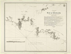
Background imageTurkey Collection: Chart of the Bay of Sighajik, 1819 (paper)

Chart of the Bay of Sighajik, 1819 (paper)
7340734 Chart of the Bay of Sighajik, 1819 (paper) by British School, (19th century); 66.8x50.5 cm; National Maritime Museum, London, UK; (add.info.: Creator: British Admiralty; J)

Background imageTurkey Collection: Chart of the Promontory of Boodroom with the Karabaghla Islands

Chart of the Promontory of Boodroom with the Karabaghla Islands and the North Point of the Island of Kos
7339475 Chart of the Promontory of Boodroom with the Karabaghla Islands and the North Point of the Island of Kos ... by Francis Beaufort F.R.S

Background imageTurkey Collection: Modern Turkey (litho)

Modern Turkey (litho)
8661150 Modern Turkey (litho) by English School, (20th century); Private Collection; (add.info.: Modern Turkey. The boundaries of the new Turkey were fixed by the Treaty of Lausanne, 1923)

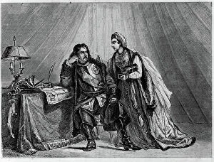
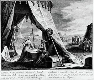
Background imageTurkey Collection: Peace of the Pruth (1711): Catherine Iere of Russia advises her wife Peter I the Great

Peace of the Pruth (1711): Catherine Iere of Russia advises her wife Peter I the Great, Emperor of Russia
XEE5032155 Peace of the Pruth (1711): Catherine Iere of Russia advises her wife Peter I the Great, Emperor of Russia, to sign the peace of Pruth in 1711 with the empire of Turkey; (add.info)

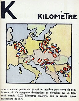
Background imageTurkey Collection: First World War 1914-1918 (14-18): Letter K as kilometre. Map of countries at war extending over

First World War 1914-1918 (14-18): Letter K as kilometre. Map of countries at war extending over 3000 km
DUV4201478 First World War 1914-1918 (14-18): Letter K as kilometre. Map of countries at war extending over 3000 km. Engraving in " Alphabet of the Great War 1914-1916

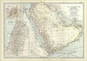
Background imageTurkey Collection: Map of Arabia with part of Turkey and Oman, c.1900 (engraving)

Map of Arabia with part of Turkey and Oman, c.1900 (engraving)
533009 Map of Arabia with part of Turkey and Oman, c.1900 (engraving); (add.info.: Map of Arabia, Turkey, Oman, Aden, with insets map of Jerusalem and Palestine, circa 1902)

Background imageTurkey Collection: Map of Turkey, c.1900 (engraving)

Map of Turkey, c.1900 (engraving)
533006 Map of Turkey, c.1900 (engraving); (add.info.: Map showing the historical boundaries of Turkey in Asia, circa 1902)

Background imageTurkey Collection: Map of the island of Santorini (Greece), 1420 (parchment)

Map of the island of Santorini (Greece), 1420 (parchment)
MMM5474136 Map of the island of Santorini (Greece), 1420 (parchment) by Buondelmonti, Cristoforo (1385-1430); National Maritime Museum, London

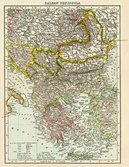
Background imageTurkey Collection: Map of the peninsula of the Balkans, (Bosnia, Serbia, Moldova, Hungary, Montenegro, Bulgaria)

Map of the peninsula of the Balkans, (Bosnia, Serbia, Moldova, Hungary, Montenegro, Bulgaria, Romania)
NWI4871491 Map of the peninsula of the Balkans, (Bosnia, Serbia, Moldova, Hungary, Montenegro, Bulgaria, Romania, Greece and Turkey), circa 1870

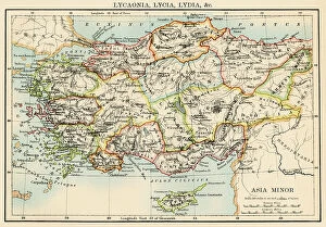
Background imageTurkey Collection: Map of the ancient regions of Asia Minor (present-day Anatolia, Turkey). 19th century lithography

Map of the ancient regions of Asia Minor (present-day Anatolia, Turkey). 19th century lithography
NWI4878395 Map of the ancient regions of Asia Minor (present-day Anatolia, Turkey). 19th century lithography.; (add.info.: Map of the ancient regions of Asia Minor (present-day Anatolia, Turkey)

Background imageTurkey Collection: Empire of Antiquity: Geographic map of ancient Greece and ancient colonies with the territories of

Empire of Antiquity: Geographic map of ancient Greece and ancient colonies with the territories of Asia Minor, Turkey
NWI4861853 Empire of Antiquity: Geographic map of ancient Greece and ancient colonies with the territories of Asia Minor, Turkey, Rhodes, Thrace, Peloponese and the Aegean Sea

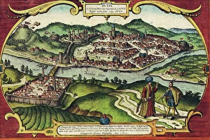
Background imageTurkey Collection: Buda, Hungary

Buda, Hungary
2901914 Buda, Hungary; (add.info.: City has status of - county; communities of Buda (right bank) - Pest (left) developed at important crossing point of the Danube; both were Roman settlements; both

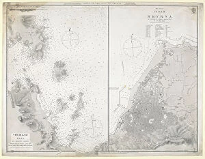
Background imageTurkey Collection: Chart of the ports in the Gulf of Smyrna, 1844-81 (paper)

Chart of the ports in the Gulf of Smyrna, 1844-81 (paper)
7340733 Chart of the ports in the Gulf of Smyrna, 1844-81 (paper) by Walker, J. & C. (19th century); 50.3x65 cm; National Maritime Museum, London, UK; (add.info.: Creator: British Admiralty; Lieut T)

Background imageTurkey Collection: Index chart to the following survey of the coast of Karamania, 1819 (engraving)

Index chart to the following survey of the coast of Karamania, 1819 (engraving)
7339425 Index chart to the following survey of the coast of Karamania, 1819 (engraving) by Beaufort, Francis (fl.1819); 60x75 cm; National Maritime Museum, London

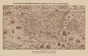
Background imageTurkey Collection: Port of Constantinople, 16th century (engraving)

Port of Constantinople, 16th century (engraving)
8663656 Port of Constantinople, 16th century (engraving) by German School, (16th century) (after); Private Collection; (add.info.: Port of Constantinople in the 16th century)

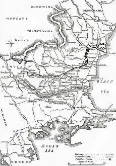
Background imageTurkey Collection: The Russo-Turkish War, 1877-78, map of the seat of war in Europe

The Russo-Turkish War, 1877-78, map of the seat of war in Europe
3062101 The Russo-Turkish War, 1877-78, map of the seat of war in Europe.; Private Collection; (add.info.: From The Century Edition of Cassell's History of England, published c. 1900)

Background imageTurkey Collection: Justus Danckers's atlas: Hungary and Greece, c.1688 (coloured engraving)

Justus Danckers's atlas: Hungary and Greece, c.1688 (coloured engraving)
7340066 Justus Danckers's atlas: Hungary and Greece, c.1688 (coloured engraving) by Danckertsz, Justus (1635-1701); 50x59 cm; National Maritime Museum, London

Background imageTurkey Collection: Turkey: Map of the Gulf of Smyrna (or Izmir) by Antonio Borg, 1760

Turkey: Map of the Gulf of Smyrna (or Izmir) by Antonio Borg, 1760
FGL5477315 Turkey: Map of the Gulf of Smyrna (or Izmir) by Antonio Borg, 1760; Fototeca Gilardi

Background imageTurkey Collection: 'Rhodes and Symi (Greek islands) facing the Turkish coast

'Rhodes and Symi (Greek islands) facing the Turkish coast
MMM5474179 'Rhodes and Symi (Greek islands) facing the Turkish coast; National Maritime Museum, London, UK; (add.info.: Rhodes and Symi (Greek islands) facing the Turkish coast

Background imageTurkey Collection: Geography Map of Asia Minor by Pierre Lapie 1816 Private Collection

Geography Map of Asia Minor by Pierre Lapie 1816 Private Collection
JAB5037396 Geography Map of Asia Minor by Pierre Lapie 1816 Private Collection; (add.info.: Geography Map of Asia Minor by Pierre Lapie 1816 Private Collection); Photo ©Jaime Abecasis

Background imageTurkey Collection: Greece, Chania, Crete: French Military Circle of Officers. On the wall the Map of Turkey

Greece, Chania, Crete: French Military Circle of Officers. On the wall the Map of Turkey, the Black Sea
LUX4765228 Greece, Chania, Crete: French Military Circle of Officers. On the wall the Map of Turkey, the Black Sea. Letter and Newspaper Sorting Lockers, 1908 - Officers of 122; (add.info.: Greece)

Background imageTurkey Collection: Map of Turkey showing telegraph cables and stations, 1881 (lithograph)

Map of Turkey showing telegraph cables and stations, 1881 (lithograph)
7339370 Map of Turkey showing telegraph cables and stations, 1881 (lithograph) by Unknown Artist, (19th century); 65x91 cm; National Maritime Museum, London

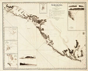
Background imageTurkey Collection: Karamania Chart III from Cape Karaboornoo to Cape Anamour, 1819 (engraving)

Karamania Chart III from Cape Karaboornoo to Cape Anamour, 1819 (engraving)
7339424 Karamania Chart III from Cape Karaboornoo to Cape Anamour, 1819 (engraving) by Beaufort, Francis (fl.1819); 60x75 cm; National Maritime Museum, London

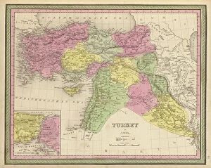
Background imageTurkey Collection: Turkey in Asia, 1849

Turkey in Asia, 1849
2902287 Turkey in Asia, 1849; (add.info.: Turkey in Asia, 1849.); Buyenlarge Archive/UIG

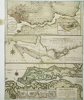
Background imageTurkey Collection: Dardanelles to Istanbul, 1788 (paper, engraving)

Dardanelles to Istanbul, 1788 (paper, engraving)
7340438 Dardanelles to Istanbul, 1788 (paper, engraving) by Unknown artist, (18th century); 80x63.5 cm; National Maritime Museum, London, UK; (add.info.: Creator: unknown A single sheet)

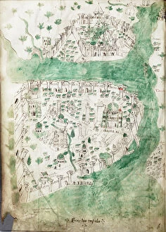
Background imageTurkey Collection: A chart of Constantinople, c.1420 (Vellum)

A chart of Constantinople, c.1420 (Vellum)
7339629 A chart of Constantinople, c.1420 (Vellum) by Buondelmonti, Cristoforo (1385-1430); 25x18 cm; National Maritime Museum, London

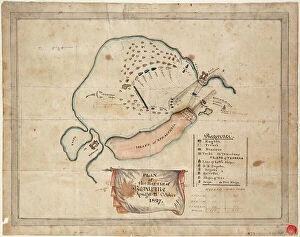
Background imageTurkey Collection: Plan of the Battle of Navarino, 21 October 1827, 1827 (coloured manuscript)

Plan of the Battle of Navarino, 21 October 1827, 1827 (coloured manuscript)
7339519 Plan of the Battle of Navarino, 21 October 1827, 1827 (coloured manuscript) by Unknown Artist, (19th century); 32x42 cm; National Maritime Museum, London

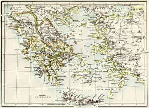
Background imageTurkey Collection: Geographic map of territories around the Aegean Sea: Greek islands, Turkey, Minor Asia; Rhodes

Geographic map of territories around the Aegean Sea: Greek islands, Turkey, Minor Asia; Rhodes, Thrace
NWI4863295 Geographic map of territories around the Aegean Sea: Greek islands, Turkey, Minor Asia; Rhodes, Thrace, Poloponese and Macedoine (Macedonia) of Antiquity

Background imageTurkey Collection: Geographic map of the Middle East at the time of the Crusades. Lithography, 19th century

Geographic map of the Middle East at the time of the Crusades. Lithography, 19th century
NWI4876898 Geographic map of the Middle East at the time of the Crusades. Lithography, 19th century.; (add.info.: Geographic map of the Middle East at the time of the Crusades)

Background imageTurkey Collection: Allegory of the British Empire as the Colossus of Rhodes, 19th century

Allegory of the British Empire as the Colossus of Rhodes, 19th century
CUL4940269 Allegory of the British Empire as the Colossus of Rhodes, 19th century; (add.info.: Il Colosso di Rodi. Allegory of the British Empire as the 'Colossus of Rhodes" monitoring)

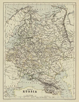
Background imageTurkey Collection: Map of European Russia (colour litho)

Map of European Russia (colour litho)
8664039 Map of European Russia (colour litho) by English School, (19th century); Private Collection; (add.info.: Map of European Russia)

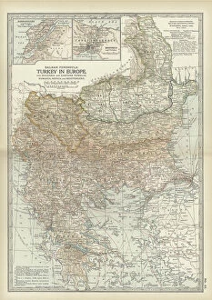
Background imageTurkey Collection: Map of Turkey, c.1900 (engraving)

Map of Turkey, c.1900 (engraving)
532998 Map of Turkey, c.1900 (engraving); (add.info.: Map showing historical boundaries of the European portion of Turkey, circa 1902)

Background imageTurkey Collection: The Balkan Peninsula (colour litho)

The Balkan Peninsula (colour litho)
8658805 The Balkan Peninsula (colour litho) by English School, (20th century); Private Collection; (add.info.: The Balkan Peninsula)

Background imageTurkey Collection: Changes in Turkey in Europe, 1856 to 1878 (litho)

Changes in Turkey in Europe, 1856 to 1878 (litho)
8652550 Changes in Turkey in Europe, 1856 to 1878 (litho) by Bartholomew, John George (1860-1920) ; Private Collection; (add.info.: Changes in Turkey in Europe, 1856 to 1878)

Background imageTurkey Collection: Constantinople and the Sea of Marmara; Ethnographic Map of the Balkan Peninsula (colour litho)

Constantinople and the Sea of Marmara; Ethnographic Map of the Balkan Peninsula (colour litho)
8653600 Constantinople and the Sea of Marmara; Ethnographic Map of the Balkan Peninsula (colour litho) by English School, (19th century); Private Collection; (add.info)

Background imageTurkey Collection: Map of Turkey in 1914 (litho)

Map of Turkey in 1914 (litho)
8661161 Map of Turkey in 1914 (litho) by English School, (20th century); Private Collection; (add.info.: Map of Turkey in 1914)

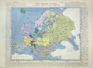
Background imageTurkey Collection: Primary cities of Europe, their population and degree of trade of individual states (print)

Primary cities of Europe, their population and degree of trade of individual states (print)
6202957 Primary cities of Europe, their population and degree of trade of individual states (print; (add.info.: CARTOGRAPHY "Primary cities of Europe)

Background imageTurkey Collection: Turkey: Map of the Gulf of Smyrna (or Izmir) by Joseph Roux, 1764

Turkey: Map of the Gulf of Smyrna (or Izmir) by Joseph Roux, 1764
FGL5477300 Turkey: Map of the Gulf of Smyrna (or Izmir) by Joseph Roux, 1764; Fototeca Gilardi

Background imageTurkey Collection: 'Carte du Teatre de la Guerre dans la Pologne, Moscovie & Turquie' by Nicolas Visscher, 1713 (print)

'Carte du Teatre de la Guerre dans la Pologne, Moscovie & Turquie' by Nicolas Visscher, 1713 (print)
7342537 'Carte du Teatre de la Guerre dans la Pologne, Moscovie & Turquie' by Nicolas Visscher, 1713 (print) by Visscher, Nicolaes the Elder (1618-1709); 41.3x50.8 cm; National Maritime Museum

Background imageTurkey Collection: Peace of the Pruth (1711): Catherine Iere of Russia advises her wife Peter I the Great

Peace of the Pruth (1711): Catherine Iere of Russia advises her wife Peter I the Great, Emperor of Russia
XEE5032156 Peace of the Pruth (1711): Catherine Iere of Russia advises her wife Peter I the Great, Emperor of Russia, to sign the peace of Pruth in 1711 with the empire of Turkey; (add.info)

Background imageTurkey Collection: Map of the empire of Alexander III of Macedonian, known as the Great (356-323 BC)

Map of the empire of Alexander III of Macedonian, known as the Great (356-323 BC), after the Battle of Ipsos (Turkey)
NWI4912667 Map of the empire of Alexander III of Macedonian, known as the Great (356-323 BC), after the Battle of Ipsos (Turkey), in 301 BC

Background imageTurkey Collection: Map of Palestine part of Turkey, c.1900 (engraving)

Map of Palestine part of Turkey, c.1900 (engraving)
533323 Map of Palestine part of Turkey, c.1900 (engraving); (add.info.: Map of Palestine (then part of Turkey), circa 1902

Background imageTurkey Collection: Map of the Ottoman Empire (colour litho)

Map of the Ottoman Empire (colour litho)
8664038 Map of the Ottoman Empire (colour litho) by English School, (19th century); Private Collection; (add.info.: Map of the Ottoman Empire)

Background imageTurkey Collection: Atlas or collection of geographic maps established on the new observations of gentlemen of

Atlas or collection of geographic maps established on the new observations of gentlemen of the Royal Academy of
JEB4874666 Atlas or collection of geographic maps established on the new observations of gentlemen of the Royal Academy of Sciences

Background imageTurkey Collection: Ukraine

Ukraine
2901937 Ukraine; (add.info.: The predecessor of Odessa, - small Tatar settlement, was founded by Hac - Giray, the Khan of Crimea, in 1440 and originally named after him as Hac?bey)

Background imageTurkey Collection: Map of Bosporus, c.1900 (engraving)

Map of Bosporus, c.1900 (engraving)
532714 Map of Bosporus, c.1900 (engraving); (add.info.: Map of Bosporus, circa 1900, from the 10th edition of Encyclopaedia Britannica.); Encyclopaedia Britannica/UIG

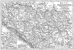
Background imageTurkey Collection: Map of the Herzegovina, Bosnia, Servia and Montenegro, 1876. Creator: Unknown

Map of the Herzegovina, Bosnia, Servia and Montenegro, 1876. Creator: Unknown
Map of the Herzegovina, Bosnia, Servia and Montenegro, 1876. Map showing the theatre of war of the Herzegovina Uprising. Reference: The names are spelt agreably to English pronunciation


All Professionally Made to Order for Quick Shipping


-

Turkey Collection

Turkey is a transcontinental country located in Southeast Europe and Southwest Asia and has a population of over 82 million people, making it the world's 18th most populous country. The capital city is Ankara, while Istanbul is the largest city and economic center. A diverse economy with industries such as textiles, automotive, electronics, and tourism contributing significantly to its GDP. The country also boasts of rich cultural heritage evident in its architecture, cuisine, music, and festivals. Turkey shares borders with eight countries including Greece, Bulgaria, Georgia, Armenia among others and has access to two seas; the Black Sea and Mediterranean Sea.
+

Our beautiful Wall Art and Photo Gifts include Framed Prints, Photo Prints, Poster Prints, Canvas Prints, Jigsaw Puzzles, Metal Prints and so much more

The Turkey collection from Media Storehouse is a stunning selection of wall art and framed prints that showcase the beauty and history of Turkey. Our collection features a range of maps, charts, and illustrations that depict the country's geography, landmarks, cities, and historical events. The artwork in our collection is sourced from various archives around the world, including museums, libraries, and private collections. Each piece in our collection has been carefully curated to offer a unique perspective on Turkey's rich cultural heritage. From antique maps depicting Ottoman-era borders to modern-day satellite images showcasing Istanbul's bustling cityscape - there is something for everyone in this diverse collection. Whether you're looking to add some Turkish flair to your home or office decor or simply want to learn more about this fascinating country - the Turkey collection from Media Storehouse offers an unparalleled glimpse into its past and present.
+

What are Turkey (Maps and Charts) art prints?

Turkey art prints are high-quality reproductions of historical maps and charts depicting the country of Turkey. These prints showcase the intricate details, unique features, and geographical landmarks of Turkey that have been captured by skilled cartographers over time. These art prints offer a glimpse into the past, allowing viewers to explore how Turkey has evolved through history. They also serve as educational tools for students, historians, and geography enthusiasts who want to learn more about this fascinating country. Turkey art prints are available in various sizes and formats such as framed or unframed prints, canvas wraps or posters. They make great additions to any home or office decor with their vintage charm adding character to any space. Whether you're looking for a piece of artwork that celebrates your love for travel or simply want to add some cultural flair to your living space - these beautiful art pieces from Media Storehouse are sure to impress.
+

What Turkey (Maps and Charts) art prints can I buy from Media Storehouse?

We offer a wide range of Turkey art prints, including maps and charts. These prints showcase the beauty and diversity of Turkey's landscapes, cities, and historical sites. You can choose from vintage maps that highlight the country's geography or contemporary charts that depict its political boundaries. In addition to maps and charts, Media Storehouse also offers photographic prints featuring iconic landmarks such as Hagia Sophia in Istanbul or Cappadocia's unique rock formations. You can also find stunning images of Turkey's coastline, mountains, and countryside. Whether you're looking for a piece to decorate your home or office or a gift for someone who loves Turkey, we have something for everyone. With high-quality printing on premium paper stock, these art prints are sure to impress anyone who sees them.
+

How do I buy Turkey (Maps and Charts) art prints?

To buy Turkey art prints from Media Storehouse, you can browse our extensive collection of high-quality images online. Simply search for "Turkey Maps and Charts" in the search bar on our website to find a range of options available. Once you have found an image that you like, select the size and format that suits your needs. You can choose from a variety of print sizes, including small, medium, large or extra-large prints. After selecting your preferred size and format, add the item to your cart and proceed to checkout. You will be prompted to enter your shipping information as well as payment details. We offer secure payment methods such as credit card payments or PayPal transactions. Once your order is confirmed, they will process it promptly so that you receive your Turkey art print in no time.
+

How much do Turkey (Maps and Charts) art prints cost?

We offer a wide range of Turkey art prints at varying prices. Our collection includes high-quality prints that are perfect for adding a touch of elegance to any room in your home or office. The cost of our Turkey art prints depends on the size, framing options, and other customizations you choose. We have something for everyone's budget with affordable options as well as premium quality products. We take pride in offering exceptional value for money while maintaining the highest standards of quality. Our Turkey art prints come in various sizes ranging from small to large formats so that you can find the perfect fit for your space. Whether you're looking to decorate your living room, bedroom or office, our selection has got you covered.
+

How will my Turkey (Maps and Charts) art prints be delivered to me?

We take great care in delivering your Turkey art prints to you. Once you have placed your order with us, our team of professionals will carefully package your print to ensure it arrives safely at its destination. We use high-quality materials that are designed to protect the artwork during transit. Depending on the size of the print, we may roll it up and place it in a sturdy tube for shipping or pack it flat between two pieces of cardboard. Our delivery partners are trusted couriers who specialize in handling fragile items such as artwork. When your Turkey art print arrives, please inspect it carefully to ensure that there is no damage during transit. If you do find any issues with your order, please contact us immediately so that we can resolve them for you as quickly as possible. We hope that you enjoy your new artwork from Media Storehouse.