Fraud Blocker Skip to main content

Home > Maps and Charts > Wales

Wales Collection (page 2)

Wales is a country located in the southwest region of Great Britain and has a population of approximately 3 million people...

1,217 items

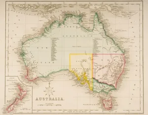
Background imageWales Collection: Map of Australia and New Zealand (coloured engraving)

Map of Australia and New Zealand (coloured engraving)
KW270862 Map of Australia and New Zealand (coloured engraving) by Archer, J. (fl.1830); Private Collection; Ken Welsh; English, out of copyright

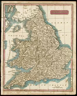
Background imageWales Collection: Map / England & Wales 1809

Map / England & Wales 1809
ENGLAND AND WALES Hand coloured engraving

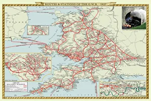
Background imageWales Collection: Old Map of the Routes and Stations of the Great Western Railway 1927

Old Map of the Routes and Stations of the Great Western Railway 1927
Completely remastered from an original fold up map published in 1927, this reproduction map shows all the routes and stations of the Great Western Railway

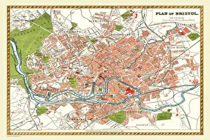
Background imageWales Collection: Old Map of Bristol 1893 from the Comprehensive Gazetteer Atlas of England and Wales

Old Map of Bristol 1893 from the Comprehensive Gazetteer Atlas of England and Wales
This detailed reproduction plan of Bristol has been re-worked from an antique originally published in the oComprehensive Gazetteer of England and Waleso 1893

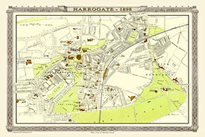
Background imageWales Collection: Old Map of Harrogate 1898 from the Royal Atlas by Bartholomew

Old Map of Harrogate 1898 from the Royal Atlas by Bartholomew
A fine very detailed town plan of Harrogate from 1898 remastered from an original contained within " The Royal Atlas of England and Wales" ; edited by J.G

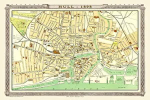
Background imageWales Collection: Old Map of Hull 1898 from the Royal Atlas by Bartholomew

Old Map of Hull 1898 from the Royal Atlas by Bartholomew
A fine very detailed plan of the City of Hull remastered from an original contained within " The Royal Atlas of England and Wales" ; edited by J.G

Background imageWales Collection: Map of England and Wales as it appeared in the Reign of Edward I

Map of England and Wales as it appeared in the Reign of Edward I
BHISM004

Background imageWales Collection: Old Map of Wales 1648 by Johan Blaeu from the Atlas Novus

Old Map of Wales 1648 by Johan Blaeu from the Atlas Novus
This detailed and most attractive reproduction map of Wales has been carefully art worked from a scan of an antique original

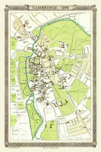
Background imageWales Collection: Old Map of Cambridge 1898 from the Royal Atlas by Bartholomew

Old Map of Cambridge 1898 from the Royal Atlas by Bartholomew
A fine very detailed plan of the City of Cambridge from 1898 remastered from an original contained within " The Royal Atlas of England and Wales" ; edited by J.G

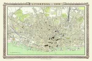
Background imageWales Collection: Old Map of Liverpool 1898 from the Royal Atlas by Bartholomew

Old Map of Liverpool 1898 from the Royal Atlas by Bartholomew
A fine very detailed plan of the City of Liverpool remastered from an original contained within " The Royal Atlas of England and Wales" ; edited by J.G

Background imageWales Collection: Old Map of Nottingham 1893 from the Comprehensive Gazetteer Atlas of England and Wales

Old Map of Nottingham 1893 from the Comprehensive Gazetteer Atlas of England and Wales
This detailed reproduction plan of Nottingham has been re-worked from an antique originally published in the oComprehensive Gazetteer of England and Waleso 1893

Background imageWales Collection: Poster, Map of Royal Britain

Poster, Map of Royal Britain. 1957

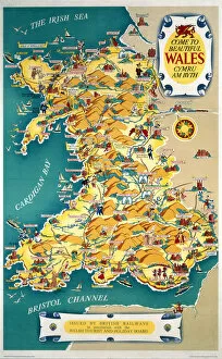
Background imageWales Collection: Come to Beautiful Wales, BR (LMR) poster, 1948-1965

Come to Beautiful Wales, BR (LMR) poster, 1948-1965
British Railways (LMR) poster. Artwork by Kerry Lee

Background imageWales Collection: An eye-sketch of Port Stephens, to the north of Broken Bay

An eye-sketch of Port Stephens, to the north of Broken Bay
Drawing LS 4 from the Watling Collection titled High water at Port Stephens at 10 o clock by a Port Jackson Painter, 1791-1792

Background imageWales Collection: Map of the British Isles 1895

Map of the British Isles 1895
The Rand-McNally Grammar School Geography 1895 - Chicago & New York

Background imageWales Collection: Victoria Australia map 1885

Victoria Australia map 1885
Encyclopedia Britannica 9th Edition New York Charles Scribners and Sons 1885 Vol XXIV

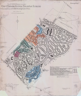
Background imageWales Collection: Preliminary layout and development plan of the Manor Estate Housing Scheme, 1924

Preliminary layout and development plan of the Manor Estate Housing Scheme, 1924
Sheffield City Council, Estates Committee.Original dimensions: 93 x 79 cm.Sheffield Local Studies Library:s (13) 4 L

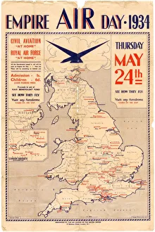
Background imageWales Collection: Poster for Empire Air Day, 1934

Poster for Empire Air Day, 1934
Shows aerodromes in England, Wales, southern Scotland and Northern Ireland, all of which were open for Empire Air Day. Admission one shilling for adults, sixpence for children

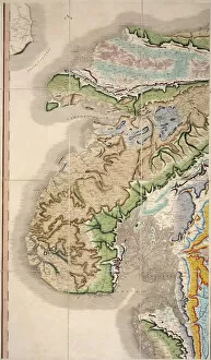
Background imageWales Collection: William Smiths Geological Map

William Smiths Geological Map
Fig. 6 from Delineation of Strata of England and Wales (1815) by William Smith

Background imageWales Collection: Inland navigation of England and Wales by

Inland navigation of England and Wales by
Map of the inland navigation of England and Wales by the canals and principal rivers, 1809. Copperplate engraving by Mutlow from John Mason Goods Pantologia, a New Encyclopedia, G

Background imageWales Collection: Flintshire Historical John Speed 1610 Map

Flintshire Historical John Speed 1610 Map
A reproduction of John Speeds historical map of the county of Flintshire. Originally published as part of his atlas called The Theatre of the Empire of Great Britain in 1610

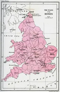
Background imageWales Collection: Map of the Wars of the Roses, 15th century (1893)

Map of the Wars of the Roses, 15th century (1893). The Wars of the Roses was a civil war fought over the throne of England between adherents of the House of Lancaster and the House of York

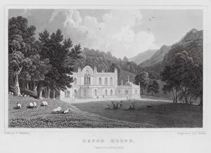
Background imageWales Collection: Hafod House, Cardiganshire (engraving)

Hafod House, Cardiganshire (engraving)
7159317 Hafod House, Cardiganshire (engraving) by Gastineau, Henry (1791-1876) (after); Private Collection; (add.info.: Hafod House, Cardiganshire)

Background imageWales Collection: Map of British Isles, lithograph, lithograph, published in 1876

Map of British Isles, lithograph, lithograph, published in 1876
Map of British Isles. Lithograph, published in 1876

Background imageWales Collection: Dylan Thomas was born in Swansea, Wales, on October 27, 1914. After grammar school

Dylan Thomas was born in Swansea, Wales, on October 27, 1914. After grammar school he moved to London where, in 1934, his first book of poetry, Eighteen Poems, was published

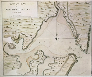
Background imageWales Collection: Map of Botany Bay, New South Wales, Australia

Map of Botany Bay, New South Wales, Australia
Cartography, 18th century. Map of Botany Bay, New South Wales, Australia

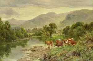
Background imageWales Collection: Church Pool, Bettws-y-coed (oil)

Church Pool, Bettws-y-coed (oil)
7064886 Church Pool, Bettws-y-coed (oil) by Parker, Henry (1858-1930); Private Collection

Background imageWales Collection: Chepstow Castle, Monmouthshire (engraving)

Chepstow Castle, Monmouthshire (engraving)
2787037 Chepstow Castle, Monmouthshire (engraving) by English School, (19th century); Private Collection; (add.info.: Chepstow Castle, Monmouthshire)

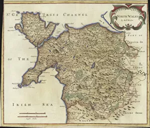
Background imageWales Collection: Map of North Wales (colour engraving)

Map of North Wales (colour engraving)
979824 Map of North Wales (colour engraving) by Morden, Robert (fl.1682-1703); Private Collection; (add.info.: Map of North Wales)

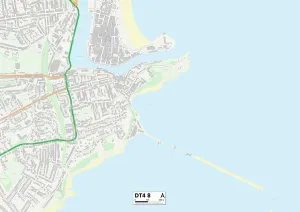
Background imageWales Collection: Weymouth and Portland DT4 8 Map

Weymouth and Portland DT4 8 Map
Postcode Sector Map of Weymouth and Portland DT4 8

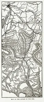
Background imageWales Collection: Map of the River Dee, Wales Victorian Engraving, Circa 1840

Map of the River Dee, Wales Victorian Engraving, Circa 1840
Very Rare, Beautifully Illustrated Antique Engraving of Map of the Course of the River Dee, Wales Victorian Engraving, 1840 from Our Own Country, Great Britain, Descriptive, Historical, Pictorial

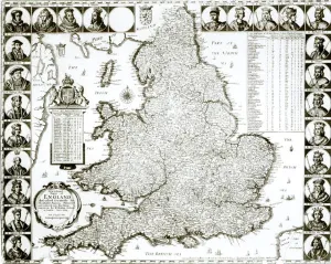
Background imageWales Collection: Map of England and Wales, 1644 (engraving) (b / w photo)

Map of England and Wales, 1644 (engraving) (b / w photo)
XJF273140 Map of England and Wales, 1644 (engraving) (b/w photo) by Hollar, Wenceslaus (1607-77); Private Collection; Czech, out of copyright

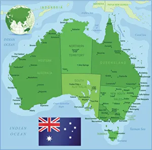
Background imageWales Collection: Map of Australia with states, cities and flag

Map of Australia with states, cities and flag
Highly detailed vector map of Australia with states, capitals and big cities

Background imageWales Collection: OS map, 1922: Sussex, Strait of Dover (colour litho)

OS map, 1922: Sussex, Strait of Dover (colour litho)
8651671 OS map, 1922: Sussex, Strait of Dover (colour litho) by English School, (20th century); Private Collection; (add.info.: Sussex, Strait of Dover)

Background imageWales Collection: OS map, 1922: Cardiganshire, Pembrokeshire, Carmarthenshire (colour litho)

OS map, 1922: Cardiganshire, Pembrokeshire, Carmarthenshire (colour litho)
8650907 OS map, 1922: Cardiganshire, Pembrokeshire, Carmarthenshire (colour litho) by English School, (20th century); Private Collection; (add.info.: Cardiganshire, Pembrokeshire, Carmarthenshire)

Background imageWales Collection: OS map, 1922: Surrey, Kent (colour litho)

OS map, 1922: Surrey, Kent (colour litho)
8645566 OS map, 1922: Surrey, Kent (colour litho) by English School, (20th century); Private Collection; (add.info.: Surrey, Kent)

Background imageWales Collection: OS map, 1922: Somerset, Wiltshire, Berkshire, Hampshire (colour litho)

OS map, 1922: Somerset, Wiltshire, Berkshire, Hampshire (colour litho)
8645564 OS map, 1922: Somerset, Wiltshire, Berkshire, Hampshire (colour litho) by English School, (20th century); Private Collection; (add.info.: Somerset, Wiltshire, Berkshire, Hampshire)

Background imageWales Collection: Geography map of the New Wales region of Australia, circa 1870. Lithograph of the 19th century

Geography map of the New Wales region of Australia, circa 1870. Lithograph of the 19th century
NWI4879138 Geography map of the New Wales region of Australia, circa 1870. Lithograph of the 19th century.; (add.info.: Geography map of the New Wales region of Australia, circa 1870)

Background imageWales Collection: Geography Atlas: representation of the island of Antigua in the Caribbean

Geography Atlas: representation of the island of Antigua in the Caribbean
VEN5030006 Geography Atlas: representation of the island of Antigua in the Caribbean. Map taken from "The west indian atlas or general description of west indies" by Thomas Jefferys

Background imageWales Collection: Geography Atlas: representation of Tobago Island in the Lesser Antilles

Geography Atlas: representation of Tobago Island in the Lesser Antilles. Map taken from "The west indian atlas or
VEN5029619 Geography Atlas: representation of Tobago Island in the Lesser Antilles. Map taken from "The west indian atlas or general description of west indies" by Thomas Jefferys

Background imageWales Collection: Tudor country woman with basket. c.1612 (engraving)

Tudor country woman with basket. c.1612 (engraving)
2911217 Tudor country woman with basket. c.1612 (engraving); (add.info.: Tudor country woman with basket, (detail), from a map of England and wales by John Speed; C1612

Background imageWales Collection: Tudor noblewoman (detail), from a map of England and wales by John Speed, c.1612 (engraving)

Tudor noblewoman (detail), from a map of England and wales by John Speed, c.1612 (engraving)
2911210 Tudor noblewoman (detail), from a map of England and wales by John Speed, c.1612 (engraving); Universal History Archive/UIG

Background imageWales Collection: Queen Elizabeth I, (detail), from a map of England and wales by John Speed, c.1612 (engraving)

Queen Elizabeth I, (detail), from a map of England and wales by John Speed, c.1612 (engraving)
2911209 Queen Elizabeth I, (detail), from a map of England and wales by John Speed, c.1612 (engraving); Universal History Archive/UIG

Background imageWales Collection: Map of proposed railway lines to run through Britain

Map of proposed railway lines to run through Britain
3733987 Map of proposed railway lines to run through Britain.; (add.info.: Map of proposed railway lines to run through Britain. Dated 19th century.); Universal History Archive/UIG

Background imageWales Collection: Geography Atlas: representation of the island of Saint Lucia (Antilles)

Geography Atlas: representation of the island of Saint Lucia (Antilles). Map taken from "The west indian atlas or
VEN5030018 Geography Atlas: representation of the island of Saint Lucia (Antilles). Map taken from "The west indian atlas or general description of west indies" by Thomas Jefferys

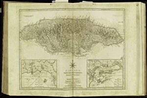
Background imageWales Collection: Geography Atlas: representation of the island of Jamaica (Antilles)

Geography Atlas: representation of the island of Jamaica (Antilles). Map taken from "The west indian atlas or
VEN5030010 Geography Atlas: representation of the island of Jamaica (Antilles). Map taken from "The west indian atlas or general description of west indies" by Thomas Jefferys

Background imageWales Collection: Chart of the West Indies, 1774 (engraving)

Chart of the West Indies, 1774 (engraving)
7340482 Chart of the West Indies, 1774 (engraving) by Speer, Joseph Smith (fl.1773); 72x118 cm; National Maritime Museum, London, UK; (add.info.: Creator: Joseph Smith Speer Single sheet. Hand col)

Background imageWales Collection: New map of the most flourishing kingdom of England, by Humphrey Lloyd of Denbigh

New map of the most flourishing kingdom of England, by Humphrey Lloyd of Denbigh, 1573 (copperplate engraving on paper)
7340124 New map of the most flourishing kingdom of England, by Humphrey Lloyd of Denbigh, 1573 (copperplate engraving on paper) by Ortelius, Abraham (1527-98); 42x53 cm; National Maritime Museum


All Professionally Made to Order for Quick Shipping


-

Wales Collection

Wales is a country located in the southwest region of Great Britain and has a population of approximately 3 million people and covers an area of around 20,780 square kilometers. The country is known for its rugged coastline, mountainous landscapes, and rich cultural heritage. Wales has two official languages: Welsh and English. Cardiff is the capital city and largest urban center in Wales. The economy relies heavily on industries such as manufacturing, tourism, agriculture, and services. Maps and charts are commonly used to navigate through the country's diverse terrain or study its demographic data or economic indicators.
+

Our beautiful pictures are available as Framed Prints, Photos, Wall Art and Photo Gifts

The Wales collection from Media Storehouse is a stunning assortment of wall art and framed prints that showcase the beauty and history of Wales. Our collection features an array of maps, charts, and illustrations dating back to the 16th century, depicting everything from Welsh castles to coastal landscapes. These high-quality prints are perfect for anyone looking to add a touch of Welsh heritage to their home or office decor. They come in a variety of sizes and framing options, making it easy for customers to find the perfect piece for their space. Whether you're a proud Welsh native or simply appreciate the country's rich culture and history, our collection has something for everyone. From antique maps that offer insight into Wales' past to modern illustrations that capture its natural beauty, these prints are sure to impress. The Wales collection is an excellent choice for anyone seeking unique artwork with historical significance.
+

What are Wales (Maps and Charts) art prints?

Wales art prints are a collection of high-quality, visually stunning prints that showcase the beauty and history of Wales. These prints feature detailed maps and charts that depict the geography, topography, and landmarks of this beautiful country. They are perfect for anyone who loves Welsh culture or wants to add a touch of Welsh charm to their home or office decor. These art prints come in a variety of sizes and styles, from vintage-inspired designs to modern interpretations. They are printed on premium quality paper using state-of-the-art printing technology to ensure vibrant colors and sharp details. Whether you're looking for a unique gift for someone special or want to decorate your own space with something truly special, Wales art prints are an excellent choice. With their timeless appeal and rich cultural heritage, they will be treasured for years to come.
+

What Wales (Maps and Charts) art prints can I buy from Media Storehouse?

We offer a wide range of Wales maps and charts art prints that are perfect for decorating your home or office. You can choose from vintage maps, antique charts, and modern designs that showcase the beauty of this stunning country. Whether you're looking for a detailed map of Cardiff or an artistic representation of Snowdonia National Park, we have something to suit every taste. Our collection includes prints featuring famous landmarks such as Caernarfon Castle, St David's Cathedral, and the Brecon Beacons. We also offer topographical maps that highlight the unique geography of Wales with its rugged coastline, rolling hillsides, and picturesque valleys. In addition to traditional paper prints in various sizes, Media Storehouse also provides canvas options for those who prefer a more durable material. With so many beautiful options available at Media Storehouse, you're sure to find the perfect Wales map or chart art print to add some Welsh charm to your space.
+

How do I buy Wales (Maps and Charts) art prints?

To buy Wales art prints from Media Storehouse, you can browse our extensive collection of high-quality prints featuring maps and charts of Wales. Once you have found the print that you like, simply add it to your cart and proceed to checkout. You will be prompted to enter your shipping information and payment details. We offer a variety of sizes for their prints, so be sure to select the size that best fits your needs. We also offer framing options if you would like your print ready-to-hang upon arrival. Their Wales art prints are perfect for anyone who loves geography or is interested in Welsh history. These unique pieces make great gifts for friends or family members who share these interests. Buying a Wales art print from Media Storehouse is easy and convenient, allowing you to enjoy beautiful artwork in no time.
+

How much do Wales (Maps and Charts) art prints cost?

We offer a wide range of Wales art prints that are available at varying prices. Our collection includes high-quality prints of maps and charts depicting the beautiful landscapes, coastlines, and historical landmarks of Wales. These prints are perfect for adding a touch of Welsh heritage to your home or office decor. Our pricing is competitive and affordable, ensuring that everyone can enjoy our stunning collection without breaking the bank. We believe in providing excellent value for money while maintaining the highest standards of quality. Whether you're looking for a small print to display on your desk or a large canvas to hang on your living room wall, we have something for everyone. So why not browse our selection today and discover the beauty of Wales through our Maps and Charts art prints?
+

How will my Wales (Maps and Charts) art prints be delivered to me?

We take great care in ensuring that your Wales art prints are delivered to you safely and securely. We use high-quality packaging materials to protect your artwork during transit, including sturdy cardboard tubes for rolled prints and flat boxes for framed or mounted prints. Our delivery partners are carefully selected based on their reliability and efficiency, so you can be confident that your order will arrive promptly and in excellent condition. Depending on the size of your print and your location, we may use a range of different couriers to ensure the best possible service. Once your order has been dispatched, you will receive an email notification with tracking information so that you can keep an eye on its progress. If you have any questions about delivery or need assistance with tracking your order, our friendly customer service team is always here to help.