Home > Europe > United Kingdom > Wales > Powys > Montgomery
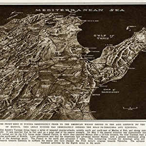
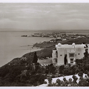
Map of northern Tunisia by G. H. Davis

![]()
Wall Art and Photo Gifts from Mary Evans Picture Library
Map of northern Tunisia by G. H. Davis
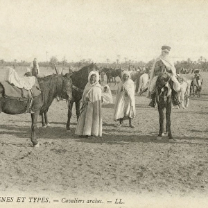
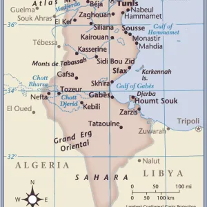
The battleground which was expected to seal the fate of North Africa and gain full control of the Mediterranean during the Second World War. A contour map of northern Tunisia, the terrain and communications, where enemy Axis forces were faced by three Allied armies. Inset is a map showing Montgomerys advance from the south. Date: 1943
Mary Evans Picture Library makes available wonderful images created for people to enjoy over the centuries
Media ID 14125810
© Illustrated London News Ltd/Mary Evans
1943 Advance Allied Allies Armies Axis Battleground Conflict Contour Control Davis Enemy Forces Gulf Maps Mediterranean Montgomery Terrain Territory Tunis Tunisia Tunisian Hammamet
FEATURES IN THESE COLLECTIONS
> Europe
> United Kingdom
> Wales
> Powys
> Montgomery
> Maps and Charts
> Early Maps
> Maps and Charts
> World
EDITORS COMMENTS
This contour map of northern Tunisia, created by renowned cartographer G.H. Davis in 1943, offers a glimpse into the strategic battleground that was expected to determine the outcome of the North African campaign during the Second World War. The terrain and communications depicted in this map were the focus of intense conflict between Axis and Allied forces, with the former led by German and Italian troops, and the latter comprised of three Allied armies: the British First Army, the American II Corps, and the French First Army. The map reveals the intricate details of the rugged and diverse landscape of northern Tunisia, including the coastal cities of Bizerta, Tunis, and Hammamet, as well as the mountainous regions of the Dorsale and the Tell. The Gulf of Tunis and the Mediterranean Sea are also clearly marked, highlighting the significance of maritime control in this pivotal campaign. An inset map on the bottom right of the print illustrates the advance of British General Bernard Montgomery's Eighth Army from the south, providing context to the broader strategic situation. The map serves as a poignant reminder of the intense struggle for control of this territory, which was expected to secure full dominance of the Mediterranean and ultimately influence the course of the wider war. This historical map offers a unique perspective on the complex geography and military strategy that shaped the outcome of the North African campaign during the Second World War.
MADE IN AUSTRALIA
Safe Shipping with 30 Day Money Back Guarantee
FREE PERSONALISATION*
We are proud to offer a range of customisation features including Personalised Captions, Color Filters and Picture Zoom Tools
SECURE PAYMENTS
We happily accept a wide range of payment options so you can pay for the things you need in the way that is most convenient for you
* Options may vary by product and licensing agreement. Zoomed Pictures can be adjusted in the Cart.