Fraud Blocker Skip to main content

Home > Europe > Germany > Maps

Map / Europe / Germany 1827

Map  /  Europe  /  Germany 1827
Sold 1
In Stock
We accept all major credit cards
Framed Photos
Buy from AU$119.99
Photo Prints
Buy from AU$12.99
Jigsaw Puzzles
Buy from AU$89.99
Poster Prints
Buy from AU$24.99
Canvas Prints
Buy from AU$124.99
Fine Art Prints
Buy from AU$92.53
Metal Prints
Buy from AU$43.99
Cards
Buy from AU$12.99
Home Decor
Buy from AU$24.99

Mary Evans Picture Library Photo Prints and Wall Art

Map / Europe / Germany 1827

Map of Germany (Prussia) showing the various nation states. Mary Evans Picture Library makes available wonderful images created for people to enjoy over the centuries. © Mary Evans Picture Library 2015 - https://copyrighthub.org/s0/hub1/creation/maryevans/MaryEvansPictureID/10012756

Media ID 575402

1827 Maps Nation Prussia

FEATURES IN THESE COLLECTIONS

> Europe > Germany > Maps

> Europe > Germany > Posters

> Europe > Germany > Related Images

> Maps and Charts > Early Maps

> Maps and Charts > Germany

> Maps and Charts > Related Images

> Mary Evans Prints Online > Maps

SECURE PAYMENTS
We happily accept a wide range of payment options so you can pay for the things you need in the way that is most convenient for you

MADE IN AUSTRALIA
Safe Shipping with 30 Day Money Back Guarantee

FREE PERSONALISATION
We are proud to offer a range of customisation including Cropping, Captions, and Filters. Zoom Cropping can be adjusted in the Basket.


EDITORS COMMENTS

This stunning print captures a piece of history with its detailed map of Germany from 1827. The map showcases the various nation states within Prussia, providing a glimpse into the political landscape of Europe during this time period. Each state is clearly delineated, allowing viewers to see how borders were defined and territories were divided. The intricate details on the map offer a fascinating insight into the historical context of Germany in the early 19th century. From major cities to smaller towns, every corner of this region is meticulously depicted, giving us a sense of what life was like for people living in these different states. As we study this map, we can imagine the political alliances and rivalries that shaped the destiny of these nation states. It serves as a reminder of how boundaries have shifted over time and how countries have evolved throughout history. This print from Mary Evans Picture Library is not just a visual representation of geography; it is also a window into the past, allowing us to connect with our ancestors and gain a deeper understanding of our shared heritage. Whether you are a history buff or simply appreciate fine art, this map of Germany from 1827 is sure to captivate your imagination and spark your curiosity about days gone by.


Framed Prints

Introducing the latest addition to our Media Storehouse Framed Prints collection: "Map / Europe / Germany 1827" by Mary Evans Picture Library from Mary Evans Prints Online. This captivating piece is a meticulously detailed map of Germany in 1827, showcasing the various nation states at a pivotal moment in European history. With Prussia taking center stage, this map is an essential addition for history enthusiasts, geography buffs, and anyone intrigued by the intricacies of Europe's political landscape in the 19th century. Our high-quality framed print brings the rich history to life, making it a stunning conversation starter for any room in your home or office. Order yours today and step back in time to explore the fascinating world of Germany's past.


Photo Prints

Discover the rich history of Europe with our exquisite selection of antique maps from Mary Evans Picture Library. This stunning print, titled "Map / Europe / Germany 1827," showcases an intricately detailed depiction of Germany during the year 1827. At this point in history, Prussia was a major power in the region, and this map beautifully illustrates the various nation states that existed at the time. Add an air of sophistication and historical depth to your home or office with this captivating piece from our Media Storehouse range of Photographic Prints. Each print is meticulously produced using high-quality materials, ensuring a vibrant and long-lasting image that is sure to impress. Order yours today and step back in time to explore the intricacies of Europe's past.


Poster Prints

Introducing the captivating "Map / Europe / Germany 1827" print from our Media Storehouse collection, brought to you by Mary Evans Picture Library via Mary Evans Prints Online. This exquisite vintage map offers a fascinating glimpse into Europe's historical geography, specifically focusing on the political landscape of Germany in 1827. The intricately detailed illustration showcases the various nation states that comprised Prussia during this period. Bring a touch of history into your home or office with this beautifully preserved piece, perfect for enhancing your decor while providing a captivating educational element. Order your "Map / Europe / Germany 1827" print today and travel back in time with every glance.


Jigsaw Puzzles

Discover the rich history and intricate details of Europe with our captivating jigsaw puzzle from the Media Storehouse collection. This exquisite puzzle features an antique map of Germany, as it appeared in 1827, from the esteemed Mary Evans Picture Library. Originally published by Mary Evans Prints Online, this map showcases the various nation states of Germany during that time. Immerse yourself in the past as you piece together this puzzle, perfect for history enthusiasts and puzzle lovers alike. Enjoy the satisfaction of completing this intricate jigsaw, and proudly display the finished product as a beautiful addition to your home décor.

diamond
Made With High Grade Materials
thumb_up
Professional Quality Finish
package_2
Carefully Packed To Aid Safe Arrival

You May Also Like


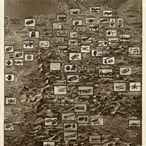
German plants raided by Allied bombing, by G. H. DavisGerman plants raided by Allied bombing, by G. H. Davis
Add to Basket
The Valkyrie / Die WalkureThe Valkyrie / Die Walkure
Add to Basket
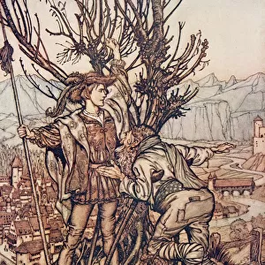
Ohe! Ohe! Horrible dragon, O swallow me not! Spare the life of poor LogeOhe! Ohe! Horrible dragon, O swallow me not! Spare the life of poor Loge
Add to Basket
1, animal, animals, aquatic, belauensis, blue, bodies, body, cephalopod, cephalopods1, animal, animals, aquatic, belauensis, blue, bodies, body, cephalopod, cephalopods
Add to Basket
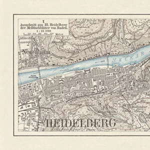
Historical city map of Heidelberg, Baden-WAOErttemberg, Germany, lithograph, published 1897Historical city map of Heidelberg, Baden-WAOErttemberg, Germany, lithograph, published 1897
Add to Basket
The Water of Life, 1909The Water of Life, 1909
Add to Basket
The White Snake, 1909The White Snake, 1909
Add to Basket
The Frog Prince, 1909The Frog Prince, 1909
Add to Basket
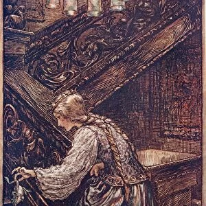
Briar Rose, 1909Briar Rose, 1909
Add to Basket
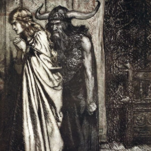
O wife betrayed I will avenge they trust deceived!, 1924. Artist: Arthur RackhamO wife betrayed I will avenge they trust deceived!, 1924. Artist: Arthur Rackham
Add to Basket
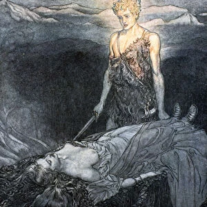
Illustration from Siegfried and the Twilight of the Gods, 1924. Artist: Arthur RackhamIllustration from Siegfried and the Twilight of the Gods, 1924. Artist: Arthur Rackham
Add to Basket
Brunnhilde kisses the ring that Siegfried has left with her. Illustration for Siegfried and The Twi Artist: Rackham, Arthur (1867-1939)Brunnhilde kisses the ring that Siegfried has left with her. Illustration for Siegfried and The Twi Artist: Rackham, Arthur (1867-1939)
Add to Basket

Gallery Wall Inspiration

Map / Asia / India C1870
Map / Asia / India C1850
Map of Ancient Greece
World Map Empire McVitie
Maps / Australia / New Zea
Map / Europe / Germany 1871
Maps / World / Eratosthenes
Maps / Australia 1854
World Known to Ptolemy
Map / Europe / France / Paris
Map / Europe / Poland 1772
London Map 1560 / Aggas
Overton World Map / 1670
WORLD MAP / 1897
Map of St Pauls and area
Map / Europe / Greece / Ford
Map /s America / Brazil 16C
Maps / Americas 1540
Maps / World / Ptolemy 2Ad
Mercator / World Map / 1587
Map / Britain / Saxon Period
Atlantis / Map
Map / Russia / Siberia 1764
Map / China / Tibet 1749
Map / Europe / Germany 1827
Map / England & Wales 1810
Map / England & Wales 9C

Discover Our Collections


MapsMaps
View Collection
Early MapsEarly Maps
View Collection
Germany Related ImagesGermany Related Images
View Collection
MapsMaps
View Collection
Maps and Charts Related ImagesMaps and Charts Related Images
View Collection
GermanyGermany
View Collection
PostersPosters
View Collection


© Copyright Media Storehouse, All Rights Reserved 2003 - 2024
Facebook     Pinterest     Card Payments     Reviews IO