Metal Print > Maps and Charts > Turkey
Metal Print : Map of european Turkey 1900


![]()
Metal Prints from Fine Art Storehouse
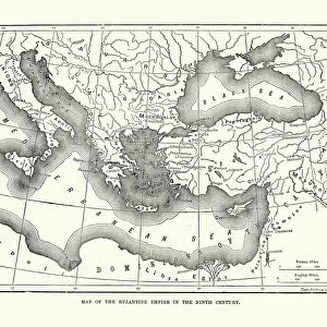
Map of european Turkey 1900
Meyers hand-Atlas Leipzig und Wien Verlag des Bibliographischen Instituts 1900
Unleash your creativity and transform your space into a visual masterpiece!
THEPALMER
Media ID 18106905
© 2014 Roberto Adrian Photography
10"x8" (25x20cm) Table Top Metal Print
Discover history with our exquisite Metal Prints from Media Storehouse. This captivating piece showcases a vintage map of European Turkey, as it appeared in 1900, taken from THEPALMER's collection in the Fine Art Storehouse. Originally published in the Meyers Hand-Atlas by Bibliographisches Institut Leipzig und Wien Verlag, this map offers a fascinating glimpse into the past. The high-quality Metal Print preserves the intricate details and rich colors of the original map, making it a stunning addition to any home or office. Elevate your space with a touch of history and artistry.
Table Top Metal Prints feature rounded corners and an easel back for easy display. Available in two sizes, 18x13cm (7x5) or 25x20cm (10x8). Lightweight and vibrant, they are perfect for displaying artwork and are guaranteed to add style to any desk or table top. The unique material is fade, moisture, chemical and scratch resistant to help ensure this art lasts a lifetime.
Made with durable metal and luxurious printing techniques, metal prints bring images to life and add a modern touch to any space
Estimated Product Size is 25.4cm x 20.3cm (10" x 8")
These are individually made so all sizes are approximate
Artwork printed orientated as per the preview above, with landscape (horizontal) or portrait (vertical) orientation to match the source image.
FEATURES IN THESE COLLECTIONS
> Fine Art Storehouse
> Map
> Historical Maps
> Asia
> Turkey
> Related Images
> Europe
> Related Images
EDITORS COMMENTS
This print showcases a historical gem, the "Map of European Turkey 1900" sourced from the renowned Meyers Hand-Atlas Leipzig und Wien Verlag des Bibliographischen Instituts in 1900. With its intricate details and exquisite craftsmanship, this piece takes us on a journey back in time to explore the geopolitical landscape of Europe during that era. The map itself is a testament to the artistry and precision involved in cartography. Every contour, border, and label has been meticulously etched onto paper with utmost care. It offers an intriguing glimpse into how boundaries were defined and territories were divided at the turn of the century. As we examine this vintage masterpiece, we are transported to an era when empires rose and fell, shaping history as we know it today. The delicate colors used to differentiate countries evoke a sense of nostalgia for bygone times. Each region tells its own story - from bustling cities to remote villages nestled amidst breathtaking landscapes. "The Map of European Turkey 1900" invites us to reflect upon our shared heritage while marveling at how much our world has evolved over time. It serves as a reminder that history is not merely confined within textbooks; it lives on through artifacts like this remarkable map print. Whether you're an avid historian or simply appreciate fine art, this print will undoubtedly captivate your imagination and spark conversations about Europe's rich past. Let it adorn your walls as both a stunning decorative piece and a window into another era – one that continues to shape our
MADE IN AUSTRALIA
Safe Shipping with 30 Day Money Back Guarantee
FREE PERSONALISATION*
We are proud to offer a range of customisation features including Personalised Captions, Color Filters and Picture Zoom Tools
SECURE PAYMENTS
We happily accept a wide range of payment options so you can pay for the things you need in the way that is most convenient for you
* Options may vary by product and licensing agreement. Zoomed Pictures can be adjusted in the Cart.